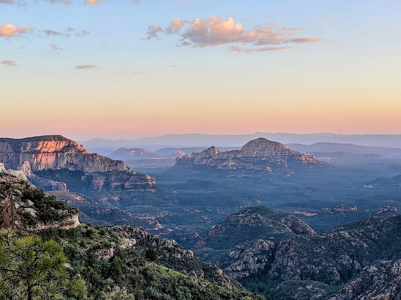
Hiking The Edge of The World in Sedona

Hiking The Edge of The World in Sedona
Hiking "The Edge of The World" is one of Sedona's hidden gems, offering adventurers the chance to experience breathtaking views and challenging terrain that truly sets this destination apart. Known for its dramatic cliff lines and awe-inspiring vistas, this trail is an unforgettable adventure combining Sedona’s famous red rock formations with a peaceful sense of isolation. It's a must-visit for those seeking a lesser-traveled hike that showcases the centerpiece of Sedona’s stunning landscape.
Adventure Guide to Hiking The Edge of The World
-
Trail Location and Access
- This unofficial trail is located near Schnebly Hill Road, a rugged area accessible by high-clearance vehicles. Parking is limited, so arriving early is recommended. The adventure begins with a moderately challenging approach through juniper forests and rock-strewn paths.
- What makes it special: The culminating point offers dramatic cliffs that truly evoke the “Edge of the World” feeling, with panoramic views extending across Coconino National Forest.
-
Key Highlights of the Trail
- Expansive Views: The trail leads to a flat, plateau-like area perched above Sedona’s iconic red rock formations. Look westward for sweeping views of Bear Mountain, Boynton Canyon, and the Verde Valley below.
- Photos and Stargazing: The open expanse is ideal for sunrise/sunset photography, as the rocks reflect vivid hues of orange and red. With minimal light pollution, this location also transforms into a stargazer’s paradise at night.
-
Safety and Unique Terrain Features
- This trail features uneven rock surfaces and a sharp drop-off at the cliff’s edge. Always remain vigilant, especially in windy conditions. Use sturdy hiking shoes due to the loose gravel and jagged rocks along the way.
Local Insights
- The Schnebly Hill Road area, including The Edge of The World, rests upon ancient sandstone, part of the geologic layer formed over 275 million years ago. Native American tribes, including the Yavapai and Apache, hold these lands sacred, often referring to the cliffs as places of spiritual reflection.
Visitor Tips
- Best times to visit: Early morning or late afternoon for cooler temperatures and better lighting for photos.
- What to bring:
- 3 liters of water per person.
- Sunglasses and sunscreen.
- GPS or a reliable trail map, as this is an unmarked route.
- Driving directions: From Sedona, take Schnebly Hill Road eastward for about 5 miles. Expect 30-40 minutes on a rough, rocky road.
Adventure Map
Reviews
Christopher Lam2 months ago
Make sure you have ground clearance before driving to this area, at least 8 inches. There are many pot holes on the trail, so you shouldn't rush. There are areas where the trail gets narrow, and sharing the path becomes a little difficult. There are also areas where cattle cross the trail, so be careful. Once you arrive at your destination, the sights are breathtaking. It's worth visiting once if you have the means to get there.
Carson Langdona year ago
I don't know about the hiking trails but they look awesome, was a Long trip in the Stewart Stevenson to retrieve a broken duce and a half deep in the pristine forest, longer trip out with my faithful companion Molly girl! Watching for squirls, if you can handle the long road in you are rewarded with spectacular views of oak creek canyon and some of the most beautiful ponderosa pine forest in the south west!
Kaylin Schwiesow7 months ago
Beautiful views. Didn’t hike the trail but drove in from Flagstaff. Can be a little tricky to get to and high clearance vehicles are recommended. Absolutely no cell service in the forest but there is at the actual edge so download any maps you might need to navigate in.
There are also camp sites all over so you can camp directly nearby.
Jay Tiniacosa week ago
Love this place! Words and photos do not explain what it is like to be here. One of the best camping experiences that I will remember for the rest of my life. Absolutely amazing and breath taking view!
shalin baggettin the last week
The drive can be slow going and bumpy, but the view is so worth it!!


