Hiking the Pinhoti Trail in Cheaha State Park
Hiking the Pinhoti Trail in Cheaha State Park
Introductory Overview
The Pinhoti Trail winds through Cheaha State Park, offering hikers some of the most challenging and rewarding terrain in Alabama. This long-distance trail, spanning over 335 miles, connects Alabama to Georgia and serves as a vital link to the Appalachian Trail. Within Cheaha State Park, the Pinhoti Trail provides breathtaking ridge-line views, rugged pathways, and access to Cheaha Mountain, the highest point in Alabama at 2,407 feet. Hikers encounter rocky outcrops, lush forests, and diverse wildlife while navigating steep sections and serene plateaus.
### Adventure Guide to Hiking the Pinhoti Trail
Cheaha Trailhead
- Location: Cheaha State Park, off Alabama Highway 281
- Highlights: This starting point provides immediate access to stunning vistas, including McDill Point, a favorite for sunset views.
- Key Features:
- Several primitive campsites along the route
- Rocky sections requiring sturdy footwear
- Stunning views of the Talladega National Forest
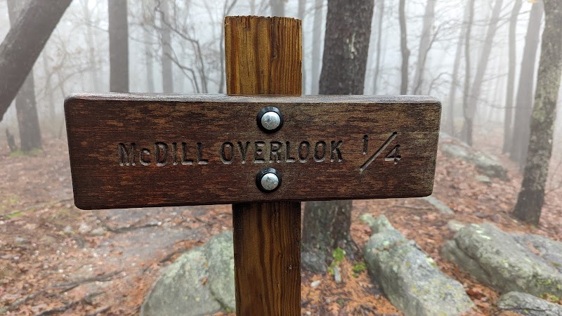
McDill Point Overlook
- Location: Around 6 miles round trip from the Cheaha Trailhead
- Why Go: Offers breathtaking panoramic views and the remains of a small airplane crash site, adding historical intrigue.
- Key Features:
- Ideal for photography enthusiasts and overnight campers
- One of the most rewarding overlooks in the area
Odum Scout Trail Connection
- Location: Merges with the Pinhoti Trail south of Cheaha State Park
- Why Go: Allows for extended trips into the Talladega National Forest, providing opportunities for multi-day hikes.
- Key Features:
- Less crowded, making it a peaceful escape
- A mix of dense forest and rocky pathways
### Local Insights
- The Pinhoti Trail serves as an important link to the Appalachian Trail, making it a favorite for long-distance hikers.
- Expect to see bald eagles, deer, and seasonal wildflowers along the route.
- Sections of the trail were used historically by the Creek and Cherokee tribes as trade paths.
### Visitor Tips
- Best Time to Visit: Fall and spring offer cooler temperatures and less humidity, making the hike more enjoyable.
- Essentials to Bring:
- Plenty of water (few natural sources along the route)
- Hiking boots with ankle support for the rugged landscape
- Bug spray, especially in warmer months
- Driving Directions: From Birmingham, Alabama, take I-20 east to Exit 191 (US-431 S) towards Cheaha State Park. The drive takes approximately 1.5 hours.
Adventure Map
Reviews
Justin Gibson5 years ago
A bit of a hike from the pinhoti trail head but it was worth it.
Alex Hartman2 years ago
Highest point in Alabama on Cheaha mountain and just a 2 mile hike from trailhead.
Stephen2 years ago
This has one of the best sunset views I have ever seen in the world. On a clear day it is absolutely amazing. Go to MacDill overlook for the best sunset view. When you turn to go to MacDill point, you will also run across a plane wreck from about 20 years ago. That's rather interesting. There's a good primitive campsite at this location as well.
Steven8 months ago
Accidentally took cave creek trail all the way to mcdill point. 2 hour hike turned into a 4 or 5 hour hike. But it was worth it. Only seen one other person.
Casey Peranich5 years ago
Great overlook. Water source about 45 minute hike away. Very quiet and peaceful.