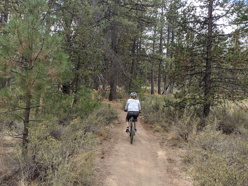
Mountain biking at the Funner Trail in Bend is a remarkable outdoor experience that attracts riders of all skill levels. This trail is renowned for its thrilling descents and captivating scenery, making it a must-visit destination for biking enthusiasts. With its blend of technical features and flowing sections, the Funner Trail exemplifies the region's mountain biking culture, showcasing the natural beauty of Central Oregon.
Adventure Guide To Mountain Biking the Funner Trail
Location: The Funner Trail is located within the Deschutes National Forest, accessible from the Powderhouse Trailhead. This location offers ample parking and direct access to various biking trails.
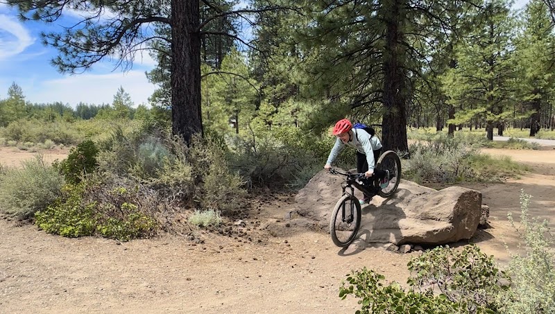
Unique Features: The trail is approximately 6.5 miles long and includes a mix of singletrack sections that wind through stunning forests and offers impressive views of the nearby mountains. What makes the Funner Trail stand out are its features such as jumps, berms, and rock sections that challenge riders while providing opportunities for skill development.
Amenities: The trailhead includes restrooms and information signage about the area, enhancing your pre-ride preparations. An added bonus is the nearby Wanoga Sno-Park, which offers seasonal shuttle services for those looking to enjoy an extended ride.
Local Insights
Bend has a rich mountain biking history, with local trail builders and biking clubs contributing to the trail's development. Participating in local biking events can provide unique insights into the biking culture, along with opportunities to meet fellow enthusiasts and learn about the best trails in the area.
Visitor Tips
Best Times to Visit: Late spring to early fall (May to September) is ideal for trail access and optimal conditions.
What to Bring: Essential items include a well-maintained mountain bike, hydration pack, snacks, and safety gear like a helmet and gloves. Don’t forget sunscreen for those sunny days!
Driving Directions: From downtown Bend, drive on Century Drive for approximately 20 minutes toward the Crossroads Trailhead. Follow the signs for Powderhouse Trailhead to access the Funner Trail.
For an exhilarating mountain biking experience, the Funner Trail is a top-tier destination in Bend, combining beautiful landscapes with challenging rides.
Adventure Map
Bend Info
No GPX info
Reviews
G3 months ago
Awesome hike. Free parking just before Google's trailhead (follow alltrails direction). There are washrooms and some benches.
No entrance fee or parking fee!
Hike was 2h15min to the top and 45 min back to the parking lot. It was appropriately marked as difficult.
The last 30 minutes involved climbing up using ropes, which makes it exciting.
Overall a great experience.
Kelly Barbosa6 months ago
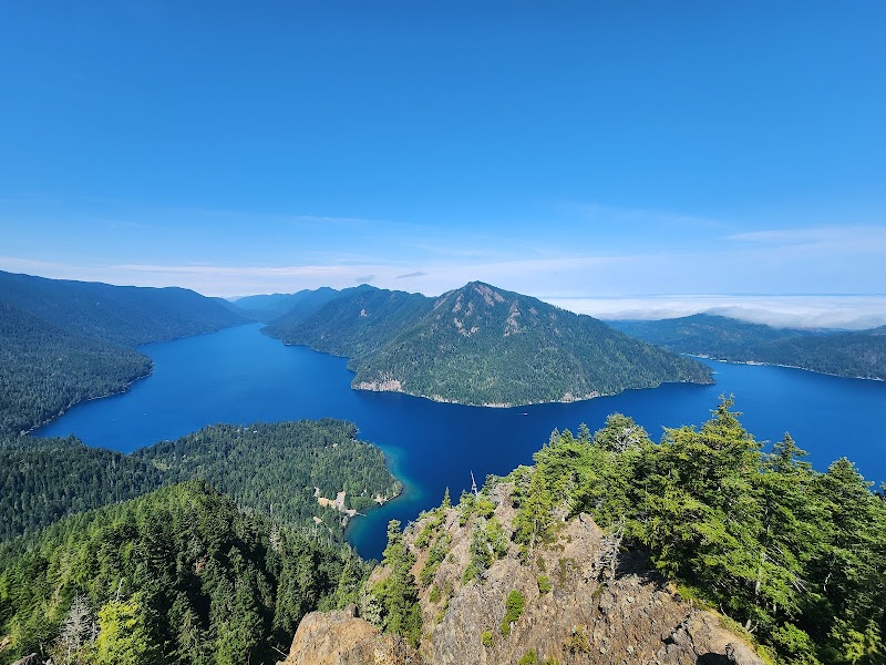
It's totally worth the hike! Very beautiful scenery of Lake Crescent. Steep most the way up, but some sections at the end have ropes to assist in the climb up and down, which was helpful. There are birds at the top that land on your hand if you have bits of food. Very cute.
Mr. Hoffman2 months ago
Mount Storm King Trail can be quite challenging for beginners, but it’s absolutely worth the effort. The steep climb and rope-assisted sections near the summit may feel tough, but the stunning views of Lake Crescent from the top make it all worthwhile. If you’re new to hiking, be prepared with proper shoes and plenty of water. The sense of accomplishment at the end is unmatched, and the scenery is breathtaking throughout. A must-do for anyone up for an adventure!
Daniel Haywood5 months ago
Amazing, but difficult, hike! Constant steep uphill and a fun rope climb at the end.
Took me in total 2h15 from the car park to the top.
15 mins from car park to trailhead, 1h05 climb up, 40 mins back down, and 15 mins back to the car. But I went at a decent pace… Added 30 mins lunch at the top too, amazing views.
Despite other people’s comments on Maps, don’t feed the birds!
USE THE GLOVES left at the rope scramble part, trust me!
Park at Marymere Falls Trailhead there is loads of parking and ignore the “parking full” signs after midday. I drove past it and there were loads of spaces (Fri 12th July, 1pm)
Casey Ta year ago
Pretty cool hike! Moderate to hard depending on your level of fitness. Trail is only 4 miles round trip but very steep most of the way, as there’s 2000+ feet of elevation gain.
Highly recommend proper hiking boots and trekking poles for the way down.
Parts of the last section, after the “end of maintained trail” sign, have ropes to assist you. The ropes aren’t really necessary for the way up, but are extremely helpful for the way down.
Definitely grab a pair of communal gloves from the pile just before the rope section starts. You’ll want them for the way down, otherwise your hands will get rope burn as you descend.
The rope sections were not as scary as I anticipated, but be sure to take your time on the way down as the trail is very steep.
The very top of the hike is pretty small and not the most comfortable for sitting and eating lunch. If you’re planning to eat lunch I’d recommend doing so just before the rope section, there’s more places to sit.
Most of the trail has tree cover. Would recommend bringing a hat for the very top though.
Took us just under 4 hours to complete the hike, including about 30 min at the top for taking photos!
Parking lot is relatively small, and filled up by 9am on a Saturday morning.
Bathrooms have actual flush toilets and sinks (as opposed to porta potties).
There are some good views of Lake Crescent just before the rope section. Lots of people stopped just before the rope section out of fear, I highly recommend pushing yourself though as the view is definitely worth it at the top!