Hiking the Hunter Creek Trail in Aspen, Colorado
Hiking the Hunter Creek Trail in Aspen, Colorado
For those seeking an escape into Aspen’s serene wilderness without straying far from town, the Hunter Creek Trail offers the perfect blend of accessibility and natural beauty. This 6-mile round-trip hike winds through lush forests, past babbling streams, and into meadows that feel like scenes from a postcard.
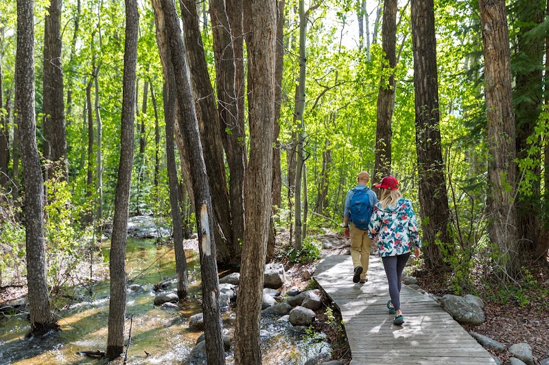
The adventure begins at the Hunter Creek Trailhead, just minutes from downtown Aspen. As you set out, the trail immediately immerses you in a tranquil woodland, where the crisp scent of pine mingles with the earthy aroma of damp soil. The sound of Hunter Creek accompanies your journey, its gentle murmur providing a soothing soundtrack as it tumbles over rocks and rushes under wooden bridges.
The initial stretch is a moderate climb, with switchbacks that weave through groves of aspen trees. In the fall, their golden leaves create a canopy of shimmering light, while in summer, wildflowers add splashes of vibrant color along the trail’s edges. As you ascend, occasional breaks in the forest reveal views of Aspen’s rooftops, reminding you how seamlessly this trail blends nature with proximity.
About two miles in, the trail opens into expansive meadows, where the world seems to widen. Here, the mountains rise dramatically on all sides, framing the verdant valley below. Whether you stop for a picnic, snap photos, or simply soak in the serenity, this spot is a highlight that feels worlds away from the bustling town you left behind.
The return trip is a gentle descent, offering a new perspective on the forested path. By the time you reach the trailhead, your lungs will feel refreshed, your spirit recharged, and your camera roll brimming with Aspen’s natural beauty.
Adventure Guide: Hunter Creek Trail in Aspen
Overview
The Hunter Creek Trail is a moderately challenging 6-mile round-trip hike offering stunning views, peaceful creekside stretches, and a mix of shaded forest and open meadows. Its close proximity to downtown Aspen makes it a favorite among locals and visitors alike.
Trail Details
- Distance: 6 miles round trip.
- Elevation Gain: ~700 feet.
- Trail Type: Out-and-back.
- Difficulty: Moderate. Accessible for most hikers but includes some rocky and steep sections.
Highlights
- Creekside Views: Hunter Creek provides a picturesque and calming companion throughout much of the hike.
- Aspen Groves: A quintessential Colorado experience, especially vibrant in fall.
- Mountain Meadows: Expansive, open areas perfect for resting and taking in the scenery.
What to Know Before You Go
- Best Season: Late spring through early fall. Snow may linger in shaded areas during early spring, and fall foliage is spectacular in September and October.
- Trailhead Access: Located just 5 minutes from downtown Aspen. Limited parking is available, so arrive early or take the free local shuttle.
- Wildlife: Deer, marmots, and chipmunks are common. Keep an eye out for hawks soaring above the meadows.
- Gear: Sturdy hiking shoes, water, and layers for variable weather. Trekking poles can be helpful for the switchbacks.
Directions
From downtown Aspen, head north on Mill Street and take a slight right onto Red Mountain Road. Follow signs to the Hunter Creek Trailhead. Limited parking is available at the trailhead, with additional spots further down Red Mountain Road.
Pro Tips
- Early Birds: Start your hike in the morning to enjoy cooler temperatures and quieter trails.
- Picnic Perfect: Pack a light lunch or snacks to enjoy in the meadows.
- Connect Trails: Combine the Hunter Creek Trail with the Smuggler Mountain Trail for a longer, looped adventure.
- Stay Hydrated: While the trail is shaded, the elevation can dehydrate you quickly—carry plenty of water.
The Hunter Creek Trail is a quintessential Aspen experience, offering a harmonious blend of effort, reward, and natural beauty. Whether you’re a seasoned hiker or just looking for a peaceful retreat, this trail delivers the perfect dose of Colorado magic.
Adventure Map
Aspen, Colorado Info
Difficulty
N/A
Distance
N/A
Elevation
N/A ft