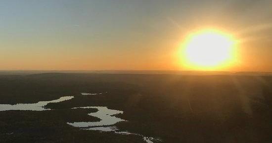
From the air, Throop reads like a regional biography: narrow river valleys, folded ridges, and the fingerprints of industry that shaped northeastern Pennsylvania for more than a century. The borough sits at the transition between the rolling foothills that climb toward the Poconos and the deeper cuts of the Lackawanna River—terrain that rewards aerial perspectives because shapes that seem ordinary on the ground resolve into meaningful patterns from above. An air tour here is less about soaring over a single iconic peak and more about synthesizing landscape and history into a coherent visual story.
On clear mornings the river corridor reflects light like a ribbon of mercury while reservoirs and quarry ponds glint in scattered pockets. The anthracite coalfields that powered the region’s railroads and manufacturing left terraces, strip pits, and rail beds that are best understood at a short flying altitude. Piloting over these features, guides often point out how the grid of towns, the angles of ridgelines, and the dark veins of forest map to the economic and social development of Lackawanna County. For photographers and curious travelers, that contextual knowledge turns a fifteen- to forty-five-minute flight into a capsule history lesson.
Seasonal color changes make each flight distinct. Late-summer haze softens the distant Poconos; autumn brings a dramatic palette of warm tones that expand the visual drama of every ridge and valley; winter, when skies are blue and cold, offers the most crystalline visibility but comes with higher cancellation risk due to weather. Balloonists prize calm, cool mornings—sunrise launches over the river valley are quiet and contemplative—while fixed-wing and helicopter operators can schedule midday or late-afternoon sorties when the light sculpts the landscape. Because air tours around Throop tend to be intimate—small planes, helicopters with a few seats, or family-run balloon crews—there’s a strong emphasis on interpretation. Pilots and guides are often local and can point out specific landmarks: a defunct rail yard, a reclaimed mine, a favored overlook along the Lackawanna State Park corridor.
Practical appeal is part of the draw. Throop’s proximity to Scranton and Interstate 81 keeps turnaround times short: you can drive in, fly a short scenic loop, and be back on the ground with time to visit a museum, walk a rail-trail, or enjoy regional food in a single afternoon. That combination—high interpretive value, striking seasonal variety, and logistical convenience—makes Throop an unexpectedly rich place for low-level aerial exploration.
Air tours here are an ideal complement to ground-based experiences. Pair a morning balloon flight with a riverside walk or a rail-trail ride in the afternoon. Combine a small-plane scenic loop with a visit to nearby Scranton cultural sites to round out a restful day of exploration.
Because flights are typically short and weather-dependent, it’s easy to fit an aerial excursion into a broader itinerary. Operators in the region often offer multiple start times to catch preferred light—dawn for balloons, mid-afternoon for helicopters, and flexible windows for fixed-wing tours.
Choose by purpose
Whale watching, snorkeling, sunset sailing, cultural canoeing, harbor sightseeing, or private chartering.
Start near the city
Waikiki and Honolulu Harbor are primary hubs, with some trips launching near Hanauma Bay.
Confirm the vessel
Gangways, shaded seating, and boarding requirements vary according to vessel size and operator.