Running the Fast-Paced Trails of Cypress Hills Interprovincial Park in Alberta/Saskatchewan
Adventure Destination

Running the Fast-Paced Trails of Cypress Hills Interprovincial Park in Alberta/Saskatchewan

Running the Fast-Paced Trails of Cypress Hills Interprovincial Park9.2/10Moderate
Photo Gallery

Category

Running the Fast-Paced Trails of Cypress Hills Interprovincial Park

Typical Duration

2-4 hours

Difficulty

Moderate

About This Adventure Destination

Introductory Overview

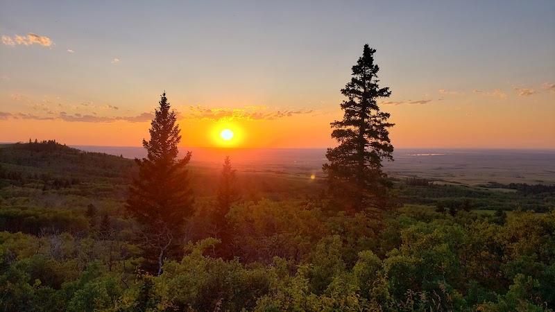
Cypress Hills Interprovincial Park, spanning Alberta and Saskatchewan, offers some of the best trail running opportunities in Canada. With its unique mix of dense forests, rolling grasslands, and rugged terrain, this park provides a challenging and scenic experience for runners of all levels. Cypress Hills is the highest point between the Rocky Mountains and Labrador, which means varying elevations, breathtaking viewpoints, and technical trails. Whether you’re looking for steep ascents, smooth pathways, or endurance-testing loops, this area delivers an unforgettable run with a mix of alpine beauty and prairie vistas.

Running the Fast-Paced Trails of Cypress Hills Interprovincial Park in Alberta/Saskatchewan

Adventure Guide to Running the Fast-Paced Trails of Cypress Hills Interprovincial Park in Alberta/Saskatchewan

1

#

  • Highlights:

2

Spruce Coulee Trail

  • Distance:

    9.2 km (loop)

  • Terrain:

    Moderate to difficult, featuring rolling hills, forested sections, and lakeside views.

  • Highlights:

    The trail circles Spruce Coulee Reservoir, providing a mix of fast-paced stretches and technical rocky sections.

  • Local Insight:

    Runners can often spot moose or white-tailed deer near the lake at dawn or dusk.

3

Horseshoe Canyon Trail

  • Distance:

    5 km (loop)

  • Terrain:

    Steep inclines, requiring strong footing and endurance.

  • Highlights:

    This challenging trail takes runners along canyon ridges, offering spectacular views of the park’s rugged landscape.

  • Local Insight:

    The elevation shifts make this a great spot for hill training, and historical points along the way detail Indigenous history and early European settlements.

4

Trans Canada Trail Connection

  • Distance:

    Varies (connects to multiple park trails)

  • Terrain:

    A mix of wide-open grasslands and tree-covered paths, suitable for distance training.

  • Highlights:

    A section of the iconic Trans Canada Trail, known for its flowing single-track runs and occasional wildlife encounters.

  • Local Insight:

    Runners who venture along this route may come across hidden viewpoints overlooking the Massold Clay Forest.

5

Visitor Tips

  • Best Time to Visit:

    Late spring to early fall for the best trail conditions.

  • What to Bring:

    Trail running shoes with good grip, hydration packs, and bear spray due to frequent wildlife sightings.

  • Driving Directions:

    Approx. 4.5-hour drive from Calgary or 4-hour drive from Regina, with easy access via Highway 1 and Highway 41.

Reviews

M
Melissa Dewara week ago

Great destination! Enjoyed the open trail and peaceful outdoor atmosphere.

G
Gary Stewart2 weeks ago

Great destination! Enjoyed the open trail and peaceful outdoor atmosphere.

R
Rezeenold Christiana month ago

Great destination! Enjoyed the open trail and peaceful outdoor atmosphere.

P
Parth Sharma2 months ago

Well, we took a random trip to the hills. Since we live like an hour and a half away from the hills. Having recently relocated into the small town life, it is an ideal place for some getaway. Wonderful and great for family time and friends too ! :)

R
Russ Boschee3 months ago

If you are looking for a campground, a place to do few hiking trails, abit of kayaking, or paddle board, or simply put your feet up and enjoy the fresh air, you cannot beat this area

Nearby Adventures

Bookable Experiences

Forty-Five Minutes of Clean, Crowd‑Pleasing Virtual Reality in Medicine Hat58.6 mi
Medicine Hat, Alberta

Forty-Five Minutes of Clean, Crowd‑Pleasing Virtual Reality in Medicine Hat

A compact, 45-minute session at SixOneSix Entertainment that delivers curated VR adventures, multiplayer options and meticulous headset hygiene—useful to planners who want a fast, safe taste of virtual reality.

58.6 miView Trips & Details →
Walk Medicine Hat: Gas‑City lore, murals and river panoramas on a guided downtown stroll58.6 mi
Medicine Hat, Alberta

Walk Medicine Hat: Gas‑City lore, murals and river panoramas on a guided downtown stroll

A lively, gratuity‑based 3‑hour walk that threads historic downtown, Gas City landmarks and the South Saskatchewan River—this guide lays out the route, meeting point, and what to expect.

58.6 miView Trips & Details →
Axes, Aces, and Adrenaline: 90 Minutes at SixOneSix’s Throwing Lanes in Medicine Hat58.6 mi
Medicine Hat, Alberta

Axes, Aces, and Adrenaline: 90 Minutes at SixOneSix’s Throwing Lanes in Medicine Hat

A guided 90‑minute axe‑throwing session at SixOneSix Entertainment in Medicine Hat that teaches novices, enforces safety, and stages friendly competition.

58.6 miView Trips & Details →
Five 14‑Minute Rounds Inside Medicine Hat’s 300‑sq/ft Free‑Roam VR Arena58.6 mi
Medicine Hat, Alberta

Five 14‑Minute Rounds Inside Medicine Hat’s 300‑sq/ft Free‑Roam VR Arena

A 75‑minute, five‑round virtual‑reality session for 1–6 players in a 300 sq/ft free‑roam arena; this guide explains what to expect and how the session runs.

58.6 miView Trips & Details →
Inside a 300 sq/ft VR Free‑Roam Arena: Two 14‑Minute Rounds of Competitive Play in Medicine Hat58.6 mi
Medicine Hat, Alberta

Inside a 300 sq/ft VR Free‑Roam Arena: Two 14‑Minute Rounds of Competitive Play in Medicine Hat

A 30‑minute session of virtual‑reality free‑roam play for groups of 1–6 people — this guide explains the arena, the two 14‑minute rounds, and what to expect.

58.6 miView Trips & Details →
Medicine Hat on Foot: A three-hour, pay-what-you-wish stroll from historic Main Street to a river lookout58.8 mi
Medicine Hat, Alberta

Medicine Hat on Foot: A three-hour, pay-what-you-wish stroll from historic Main Street to a river lookout

A lively, gratuity-based guided walk that covers Medicine Hat’s downtown architecture, public art, riverfront vistas and landmarks—useful as an orientation for first-time visitors and locals alike.

58.8 miView Trips & Details →