Hiking Wagner Butte Trail: Oregon's Scenic Gem
Adventure Destination

Hiking Wagner Butte Trail: Oregon's Scenic Gem

Explore the 7.2-mile Wagner Butte Trail in Southern Oregon's Siskiyou Mountains. With moderate difficulty, this trail offers rewarding views, wildflowers, and bird watching opportunities. Ideal for adventure seekers looking for a scenic hike.

Hiking7.3/10Moderate
Photo Gallery

Category

Hiking

Typical Duration

2-4 hours

Difficulty

Moderate

About This Adventure Destination

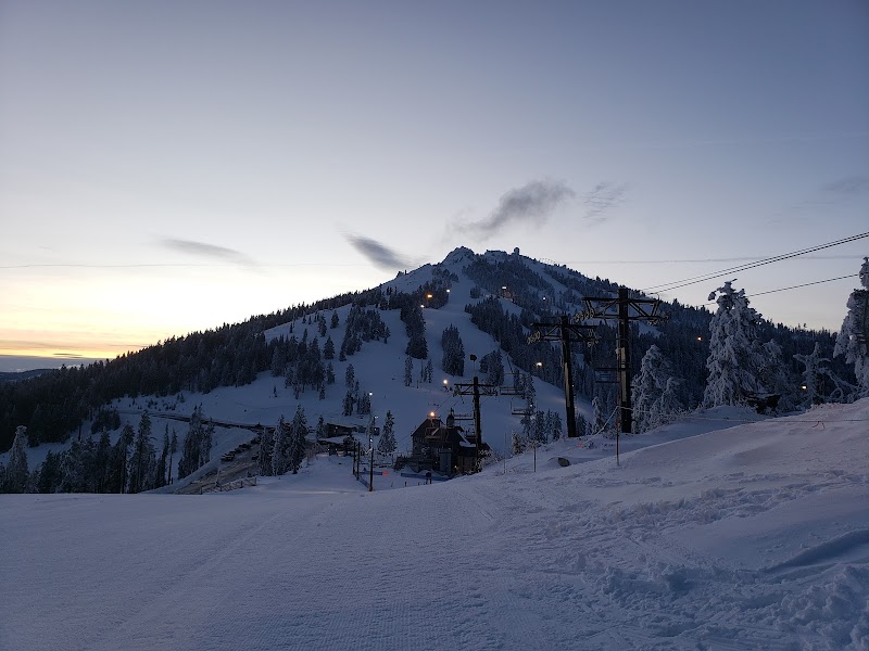
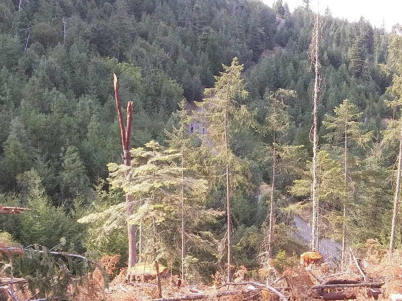
Wagner Butte Trail is a celebrated outdoor destination located in Southern Oregon’s Siskiyou Mountains, a region known for its rich biodiversity and scenic mountain landscapes. This trail stands out for offering hikers a rewarding challenge combined with an exceptional panoramic view at its summit. The trek covers approximately 7.2 miles roundtrip and features a varied route through dense forests dominated by towering pines and firs, with seasonal displays of colorful wildflowers adding bursts of color during spring and early summer.

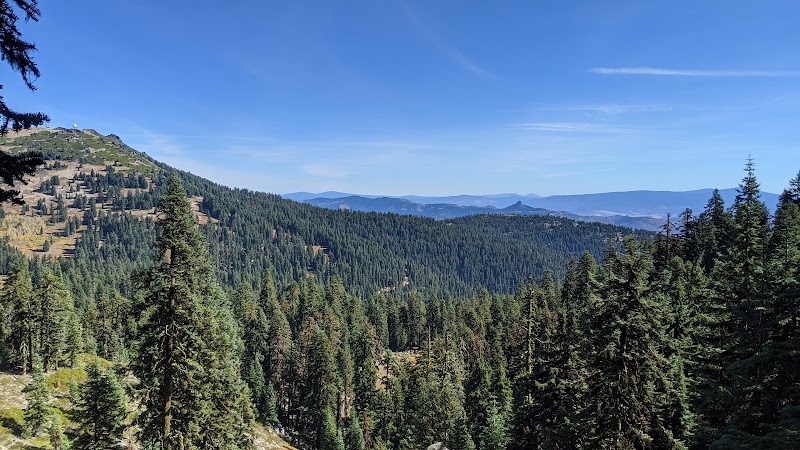
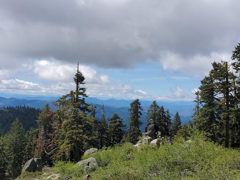
The trail’s highlight is reaching the peak of Wagner Butte, where visitors can take in sweeping vistas that extend across the Rogue Valley and beyond. On clear days, it is possible to see Mount Shasta in California to the south as well as Crater Lake to the north, making this viewpoint one of the most impressive natural lookout spots in the area. The landscape shows a mix of rocky outcrops and forested slopes, offering a glimpse of Southern Oregon’s diverse geology and ecosystems.

Wagner Butte also carries historical significance as an early 20th-century fire lookout station, with subtle remains from that era still found near the summit. These historic traces add an interesting layer of heritage to the natural beauty, presenting visitors with a chance to reflect on the region's fire management history and mountainous terrain. This trail appeals to those seeking a physically engaging hike matched with nature’s quiet beauty and a touch of local history.

Whether hiking for the physical challenge, the views, or the peaceful surroundings, Wagner Butte Trail is a standout choice for anyone looking to experience Southern Oregon’s wilderness firsthand.


Editorial Assessment

Wagner Butte Trail is a remarkable location offering stunning views and diverse flora. While it’s a memorable hike, its recognition beyond local circles remains limited, hence not reaching the top echelons of global natural landmarks.
Hiking Wagner Butte Trail: Oregon's Scenic Gem

Adventure Guide to Hiking Wagner Butte Trail: Oregon's Scenic Gem

1

Hiking the Wagner Butte Trail

  • What makes it special:

    A moderately strenuous 7.2-mile roundtrip hike featuring dense conifer forests and meadows

  • Key features:

    Panoramic summit views of Rogue Valley, Mount Shasta, Crater Lake; wildflowers in spring; rocky summit terrain

  • Local insight:

    The trail was historically used for fire lookout purposes in the early 1900s, offering a blend of natural and historical interest

  • Visitor tips:

    Best visited between late spring and early fall when the trail is dry and wildflowers bloom. Bring sturdy hiking boots, water, and layers for summit winds.

2

Wildlife Viewing Opportunities

  • What makes it special:

    Home to diverse fauna, including deer, birds of prey, and occasional black bears

  • Key features:

    Quiet forested sections ideal for spotting woodland creatures and listening to bird calls

  • Local insight:

    Early morning or late afternoon are best for wildlife sightings; carry binoculars and stay on marked trails

  • Visitor tips:

    Carry bear spray if comfortable and familiarize yourself with local wildlife safety; wear insect repellent during warmer months.

3

Nearby Outdoor Activities at Rogue Valley

  • What makes it special:

    Complement your hike with nearby fishing spots, mountain biking trails, and scenic drives through Southern Oregon’s forests

  • Key features:

    Access to rivers for fishing, varied mountain bike paths, and viewpoints scattered throughout the region

  • Local insight:

    The Rogue Valley climate supports year-round outdoor recreation, with mild winters and warm summers

  • Visitor tips:

    Plan for flexible activities depending on weather; pack sunscreen, water, and a trail map for safer navigation. ---

4

Practical Information and Directions

  • Best times to visit:

    May through October

  • What to bring:

    Water, layered clothing, hiking boots, sunscreen, snacks, first aid kit

  • Directions:

    From Medford, Oregon, take OR-140 east toward the Siskiyou Mountains, then turn onto biomass roads leading to the trailhead near Wagner Butte. The drive typically takes about 1 to 1.5 hours depending on starting point and road conditions.

  • Safety note:

    Trail elevation gain can be steep in sections; pace yourself and watch for loose rocks near the summit. Wagner Butte Trail rewards visitors with its remarkable combination of physical activity, peaceful natural surroundings, and sweeping mountain views, making it an outstanding feature of Southern Oregon’s outdoor offerings.

Reviews

L
Larry Wilsona month ago

Incredible experience! The views and natural scenery at Hiking Wagner Butte Trail: Oregon's Scenic Gem are unforgettable. Well marked trails and a fantastic outdoor getaway.

P
Peter M.3 months ago

Clean trails with great directions. Once you arrive, there are multiple scenic vantage points to explore. Highly recommend visiting early in the morning.

D
David Pestana6 months ago

One of my favorite destinations in the region. Sunset here transitions into an unforgettable evening with shifting light on the landscape.

Nearby Adventures

Bookable Experiences

One Day on Southern Oregon’s Rivers: Guided Fishing from Ashland7.30 mi
Ashland, Oregon

One Day on Southern Oregon’s Rivers: Guided Fishing from Ashland

A one-day guided fishing excursion out of Ashland with Noah's River Adventures that pairs expert instruction with chances at salmon, steelhead and trout.

7.30 miView Trips & Details →
Hells Corner: A Full-Day Charge Down the Klamath’s Class 4 Teeth7.30 mi
Ashland, Oregon

Hells Corner: A Full-Day Charge Down the Klamath’s Class 4 Teeth

A full-day rafting run from Ashland that threads 14 river miles of Class 3–4+ whitewater (including the famed Caldera) with expert guides, riverside meals and door-to-door transport.

7.30 miView Trips & Details →
Rogue River Half‑Day Express: 5.5 Miles From Mile‑Long Calm to Two Class IV Climaxes7.30 mi
Ashland, Oregon

Rogue River Half‑Day Express: 5.5 Miles From Mile‑Long Calm to Two Class IV Climaxes

A brisk AM or PM 5.5‑mile Rogue River rafting run—an express half‑day that threads Class I–III water and finishes with two Class IV rapids, useful for planners who need clear timing, gear and age guidance.

7.30 miView Trips & Details →
Drifting the Rogue: A Family Float to Discovery Park7.31 mi
Medford, Oregon

Drifting the Rogue: A Family Float to Discovery Park

A 3/4‑day family float on the Rogue River that includes a boat‑in stop at The Discovery Park for rentals, an AquaPark, and food — this guide explains what to expect from the trip.

7.31 miView Trips & Details →
Two Days Rafting Hell’s Corner to Kikaceki Canyon — The West’s Best Whitewater7.31 mi
Klamath Falls, Oregon

Two Days Rafting Hell’s Corner to Kikaceki Canyon — The West’s Best Whitewater

A focused, two-day river camp out that runs Spring Island to Fall Creek access and covers Hell’s Corner, Wards Canyon and a class 4+ finale—this guide distills the route, timing and what to expect.

7.31 miView Trips & Details →
A splash-and-sunrun down the Wild & Scenic Deschutes: classic family whitewater through Maupin’s canyon8.24 mi
Maupin, Oregon

A splash-and-sunrun down the Wild & Scenic Deschutes: classic family whitewater through Maupin’s canyon

A single-day, 11-mile Deschutes River run from Harpham Flat to Sandy Beach that pairs Class II–III+ rapids with calm floats, riverside lunch, and expert-guided paddling—this guide explains what to expect and how to plan.

8.24 miView Trips & Details →