Climbing Capitol Peak: An Adventurer's Guide
Adventure Destination

Climbing Capitol Peak: An Adventurer's Guide

Capitol Peak in Aspen, CO, offers a challenging 17-mile hike with 5,300 ft elevation gain. Known for the Knife Edge, it's an extreme climb for adventure seekers. Best mid-July to early September.

Climbing8.8/10Extreme
Photo Gallery

Category

Climbing

Typical Duration

Half day

Difficulty

Extreme

About This Adventure Destination

Capitol Peak, rising 14,137 feet above the rugged Elk Mountains, is a name spoken with equal parts reverence and awe. Known as one of Colorado’s most challenging 14ers, it’s not just a climb—it’s a test of courage, skill, and resolve. With its infamous Knife Edge and relentless exposure, Capitol Peak offers an adventure that rewards the bold with a summit experience few dare to claim.

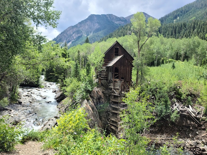
The journey begins at the Capitol Creek Trailhead, where the first few miles lull you into a false sense of ease. Rolling meadows, vibrant with wildflowers in summer, stretch toward the base of the peak. The trail follows Capitol Creek, its cool waters glistening under the alpine sun, as the rugged form of Capitol Peak grows ever larger and more imposing in the distance.

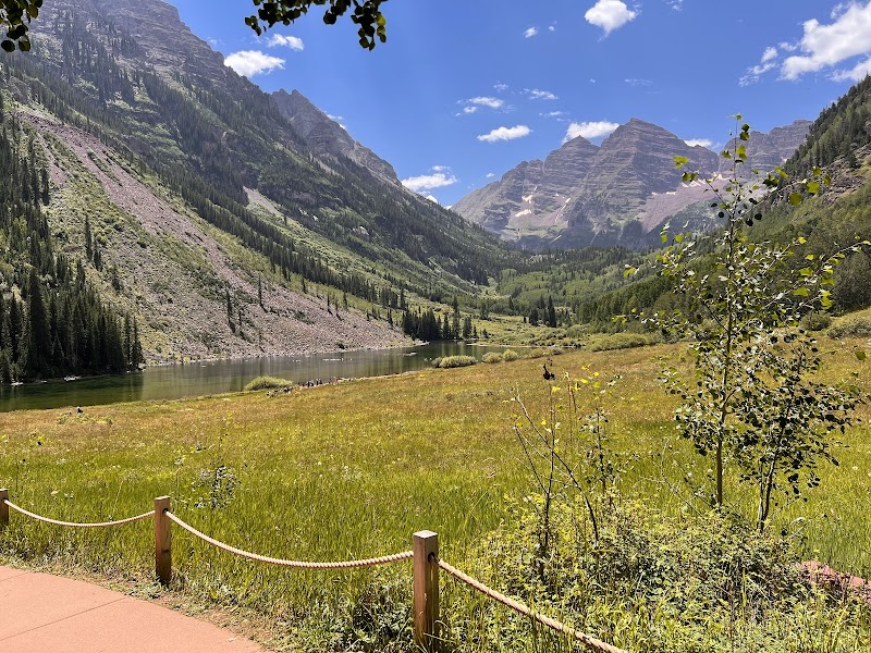
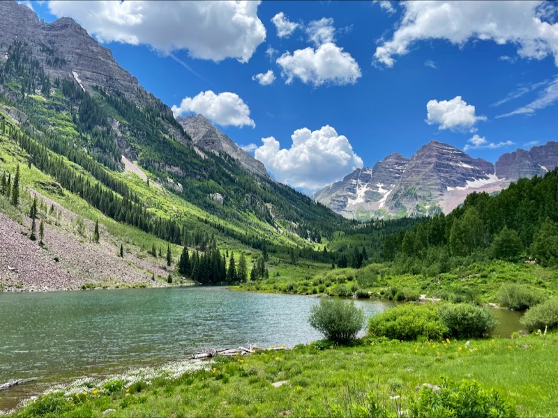
After a steady 6.5-mile approach, you’ll reach Capitol Lake, a pristine alpine jewel cradled beneath the dramatic cliffs of Capitol Peak. Here, climbers often set up camp, watching the sunset turn the peak’s sheer walls a fiery orange. But the lake is only the prelude—the real adventure begins at dawn.

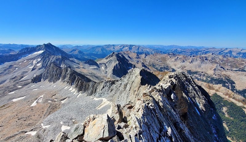
The ascent is relentless, navigating steep scree fields and talus slopes that demand precision and stamina. As you gain elevation, the route becomes technical, leading to the Knife Edge, a narrow ridge of rock with sheer drops on both sides. Here, every movement counts. Hands and feet must work in unison, and focus must override fear. The thrill is electric, the exposure unforgettable.

Beyond the Knife Edge, the climb doesn’t let up. Scrambling over rock chimneys and navigating loose, steep terrain, the summit feels hard-earned. But standing at the top, with the Elk Mountains sprawling in every direction, is a triumph that defies description. Capitol Peak isn’t just a mountain—it’s a journey into the depths of your determination and the heights of Colorado’s wild beauty.


Editorial Assessment

Capitol Peak is renowned for its challenging climb and dramatic alpine views, making it a sought-after destination for experienced adventurers. Its rugged beauty and the thrill of its ascent contribute to its high appeal for outdoor enthusiasts.
Climbing Capitol Peak: An Adventurer's Guide

Adventure Guide to Climbing Capitol Peak: An Adventurer's Guide

1

Overview

  • Overview:

    Capitol Peak, one of Colorado’s most challenging 14ers, is a Class 4 climb featuring significant exposure, technical scrambling, and high-consequence terrain. This climb demands advanced skills, careful planning, and respect for its formidable nature. ---

2

Route Details

  • Route:

    Northeast Ridge.

  • Distance:

    ~17 miles round trip.

  • Elevation Gain:

    ~5,300 feet.

  • Difficulty:

    Class 4. Features steep terrain, technical scrambling, and exposed ridges. ---

3

What to Know Before You Go

  • Best Season:

    Mid-July through early September. Snow often lingers on the route until midsummer.

  • Trailhead:

    Capitol Creek Trailhead. A high-clearance vehicle is recommended for the rough dirt road leading to the trailhead.

  • Gear Recommendations:
  • Details:

    Helmet for rockfall protection.

  • Details:

    Climbing gloves for better grip and comfort on the Knife Edge.

  • Details:

    Hiking boots with excellent traction.

  • Details:

    Trekking poles for the approach and descent. ---

4

Key Challenges

  • Overview:
    1. The Approach: A 6.5-mile trek to Capitol Lake with significant elevation gain. 2. Knife Edge: A 150-foot-long, narrow ridge with sheer drops on both sides—intensely exposed and requiring precise movements. 3. Summit Push: Technical scrambling over loose, steep terrain beyond the Knife Edge. ---
5

Safety Tips

  • Start Early:

    Aim to summit before 10 a.m. to avoid afternoon thunderstorms.

  • Know Your Limits:

    Capitol Peak is not for beginners or the faint of heart. Be honest about your skills and experience.

  • Route Finding:

    The path beyond the Knife Edge is not always intuitive—study maps, GPS tracks, and detailed route descriptions.

  • Group Size:

    Climb with a small, experienced group to reduce rockfall risk and ensure efficient movement. ---

6

Directions and Parking

  • Overview:

    From Aspen, take CO-82 west and turn onto Snowmass Creek Road. Follow the signs to Capitol Creek Trailhead. A high-clearance vehicle is recommended for the final stretch of road. Parking is limited, so arrive early. ---

7

Pro Tips

  • Acclimate:

    Spend a few days at altitude in Aspen or Snowmass before tackling Capitol Peak to avoid altitude sickness.

  • Stay Hydrated:

    Bring 3–4 liters of water, as the climb is physically demanding and exposed.

  • Camp Smart:

    Capitol Lake offers the best camping spot for summit attempts—secure your permit in advance.

  • Study the Weather:

    Turn back immediately if storms threaten, as the exposed terrain becomes treacherous in rain or lightning. ---

8

After the Climb

  • Overview:

    Celebrate your success in Aspen with a well-earned meal. The truffle fries at Ajax Tavern or a hearty steak at Steakhouse No. 316 will never taste better. Reflect on the climb and the courage it took to tackle one of Colorado’s most daunting peaks. ---

9

Safety and Sustainability

  • Respect the Mountain:

    Capitol Peak has claimed lives—treat it with the respect it demands.

  • Leave No Trace:

    Pack out all trash, and avoid stepping off-trail to protect the fragile alpine environment.

  • Know When to Turn Back:

    The summit is optional—safety is not. If conditions worsen or you feel uncertain, prioritize your life over the climb. --- Climbing Capitol Peak is more than a physical feat—it’s an exploration of grit, determination, and the wild beauty of the Rockies. For those who rise to its challenge, the reward is not just a summit but a story of courage and connection to Colorado’s untamed spirit.

Reviews

B
Brian Baker2 months ago

Looks great from a distance! Can't wait to climb it! ---Update--- Climbed it! Loved it! From Capitol Peak TH and back, with some trail running, took about 12 hours round-trip. The knife edge was much shorter than I'd expected! The hardest part of the climb was going over the top of K2. After the knife, there's a lot of exposed scrambling along ledges, though there are cairns, and it's all pretty straightforward. Coming back, I accidentally avoided the knife by following cairns on climber's left (south face), so there is definitely a way around it!

J
Jason Wiszynskia year ago

Easy day hike… for some ;)

E
Evelina Murtazinaa year ago

The beginning of the winter season🔥

T
Tommy Sandsa year ago

Great destination! Enjoyed the open trail and peaceful outdoor atmosphere.

K
Koby Lawson4 months ago

On July 20th, our adventure began at 7:15 AM from the Capitol Peak Trailhead. We followed the Capitol Ditch Trail, reaching Campsite #4 near Capitol Lake three hours later. I would definitely recommend #1-4, with 2 being the best view. After a quick lunch, we enjoyed some fishing, catching beautiful Colorado cutthroat trout. With time to spare, I hiked up to the Daly Saddle to scout our route for the next day. Skirting around the gendarme and visiting the Daly keyhole, I soaked in the breathtaking views before hustling back for a refreshing plunge in Capitol Lake. As the sun set, we caught a few more trout and settled in for the night. The next morning, we broke camp at 5:42 AM, reaching the top of the Saddle in 30 minutes. We descended into the talus field, navigating steep switchbacks and multiple snow crossings. Thankfully, the well-formed path and deep footprints made the snow crossings manageable without micro spikes. At the base of K2, my dad decided to turn back, leaving me to attempt the summit solo. Contrary to reports, scrambling up and over K2 was not as challenging as anticipated. The exposure on the knife edge was thrilling, and the minimal wind made for perfect conditions. I encountered two hikers on my way to the summit: one descending and one slowly ascending. I reached the ridgeline slightly farther south than expected, but the panoramic views were spectacular. As I summited, a helicopter circled below, hovering above the Daly Saddle and Capitol Lake. Alone on the summit, I basked in the perfect weather before beginning my descent. The round trip from Campsite #4 took six hours. The descent was quicker, but the loose rocks on the upper East face required caution to avoid dislodging them onto the trail below. The snow crossings had softened in the day's heat, creating slippery conditions, but micro spikes remained unnecessary. I sped up during the final 1,000-foot descent from the Daly Saddle, finishing with a trail run. We left camp at 1:37 PM, arriving back at the trailhead three hours later. Overall, it was an incredible trail that I would highly recommend. Videos of the hike: Ditch Trail to Campsite #4: https://youtu.be/GckN9L3IFbI Campsite #4 to the Summit: https://youtu.be/xXTwM9H1Lbw The Descent: https://youtu.be/280t-c9V3uo

Nearby Adventures

Bookable Experiences

Soiled Doves: Walking Leadville’s Brothel District Between Parlor Houses and Ghost Stories42.9 mi
Leadville, Colorado

Soiled Doves: Walking Leadville’s Brothel District Between Parlor Houses and Ghost Stories

A roughly two-hour walking history and ghost tour that traces Leadville’s red‑light streets and the women—madams, dance‑hall girls and soiled doves—who shaped the town’s nightlife.

42.9 miView Trips & Details →
Whispers in the Clouds: Secrets of the Silver Ghosts42.9 mi
Leadville, Colorado

Whispers in the Clouds: Secrets of the Silver Ghosts

A high-altitude, nighttime walking tour through Leadville’s most haunted sites—an immersive 75–90 minute storytelling walk that starts and ends at Zaitz Park.

42.9 miView Trips & Details →
Steel City Spin: An eBike Charge Through Pueblo’s Riverfront, Murals and Lakeshore42.8 mi
Leadville, Colorado

Steel City Spin: An eBike Charge Through Pueblo’s Riverfront, Murals and Lakeshore

A 6-hour, fully supported eBike ride that threads the Arkansas River Trail, downtown murals and Lake Pueblo views—timed to coincide with the Steel City Music Festival and useful as a practical guide to the event-day flow.

42.8 miView Trips & Details →
Rocky Point Ride: One Hour of Quiet on Vail’s High Trails51.2 mi
Vail, Colorado

Rocky Point Ride: One Hour of Quiet on Vail’s High Trails

An adults-only, one-hour horseback ride from Vail Stables that trades spectacle for stillness—this guide explains what to expect, how the hour flows, and what to bring.

51.2 miView Trips & Details →
Lesson 2: Fundamentals of Kayaking — Read the current in Gypsum’s sandstone canyons34.5 mi
Gypsum, Colorado

Lesson 2: Fundamentals of Kayaking — Read the current in Gypsum’s sandstone canyons

A hands-on, half-day kayaking lesson on the Colorado River that teaches core maneuvers and river reading to students who have completed Lesson 1.

34.5 miView Trips & Details →
Aspen Gold and Mountain Air: A 2.5‑Hour Fall Ride out of Leadville43.1 mi
Leadville, Colorado

Aspen Gold and Mountain Air: A 2.5‑Hour Fall Ride out of Leadville

A narrated, roundtrip 2.5‑hour excursion through the San Isabel National Forest offering panoramic views of the Upper Arkansas Valley and Colorado’s highest peaks—this guide explains what to expect and how to plan.

43.1 miView Trips & Details →