Exploring the Flatirons Vista Trails in Boulder
Adventure Destination

Exploring the Flatirons Vista Trails in Boulder

Exploring the Flatirons Vista Trails 9.6/10Moderate
Photo Gallery

Category

Exploring the Flatirons Vista Trails

Typical Duration

2-4 hours

Difficulty

Moderate

About This Adventure Destination

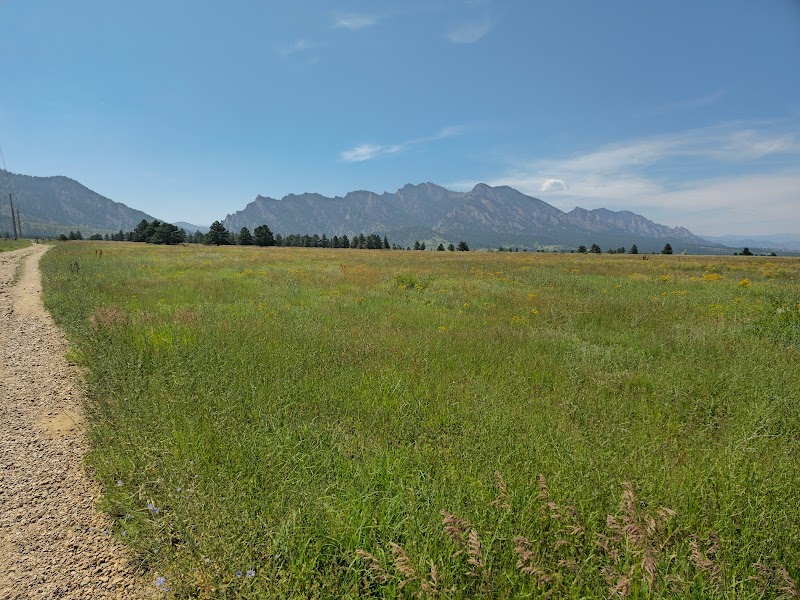
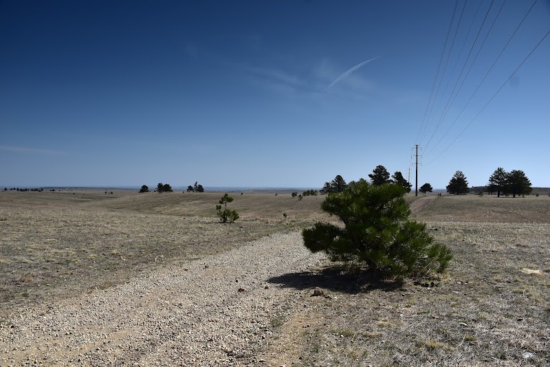
The Flatirons Vista Trails is a captivating destination that showcases the stunning beauty of Boulder, Colorado. Serving as a gateway to some of the most picturesque views of the iconic Flatirons, these trails offer visitors an unforgettable experience. The area is significant not only for its breathtaking scenery but also for its accessibility and diverse hiking options.
Exploring the Flatirons Vista Trails in Boulder

Adventure Guide to Exploring the Flatirons Vista Trails in Boulder

1

1. Flatirons Vista Loop

  • Details:

    Location: This trailhead is located at the Flatirons Vista Trailhead, just off Highway 93.

  • Details:

    What Makes It Special: The loop provides panoramic views of the Flatirons and the encompassing foothills. As you hike, you will encounter expansive open spaces dotted with wildflowers in the spring and summer.

  • Details:

    Key Features: The trail is approximately 3.3 miles long and features a gentle incline, making it suitable for families and casual hikers. There are picnic areas available for a relaxing post-hike lunch. 2. South Meadow Trail

  • Details:

    Location: Accessed via the Flatirons Vista Trailhead.

  • Details:

    What Makes It Special: This trail offers an immersive experience through flora and fauna native to the region. Wildlife enthusiasts may spot deer, rabbits, and various bird species.

  • Details:

    Key Features: The trail is about 1.5 miles round-trip and features interpretive signs that provide insights into the local ecology. 3. Ned's Trail

  • Details:

    Location: Connects to the Flatirons Vista Loop.

  • Details:

    What Makes It Special: This trail is slightly more challenging, offering a more secluded route with fewer crowds and stunning vistas of the Flatirons.

  • Details:

    Key Features: The trail showcases unique rock formations and varied terrain, appealing to more seasoned hikers.

2

Local Insights:

  • Overview:

    The Flatirons are not only a hiking destination but also carry historical significance, reflecting the geological forces that shaped this area millions of years ago.

3

Visitor Tips:

  • Details:

    Best Times to Visit: Early morning offers cooler temperatures and breathtaking sunrises.

  • Details:

    What to Bring: Sunscreen, plenty of water, sturdy hiking shoes, and a camera.

  • Details:

    Driving Directions: From downtown Boulder, take Baseline Road west to Highway 93. The trailhead is approximately a 15-minute drive.

Reviews

L
Leann Slovenskia month ago

Great destination! Enjoyed the open trail and peaceful outdoor atmosphere.

K
Kris Baltz2 months ago

Great destination! Enjoyed the open trail and peaceful outdoor atmosphere.

E
Eric Burke2 months ago

Awesome trail run

M
Mr O2 months ago

Excellent and easy trail to get your steps on. Running, dog walk walking and hiking are good here. Parking is not free but pay stations are on site. Colorado has their parks and each city has their parks so something to think about when visiting and budgeting for the outdoors. Overall a great day. I highly recommend this location.

A
Aimee Wilder2 months ago

Great destination! Enjoyed the open trail and peaceful outdoor atmosphere.

Nearby Adventures

Bookable Experiences

Learn to Lead Traditional Climbs: A Boulder‑Area School for Removable Protection in Eldorado and Unaweep1.69 mi
Boulder, Colorado

Learn to Lead Traditional Climbs: A Boulder‑Area School for Removable Protection in Eldorado and Unaweep

An 8‑hour Trad Leading course from Colorado Climbing Company that teaches lead belaying, placing removable protection, anchor building and outdoor ethics — the practical foundation for climbing places such as Eldorado Canyon and Unaweep Canyon.

1.69 miView Trips & Details →
Capturing Mashantucket: Photos / Video with HighFlyer Zipline5.45 mi
MASHANTUCKET, Connecticut

Capturing Mashantucket: Photos / Video with HighFlyer Zipline

A concise guide to the Photos / Video listing — a City Tour in Mashantucket, Connecticut, operated by HighFlyer Zipline, with essential factual notes and accompanying images.

5.45 miView Trips & Details →
Bliss in Boulder: A Short, Steep Ascent to Royal Arch beneath the Flatirons5.61 mi
Boulder, Colorado

Bliss in Boulder: A Short, Steep Ascent to Royal Arch beneath the Flatirons

A guided 3.3-mile, 1,200-foot climb from Chautauqua Park to Boulder’s iconic Royal Arch—this guide outlines what to expect on the trail and how to plan for the day.

5.61 miView Trips & Details →
On the Edge of Boulder: A Full-Day Ascent of a Flatiron6.34 mi
Boulder, Colorado

On the Edge of Boulder: A Full-Day Ascent of a Flatiron

A full-day, guided climb to the summit of one of Boulder's iconic Flatirons — over 1,000 feet of climbing with spectacular views and an easy approach.

6.34 miView Trips & Details →
Red-Gold Ridges: Classic Climbs of Eldorado Canyon6.40 mi
Colorado Springs, Colorado

Red-Gold Ridges: Classic Climbs of Eldorado Canyon

A full-day guided climbing experience in Colorado Springs that puts you on Eldorado’s storied routes—Swanson’s Arete, Yellow Spur, Rewritten and the demanding Naked Edge—useful for planning which classic to tackle.

6.40 miView Trips & Details →
Half-Day Wade with Front Range Anglers: Chase Wild Browns and Cutthroats in Boulder’s Mountain Streams6.55 mi
Boulder, Colorado

Half-Day Wade with Front Range Anglers: Chase Wild Browns and Cutthroats in Boulder’s Mountain Streams

A four-hour, walk-and-wade guided fly-fishing trip that pairs certified, patient instruction with Boulder Creek and nearby Rocky Mountain lakes for anglers of all levels.

6.55 miView Trips & Details →