Discover Indian Sands Trailhead: The Oregon Coast Gem
Adventure Destination

Discover Indian Sands Trailhead: The Oregon Coast Gem

Explore the Indian Sands Trailhead near Brookings, OR. A moderate trail with stunning sandstone formations and views of the Pacific. Ideal for hiking, beachcombing, and wildlife viewing. Visit in spring or fall for a quieter experience.

Hiking8.3/10Moderate
Photo Gallery

Category

Hiking

Typical Duration

2-4 hours

Difficulty

Moderate

About This Adventure Destination

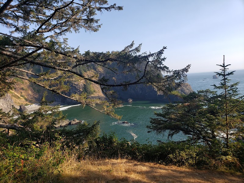
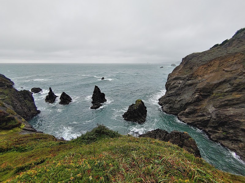
Indian Sands Trailhead, located near Brookings on the southern Oregon Coast, offers a distinctive outdoor destination where coastal forest meets rare sand dunes perched high above the Pacific Ocean. Part of the Samuel H. Boardman State Scenic Corridor, this site stands out for its unusual landscape feature: loose, golden sand dunes forming atop rugged cliffs – a contrast to the typical rocky shoreline found throughout the region.

The trail takes visitors through shaded evergreen stands and winds up steep sections before opening to stunning sandy ridges with expansive ocean views. These dunes are continuously shaped by coastal winds and waves, creating a shifting terrain that invites hikers to experience both forest paths and sandy stretches in one journey. Along the way, native coastal pines, wildflowers, and native grasses add splashes of green and color against the soft yellows of sand. This unusual coastal dune system is considered rare along Oregon’s shoreline, making Indian Sands a sought-after spot for those interested in diverse landscapes.

Cultural traces link the area to Native American history, with occasional findings of artifacts indicating the longstanding presence of indigenous peoples along this part of the coast. Visitors often appreciate the mix of natural beauty and cultural depth here, creating a memorable hiking experience that combines both adventure and quiet reflection.

Though the trail offers rewarding views, the terrain includes steep, sometimes uneven sections. It’s recommended to follow established routes carefully, keeping to marked paths to protect the fragile dunes and prevent erosion. This area’s strong wind, ocean breeze, and variable weather conditions highlight the importance of proper preparation before visiting.


Editorial Assessment

A unique coastal landscape with impressive sandstone formations and beautiful dunes. While not extremely iconic on a global scale, it provides a rare geological feature on the Oregon Coast worthy of exploration.
Discover Indian Sands Trailhead: The Oregon Coast Gem

Adventure Guide to Discover Indian Sands Trailhead: The Oregon Coast Gem

1

1. Hiking to the Coastal Sand Dunes

  • What makes it special:

    The trail features a unique combination of forest shelter and open sand dunes on cliffs overlooking the Pacific.

  • Key features:

    Steep forest paths, loose sand sections, panoramic ocean views.

  • Local insight:

    The sand dunes here are a rare natural feature on the Oregon coast, requiring hikers to stay on marked trails to preserve the landscape.

  • Visitor tips:

    Best visited in late spring through early fall to avoid slippery, wet conditions. Bring sturdy hiking shoes and layered clothing for variable weather.

2

2. Photography of Coastal Vistas

  • What makes it special:

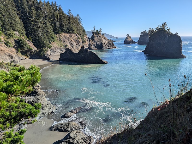
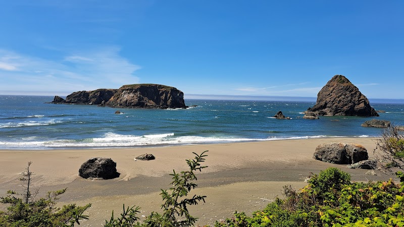
    Dramatic cliffside views with constantly changing dune shapes and crashing waves create ideal photo opportunities.

  • Key features:

    Golden sand dunes, coastal pines, and vibrant skies at sunrise or sunset.

  • Local insight:

    Early morning and late afternoon light provide the best natural contrast and fewer crowds.

  • Visitor tips:

    Pack a wide-angle lens and tripod for stable shots; use apps to track tides for beach views.

3

3. Wildlife Observation and Botany Walks

  • What makes it special:

    The area supports various coastal plants and animal life adapted to wind-sculpted dunes and forest edges.

  • Key features:

    Dense coastal pine groves, wildflowers, and occasional sightings of shorebirds or small mammals.

  • Local insight:

    Respect sensitive habitats by staying on designated paths, especially in dune areas vulnerable to foot traffic.

  • Visitor tips:

    Bring binoculars and field guides for birdwatching; avoid disturbing wildlife. ---

4

Getting There & Practical Info

  • Location:

    About 6 miles north of Brookings, Oregon, off Oregon Coast Highway (Highway 101).

  • Directions:

    From Brookings, drive north on Hwy 101 for roughly 10 minutes. Look for the Indian Sands Trailhead parking area on the right side with ample space.

  • Travel time:

    Approximately 10 minutes from central Brookings by car.

  • Best times to visit:

    Late spring through fall for safer trail conditions and clearer weather.

  • What to bring:
  • Details:

    Sturdy hiking footwear

  • Details:

    Layers for wind and variable temperature

  • Details:

    Water and snacks

  • Details:

    Sunscreen and insect repellent

  • Details:

    Map or GPS (trail markers can be unclear)

  • Tips:

    Stay on main trails to protect the dunes. Bathrooms are not available on-site; plan accordingly. This blend of coastal forest and sand dunes alongside spectacular ocean views makes Indian Sands Trailhead a memorable stop for outdoor enthusiasts and nature lovers on Oregon’s southern coast.

Reviews

R
Raghav Kahola month ago

Great destination! Enjoyed the open trail and peaceful outdoor atmosphere.

R
Rain Louisea month ago

The parking lot is large. There are several paths but all seem to end at the same place. Wear sturdy shoes because the trail is very challenging to climb.

T
Theora Palmera month ago

Great destination! Enjoyed the open trail and peaceful outdoor atmosphere.

K
Kiki S2 months ago

We really enjoyed the views of this trail and feeling immersed in it. However, the trail is very poorly marked and hard to follow even with All Trails or satellite and maps. I'm not totally sure we were on the trail the whole time. It is beautiful though going down and around. There are sandy parts and it can be very windy. Part of the trail is forested also and the brush is high in places so I would recommend hiking pants and long sleeves. You do have elevation change but it isn't too extreme. There is plenty of parking, no fee. There is no bathroom.

J
Jian Liang2 months ago

This is a hidden treasure. The trail head is even hard to be recognized. Parking is easy. Climbing in the beginning was a little bit harder for me. The middle part is quite easy. The last section is the part where you should be aware of the slippery because it is all rocky, particularly in the rainy days. We enjoyed the least people visited trail. But without anyone in front or behind you was somehow scary for us. Therefore we did some marks on the way we went in to avoid missing the way out.

Nearby Adventures

Bookable Experiences

Dockside Relief: Pump Out Service at Shelter Cove Marina, Eureka19.4 mi
Eureka, California

Dockside Relief: Pump Out Service at Shelter Cove Marina, Eureka

A concise guide to Shelter Cove Marina’s dockside pump out—available Mondays and Fridays—plus the sign-up rule you need to know.

19.4 miView Trips & Details →
Tie the Knot Against Crescent City’s Harbor and Pacific Skyline29.8 mi
Crescent City, California

Tie the Knot Against Crescent City’s Harbor and Pacific Skyline

A three-hour private wedding charter in Crescent City offering panoramic harbor, coastal and skyline views for an intimate party—this guide explains what to expect and how to plan.

29.8 miView Trips & Details →
Paddling Beneath Giants: A Half-Day Descent of the Lower Smith Through Redwoods29.2 mi
Fort Bragg, California

Paddling Beneath Giants: A Half-Day Descent of the Lower Smith Through Redwoods

A concise guide to Redwood Rides’ half-day Lower Stretch trip — what you’ll see on the water, the rapids you’ll run, and the practical details to plan your morning on the Smith River.

29.2 miView Trips & Details →
Solitude on the Old Redwood Highway — Biking the 1930s road high above the Pacific29.2 mi
Eureka, California

Solitude on the Old Redwood Highway — Biking the 1930s road high above the Pacific

A guided ride through Eureka’s temperate rainforest on a long-closed 1930s highway, useful for planning whether to pedal a short out‑and‑back or tackle the full 8‑mile descent to Enderts Beach.

29.2 miView Trips & Details →
Riverlight & Fire: A Farm‑to‑Table Dinner on the Trinity’s Class II–III Water32.5 mi
Junction City, California

Riverlight & Fire: A Farm‑to‑Table Dinner on the Trinity’s Class II–III Water

An evening trip that pairs either a run of Upper Trinity rapids or a scenic Class II float with a locally sourced, fireside beach dinner—this guide explains what to expect and how to prepare.

32.5 miView Trips & Details →
Crescent City Breaks: Learn to Ride the Wild Northern California Coast28.9 mi
Crescent City, California

Crescent City Breaks: Learn to Ride the Wild Northern California Coast

A fully outfitted, two-hour surf and ocean SUP lesson on the south coast of Oregon and Crescent City — this guide explains what’s included, who it’s for, and how to book.

28.9 miView Trips & Details →