Majestic Rock Formations of Red Rock Canyon
Adventure Destination

Majestic Rock Formations of Red Rock Canyon

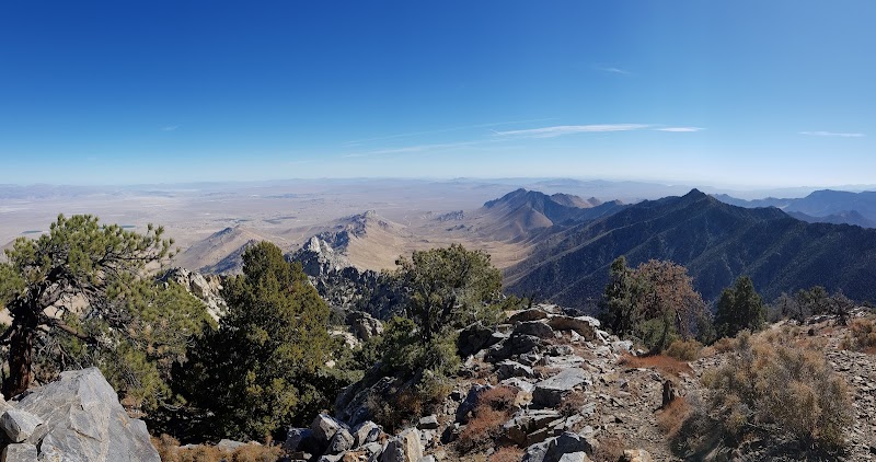
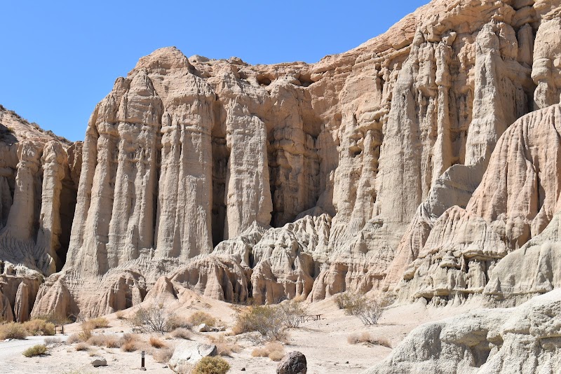
Explore the 1.2-mile loop at Red Rock Canyon State Park, offering easy hiking along towering rock formations. Located near Cantil, CA, this area is perfect for photographers and geology enthusiasts. Best visited in spring or fall for a vibrant display of colors and wildflowers.

Hiking8.0/10Easy
Photo Gallery

Category

Hiking

Typical Duration

2-4 hours

Difficulty

Easy

About This Adventure Destination

Red Rock Canyon State Park, located in the mesmerizing Mojave Desert in California, is a geologically unique treasure trove. Known for its striking rock formations, towering cliffs, and vibrant colors, this park offers a vivid glimpse into the earth’s ancient history. Just outside the small town of Cantil, travelers are greeted by dramatic landscapes that serve as a beautiful backdrop for adventure-seeking visitors. The park’s distinct features include sculpted pinnacles and wide plains, crafted over millennia by natural forces. These formations, primarily composed of sandstone, create a captivating playground for geology enthusiasts and photographers alike. Among its natural wonders, Red Rock Canyon is home to fossil beds, showcasing remnants of a by-gone aquatic era. Established as a state park in 1968, its deep-rooted history hails back to Native American tribes, who once navigated these rugged terrains. The park stands out as a conservation area that highlights the ecologically diverse features of the Californian desert. Vibrant wildflowers and unique wildlife add to its allure. Those who venture here find a peaceful escape and an invigorating setting for outdoor activities. Whether you are drawn to the geological beauty, the alluring hiking trails, or simply seeking a serene moment amidst nature, Red Rock Canyon State Park promises an unforgettable experience.

Editorial Assessment

Red Rock Canyon State Park offers a unique blend of geological wonders and outdoor adventures, making it a remarkable destination. While not among the top few natural landmarks globally, its impressive rock formations and visitor-friendly amenities make it a must-see location in California.
Majestic Rock Formations of Red Rock Canyon

Adventure Guide to Majestic Rock Formations of Red Rock Canyon

1

Experience Majestic Rock Formations of Red Rock Canyon

  • Special Features: Explore the 1.2-mile loop at Red Rock Canyon State Park, offering easy hiking along towering rock formations. Located near Cantil, CA, this area is perfect for photographers and geology enthusiasts. Best visited in spring or fall for a vibrant display of colors and wildflowers.
  • Visitor Tips: Best time to visit is during Spring and Fall. Bring adequate water, appropriate outdoor gear, and camera.
  • Directions: 37749 Abbott Dr, Cantil, CA 93519, USA
2

Exploring Near Cantil, California

  • Local Insights: Offers direct access to top trails, protected natural reserves, and picturesque viewpoints across Cantil, California.
  • Visitor Tips: Check local regulations, trail conditions, and weather before heading out.
3

Photography and Wildlife

  • Special Highlights: Watch for native wildlife including Desert Bighorn Sheep, Lizards.
  • Visitor Tips: Arrive in early morning or late afternoon for the softest lighting and quieter trails.

Reviews

E
Emma Correiain the last week

Beautiful state park! Off reading recreation hot spot. Some hiking trails. Camping is available. I imagine the night sky views are insane here. If passing through for some walks, dedicate 1-2 hours at most. Bring plenty of water! Bathrooms are available (pit toilets) as well as water fill stations.

A
Amalia Cuevasin the last week

Beautiful place 🤩🤩🤩

Y
Yami De La O2 weeks ago

Beautiful place the rocks have a beautiful red tone

C
Carrie Myers4 weeks ago

Great destination! Enjoyed the open trail and peaceful outdoor atmosphere.

I
Ian “Ionic” Plutea month ago

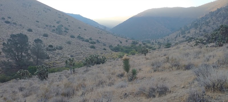
The Red Rock Cliff has a neat and short trail offering a glimpse of the area with some larger joshua trees and panoramic shot of the entire cliff face. Yes this area has Joshua trees and California City (South of the canyon) had the largest of the trees. It is quiet, a trip woth taking alone as there are very few birds or even vegitation for the wind to make noise. The area has two other sites worth seeing (Read Below) If you follow the OHV trail along the highway cross under the bridge for easy access to Haygen Canyon by foot. That canyon offers some more interesting rock formations and a past tourist trap named rock formation by the old owner. Be sure to continue on to the campground. There are two nature trails in the campground that are the best in the area. One of the trails is relatively flat and provides upclose access to another Joshua tree Grove and the local cacti. The other trail goes to the top of the cliff surrounding the campground and is of moderate difficulty. You get to see the geology and can appreciate the oldest rocks in the world (litteraly) next to newer volcanic material pushing up from below.

Nearby Adventures

Bookable Experiences

A Tasting Walk Through Tehachapi’s Historic Downtown32.6 mi
Tehachapi, California

A Tasting Walk Through Tehachapi’s Historic Downtown

A one-mile, three-hour Saturday walking tour of Tehachapi’s Historic Downtown that stitches together five local food stops with murals, artists’ shops and museums—this guide lays out what to expect and the practical details.

32.6 miView Trips & Details →
Lofted Log Comfort: Cabin #1’s Quiet Retreat in Tuscumbia29.7 mi
Tuscumbia, Alabama

Lofted Log Comfort: Cabin #1’s Quiet Retreat in Tuscumbia

Two-to-seven night stays in an authentic log cabin for up to five guests, with simple modern comforts and a short walk to shared bath facilities.

29.7 miView Trips & Details →
Punching Through Class IV: A Half-Day on the Upper Kern34.9 mi
Kernville, California

Punching Through Class IV: A Half-Day on the Upper Kern

A focused half-day run through the Upper Kern’s Class III–IV rapids above Isabella Lake, useful for planning gear, fitness and timing for this Sierra South Mountain Sports outing.

34.9 miView Trips & Details →
Two Days on the Lower Kern: From Cottonwood Corridors to a Class IV Roar41.3 mi
Kernville, California

Two Days on the Lower Kern: From Cottonwood Corridors to a Class IV Roar

A two-day, 21-mile overnight rafting run that moves from gentle Class II warm-ups to adrenaline-charged Class IV drops — this guide distills what to expect, what to pack, and who should go.

41.3 miView Trips & Details →
Lower Kern Half‑Day: Four Splashy Miles of Beginner Whitewater36.3 mi
Kernville, California

Lower Kern Half‑Day: Four Splashy Miles of Beginner Whitewater

A 3–4 hour, beginner‑friendly rafting run on the Lower Kern (Class II–III) that delivers splashy rapids, scenic riverbanks and chances to cool off during the May–September season.

36.3 miView Trips & Details →
Charge the Lower Kern: a full-day Class III–IV descent through narrow canyons and massive boulders42.4 mi
Kernville, California

Charge the Lower Kern: a full-day Class III–IV descent through narrow canyons and massive boulders

A 6–8 hour, 13‑river‑mile run out of Kernville with hearty deli‑style lunch — this guide lays out what to expect, who fits the trip, and the practical details to arrive ready.

42.4 miView Trips & Details →