A Coastal Dash: Running the Isle of Palms Connector
Adventure Destination

A Coastal Dash: Running the Isle of Palms Connector

Explore this 7-mile route over the Isle of Palms Connector near Charleston, SC. Offering moderate inclines, scenic marsh views, and ocean breezes, it's perfect for an invigorating run. Best visited in spring or fall for cooler temperatures.

Running7.0/10Moderate
Photo Gallery

Category

Running

Typical Duration

2-4 hours

Difficulty

Moderate

About This Adventure Destination

The Isle of Palms Connector, with its sweeping marsh views and ocean breezes, is a favorite route for Charleston runners looking for a scenic and invigorating workout. Spanning 3.5 miles one way, this bridge and roadway link Mount Pleasant to the barrier island of Isle of Palms, offering a mix of challenging inclines, breathtaking vistas, and a touch of salt air to keep you motivated.

The Route

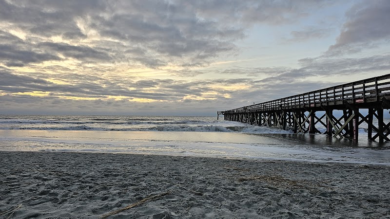
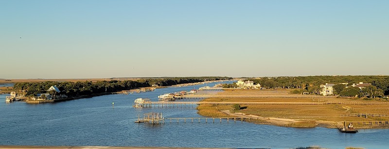
Start your run near the Mount Pleasant side of the Connector, where wide pedestrian and bike lanes ensure safety and plenty of space. The route quickly ascends the bridge, offering a moderate incline that tests your endurance while rewarding you with panoramic views of the surrounding marshlands and Intracoastal Waterway. As you crest the bridge, the Isle of Palms’ sandy shores and the Atlantic Ocean come into view—a stunning payoff for the climb.

The downhill stretch toward the Isle of Palms is smooth and exhilarating, with the salty breeze cooling you as you stride toward the island. Once you reach the base, you can either turn around for a challenging out-and-back workout or continue running along the quiet streets of the Isle of Palms for a longer route.

The bridge’s openness means you’re exposed to the elements, so plan accordingly for the sun and wind. Early mornings and evenings are particularly magical, with cooler temperatures and vibrant skies that make every step a joy.


Adventure Guide: Running the Isle of Palms Connector

Route Overview

  • Distance: 7 miles round trip (3.5 miles one way).
  • Terrain: A mix of steady inclines and flat stretches with smooth surfaces.
  • Scenery: Marshlands, Intracoastal Waterway, and coastal vistas.

Best Times to Run

  • Morning: Catch the sunrise over the ocean and enjoy cooler weather.
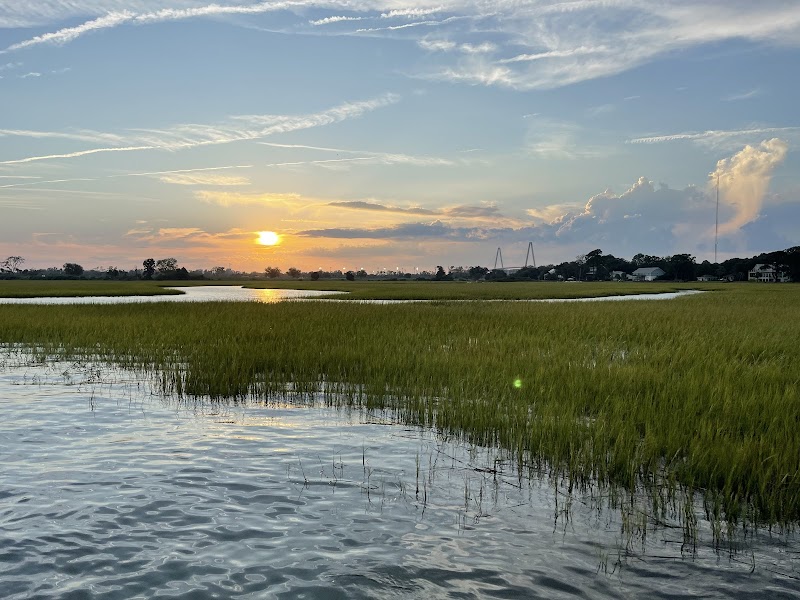
  • Evening: Sunset runs offer stunning colors and a more tranquil atmosphere.

Pro Tips

  • Hydration: Bring water or a hydration pack, as there are no fountains along the route.
  • Sun Protection: Wear sunscreen and a hat to shield against the open sunlight.
  • Wind Awareness: Coastal breezes can be strong, so dress in layers if needed.

Post-Run Highlights

  • Cool down with a stroll along the Isle of Palms beach or enjoy a refreshing dip in the ocean.
  • Head to a nearby café, like The Refuge, for a coffee or smoothie to refuel after your run.

Getting There

Park near the base of the Connector on the Mount Pleasant side, where there are safe areas to leave your vehicle. If starting on the Isle of Palms side, parking is available near the beach access points.

Running the Isle of Palms Connector is more than just a workout—it’s an experience that blends natural beauty, a rewarding challenge, and the refreshing spirit of the Lowcountry’s coastal landscapes.

Editorial Assessment

The Isle of Palms Connector offers a scenic setting for outdoor activities, with views of marshlands and waterways that enhance the running experience. While it's beautiful and appealing for local outdoor enthusiasts, it lacks the unique geological or ecological features that would place it among the top natural landmarks globally.
A Coastal Dash: Running the Isle of Palms Connector

Adventure Guide to A Coastal Dash: Running the Isle of Palms Connector

1

Experience A Coastal Dash: Running the Isle of Palms Connector

  • Special Features: Explore this 7-mile route over the Isle of Palms Connector near Charleston, SC. Offering moderate inclines, scenic marsh views, and ocean breezes, it's perfect for an invigorating run. Best visited in spring or fall for cooler temperatures.
  • Visitor Tips: Best time to visit is during Spring and Fall. Bring adequate water, appropriate outdoor gear, and camera.
  • Directions: SC 517, Charleston County, South Carolina
2

Exploring Near Charleston, South Carolina

  • Local Insights: Offers direct access to top trails, protected natural reserves, and picturesque viewpoints across Charleston, South Carolina.
  • Visitor Tips: Check local regulations, trail conditions, and weather before heading out.
3

Photography and Wildlife

  • Special Highlights: Capture panoramic sunrise and sunset views across the surrounding mountain terrain.
  • Visitor Tips: Arrive in early morning or late afternoon for the softest lighting and quieter trails.

Reviews

C
cynthia Williamsa year ago

Great destination! Enjoyed the open trail and peaceful outdoor atmosphere.

K
ken nortona year ago

Great destination! Enjoyed the open trail and peaceful outdoor atmosphere.

G
Gina2 years ago

Great destination! Enjoyed the open trail and peaceful outdoor atmosphere.

S
Shawn Hart3 years ago

This is an amazing bridge for bike rides and viewing sunrises and sunsets!

E
Emma W6 months ago

Wonderful bridge! Great engineering!

Nearby Adventures

Bookable Experiences

Lowcountry from Above: A Short Beach Tour Over Johns Island’s Coastline16.7 mi
Johns Island, South Carolina

Lowcountry from Above: A Short Beach Tour Over Johns Island’s Coastline

A 20–30 minute aerial tour of Charleston’s beaches, barrier islands, marshes and secluded coves — a compact primer on the Lowcountry.

16.7 miView Trips & Details →
Sight-Fishing the Lowcountry: A Full-Day Inshore Hunt for Redfish in Beaufort56.6 mi
Beaufort, South Carolina

Sight-Fishing the Lowcountry: A Full-Day Inshore Hunt for Redfish in Beaufort

An 8-hour guided inshore day with Indigo Fishing Charters—sight fish for Redfish and seasonal species with Capt Jon; this guide explains what to expect and what to bring.

56.6 miView Trips & Details →
Street-Smart Speed: eScooting Isle of Palms3.72 mi
Isle of Palms, South Carolina

Street-Smart Speed: eScooting Isle of Palms

An on‑demand electric scooter option on Isle of Palms that speeds short urban commutes and errands—this guide distills what to expect and how the service fits into island life.

3.72 miView Trips & Details →
Along the Streets and Sea Islands: A 2‑Hour Guided Walk and Drive Through Charleston’s Gullah Geechee Legacy7.25 mi
Charleston, South Carolina

Along the Streets and Sea Islands: A 2‑Hour Guided Walk and Drive Through Charleston’s Gullah Geechee Legacy

A focused, two‑hour guided experience that traces the cultural influence of enslaved Africans across Charleston and the nearby Gullah Geechee Sea Islands and explains what travelers should expect.

7.25 miView Trips & Details →
Sunset Harbor, Whole-Hog BBQ, and an Open Bar — Charleston’s 90-Minute Evening Afloat7.25 mi
Charleston, South Carolina

Sunset Harbor, Whole-Hog BBQ, and an Open Bar — Charleston’s 90-Minute Evening Afloat

A 90-minute sunset harbor cruise in Charleston that pairs Rodney Scott’s BBQ with an open bar; this guide distills what to expect and how the event is structured.

7.25 miView Trips & Details →
Paddling the Shrimping Village: Jeremy Creek to McClellanville Harbor at Sunset27.3 mi
McClellanville, South Carolina

Paddling the Shrimping Village: Jeremy Creek to McClellanville Harbor at Sunset

A focused, 2-hour guided kayak through McClellanville’s historic shrimping waterways — this guide covers what to expect, what to bring, and who can join.

27.3 miView Trips & Details →