Introduction
Eno River State Park sits within the Raleigh–Durham region of central North Carolina, where a shallow, rocky river threads a southern Piedmont valley. The park's network of 16 trails follows the riverbanks, climbs ridge lines and links a handful of historic fords, mill sites and seasonal swimming spots. The park was created after a grassroots campaign in the 1960s and formally preserved as a state park in 1975; its roughly 1,000 acres now contain regrown native forests of oak, poplar, maple, dogwood and hickory alongside understory shrubs such as mountain laurel and Catawba rhododendron.
Trail options at Eno are explicit about scale: short, relatively flat loops that hug the river are paired with longer ridge and loop routes that use switchbacks, stairs and bluffs to gain views of rapids and rock outcrops. Several named segments and access points organize the experience—Few’s Ford (the park office), Buckquarter Creek Trail, Cox Mountain loop and Laurel Bluffs, which is also part of the Mountains‑to‑Sea Trail.
Primitive and group campsites lie along the river and are exclusively hike‑in; the park notes those sites are no more than 1.5 miles from parking areas and that reservations can be made online. These concrete route choices—short family circuits, daylong ridge connectors, or multi‑day backpacking with primitive camps—shape what most visitors do here and why the river matters as the park’s organizing feature.
River and trails: alternation of flat banks and ridgelines
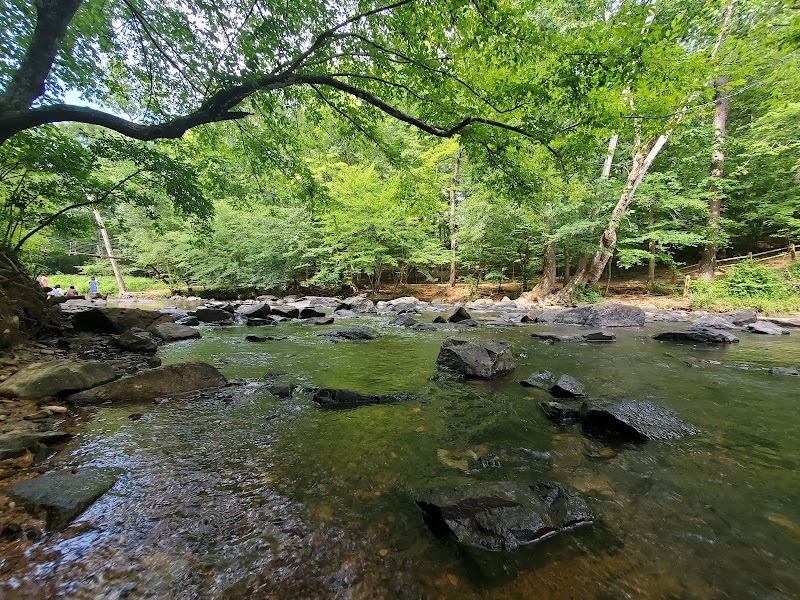
The Eno River functions as the park’s backbone: shallow, rocky stretches alternate with brisk little rapids and rock outcrops. Trails often descend to the riverbank after climbing to ridgelines, so a single outing can shift between easy flat walking and steeper, sometimes stepped terrain.
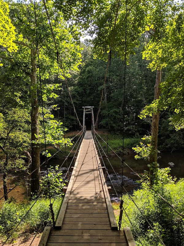
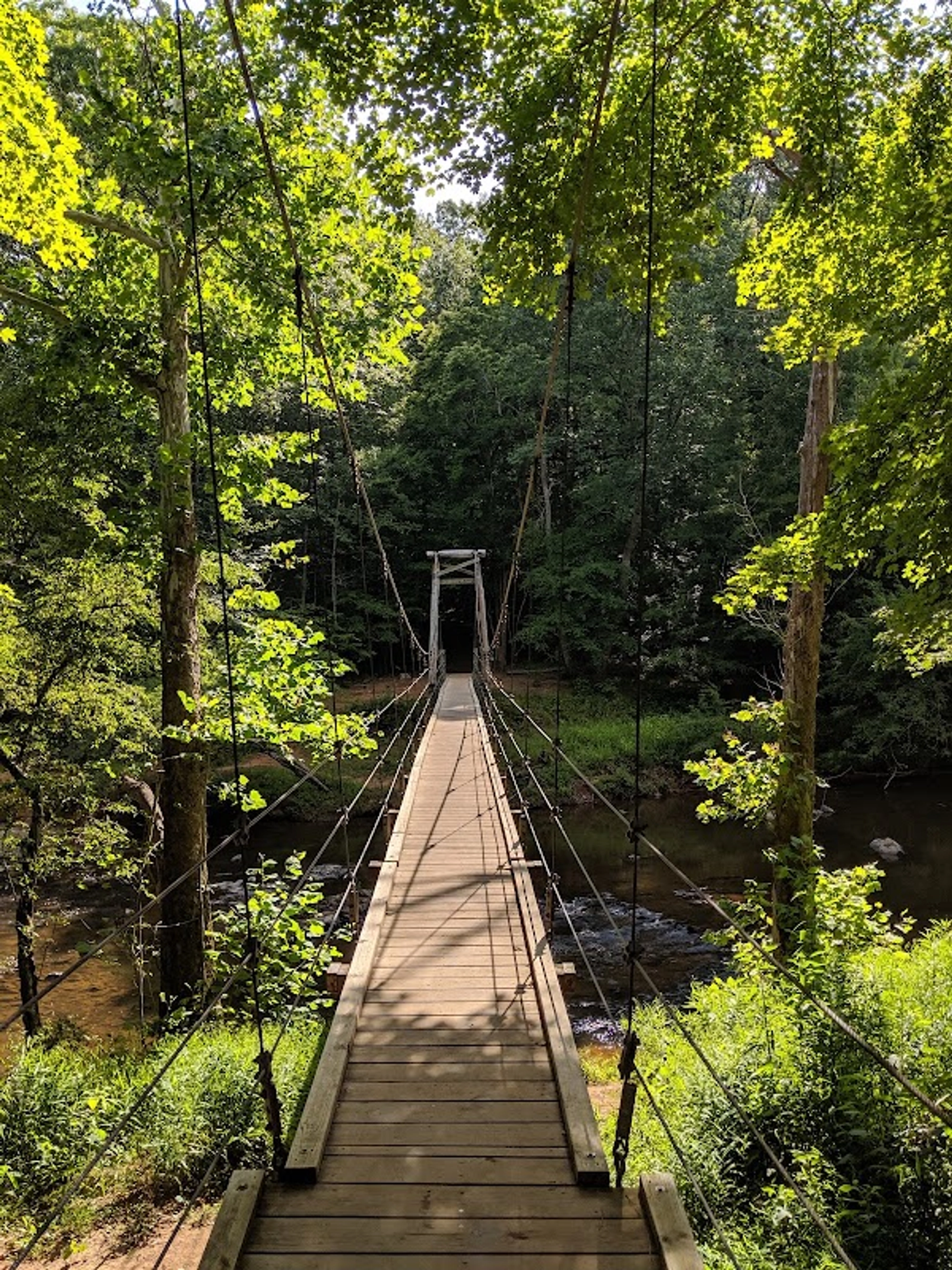
Named routes illustrate that variety. From Few’s Ford access the Buckquarter Creek Trail (about 1.5 miles) reaches a rock overlook above notable rapids; the Cox Mountain loop (about 3.75 miles) crosses a suspension footbridge and links with Fanny’s Ford Trail. Laurel Bluffs follows the Eno for roughly six miles as part of the Mountains‑to‑Sea Trail, making a longer out‑and‑back option of more than 12 miles possible on that corridor.
Named features and access points to plan around
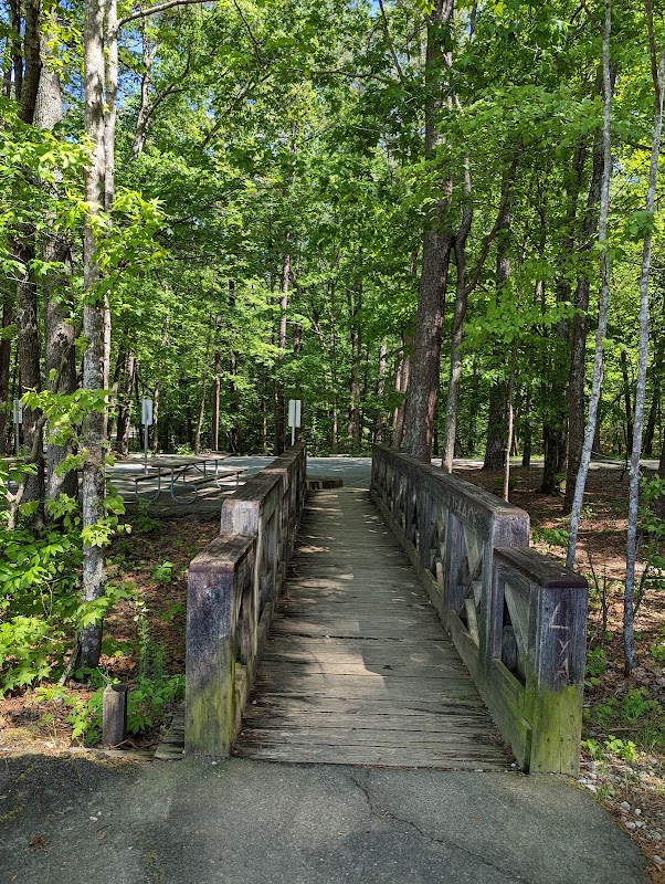
Five parking areas provide discrete entry points that shape the walk you do: Few’s Ford (the park office) serves Buckquarter Creek; Pleasant Green, Cabelands, Cole Mill and Pump Station accesses each give access to distinct trail segments and riverside features.
Specific spots carry practical meaning: Laurel Bluffs and Eno Quarry are identified as a mined quarry-turned-summer swimming hole, while Cole Mill Trail leads toward Bobbit Hole, another popular cooling spot. For anyone planning a visit, choosing the access that serves the feature you want eliminates needless backtracking.
History and forest succession along the Eno
A grassroots campaign in the 1960s prevented a dam and led to the park’s establishment in 1975; the valley preserves archaeological remnants of settlement and an earlier industrial era, including more than 30 grist mill sites, river fords and homestead traces.
Farming and timbering once opened the valley, but slopes have since reforested with native trees—oak, poplar, maple, dogwood and hickory—with mountain laurel and rhododendron in the understory and a spring wildflower carpet reported along certain trails, especially near Pump Station Access.
Primitive camping and multi‑day options
The park provides several primitive and group campsites along the river intended for hike‑in use; the official guidance is that all sites are hike‑in only and located within about 1.5 miles of parking. Reservations for those sites are available online, and campers should plan to reach sites on foot from the nearest access point.
Recent visitors confirm the campsite appeal as a way to extend a river hike into an overnight experience. Reviews note that trails and campsites can be quiet in off‑peak hours and that some longer loops allow for semi‑secluded riverside stays when open and accessible.
Trail conditions, closures and visitor notes
Trails range from flat family loops to moderate ridge climbs; park literature calls many routes moderate and suitable for a wide range of hikers. Because the trail network is extensive, check the park’s current trail status before heading out—reviews and park notes both reference periodic closures for storm damage or repairs (for example, suspension‑bridge work or storm impacts).
Visitor behavior affects the experience: supplied reviews praise shade and wildlife sightings but also note localized litter and improperly discarded pet waste on some trails. Those reports suggest bringing a readiness to pack out waste and choosing less-busy times for wildlife viewing or solitude.
Conclusion
Eno River State Park is best understood as a river‑first hiking landscape: the Eno organizes short family loops, longer ridge connectors and hike‑in primitive campsites into a coherent set of route choices. Its historical fabric—mill ruins and fords—adds texture to the walking experience, while the trail network’s diversity lets visitors select an outing that matches their time and stamina.
For readers deciding whether to go, the practical distinction is simple: come for short, shaded river walks and easy water access with family; choose Laurel Bluffs or linked ridge loops for a demanding day; or reserve one of the hike‑in primitive sites to stretch a visit into an overnight along the river. Check current trail status and camping reservation procedures before you go.