Hiking the Lava Cast Forest Trail in Bend
Adventure Destination

Hiking the Lava Cast Forest Trail in Bend

Explore the 2.5-mile Lava Cast Forest trail near La Pine, Oregon. Noted for its volcanic geology, this moderately challenging hike features lava-cast trees and panoramic vistas. Best visited late spring through early fall, it's perfect for nature lovers.

Hiking7.8/10Moderate
Photo Gallery

Category

Hiking

Typical Duration

2-4 hours

Difficulty

Moderate

About This Adventure Destination

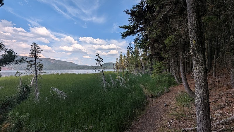
Hiking the Lava Cast Forest Trail offers an extraordinary opportunity to experience the unique geological features formed by ancient volcanic activity in the Bend area. This trail, located within the Newberry National Volcanic Monument, showcases a striking landscape filled with lava formations, making it a distinctive destination for outdoor enthusiasts and nature lovers. Not only does it provide insight into the region's volcanic past, but the setting also presents stunning views and a chance to connect with the diverse ecosystems of Central Oregon.

Editorial Assessment

The Lava Cast Forest Trail in Bend offers a unique experience of hiking through ancient lava flows with a landscape shaped by volcanic activity. While not as globally iconic as some major landmarks, it's a fascinating location for those interested in geology and natural history.
Hiking the Lava Cast Forest Trail in Bend

Adventure Guide to Hiking the Lava Cast Forest Trail in Bend

1

- Location: Lava Cast Forest Trailhead, near La Pine, OR

  • Overview:

    This trailhead serves as the starting point for an unforgettable hiking experience. The trail is moderately challenging, spanning approximately 2.5 miles round trip. The unique combination of lava-cast trees and serene forests creates a compelling backdrop for any hiker.

  • Details:

    Features: Lava Formations and Interpretive Signs The highlight of the trail is the fascinating lava-cast trees—specimens that are preserved under layers of hardened lava. The interpretive signs along the path provide context about the geological activity that formed this incredible landscape.

  • Details:

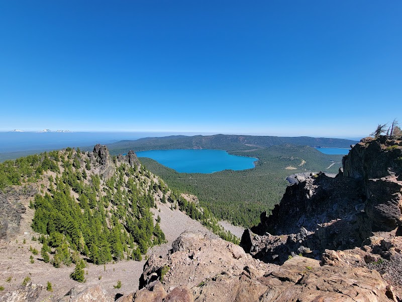
    Scenic Views: Panoramic Vistas As hikers traverse the trail, they are rewarded with panoramic views of the surrounding volcanic landscape. The area is not only picturesque but is also rich in flora and fauna, making it an excellent spot for photographers and nature watchers alike.

2

Local Insights

  • Overview:

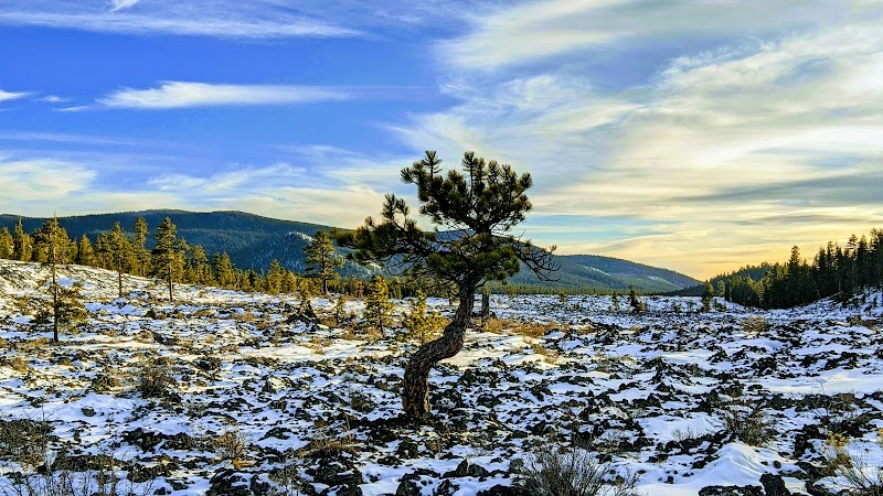
    The Lava Cast Forest was formed around 7,700 years ago when a lava flow enveloped a forest of trees. As the lava cooled, it formed impressions of the trees, giving rise to intricately shaped petrified formations. This area is a great spot to learn about the geology and ecology of volcanic landscapes.

3

Visitor Tips

  • Details:

    Best Times to Visit: Late spring through early fall offers the best conditions for hiking.

  • Details:

    What to Bring:

  • Details:

    Sturdy hiking shoes

  • Details:

    Water and snacks

  • Details:

    Sunscreen and hats for sun protection

  • Details:

    Driving Directions: From Bend, take Highway 97 south and then head east on Highway 31 for approximately 30 minutes to reach the trailhead. With its unparalleled natural beauty and educational value, the Lava Cast Forest Trail is a must-visit for anyone in Bend looking to experience the area's volcanic heritage.

Reviews

B
Bruce Clark5 months ago

Very neat to see how the trees burned away leaving a hole in the lava rock.

S
Scoot Feet3 months ago

Nice trail!! Along the river, saw people rafting the rapids!

S
Ski Dork2 months ago

12-31-2023 From Sunriver on S Century Drive, head east on Lava Cast forest rd 9720. Its gravel all the way to Forest rd 950. There is a sign at intersection of 9720 & 950. Turn R on 950 for short drive on dirt rd. Google map will send you off on rd 440. Dont take it. Go till rd 950. Really cool today with some snow on the ground and clouds blowing right onto the trail. Watched small clouds roll in across the lava and envelope us as they passed. Good interpretive signs explaining geology and plants. Trail direction suggests clockwise. We agree for view of mountains toward end of trial and last half of trail is single wide.

P
Pamela3 months ago

Very fascinating

B
Bethany Moore4 months ago

Really neat hike with the kids. About a mile long, partially shaded and lots of tree molds formed by the lava to check out.

Nearby Adventures

Bookable Experiences

Deschutes by Day: A Full‑Throat Run Through Canyon, Petroglyphs and a Natural Waterslide16.9 mi
Bend, Oregon

Deschutes by Day: A Full‑Throat Run Through Canyon, Petroglyphs and a Natural Waterslide

A 7‑hour, 14‑mile descent run by Nate's Rogue Adventures that combines rapids, riverside lunch, petroglyphs and canyon scenery—this guide explains what to expect and what to pack.

16.9 miView Trips & Details →
Shorelines and Steelhead: A Day on the Lower Deschutes16.9 mi
Bend, Oregon

Shorelines and Steelhead: A Day on the Lower Deschutes

An eight-hour shore-based fishing day targeting native red-side trout and migrating steelhead on the protected Lower Deschutes—this guide explains what to expect and what to pack.

16.9 miView Trips & Details →
Bend’s Workhorse Trailer: 7,710 Pounds, 20 Feet and a 12k Winch16.9 mi
Bend, Oregon

Bend’s Workhorse Trailer: 7,710 Pounds, 20 Feet and a 12k Winch

A heavy‑duty utility trailer from Bend Trailer Rentals — 20 feet overall with drive‑over fenders and a 12,000‑lb winch — offered in 4‑hour, 24‑hour and 7‑day rental terms.

16.9 miView Trips & Details →
Built to Carry: Bend’s 102" x 20' Heavy-Duty Car Hauler16.9 mi
Bend, Oregon

Built to Carry: Bend’s 102" x 20' Heavy-Duty Car Hauler

A practical, specification-led guide to renting Bend Trailer Rentals’ 102" x 20' hauler—covering capacity, included winch, and available rental durations.

16.9 miView Trips & Details →
Lower Deschutes Ultimate Day: A full‑throttle, high‑desert river day that threads petroglyph cliffs, waterfalls and class‑3 whitewater17.6 mi
Bend, Oregon

Lower Deschutes Ultimate Day: A full‑throttle, high‑desert river day that threads petroglyph cliffs, waterfalls and class‑3 whitewater

A 7‑hour, 21‑mile guided rafting day from Harpham Flats to Sandy Beach that combines rapids, riverside lunch and a natural waterslide—this guide explains what to expect and what to pack.

17.6 miView Trips & Details →
The Last Fling Before The Ring!28.9 mi
Kelowna, British Columbia

The Last Fling Before The Ring!

Experience the rush of whitewater rafting on the region’s dramatic rivers with Sip & Anchor. Whether you're after adrenaline or scenic views, every trip promises excitement and adventure.

28.9 miView Trips & Details →