Majestic Mount Elbert: Colorado's Towering Jewel
Adventure Destination

Majestic Mount Elbert: Colorado's Towering Jewel

Explore the challenging trails of Mount Elbert, the tallest peak in Colorado. Enjoy hiking, camping, and stunning views over 14,440 feet. Summer is the best time for clear skies. Ideal for adventure seekers and nature lovers.

Hiking8.9/10Hard
Photo Gallery

Category

Hiking

Typical Duration

2-4 hours

Difficulty

Hard

About This Adventure Destination

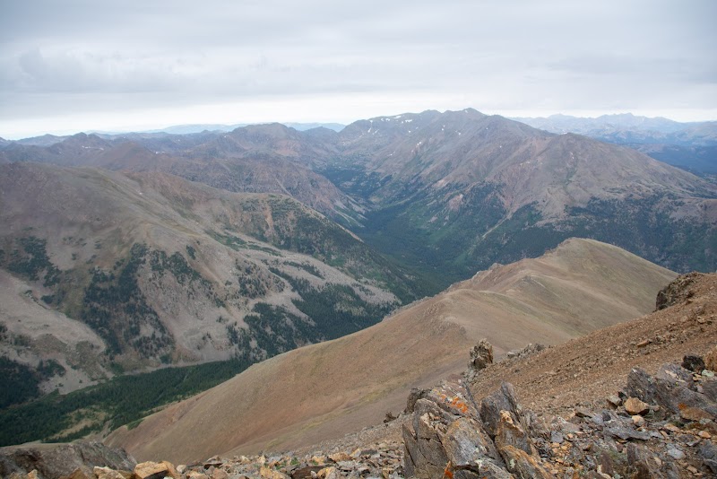
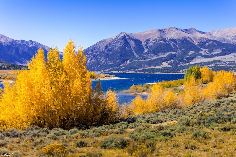
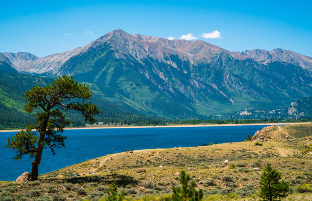
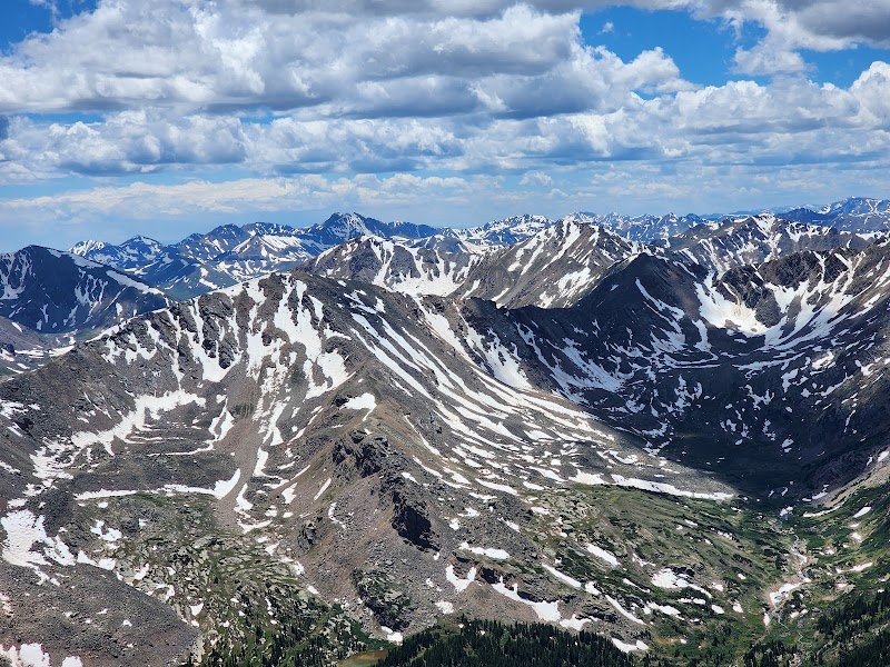
Mount Elbert, located in the stunning Rockies of Colorado, is the highest peak in the state and the entire Rocky Mountain range of North America. Its impressive elevation of 14,440 feet makes it a coveted destination for avid hikers and outdoor enthusiasts. This natural giant resides near the charming town of Leadville, providing a striking backdrop that captures the adventurous spirit unique to this region. Mount Elbert stands as a testament to Colorado's natural beauty, with its snow-capped summit visible for miles, framed by the expansive, evergreen forests and serene alpine lakes that adorn its lower slopes. Its geological makeup primarily consists of ancient, metamorphic rock, offering a rugged texture to the already captivating landscape.

While the mountain itself offers a challenging yet rewarding climb, visitors can also enjoy diverse flora and fauna that thrive in this high-altitude environment, including vibrant wildflowers and hardy mountain goats. As a historical note, Mount Elbert was first ascended in 1874, a significant event in local history that highlighted the peak's draw to explorers and nature lovers alike. The mountain, part of the San Isabel National Forest, offers a thrilling adventure amidst breathtaking natural beauty, making it a must-see for those visiting Colorado.

Editorial Assessment

Mount Elbert offers a premier hiking experience with breathtaking views, varied outdoor activities, and significant elevation. Its iconic status in the Rockies makes it a sought-after destination for adventurers visiting Colorado.

Majestic Mount Elbert: Colorado's Towering Jewel

Adventure Guide to Majestic Mount Elbert: Colorado's Towering Jewel

1

Experience Majestic Mount Elbert: Colorado's Towering Jewel

  • Special Features:

    Explore the challenging trails of Mount Elbert, the tallest peak in Colorado. Enjoy hiking, camping, and stunning views over 14,440 feet. Summer is the best time for clear skies. Ideal for adventure seekers and nature lovers.

  • Visitor Tips:

    Best time to visit is during Late June to September. Bring adequate water, appropriate outdoor gear, and camera.

  • Directions:

    Mount Elbert, Colorado 81211, USA

2

Exploring Near Leadville, Colorado

  • Local Insights:

    Offers direct access to top trails, protected natural reserves, and picturesque viewpoints across Leadville, Colorado.

  • Visitor Tips:

    Check local regulations, trail conditions, and weather before heading out.

3

Photography and Wildlife

  • Special Highlights:

    Watch for native wildlife including Mountain Goats, Marmots.

  • Visitor Tips:

    Arrive in early morning or late afternoon for the softest lighting and quieter trails.

Reviews

J
Jorge yin the last week

It was strong...

S
Siran Lusea month ago

like it

I
Ivan Apparition2 months ago

Hey everyone.... Mount Elbert is the highest peak in the Rocky Mountains in North America, with a height of 4,401 m (14,440 ft ) and it seems to me that the 2 highest mountains in the USA....In my opinion, easy, medium hiking... Be careful, don't underestimate it

松
松平高矩3 months ago

General and shortest route explanation A map and notes are posted at the trailhead (① on the trail map). As I mentioned earlier, I started walking in the dark, so I took this photo when I returned. The first third is through forest. At the beginning of the walk , I could only see my feet illuminated by the headlamp, but gradually the light became brighter and I could see my surroundings. If you go further and reach ② on the map, you will cross the tree line. In the image below, you can see a faint peak in the distance, but there is no way the real peak is this close, and it is just the first pseudo peak. False peaks will appear many times in the future, and you will be disappointed if you have high expectations. When I looked back, the eastern sky became brighter and the sun began to rise.The weather had been nice up until this point, and we climbed the mountain while enjoying the wonderful scenery around us. In the distance, peaking out from behind the clouds is Mount Massive . At this point, I had been climbing for over an hour and a half and was sweating a lot. However, the temperature on the mountain seemed to be quite low even though it was August, and when I looked at my partner's black shirt as I walked with him, I could see that the sweat had turned into white frost.I still have a long way to go, so I will keep walking.Once you get over the slope, that false peak approaches. This is quite long and difficult,The scenery in front of me doesn't change much no matter how I walk, but the scenery around me is soothing. The really tough part comes from the rocky area ahead, and the slope becomes steeper. From this point I started to feel gas, and I couldn't see much of the scenery. After being confused by several false peaks, I finally reached the final slope. We finally reached the top of the mountain, but due to the gas we could hardly see the surrounding scenery. You can see that you have reached the highest point, but the top is full of rocks and there is no sign that indicates it is the summit of Elbert. Still, I was impressed just by stepping on the peak, but another hiker who was there at the time lent me a self-made sign that he had brought with him, so I was able to take a commemorative photo with it. It's done. Even though I couldn't see the surrounding scenery, I was very grateful to know that this was the summit of Mt. Elbert. If you are about to climb the mountain, it is a good idea to bring a sign for a commemorative photo in case something like this happens. I think if you write it on paper and fold it, it will be light and not bulky. After hitting the peak, it was a race against the afternoon thunder and it started to rain a bit, so I descended to the treeline as quickly as possible. Above that level, there is no place to hide even if there is thunder, so it is very dangerous and scary. However, on the way down, I felt a sense of accomplishment as I had already reached the top of the mountain, and having eaten the Lunch I had brought with me on the way up, my stomach was full, so I felt refreshed, and as the altitude decreased, the effects of altitude sickness gradually disappeared, especially as I returned to the forest area. After that, I was able to relax and walk. This experience of conquering the highest peak in the Rocky Mountains will be a memory that will last a lifetime. It was a long and strenuous hike, but if you're used to mountain hiking to a certain extent, you can reach this mountain if you put in the effort, so if you're interested, please give it a try. Matsudaira, Kamezawa-cho, Sumida-ku, Tokyo General and shortest route explanation A map and notes were posted at trailhead ①, and as mentioned above, I started walking in the dark, so this photo was taken when I came back.The first third is through the forest. . At the beginning of the walk, I could only see my feet illuminated by the headlamp, but gradually the light became brighter and I could see my surroundings. When you get to ② on the map, you will be over the tree line. Below, you can see a faint peak in the distance, but the real peak can't be this close, and the first false peak will appear many times in the future, and you'll be disappointed if you have high expectations. When I looked back, the sky in the east became brighter and the sun began to rise. The weather had been nice up until this point, and we climbed the mountain while enjoying the wonderful scenery around us. In the distance, peaking out from behind the clouds is Mount Massive. At this point, I had been climbing for over an hour and a half and was sweating profusely. However, the temperature in the mountains is quite low even in August, and we have a long way to go, so we keep walking. Once you get over the slope, that pseudo peak approaches. It's quite long and difficult, but the scenery in front of you doesn't change as you walk, and there are no signs at the top of Mt. Elbert, making it easy to find your way out. Matsudaira, Kamezawa-cho, Sumida-ku
S
samuel hernandez4 months ago

Great destination! Enjoyed the open trail and peaceful outdoor atmosphere.

Nearby Adventures

Bookable Experiences

Stove‑Warm Nights Under Colorado Stars: Sleep Yurt Rentals at Tennessee Pass11.0 mi
Leadville, Colorado

Stove‑Warm Nights Under Colorado Stars: Sleep Yurt Rentals at Tennessee Pass

Handcrafted log beds, a woodstove and a kitchenette in off‑grid yurts 1.3 miles from the Nordic Center and 0.3 miles from the Cookhouse—this guide explains what to expect and how to plan your stay.

11.0 miView Trips & Details →
A Mile to Lunch: Backcountry Dining at the Tennessee Pass Cookhouse11.7 mi
Leadville, Colorado

A Mile to Lunch: Backcountry Dining at the Tennessee Pass Cookhouse

A one‑mile trek outside Leadville to the Tennessee Pass Cookhouse that pairs a short backcountry approach with an elegant, outdoors lunch—this guide explains what to expect and what equipment is provided.

11.7 miView Trips & Details →
To the Top of Mosquito Pass: A High‑Country UTV Through Colorado’s Silver Rush12.0 mi
Leadville, Colorado

To the Top of Mosquito Pass: A High‑Country UTV Through Colorado’s Silver Rush

A half‑day, guided UTV ride from Leadville that reaches Mosquito Pass and threads historic mining country, offered year‑round in Polaris RzRs.

12.0 miView Trips & Details →
Three Hours to the Top: Snowmobiling Prospect Mountain from Birdseye Outpost12.1 mi
Leadville, Colorado

Three Hours to the Top: Snowmobiling Prospect Mountain from Birdseye Outpost

A 3-hour guided snowmobile tour that begins at 10,000 feet at Birdseye Outpost, includes hands-on training, and reaches over 12,600 feet for sweeping views of Leadville and the Continental Divide.

12.1 miView Trips & Details →
Two Hours to the Top: Snowmobiling Prospect Mountain from Birdseye Outpost12.1 mi
Leadville, Colorado

Two Hours to the Top: Snowmobiling Prospect Mountain from Birdseye Outpost

A focused, 2-hour snowmobile outing that begins at 10,000 feet with on-site training and finishes on Prospect Mountain with panoramic views—this guide explains what to expect and how to prepare.

12.1 miView Trips & Details →
Pedal‑Assist to the Tundra: eBiking Trail Ridge Road from Grand Lake12.2 mi
Grand Lake, Colorado

Pedal‑Assist to the Tundra: eBiking Trail Ridge Road from Grand Lake

A focused, 3‑hour guided eBike outing from Grand Lake’s West Entrance that carries riders through alpine forests, tundra and scenic sections of Trail Ridge Road with guide‑led interpretation and battery support.

12.2 miView Trips & Details →