Discover Pinch In Trail's Majestic Views
Adventure Destination

Discover Pinch In Trail's Majestic Views

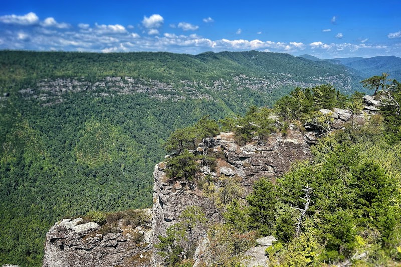
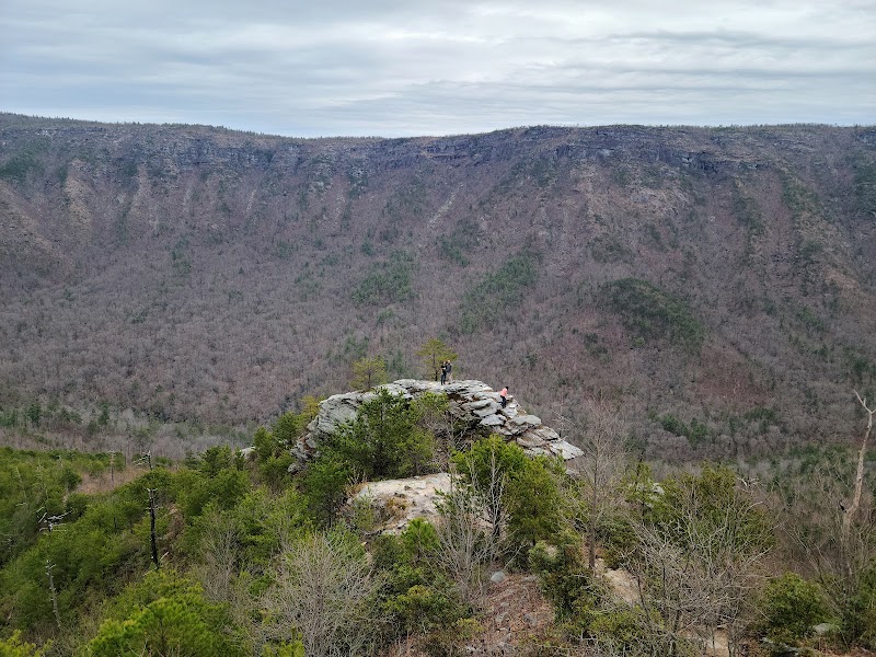
Explore the challenging Pinch In Trail near Marion, NC, known for its steep climbs and stunning views of Linville Gorge. A 2-mile trail offering adventure seekers breathtaking vistas. Best visited in spring and fall, this hike is considered hard and requires permits.

Hiking8.0/10Hard
Photo Gallery

Category

Hiking

Typical Duration

2-4 hours

Difficulty

Hard

About This Adventure Destination

Hiking the Pinch In Trail: A North Carolina Gem

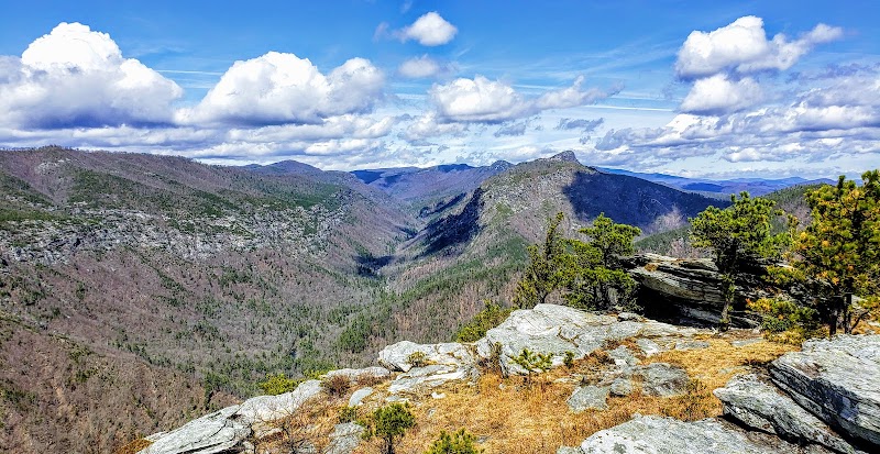
Located near Marion, in the picturesque region of North Carolina, the Pinch In Trail is a remarkable destination for nature enthusiasts and hiking aficionados. Grandfather Mountain looms in the background, offering a stunning canvas of rugged terrains and panoramic vistas. The trail presents an exhilarating challenge, rewarding trekkers with its breathtaking views of the Linville Gorge, a dramatic canyon carved by the relentless force of the Linville River.

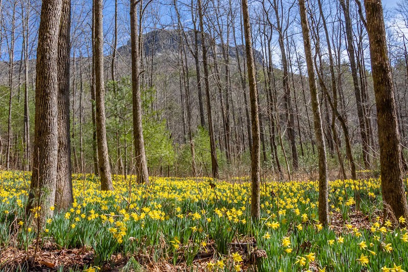
The Pinch In Trail is celebrated for its steep climbs and rugged paths, making it a favorite among seasoned hikers. The geological formations along the route are mesmerizing, showcasing ancient rock layers and diverse flora. It's not uncommon to encounter the region's unique wildlife, including birds of prey soaring overhead or the occasional deer venturing through the underbrush.

For those interested in history, the surrounding area is rich with stories of native tribes and early American settlers who once traversed these lands. The trail connects to other notable paths, offering options for extended hikes in the Pisgah National Forest.

With its challenging terrain and stunning natural beauty, the Pinch In Trail stands out as a must-visit destination in North Carolina, heralded for its adventurous spirit and the incredible views it offers.

Editorial Assessment

Pinch In Trail is admired for its challenging hikes and stunning views of Linville Gorge, making it a must-visit for avid hikers and outdoor enthusiasts.
Discover Pinch In Trail's Majestic Views

Adventure Guide to Discover Pinch In Trail's Majestic Views

1

Experience Discover Pinch In Trail's Majestic Views

  • Special Features:

    Explore the challenging Pinch In Trail near Marion, NC, known for its steep climbs and stunning views of Linville Gorge. A 2-mile trail offering adventure seekers breathtaking vistas. Best visited in spring and fall, this hike is considered hard and requires permits.

  • Visitor Tips:

    Best time to visit is during Spring and Fall. Bring adequate water, appropriate outdoor gear, and camera.

  • Directions:

    Marion, NC 28752, USA

2

Exploring Near Marion, North Carolina

  • Local Insights:

    Offers direct access to top trails, protected natural reserves, and picturesque viewpoints across Marion, North Carolina.

  • Visitor Tips:

    Check local regulations, trail conditions, and weather before heading out.

3

Photography and Wildlife

  • Special Highlights:

    Watch for native wildlife including Birds of prey, Deer.

  • Visitor Tips:

    Arrive in early morning or late afternoon for the softest lighting and quieter trails.

Reviews

W
Watauga county Lovea year ago

This is OPENED 24hrs 7 days a week like ALL NATIONAL FOREST ARE! Not sure why it says otherwise.

T
The Ox Groupa year ago

Great destination! Enjoyed the open trail and peaceful outdoor atmosphere.

B
Brady Parks2 years ago

Great destination! Enjoyed the open trail and peaceful outdoor atmosphere.

W
Walter Alexsander Gusman Gusmana month ago

Great destination! Enjoyed the open trail and peaceful outdoor atmosphere.

J
James D2 years ago

We did the Pinchin to Linville River to Conley to Rock Jock trail 9.5 mile loop. I've read the other reviews and agree. It's hard. It's doable but hard. More like slow going. It starts out with a very steep decent. This goes on for about 2 miles. The hardest parts were where the leaves had covered the path and made it slippery. Amazing views when the trees open up. Halfway down is a big bald rock sticking up. Can't miss it. Easy climb and well worth it. This is also the first time we found ourselves off trail and didn't know where to go. If you go on this trail download Alltrails and pay the $35 annual fee. It will save you. The trails get less marked as you go. We got lost about 5 times. You need the app. Not affiliated. When you get to the bottom the seen changes to a green rainforest feel. This was in January so I imagine it really fills in in the summer. It takes you many miles along the river. You don't see it as much as you would like but you always hear it. When the trail does run up next to the river it's great. The classic rough flowing mountain river. It runs along the river for miles. The trail then turns back up and away from the river. This time it's less of a steep climb and more like a ton of switch backs. You'll see many creeks and 2 foot water falls. It also takes you to some "caves". More like rock shelter over hangs though kinda deep. Pretty cool. This is about where we lost day light. We are first year hikers and misjudged and didn't respect time on the trail. If you do this one start early and make tracks. We had head lamps and when it started to rain we put on our rain gear. Again without the Alltrails app on our phone in a zip lock bag we would have been S.O.L. It kept us on trail. Again this one was hard. It may not sound like fun but we loved it. If you like to push and test yourself then this is it. Bring lots of water, hiking sticks, flash lights, and the app.

Nearby Adventures

Bookable Experiences

Lake James by MasterCraft: Captain Eric’s private wake sessions for big waves and smooth slaloms7.62 mi
Nebo, North Carolina

Lake James by MasterCraft: Captain Eric’s private wake sessions for big waves and smooth slaloms

Private charters on Lake James aboard GreenFlash Watersports’ MasterCraft NXT20 offering waterskiing, wakeboarding, wake surfing, tubing or a booze cruise for groups of up to 10.

7.62 miView Trips & Details →
Daylight and Drama on the Roan: A Full-Day Photography Trek from Asheville19.5 mi
Asheville, North Carolina

Daylight and Drama on the Roan: A Full-Day Photography Trek from Asheville

An 8-hour guided photography adventure into the Roan Highlands with tailored hiking options, instruction, snacks, and optional pickup from Asheville — this guide explains what to expect and how to prepare.

19.5 miView Trips & Details →
Mile‑high Perspectives: Hiking Grandfather Mountain’s Swinging Bridge and Blue Ridge Overlooks19.8 mi
Linville, North Carolina

Mile‑high Perspectives: Hiking Grandfather Mountain’s Swinging Bridge and Blue Ridge Overlooks

An 8‑hour guided outing from Asheville that visits a Blue Ridge Parkway overlook, the iconic mile‑high swinging bridge, and Grandfather Mountain’s nature center and exhibits.

19.8 miView Trips & Details →
Atop the East: A Short, Scenic Ascent to Mt. Mitchell’s Summit21.2 mi
Burnsville, North Carolina

Atop the East: A Short, Scenic Ascent to Mt. Mitchell’s Summit

A relaxed small‑group outing from Asheville that reaches the highest point east of the Mississippi, with short hiking, overlooks on the Blue Ridge Parkway, and time for lunch and the gift shop.

21.2 miView Trips & Details →
Banner Elk’s White Wolf Lodge: Practical, top‑brand ski rentals for the slopes23.2 mi
Banner Elk, North Carolina

Banner Elk’s White Wolf Lodge: Practical, top‑brand ski rentals for the slopes

A concise guide to renting skis, boots and poles from White Wolf Lodge in Banner Elk — rates, pickup windows, helmet options and junior pricing.

23.2 miView Trips & Details →
Canoe the New: South Fork paddling just east of Boone27.4 mi
Boone, North Carolina

Canoe the New: South Fork paddling just east of Boone

Guided and self-paced canoe outings on the South Fork of the New River — trips from 1.5 hours to more than six, with a simple, leave-your-worries-behind approach.

27.4 miView Trips & Details →