Scenic Heights at Sage Mountain National Park
Adventure Destination

Scenic Heights at Sage Mountain National Park

Sage Mountain National Park on Tortola offers moderate hiking trails through tropical rainforest leading to the highest peak in the British Virgin Islands. Enjoy birdwatching, scenic views, and nature observation in a peaceful, cool forest environment best visited from November to May.

Hiking7.8/10Moderate
Photo Gallery

Category

Hiking

Typical Duration

2-4 hours

Difficulty

Moderate

About This Adventure Destination

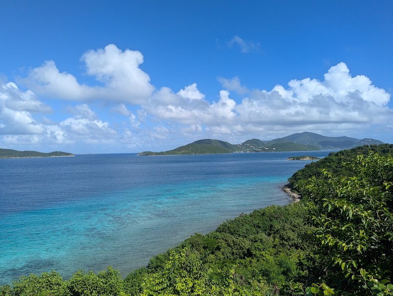
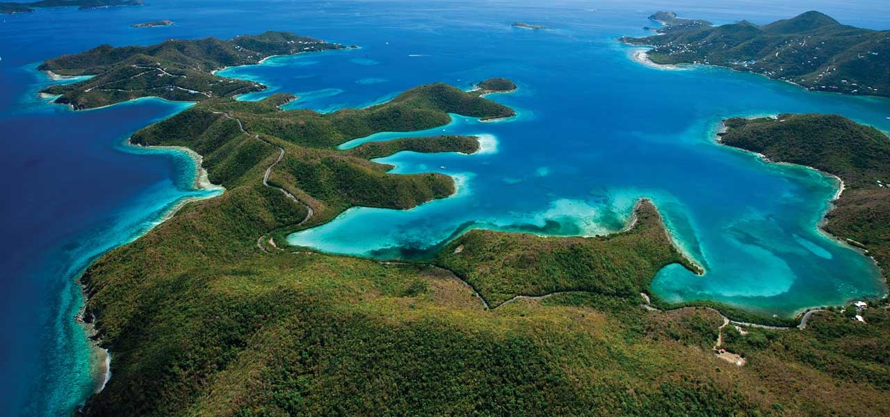
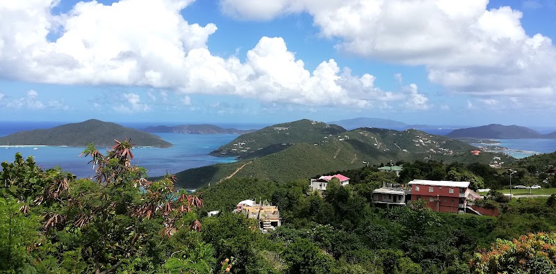
Sage Mountain National Park, located on Tortola in the British Virgin Islands, is renowned for being the highest point in this Caribbean territory. This park offers a unique contrast to the typical beachside imagery associated with the islands, featuring lush tropical rainforest with rare plant species and panoramic views of the surrounding turquoise seas and neighboring islands. The park's centerpiece is Sage Mountain, a volcanic peak reaching 525 meters (1,722 feet) in elevation, providing visitors with a refreshing cool climate and a distinct ecological environment compared to the tropical coastal zone below.

The park's thick canopy shelters a variety of wildlife, including several species of birds endemic to the Caribbean. Hikers will find several well-marked trails winding their way through vibrant flora such as tropical hardwoods, ferns, and flowering plants. Pressure from erosion and weathering over centuries has sculpted fascinating rock formations along the trails, adding geological interest.

Historically, Sage Mountain National Park was established to preserve this unique habitat and maintain the natural beauty of Tortola’s central highlands. The view from the summit is breathtaking, with expansive overlooks that provide striking perspectives of the Virgin Islands’ chain stretching across the horizon. This blend of impressive elevation, rich biodiversity, and solitude from bustling coastal areas makes Sage Mountain National Park a standout destination for those seeking nature away from the beach.

Editorial Assessment

Sage Mountain’s highest peak offers a unique natural experience in the Caribbean with its cool forest environment and commanding views. While it is a distinctive and cherished natural site in the British Virgin Islands, it lacks the extraordinary geological features or global fame required for an iconic rating over 90. It remains a valued destination for nature lovers and hikers, though its appeal is primarily regional.
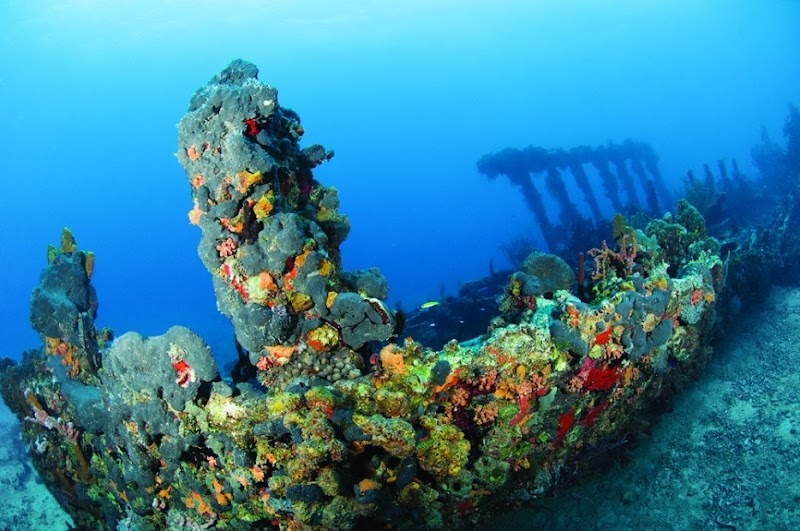
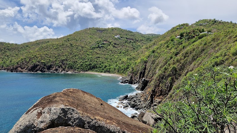
Scenic Heights at Sage Mountain National Park

Adventure Guide to Scenic Heights at Sage Mountain National Park

1

Experience Scenic Heights at Sage Mountain National Park

  • Special Features:

    Sage Mountain National Park on Tortola offers moderate hiking trails through tropical rainforest leading to the highest peak in the British Virgin Islands. Enjoy birdwatching, scenic views, and nature observation in a peaceful, cool forest environment best visited from November to May.

  • Visitor Tips:

    Best time to visit is during November to May. Bring adequate water, appropriate outdoor gear, and camera.

  • Directions:

    C83Q+FP8, Freshwater Pond, British Virgin Islands

2

Exploring Near Road Town, British Virgin Islands

  • Local Insights:

    Offers direct access to top trails, protected natural reserves, and picturesque viewpoints across Road Town, British Virgin Islands.

  • Visitor Tips:

    Check local regulations, trail conditions, and weather before heading out.

3

Photography and Wildlife

  • Special Highlights:

    Watch for native wildlife including Red-legged Thrush, Caribbean Euphonia.

  • Visitor Tips:

    Arrive in early morning or late afternoon for the softest lighting and quieter trails.

Reviews

M
Marco Alleynein the last week

Hiking to the highest point in the Virgin Islands sounds intimidating and as a result, before going, I felt a little unsure if I was ready to try it especially because it had been raining that morning. But 10 minutes in, those concerns were allayed. Yes, there are some technically "difficult" sections where you have to climb over a tree trunk or two but it generally feels comfortable and safe. You just need to take your time and be sure of your footing. The lookout point at the highest point gives an amazing view over some of the other islands. Unfortunately the cloud cover and rain that day made extended visibility an issue but beautiful none the less. Overall, it's something I'd definitely do again.

T
Travelling Dave3 months ago

Great destination! Enjoyed the open trail and peaceful outdoor atmosphere.

P
Pete May7 months ago

The visitors center staff was helpful. Shop and restrooms avaialable. There were several trails in wilderness. Minimal amount of signage. Views of many plants and trees but not many overlook views.

M
Maria Cruz10 months ago

Great experience! I bit complicated to get there but it was worth it.

M
Mathisa year ago

We took the central path and then returned via the northern path. It took us about an hour and a half. You walk through a rainforest. Be careful, the path isn't maintained. We even had to jump over a fallen tree on the way back. Otherwise, the hike is very well marked. I recommend doing it if you're visiting the island. Keep in mind, there aren't many viewpoints overlooking the island and the sea.

Nearby Adventures

Bookable Experiences

Santa Maria Hidden Beach Escape: A Quiet 1‑Mile Hike to Pristine Sands21.1 mi
Red Hook, St. Thomas

Santa Maria Hidden Beach Escape: A Quiet 1‑Mile Hike to Pristine Sands

A moderately challenging 1‑mile out‑and‑back trail from an overgrown trailhead on Fortuna Road leads to the secluded white sands and snorkeling reefs of Santa Maria Beach.

21.1 miView Trips & Details →
Ridge Loop Over Magens Bay: A 2.4‑Mile Tropical Circuit Above St. Thomas’ Most Famous Beach17.4 mi
St. Thomas, St. Thomas

Ridge Loop Over Magens Bay: A 2.4‑Mile Tropical Circuit Above St. Thomas’ Most Famous Beach

A compact 2.4-mile loop that takes roughly 1 hour 17 minutes, threading lush forest and open ridgelines for sustained panoramas of Magens Bay—this guide distills route, kit, and logistics for the hike.

17.4 miView Trips & Details →
Glide Charlotte Amalie: Stand‑Up Paddleboard Rentals on St. Thomas’ Calm Water21.1 mi
Charlotte Amalie, St. Thomas

Glide Charlotte Amalie: Stand‑Up Paddleboard Rentals on St. Thomas’ Calm Water

Rent a stand‑up paddleboard in Charlotte Amalie—available as one‑day or one‑week rentals—to explore sheltered waters, connect with the shoreline, and get a full‑body workout.

21.1 miView Trips & Details →
Charlotte Amalie’s North‑Shore Secrets: Private Boat Charter to Reefs, Caves, and an Empty Beach21.1 mi
Charlotte Amalie, St. Thomas

Charlotte Amalie’s North‑Shore Secrets: Private Boat Charter to Reefs, Caves, and an Empty Beach

A private 4–5 hour boat excursion from Hull Bay (or Brewers Bay) that visits two thriving reefs, secret snorkel caves, and a secluded, crowd‑free beach.

21.1 miView Trips & Details →
Jeep, Beaches, Rum and Craft Beer: A Short, Local-Led St. Thomas Immersion21.1 mi
St. Thomas, St. Thomas

Jeep, Beaches, Rum and Craft Beer: A Short, Local-Led St. Thomas Immersion

A private, 3–4 hour Jeep tour that pairs snorkeling and scenic overlooks with locally made rum, Leatherback Brewing Co. beers and a beachside lunch.

21.1 miView Trips & Details →
Two Seas, One Jeep: A Private Eco-Guide Loop Around St. Thomas21.1 mi
St. Thomas, St. Thomas

Two Seas, One Jeep: A Private Eco-Guide Loop Around St. Thomas

A private 4–5 hour Jeep excursion with an eco-guide that stops at scenic overlooks and includes snorkeling at two beaches, snorkel gear and drinks—this guide orients you to what to expect and how to prepare.

21.1 miView Trips & Details →