Ride the Ridge: Biking the Marin Headlands
Adventure Destination

Ride the Ridge: Biking the Marin Headlands

Explore the Marin Headlands, featuring a 13-mile biking route with moderate difficulty and stunning ocean views. Spot local wildlife and enjoy historical sites. Best biked in spring and fall.

Biking8.2/10Moderate
Photo Gallery

Category

Biking

Typical Duration

2-4 hours

Difficulty

Moderate

About This Adventure Destination

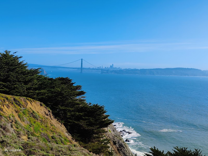
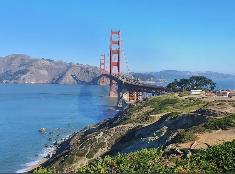
The Marin Headlands, a striking landscape just north of the Golden Gate Bridge, offers breathtaking views and challenging terrain for cyclists. With its rugged coastline, winding roads, and historical landmarks, this biking route draws adventurers looking for both scenic beauty and athletic challenge. Encompassing over 1,500 acres of protected land, riders can enjoy coastal trails, coastal scrub, and panoramic vistas of the Pacific Ocean and the San Francisco skyline. This stunning area serves as a playground for cyclists of all skill levels, from casual bikers to rugged mountain bikers seeking technical climbs and descents.

The best time to bike here is in the spring and fall when temperatures are mild, and wildlife is active—look out for local deer, coyotes, and even the occasional seal along the shore. As you climb to iconic points like the Marin Headlands Visitor Center and Battery Spencer, history intertwines with nature, echoing tales of military defenses and coastal radar during World War II, now laying rusted yet proud above the ocean. Bring plenty of water and be prepared for coastal winds, which can be fierce at times.

Editorial Assessment

The Marin Headlands offers a stunning landscape with rugged cliffs, sweeping ocean views, and diverse wildlife, making it an attractive destination for outdoor enthusiasts, especially those interested in biking and hiking. While it's a beautiful and adventurous location, it doesn't feature a unique geological formation that places it among the top natural landmarks globally.
Ride the Ridge: Biking the Marin Headlands

Adventure Guide to Ride the Ridge: Biking the Marin Headlands

1

Key Facts and Details:

  • Trail Length: Approximately 13 miles of marked cycling routes.
  • Difficulty: Moderate to challenging, with steep climbs and descents.
  • Best Time to Visit: Spring and fall for optimal weather.
  • Start Point: Golden Gate Bridge Welcome Center or Marin Headlands Visitor Center. **Recommended Suggestions:**
  • Details: Consider starting early to avoid crowds and fully appreciate the sunrise over the bay.
  • Details: Carry a repair kit and a spare tube; the rugged terrain can be tough on tires.
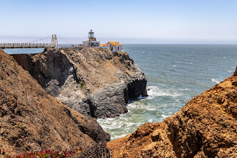
  • Details: Don’t miss the picturesque views from the Point Bonita Lighthouse, which requires a short walk from the bike trail. **Interesting Facts:**
  • Details: The Marin Headlands play a vital role as a wildlife habitat, especially for migratory birds.
  • Details: The Golden Gate National Parks Conservancy oversees this area, preserving its natural and cultural history. **History:** Originally inhabited by the Coast Miwok people, the Marin Headlands were transformed during the 19th century into a strategic military site. Batteries were constructed to guard the entrance to San Francisco Bay, and remnants of these installations can still be seen today. Biking through this historical landscape not only provides exercise but offers insight into the rich narrative of the region.

Reviews

S
Siddhant Sehgalin the last week

Great destination! Enjoyed the open trail and peaceful outdoor atmosphere.

S
Sushil Khadkaa week ago

Great destination! Enjoyed the open trail and peaceful outdoor atmosphere.

D
David Gomez2 weeks ago

Great view

R
ramesh k2 weeks ago

The Marin Headlands features a diverse network of trails ranging from flat, relaxing shoreline walks to steep ridge climbs with panoramic views of the Pacific Ocean, Golden Gate Bridge, and San Francisco skyline. ​Here are five of the best hiking options, categorized by difficulty and length: ​1. Slacker Hill via SCA Trail ​Difficulty: Moderate ​Distance: ~2.6 miles round-trip ​Elevation Gain: ~550 feet ​Type: Out-and-back ​Highlights: Widely considered the single best viewpoint of the Golden Gate Bridge and San Francisco Bay. The trail climbs up a dirt singletrack through coastal scrub before ending at a high, sweeping peak overlooking the entrance to the bay. ​2. Coastal Trail to Hill 88 Loop ​Difficulty: Moderate to Strenuous ​Distance: ~5.5 to 6.0 miles loop ​Elevation Gain: ~1,250 feet ​Type: Loop ​Highlights: Leaves from Rodeo Beach, passes WWII artillery installations (Battery Townsley), and ascends to the summit of Hill 88—a Cold War-era radar station site. You return down via the Miwok and Lagoon trails with constant ocean views. ​3. Tennessee Valley Trail to Tennessee Cove ​Difficulty: Easy ​Distance: 3.4 miles round-trip ​Elevation Gain: ~170 feet ​Type: Out-and-back ​Highlights: Ideal for families or an easy, mostly paved stroll. The path weaves gently down a lush valley floor and leads directly to a secluded, rocky beach with crashing waves and tide pools. ​4. Rodeo Lagoon Trail ​Difficulty: Easy ​Distance: ~1.5 miles loop ​Elevation Gain: Negligible (Mostly flat) ​Type: Loop ​Highlights: A quick, scenic walk encircling a coastal lagoon near the Marin Headlands Visitor Center. It is a prime route for birdwatching (pelicans, egrets, herons) and leads straight to Rodeo Beach. ​5. Gerbode Valley / Bobcat & Miwok Loop ​Difficulty: Moderate to Strenuous ​Distance: ~5.2 miles loop ​Elevation Gain: ~1,000 feet ​Type: Loop ​Highlights: Takes you into the tranquil, open interior valleys of the Headlands, away from the coastal road traffic. You get rolling green hills in spring, panoramic ridge views, and glimpses of both the ocean and the city skyline. ​Quick Hiking Advice: ​Fog & Layers: The coastal headlands trap heavy fog, especially during summer mornings. Bring wind-resistant layers and check local weather before starting. ​Exposure: Most trails are fully exposed with very little tree cover or shade. Pack sun protection and plenty of water. ​Trailhead Parking: Parking near Rodeo Beach or along Conzelman Road fills up rapidly on weekends. Aim to start before 9:00 AM.

J
Jamshed K2 weeks ago

Great destination! Enjoyed the open trail and peaceful outdoor atmosphere.

Nearby Adventures

Bookable Experiences

Race-Ready and Tuned: Bay City Bike’s Escape From Alcatraz 2026 — custom-fit rentals for the Alcatraz triathlon5.92 mi
San Francisco, California

Race-Ready and Tuned: Bay City Bike’s Escape From Alcatraz 2026 — custom-fit rentals for the Alcatraz triathlon

A up-to-3-day, operator-run bike rental and mechanic service in San Francisco that supplies prepped aluminum or carbon road bikes, fit adjustments, and race-day readiness for triathletes.

5.92 miView Trips & Details →
Build Your Own Taqueria: A Hands-On Mexican Feast in Berkeley13.7 mi
Berkeley, California

Build Your Own Taqueria: A Hands-On Mexican Feast in Berkeley

In a three-hour, team-based class at Berkeley Kitchen, Chef Kevin Berk leads students through customizable tacos, soups, sides and churros—this guide orients you to the format, menu choices, and practical rules you’ll need to know.

13.7 miView Trips & Details →
Private Chalet Seating Steps from Downtown Ice — A Quiet, VIP-Like Session in San Jose48.7 mi
San Jose, California

Private Chalet Seating Steps from Downtown Ice — A Quiet, VIP-Like Session in San Jose

A compact, 60-minute private seating experience at Skate Chalet with allowed food and drink and To Go pickup options from Poppy & Claro — this guide explains the logistics and what to expect.

48.7 miView Trips & Details →
Experience Venice Without Jet Lag: Private Gondola Cruises on Lake Merritt13.5 mi
Oakland, California

Experience Venice Without Jet Lag: Private Gondola Cruises on Lake Merritt

Private Dolce Vita Gondola mini cruises across Lake Merritt (25 or 50 minutes) for celebrations, surprises, and intimate outings.

13.5 miView Trips & Details →
Caneel Hill Trail — San Jose’s Namesake Hike Guided by Island Trail Adventures49.7 mi
San Jose, California

Caneel Hill Trail — San Jose’s Namesake Hike Guided by Island Trail Adventures

A concise, factual guide to the Caneel Hill Trail hiking experience in San Jose, operated by Island Trail Adventures.

49.7 miView Trips & Details →
Leinster Bay Trail — A concise hiking route in San Jose run by Island Trail Adventures49.7 mi
San Jose, California

Leinster Bay Trail — A concise hiking route in San Jose run by Island Trail Adventures

A focused guide to the Leinster Bay Trail, documenting the hiking experience in San Jose and pointing readers to the operator for planning and logistics.

49.7 miView Trips & Details →
