Hiking the Sterling Pond Trail: A Jewel Above the Clouds
Adventure Destination

Hiking the Sterling Pond Trail: A Jewel Above the Clouds

Exploring the Sterling Pond Trail 9.6/10Moderate
Photo Gallery

Category

Exploring the Sterling Pond Trail

Typical Duration

2-4 hours

Difficulty

Moderate

About This Adventure Destination

Tucked into the folds of Vermont’s rugged highlands, the Sterling Pond Trail feels like stepping into a secret world. This 2.3-mile round trip may be short, but don’t let its brevity fool you—it’s a climb that grips you from the start. Roots claw at your boots, and rocks anchor the steep ascent as the canopy closes overhead, shrouding you in nature’s quiet determination.

The air kisses your skin, cooler and sweeter with every step upward, carrying the scent of damp earth and pine. The forest tightens its grip as you ascend, the trees whispering in a language only the wind understands. The path steepens abruptly, daring you forward with the promise of something extraordinary waiting at the summit.

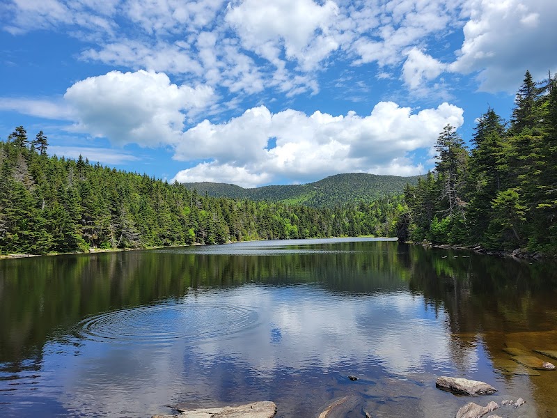
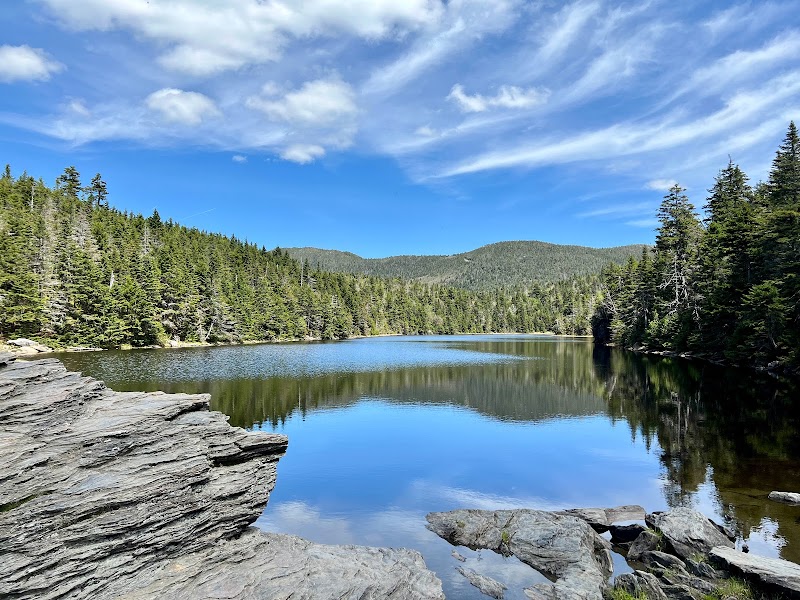
And then, just as your legs start to burn, the trail releases you into a clearing. Sterling Pond sprawls before you like liquid glass, its surface perfectly still, mirroring the ridges and sky above. The pond is cradled by steep, rocky walls, giving it an air of solitude and reverence. Sit quietly on the shore, and you might hear the soft plop of a trout breaking the surface or the echo of a jay’s call ricocheting off the cliffs.

This is a place where time pools, as still and reflective as the pond itself. Sterling Pond doesn’t just reward the climb; it invites you to linger, to soak in the quiet majesty of nature’s own cathedral.


Adventure Guide Summary

About the Sterling Pond Trail

  • Distance & Difficulty: The trail is 2.3 miles round trip with an elevation gain of approximately 1,000 feet, rated moderate due to its steep sections.
  • Unique Features: The trail leads to Sterling Pond, one of Vermont’s highest-elevation ponds, perched at over 3,000 feet.

Trailhead & Directions

  • The trail begins at the Smugglers’ Notch parking area, just off Vermont Route 108. From Stowe Village, it’s a 15-minute drive. Parking can be limited, especially in summer and fall.

What to Bring

  • Sturdy hiking shoes, water, and layers for cooler temperatures near the pond.
  • A snack or packed lunch to enjoy at the summit.

Trail Highlights

  • Views: After heavy rains, a small cascade flows along parts of the trail, adding a touch of wild beauty.
  • Wildlife: Look for signs of moose near the pond’s edges or listen for the distinct croak of bullfrogs.
  • Photography: The pond’s reflection of the cliffs above offers incredible photo opportunities, particularly during sunrise or late afternoon light.
Hiking the Sterling Pond Trail: A Jewel Above the Clouds

Adventure Guide to Hiking the Sterling Pond Trail: A Jewel Above the Clouds

1

Experience Hiking the Sterling Pond Trail: A Jewel Above the Clouds

  • Special Features:

    Iconic outdoor destination known for outdoor exploration and scenic views.

  • Visitor Tips:

    Best time to visit is during Spring and Fall. Bring adequate water, appropriate outdoor gear, and camera.

  • Directions:

    Mountain Rd, Lamoille County, Vermont

2

Exploring Near the area

  • Local Insights:

    Offers direct access to top trails, protected natural reserves, and picturesque viewpoints across the area.

  • Visitor Tips:

    Check local regulations, trail conditions, and weather before heading out.

3

Photography and Wildlife

  • Special Highlights:

    Capture panoramic sunrise and sunset views across the surrounding mountain terrain.

  • Visitor Tips:

    Arrive in early morning or late afternoon for the softest lighting and quieter trails.

Reviews

C
Cheyenne Rosea month ago

Great destination! Enjoyed the open trail and peaceful outdoor atmosphere.

P
PATHIPATI VENKATESHa month ago

The Sterling Pond Trail in Stowe, Vermont, is an incredible trail to visit during the fall season. I went in early fall as the colors were just beginning to change, and it was one of the most scenic trails I’ve experienced. The small water streams along the path add to its beauty, making it an unforgettable hike.

M
MLouie L2 months ago

Great destination! Enjoyed the open trail and peaceful outdoor atmosphere.

M
Matthew Wendling2 months ago

Possibly the best short hike I've ever done.

J
Josh B3 weeks ago

I think this one’s graded as moderate difficulty, but honestly I thought it was pretty hard. Pretty much gaining elevation the entire way there. Also a little slick and slippery in spots, at least during the fall. I will say the payoff was worth it, so if you’re looking for something like that, this is perfect for you. As for parking, it’s definitely quite limited during touristy season, so keep that in mind and plan accordingly.

Nearby Adventures

Bookable Experiences

Vermont Wines Along Lake Champlain: A Four‑Hour Vineyard Tour from Burlington7.54 mi
Burlington, Vermont

Vermont Wines Along Lake Champlain: A Four‑Hour Vineyard Tour from Burlington

A focused, 4-hour tasting route that traces shoreline vineyards outside Burlington — this guide explains what you’ll taste, what to bring, and how the door-to-door tour runs.

7.54 miView Trips & Details →
A Taste of Stowe: Three Hours of Vermont Flavor and Story7.54 mi
Stowe, Vermont

A Taste of Stowe: Three Hours of Vermont Flavor and Story

A guided, three-hour walking-and-ride tasting that samples local cheese, ice cream, chocolate and more with door-to-door transport for guests staying in Stowe.

7.54 miView Trips & Details →
Two Hours, Twenty-Five Miles: Backcountry Snowmobiling Across Mount Mansfield7.54 mi
Stowe, Vermont

Two Hours, Twenty-Five Miles: Backcountry Snowmobiling Across Mount Mansfield

A guided, two-hour snowmobile tour through Mount Mansfield State Forest that covers varied terrain and practical planning details for riders of differing skill levels.

7.54 miView Trips & Details →
Four Miles of Quiet: Paddling the Winooski beneath Camel’s Hump7.96 mi
Burlington, Vermont

Four Miles of Quiet: Paddling the Winooski beneath Camel’s Hump

A roughly two‑hour, four‑mile paddle from Waterbury that threads gentle currents, Vermont farmland vistas and steady birdlife—this guide explains what to expect and how to match the right craft to the river.

7.96 miView Trips & Details →
Upper Gorge, 9 Miles of Winooski Whitewater: A Short, Savage Run Through Vermont’s Gorge7.96 mi
Burlington, Vermont

Upper Gorge, 9 Miles of Winooski Whitewater: A Short, Savage Run Through Vermont’s Gorge

A 9-mile, typically 4-hour run of the Winooski River’s advanced upper gorge featuring Class I/II whitewater—this guide distills what paddlers need to know before they commit.

7.96 miView Trips & Details →
Float Richmond: Tube Rentals Launched from Main Street7.96 mi
Richmond, Virginia

Float Richmond: Tube Rentals Launched from Main Street

Umiak Outdoor Outfitters rents tubes daily from its Richmond store (and Stowe); this guide explains pickup, timing, and the self‑shuttle vs. operator shuttle options to plan a seamless float.

7.96 miView Trips & Details →