Hiking the Misery Ridge Trail: A Climb to Awe at Smith Rock State Park
Adventure Destination

Hiking the Misery Ridge Trail: A Climb to Awe at Smith Rock State Park

Misery Ridge Trail is a 3.7-mile loop near Terrebonne, Oregon. This hard trail features steep switchbacks and panoramic views, popular for hiking and climbing. Expect a challenge and stunning scenery. Best in spring and fall.

Hiking8.7/10Hard
Photo Gallery

Category

Hiking

Typical Duration

2-4 hours

Difficulty

Hard

About This Adventure Destination

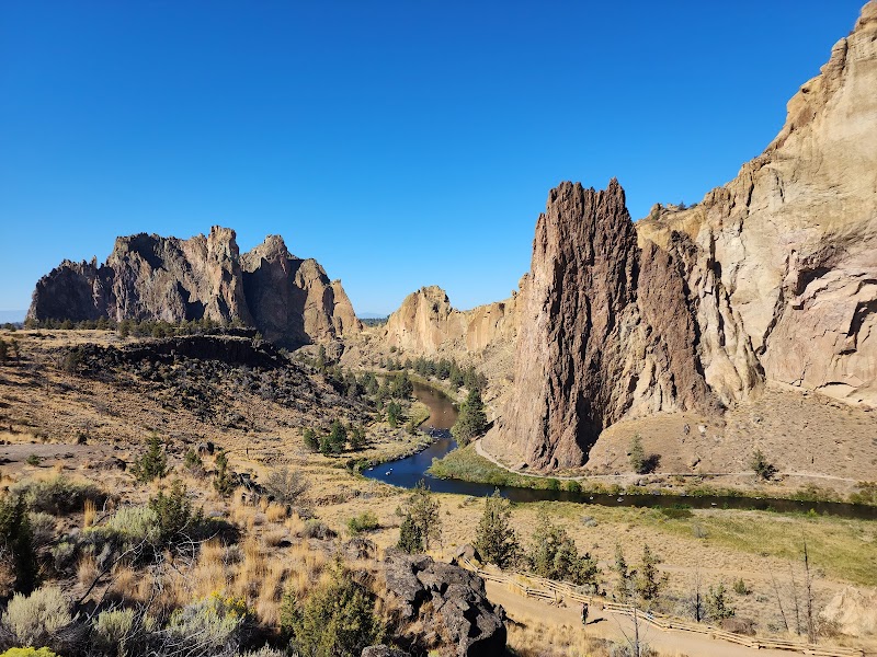
Misery Ridge Trail doesn’t just ask for effort—it demands it, rewarding every labored breath with vistas that redefine the word “epic.” Located in the heart of Smith Rock State Park, this iconic trail is a proving ground for those who dare to ascend its steep switchbacks. Yet, “misery” here feels like a misnomer. What begins as a challenge transforms into a triumphant communion with some of Oregon’s most dramatic landscapes.

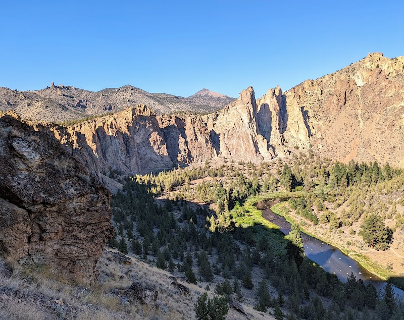
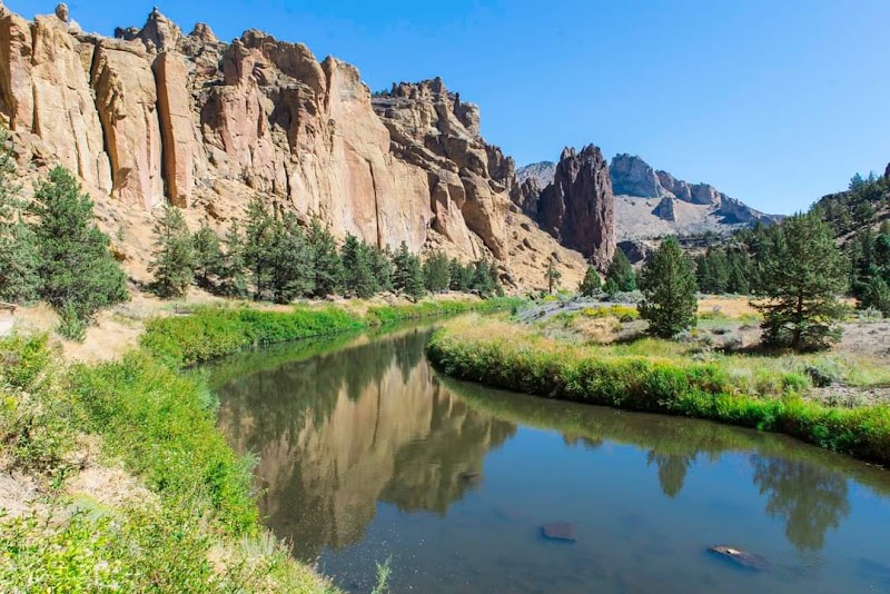
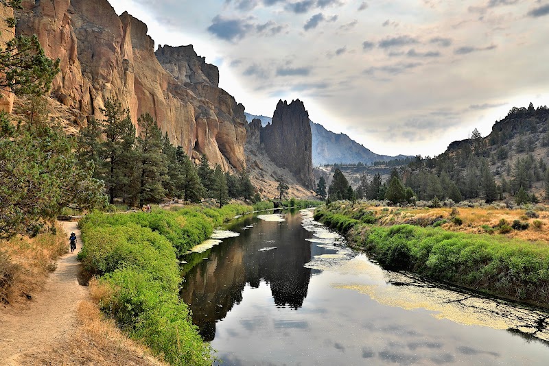
The trail begins unassumingly, skirting the Crooked River, which glistens like a green ribbon against the ochre cliffs. Early on, the ascent kicks in—switchbacks clawing up the ridge as the rock walls rise like fiery sentinels. Each step upward is a test, the trail gritty beneath your boots and the air sharp with the scent of sagebrush baked by the sun.

At the summit, the world unfurls. The Crooked River loops far below, carving a serpentine path through the canyon. To the west, the Cascade Range dominates the horizon, its snow-capped peaks standing in stark contrast to the desert-like expanse of Smith Rock. It’s the kind of view that stops you cold, the ache in your legs fading as awe takes over.

As the trail winds down, you pass Monkey Face, a 350-foot spire that seems to defy gravity and logic. Rock climbers cling to its vertical face, tiny specks against the monolithic stone. The descent carries you back to the river, your heart full and your legs pleasantly worn.

Misery Ridge Trail is more than just a hike—it’s a pilgrimage to the soul of the Pacific Northwest. It challenges your body and rewards your spirit, leaving you humbled, exhilarated, and utterly connected to the grandeur of Smith Rock.


Editorial Assessment

Smith Rock State Park, especially the Misery Ridge Trail, offers stunning views and challenging hikes, making it highly appealing for outdoor adventure enthusiasts. Its unique rock formations and picturesque settings contribute to its iconic status.
Hiking the Misery Ridge Trail: A Climb to Awe at Smith Rock State Park

Adventure Guide to Hiking the Misery Ridge Trail: A Climb to Awe at Smith Rock State Park

1

Overview:

  • Overview:

    The Misery Ridge Trail is a challenging 3.7-mile loop in Smith Rock State Park, featuring steep climbs, jaw-dropping views, and iconic rock formations. It’s a must for hikers seeking a rewarding adventure. --- Key Highlights:

  • Steep Switchbacks:

    The ascent is rigorous, with a 1,000-foot elevation gain that tests your stamina.

  • Summit Views:

    Panoramic vistas of the Crooked River and the Cascade Range await at the top.

  • Monkey Face:

    A striking 350-foot rock spire and a favorite for climbers.

  • Crooked River Path:

    The descent offers a scenic riverside trail, perfect for cooling down. --- Trail Tips:

  • Gear Up:

    Wear sturdy hiking boots and bring trekking poles for the steep climb.

  • Stay Hydrated:

    The exposed trail can get hot, so carry plenty of water.

  • Best Seasons:

    Spring and fall provide mild weather and fewer crowds; summer can be intense.

  • Entry Fee:

    The park requires a $5 day-use fee or an Oregon State Parks Pass. --- Accessibility: Due to the elevation gain and rocky terrain, this trail is best suited for experienced hikers in good physical condition. --- Getting There: From Bend, take US-97 north to Terrebonne, then follow signs to Smith Rock State Park. The trailhead is accessible from the main parking lot. --- Insider’s Note: Start early in the day to beat the heat and the crowds. The golden morning light makes the rock formations glow, adding a magical touch to the already breathtaking landscape.

Reviews

G
Grant Floyd2 years ago

Great trail for getting an elk hunting shape!! you do need a parking permit, though, or an annual forest pass.

L
Lilly Michelakis2 months ago

Beautiful trail that takes you all the way around the rock formation and down to the river. We went around counterclockwise like we saw suggested and would definitely recommend doing this to avoid a lot of long switchbacks. The beginning is steep but fairly short.

R
Ryan Hadd6 months ago

Beautiful but not for the grossly out of shape!

R
Ramblin’ Man8 months ago

Recommended by the local state park ranger for biking if… 1. You seek a 30 minute burn right out of the gate. (Last photo, misery ridge). 2. You want scenery. Connect to summit loop and enjoy stunning views the rest of the way with a small climb out at the end. Out and back or connect to summit!

N
Nancho duque9 months ago

Great destination! Enjoyed the open trail and peaceful outdoor atmosphere.

Nearby Adventures

Bookable Experiences

Two Days on the Lower Deschutes: Raft, Swim and Camp Under Central Oregon Skies18.2 mi
Madras, Oregon

Two Days on the Lower Deschutes: Raft, Swim and Camp Under Central Oregon Skies

A guided 2-day, 1-night rafting and beach-camp trip through the Wild & Scenic Lower Deschutes Canyon—perfect for families and first-time overnight paddlers.

18.2 miView Trips & Details →
Open Barn Day 2026 — A Day of Horses, Hope & Community18.3 mi
Bend, Oregon

Open Barn Day 2026 — A Day of Horses, Hope & Community

A two-hour, family-friendly open house at Happy Trails Horse Rescue in Bend where visitors meet rescue horses, take part in activities, and learn how the rescue gives horses a second chance.

18.3 miView Trips & Details →
Canyon Light and Friendly Rapids: A 3-Day Deschutes River Overnight from Madras18.5 mi
Madras, Oregon

Canyon Light and Friendly Rapids: A 3-Day Deschutes River Overnight from Madras

A three-day, all-inclusive rafting expedition down Oregon’s Deschutes offering Class II–III whitewater, deluxe riverside camping, and gourmet meals—this guide lays out what to expect on the river and at camp.

18.5 miView Trips & Details →
A Gentle Seven‑Hour Run: Day Rafting the North Santiam out of Gates20.1 mi
Gates, Oregon

A Gentle Seven‑Hour Run: Day Rafting the North Santiam out of Gates

A mellow, seven-hour day trip on the North Santiam River designed for cautious novices, young children and senior adventurers—this guide explains what to expect and what to bring.

20.1 miView Trips & Details →
We Bring Inflatable Kayaks and SUPs to Your Sisters‑Area Vacation Rental — Delivered and Picked Up20.9 mi
Sisters, Oregon

We Bring Inflatable Kayaks and SUPs to Your Sisters‑Area Vacation Rental — Delivered and Picked Up

Multi‑day deliveries of inflatable paddleboards and kayaks, pumps included, brought to vacation rentals between Sunriver and Bend to make on‑water days effortless.

20.9 miView Trips & Details →
Paddle Three Creek Lake: Canoe Rentals for Quiet Water and Shoreline Fishing21.1 mi
Sisters, Oregon

Paddle Three Creek Lake: Canoe Rentals for Quiet Water and Shoreline Fishing

Daytime canoe rentals (1–8 hours) from Three Creek Lake Store and Marina — this guide distills what to bring, permit requirements, and the simple routes around Tam McArthur Rim.

21.1 miView Trips & Details →