Stone Mountain State Park
Route-driven dome hiking

Stone Mountain State Park

A route-driven dome hike in northwestern North Carolina

Stone Mountain State Park composes meadow, a restored homestead, a stair climb beside a roughly 200-foot waterfall and a broad granite dome into a readable loop. This feature explains that progression, the route choices it creates, and how campers and trail runners can match goals to terrain.

Hiking7.5/10Moderate
Photo Gallery

Park acreage

Approximately 14,100 acres

Official trails

About 16 miles of official trail

Stone Mountain Loop

~4.5 miles

Widow Rock/Cedar Rock/Black Jack Ridge loop

~5 miles (combined loop)

Mountains-to-Sea Trail

~6-mile stretch through the park

Overview

Stone Mountain State Park sits in the highlands of northwestern North Carolina and centers on a vast exposed granite dome that defines the area’s trails and approaches. The park contains roughly 14,100 acres and about 16 miles of official trails; those numbers shape the experience here: routes link meadow, homestead, waterfall and the dome itself rather than forming a single linear corridor. The Stone Mountain Loop Trail—about 4.5 miles—serves as the park’s defining circuit and is the clearest way to read the land from base to summit.

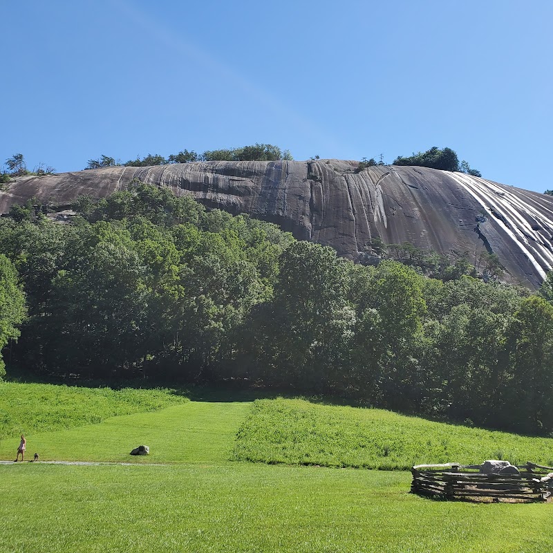
Hikers and trail runners will find a progression in the terrain: meadow and historic Hutchinson Homestead at the mountain’s base, a wooden stair climb beside a roughly 200-foot waterfall, and then the dome’s exposed granite plane that shifts from gently sloped ledge to increasingly steep faces. That progression creates practical decisions—how far onto the dome to go, whether to include out-and-back segments, or whether to camp and use the park as a multi-day base. The paragraphs below map that route, explain how the pieces fit together, and point readers to the specific choices the source supports.

Getting oriented

Approach and first impressions

The Stone Mountain Loop Trail begins from a trailhead located roughly a mile down the road from the Visitor Center; the Visitor Center is the natural orientation point for first-time visitors and a place to pick up park maps. Early in the loop the trail carries hikers across a broad meadow at the mountain’s base, where the Hutchinson Homestead—an on-site restoration noted in the source—sits as an interpretive focal point.

Approaching the dome from this lower meadow sets expectations: the route moves quickly from open grassland and cultural interpretation into more vertical terrain. One recent visitor described walking from the upper parking lot to the summit, then returning to the lower parking area to inspect the creek and rock face below, which underlines that the park’s lower and upper approaches reward distinct sequences of viewpoints.

The defining circuit

Stone Mountain Loop Trail: base to forehead

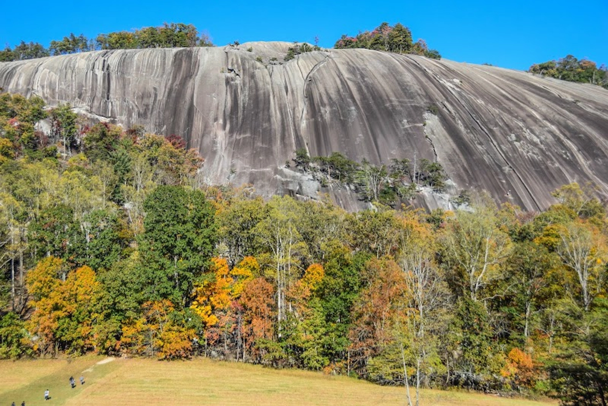
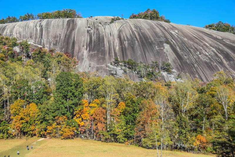
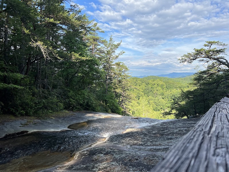
The Stone Mountain Loop is the park’s most cited route and is described in the source as roughly 4.5 miles long. Not long after leaving the meadow the trail climbs a wooden staircase that runs alongside a waterfall estimated in the source to be about 200 feet tall; that ascent deposits hikers onto the dome’s upper surface, sometimes called the mountain’s “forehead.”

On the dome’s upper slab the rock initially presents a gentle slope where people commonly pause for rest or a picnic. The source explicitly warns that the slope becomes steeper relatively quickly the farther out one ventures, and many itineraries return down the westernmost face, which can be markedly steeper—terrain that calls for careful footing and route judgment.

Longer routes

Alternatives: Widow Rock loop and the Mountains-to-Sea Trail

For hikers who want more mileage or to avoid the crowds the source recommends two clear alternatives: a five-mile combined loop that joins Widow Rock, Cedar Rock and Black Jack Ridge, and a roughly six-mile stretch of the Mountains-to-Sea Trail that runs through the park and offers quieter singletrack. These options let visitors choose either a longer circuit or a segment-focused approach that minimizes time on the exposed dome.

Choosing between the Stone Mountain Loop and these alternatives is a matter of trade-offs: the shorter loop centers the dome and waterfall sequence; the longer loops prioritize varied ridge and singletrack mileage away from the dome’s exposed slab.

Facilities and real-world notes

Camping, visitor center and on-the-ground conditions

The source points readers to downloadable maps and notes map availability at the park; supplied visitor reviews supply additional operational detail. Multiple reviewers describe a developed campground with standard state-park campsite layouts, potable water, clean bathrooms and showers, and convenient picnic setups—details that support planning for multi-day stays.

Several recent visitors independently reported little to no internet signal inside the park and advised getting maps at the Visitor Center and downloading routing information before arrival. One reviewer also mentions interpretive exhibits in the Visitor Center (including a moonshine/history exhibit) and a general store near the entrance where they bought ice cream—small practical details that help set expectations for services and amenities.

Geology and movement

The dome, climbing and how the rock shapes choices

Stone Mountain is an exposed granite dome that the source says attracts friction climbers who prefer slab-style movement. That character—the broad, sloped granite surface that graduates from gentle to steep—fundamentally shapes decisions about how far to go onto the dome and whether to remain on trail or explore more direct lines.

Because the dome changes grade quickly, the source emphasizes measured progress and careful returns down the steeper western face. For groups with children or less confident footing, the dome’s upper gentle ledge is a natural terminus; more adventurous parties will be explicit about where they intend to circle or descend.

Why Stone Mountain matters

Stone Mountain State Park matters as a route-first destination: it strings together a meadow and restored homestead, a waterfall-assisted climb and a wide granite dome so that each segment reframes the next. That arrangement makes route decisions—the loop, the longer ridge options, or an overnight at a nearby campground—the essential planning choice for visitors rather than a single featured overlook.

The park will most satisfy hikers, trail runners and campers who want a compact outing with clear transitions between cultural, watery and rocky landscapes and who plan their route around their comfort on exposed slab. The supplied sources show a destination that rewards modest planning, attention to footing on granite, and a willingness to treat the dome as the destination’s defining element.
Editorial Assessment

Source-supported strengths: a clearly defined route progression from meadow and historic Hutchinson Homestead to a waterfall ascent and an exposed granite dome, plus a compact 4.5-mile loop and additional trail options (Widow Rock/Cedar Rock/Black Jack Ridge loop and a Mountains-to-Sea Trail segment). Limitations: the feature set is regionally significant rather than internationally famous, and the park’s primary draw is route variety and geological character rather than large-scale infrastructure or broad-name recognition. (Sources: source_article, reviews)

Stone Mountain State Park

Which experience should you choose?

Which experience should you choose?

Use these options to match the park’s route types to visitor goals and comfort with exposed granite.

OptionBest ForEmphasis
Stone Mountain Loop (4.5 miles)Day hikers and trail runners who want a concise sequence of meadow, waterfall climb and summit slab.Short circuit that centers the dome and the 200-foot waterfall stair climb.
Mountains-to-Sea Trail segment (~6 miles)Hikers seeking quieter singletrack and more continuous mileage away from the dome.Longer segment hiking with less time on exposed slab.
Camp and exploreFamilies and overnight visitors who want to combine campsite comfort with several short hikes.Use campground infrastructure and Visitor Center maps to plan multiple short outings from a base camp.
Stone Mountain State Park

Practical planner

Maps & orientation

Park maps are available for download and at the Visitor Center; multiple reviewers urge picking up paper maps on arrival because cellular internet can be unreliable inside the park.

Source Verified

Trail hazards

The dome’s upper granite begins gently but becomes steeper the farther out you go; the westernmost face is a steeper descent for many loop users—plan route turns and exercise caution on slab sections.

Source Verified

Camping & facilities

Recent visitors report developed state-park campsites with potable water, toilets and showers; reviewers described bathroom facilities as clean and serviceable.

Visitor Reported

Visitor services

The Visitor Center contains small interpretive exhibits and free trail maps; a general store near the entrance is reported by reviewers to sell snacks and ice cream.

Visitor Reported
Maps and Visitor Center are primary orientation points; pick up a paper map on arrival. (Source: source_article, reviews)
Stone Mountain State Park

Frequently Asked Questions

Reviews

L
Larry Wilsona month ago

Incredible experience! The views and natural scenery at Stone Mountain State Park are unforgettable. Well marked trails and a fantastic outdoor getaway.

P
Peter M.3 months ago

Clean trails with great directions. Once you arrive, there are multiple scenic vantage points to explore. Highly recommend visiting early in the morning.

D
David Pestana6 months ago

One of my favorite destinations in the region. Sunset here transitions into an unforgettable evening with shifting light on the landscape.

Nearby Adventures

Bookable Experiences

A Full‑Day Float: 6.5 Miles Down the Yadkin from Ronda to Elkin13.9 mi
Ronda, North Carolina

A Full‑Day Float: 6.5 Miles Down the Yadkin from Ronda to Elkin

A long, scenic tube trip on the Yadkin River that runs roughly 4–6 hours—this guide lays out what to expect, what to pack, and the route logistics.

13.9 miView Trips & Details →
Two Miles of Easy Current: Tubing the New River Beneath the Blue Ridge22.3 mi
Crumpler, North Carolina

Two Miles of Easy Current: Tubing the New River Beneath the Blue Ridge

A tubes-only, 1–2 hour float down a peaceful 2-mile stretch of the New River; this guide explains what to expect on the water and what equipment the operator provides.

22.3 miView Trips & Details →
Seven miles of New River: a short, scenic paddle through Blue Ridge foothills22.3 mi
Crumpler, North Carolina

Seven miles of New River: a short, scenic paddle through Blue Ridge foothills

A 2–4 hour, 7-mile kayaking and canoeing run on the New River; this guide outlines what to expect, the fleet options, and trip logistics.

22.3 miView Trips & Details →
Mayberry Revisited: Four Days in the Real-Life Town That Inspired The Andy Griffith Show24.6 mi
Mount Airy, North Carolina

Mayberry Revisited: Four Days in the Real-Life Town That Inspired The Andy Griffith Show

A four-day, three-night Shepherd Bus Tours itinerary timed to Mayberry Days® (Sept 25–28, 2025) that covers the festival, museum visits, parade seating needs, and the town’s nostalgic attractions.

24.6 miView Trips & Details →
Creekside Campsites with 30 AMP Hookups on Elk Creek31.0 mi
Ferguson, North Carolina

Creekside Campsites with 30 AMP Hookups on Elk Creek

A practical guide to year‑round, creekside camping at Leatherwood Mountains’ Elk Creek Campground — size, hookups, pet and horse policies you need to know.

31.0 miView Trips & Details →
Line, Cast, Calm: Learning Fly Fishing on Todd’s Blue Ridge Trout Streams32.9 mi
Todd, North Carolina

Line, Cast, Calm: Learning Fly Fishing on Todd’s Blue Ridge Trout Streams

A focused, three-hour lesson with Wahoo’s Adventures that teaches core fly-fishing skills on the pristine trout waters around Todd, North Carolina.

32.9 miView Trips & Details →