Hiking to Mount Conness in Tuolumne Meadows
Adventure Destination

Hiking to Mount Conness in Tuolumne Meadows

Explore a challenging trek to Mount Conness from Tuolumne Meadows, featuring stunning views and rugged terrain. Ideal for adventure seekers, this 10-15 mile hike is best tackled from July to September. Enjoy the sweeping vistas and spot wildlife along the way.

Hiking7.8/10Hard
Photo Gallery

Category

Hiking

Typical Duration

2-4 hours

Difficulty

Hard

About This Adventure Destination

Introductory Overview

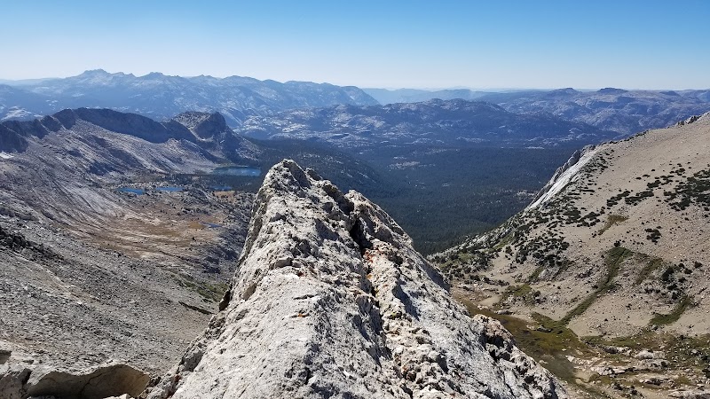
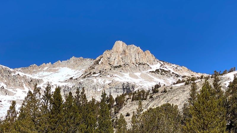
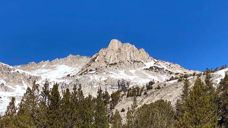
Hiking to Mount Conness (12,590 feet) from Tuolumne Meadows offers one of the most rewarding alpine adventures in Yosemite National Park and the adjacent Inyo National Forest. This challenging trek combines stunning high-altitude scenery, sweeping granite landscapes, and exhilarating ridge walking. The hike allows you to experience a lesser-traveled but spectacular part of the Sierra Nevada, with panoramic views of Yosemite Valley, Mono Lake, and the Cathedral Range. Hikers should be prepared for steep climbs, route-finding challenges, and possible exposure to high winds.

Editorial Assessment

Hiking to Mount Conness offers stunning views and a challenging trek through the beautiful landscape of Tuolumne Meadows. While it's a rewarding adventure for outdoor enthusiasts, it doesn't quite reach the iconic status of the world's top natural landmarks.
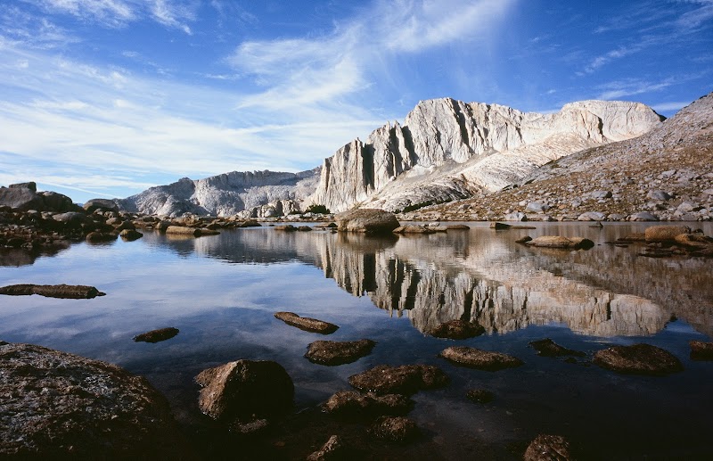
Hiking to Mount Conness in Tuolumne Meadows

Adventure Guide to Hiking to Mount Conness in Tuolumne Meadows

1

#

  • Highlights: #
2

Trailhead and Route Options

  • Details: **Saddlebag Lake Trailhead (Easier Route)**:
  • Details: Begins near **Saddlebag Lake**, outside Tuolumne Meadows.
  • Details: 10-12 miles round trip with about **4,000 feet of elevation gain**.
  • Details: Follows a **class 2 route** (scrambling but no technical climbing required).
  • Details: Key landmarks: **Sawmill Campground, alpine meadows, and Conness Lakes** before reaching the summit ridge.
  • Details: **Young Lakes Route (More Challenging)**:
  • Details: 15+ miles round trip, with complex **route-finding and exposed ridges**.
  • Details: Best for experienced backcountry hikers comfortable with **off-trail navigation**.
  • Details: Spectacular views of Young Lakes and Ragged Peak along the way.
3

Key Features and Highlights

  • Details: **Conness Lakes**: Crystal-clear alpine lakes below the summit, offering a perfect resting spot.
  • Details: **Panoramic Summit Views**: Includes a full 360-degree perspective of Yosemite high country, White Mountains, and even distant peaks like Mount Ritter.
  • Details: **Wildlife Sightings**: Keep an eye out for **marmots, pika, and golden eagles** along the way.
4

Local Insights

  • Details: **Historic Mining Sites**: The area around Mount Conness once hosted **early 20th-century mining operations**, remnants of which can still be found along old routes.
  • Details: **Changing Weather**: **Afternoon thunderstorms** are common in summer—plan to summit early and descend before storms build.
5

Visitor Tips

  • Details: **Best Time to Hike**: July–September, when snow has melted but crowds remain low.
  • Details: **What to Bring**:
  • Details: **Layers** for unpredictable temperatures.
  • Details: **Plenty of water** (no reliable filtering sources near the summit).
  • Details: **GPS, map, and compass** to aid navigation.
  • Details: **Driving Directions**:
  • Details: From Tuolumne Meadows, **drive 10 miles east on Tioga Road** to Saddlebag Lake Road, then another **2 miles to the trailhead**. Travel time: **20 minutes**.

Reviews

E
Eric Swanson3 years ago

Great destination! Enjoyed the open trail and peaceful outdoor atmosphere.

J
John “Sotts” Forsyth3 years ago

Great destination! Enjoyed the open trail and peaceful outdoor atmosphere.

T
Tina Nguyen3 years ago

Mount Conness is a 12,590-foot high peak in the Sierra Nevada range. It is located on the boundary between the Inyo National Forest and Eastern Yosemite National Park. The Conness Glaciers are phenomenal.. I hiked Conness for the first time on May/10/2021. The trail is 7.4 miles out and back and has 3,080 ft of elevation gain. It is a good workout trail. I started at the Sawmill Campground, hiking up towards Alpine Lake. The first 1.5 miles was 500 ft of elevation gain, it was not challenging for me but I had a difficult time finding the trail since the ground was covered by both snow and ice. I actually ended up near White Mountain instead of Alpine Lake. The views of White Mountain are spectacular, but the high altitude was killing me. I didn’t see any hikers, as I think I was there a little early in the season, as it's best to aim to go hike this area between June and September. I’ll give Conness another try sometime in the middle to late summer as that will give me time to acclimate and prepare myself for it.. NATURE + free = HEAVEN!!!

C
Corbin Trincheraa year ago

Amazing free solo September 14 2023

I
In We Go2 years ago

7/23/22- Mt. Conness North Ridge to Summit Loop Hike/Climb. The day stared out clear and beautiful, but by late morning smoke from the Oak Fire in Mariposa County had settled in and made visibility and breathing difficult. We took our time to enjoy the day so it took us over 12 hours to complete the loop. Trailhead starts at Saddlebag Lake dam. Free overnight parking at Saddlebag Trailhead parking area (adjacent to group campground which requires reservations). Pit toilets are located between trailhead parking lot and group campground. Trail from Saddlebag Lake passes alpine lakes (bring a water filter) and meadows and is in good condition and well traveled. To summit Mt. Conness from the north ridge requires hiking up the scree slope on a faint or nonexistent trail, then scrambling a narrow boulder topped ridge line. The ridge line leads to two pinnacles on the north face of the summit. These are 4th class scrambling but could be aided with ropes. Two rappels are set up on natural anchors with rope and webbing on the second pinnacle to descend to the first section of the climb. The climb to the summit is 5th class. Because of exposure, most people will want to ascend the entire north face with ropes (no climbing shoes needed) but some sections can easily be scrambled up to the summit without ropes. After signing the register, proceed to scramble down the East ridge. There are some rock steps set up making the path easy to find but after the rock scrambling section there is a flat dirt expanse which has many faint trails going east and south, follow trail and cairns going east, this route will eventually merge with the out and back hike listed on AllTrails as Mt. Conness. Again the trail is faint or nonexistent. Aim for the valley with a series of small alpine lakes. A trail picks up near the lakes and descends along a waterfall into another much larger valley. Again it’s hard to pick out a well trafficked trail until you reach the valley floor. This trail will lead to the Saw Mill campground where you can follow the road back up to the saddlebag trailhead parking lot (or like we did, start bushwhacking through the forest and across a stream to the Lee Vining Creek canyon and then ascend the slope to the road across the street from the trailhead parking lot).

Nearby Adventures

Bookable Experiences

First Strokes: Mastering Paddleboard Basics on Raymond’s Flat Water32.7 mi
Raymond, California

First Strokes: Mastering Paddleboard Basics on Raymond’s Flat Water

A focused 3-hour, on-the-water lesson that teaches paddling technique, safety and rescue skills while letting you try different paddlecraft—this guide distills what to expect and how to prepare.

32.7 miView Trips & Details →
Cabin 11 at Rock Creek Lodge — A Spacious, Wood‑Heated Mountain Retreat in Mammoth Lakes29.1 mi
Mammoth Lakes, California

Cabin 11 at Rock Creek Lodge — A Spacious, Wood‑Heated Mountain Retreat in Mammoth Lakes

A three‑night minimum stay in a large mountain cabin that sleeps up to eight; this guide lays out the cabin’s layout, amenities, and practical details for planning a multi‑person getaway.

29.1 miView Trips & Details →
Fireside Comfort in the Eastern Sierra: Cabin 3 at Rock Creek Lodge29.1 mi
Mammoth Lakes, California

Fireside Comfort in the Eastern Sierra: Cabin 3 at Rock Creek Lodge

A practical guide to Cabin 3 — a large, modern three‑bedroom rental in Mammoth Lakes that sleeps up to six, features a full kitchen and faux‑wood fireplace, and accepts pets.

29.1 miView Trips & Details →
Cabin 2, Mammoth Lakes — a small mountain cabin with a wood‑burning stove and full kitchen29.1 mi
Mammoth Lakes, California

Cabin 2, Mammoth Lakes — a small mountain cabin with a wood‑burning stove and full kitchen

A compact two‑room retreat at Rock Creek Lodge that sleeps up to four, offers a full kitchen and wood‑stove heat, and accepts pets—this guide lays out the practical facts you need to plan a stay.

29.1 miView Trips & Details →
Four Days to Yosemite’s Giants: A Lodge Stay and a Day in the Valley40.3 mi
San Bruno, California

Four Days to Yosemite’s Giants: A Lodge Stay and a Day in the Valley

A four-day Yosemite itinerary that pairs a guided outbound day—crossing the San Joaquin Valley and visiting a Giant Sequoia grove and Tunnel View—with an unguided overnight stay at Yosemite View Lodge; this guide outlines the route, logistics, and what to expect.

40.3 miView Trips & Details →
A Full Day on Yosemite’s Rivers: Guided Fly Fishing with Tight Line48.5 mi
Mariposa, California

A Full Day on Yosemite’s Rivers: Guided Fly Fishing with Tight Line

A 6–7 hour guided fly-fishing outing in and around Yosemite and the Sierra Nevada, suitable for beginners through experts and offered by Tight Line Fly Guide.

48.5 miView Trips & Details →