Mystic Falls
Hike

Mystic Falls

Short hike linking a 70-foot cascade with a basin overlook

From the Biscuit Basin boardwalk the Mystic Falls route moves into a forested loop that reaches a close waterfall view and a fenced overlook over the Firehole River and Upper Geyser Basin, offering a compact progression through Yellowstone’s thermal and post-fire landscapes.

Hiking7.2/10Moderate
Photo Gallery

Waterfall height

Approximately 70 feet

Trailhead

Biscuit Basin parking area

Key features

Boardwalks, burned forest, waterfall overlook, fenced basin viewpoint

Burn history

Trail passes through forest affected by the 1988 fires

Introduction

Mystic Falls sits in the Old Faithful neighborhood of Yellowstone National Park and is named for a roughly 70-foot cascade on the Firehole River. The hike described in the supplied guide begins at the Biscuit Basin trailhead and threads from developed boardwalks into a short forested loop that reaches a small overlook above the falls and, with a short extension, a fenced vantage over the Firehole River and Upper Geyser Basin.

From the boardwalk the route follows the Little Firehole Meadows Trail, passes the Summit Lake junction, and—at about 0.6 miles from the trailhead—turns onto the Mystic Falls Trail. For many visitors the sequence matters: boardwalk and thermal features first, a compact climb to the falls and overlook next, then a steeper stretch to the fenced viewpoint on the Fairy Creek Trail before returning on the same connectors. That progression—thermal boardwalks, forested trail, waterfall, then basin overlook—shapes what the outing feels like and what gear and attention it requires.

One recent visitor reported completing the outing as a roughly 1.4-mile hike, and supplied accounts highlight that the trail is approachable for novice day hikers while still offering a sense of route-finding between trail junctions. Read on for a routing-first view of what to expect on the ground, how the falls and the fenced overlook relate to the surrounding thermal landscape, and who should plan this short Yellowstone outing.

Getting started

Route and Trailhead

The practical start is the Biscuit Basin parking area: cross the Firehole River on the trail bridge, then follow the Biscuit Basin boardwalk until you find the Little Firehole Meadows Trail. The primary source lists those sequence markers precisely and gives a clear turn at 0.6 miles onto the Mystic Falls Trail; the boardwalk sections keep hikers out of delicate thermal ground until the route leaves developed areas.

From the Mystic Falls Trail the path leads to both the base/overlook for the falls and a junction that connects with the Fairy Creek Trail. Taking the Fairy Creek link leads to a small fenced overlook that provides sweeping views of the Firehole River and the Upper Geyser Basin; after that viewpoint the trail drops steeply to rejoin the Mystic Falls Trail for the return. These junctions can feel like short navigational puzzles, but the loop is compact and straightforward when followed in order.

Defining feature

The Waterfall and Overlooks

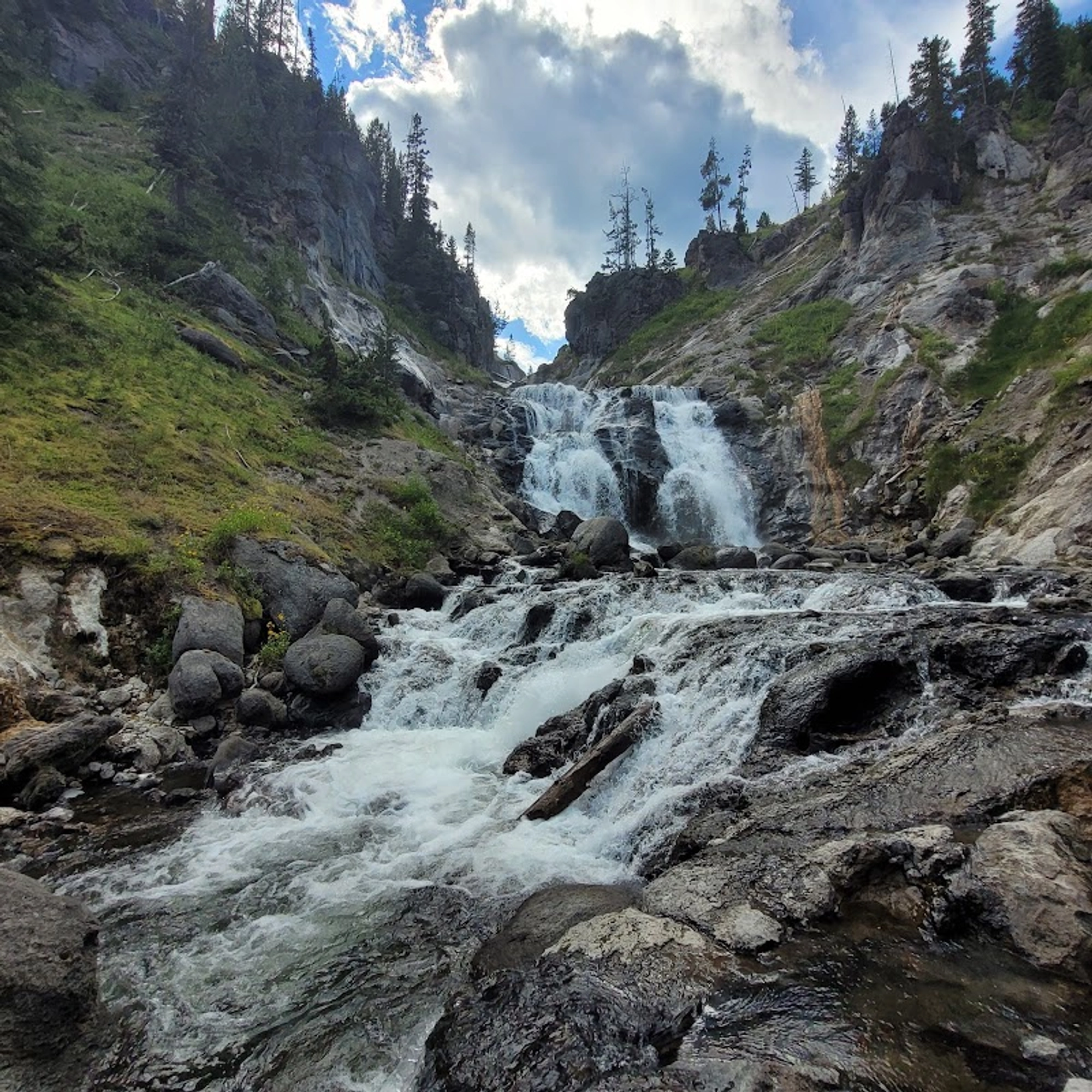
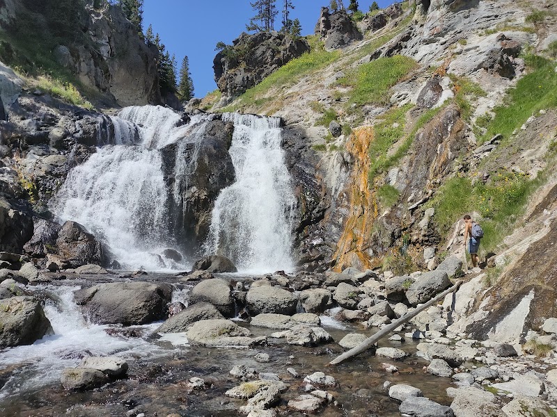
Mystic Falls is described in the primary source as a roughly 70-foot cascade created where the Firehole River plunges off the Madison Plateau into Biscuit Basin. The primary attraction on this route is the pair of experiences: an immediate, close encounter with the falls and a separate, higher fenced overlook that frames the river and the broader geyser basins beyond.

The falls themselves are reached early in the route’s sequence; the fenced overlook is reached by continuing east on the Fairy Creek Trail past the falls’ overlook and then ascending before a steep drop back to the Mystic Falls Trail. Expect two distinct viewing moments rather than a single panoramic stop: one intimate and waterfall-focused, the other panoramic and basin-oriented.

Landscape

Burned Forest and Landscape Context

The trail passes almost entirely through forest that was affected by the 1988 wildfires, a fact noted in the supplied article. That burn history changes the trail’s character: understory is often open, views through the trunks can pick out thermal steam or distant basin features, and sunlight patterns on the trail differ from an unburned mature stand.

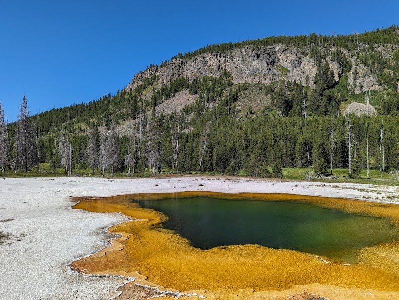
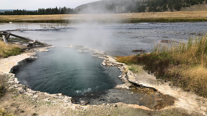
This post-fire setting also makes the route legible as a short landscape study: hikers move from the mineral-rich edges of Biscuit Basin and boardwalks into a recovering forested slope above the Firehole. The combination of thermal features and post-fire forest is intrinsic to the hike’s narrative and helps explain why the route links a waterfall and an overlook of distant geyser basins rather than offering continuous river canyon scenery.

Who it's for

Navigation, Difficulty, and Visitor Fit

The primary source rates the hike easy-to-moderate and highlights the short climb and several junctions that add a mild navigational element. Beginner hikers who want to stray briefly from the boardwalks but prefer a short, managed outing are the audience identified in the source article; one supplied visitor review described participants aged 8–72 completing the route with relative ease.

Because the loop uses both boardwalk and unpaved trail segments, expect a mix of footing: flat, firm boardwalks; short climbs and descents on the Mystic Falls Trail; and a steeper drop coming off the fenced overlook toward the return. The junctions reward attention to signage but are not described as complex; the supplied material emphasizes retracing steps on the Mystic Falls Trail to return to the Little Firehole Meadows Trail and the boardwalk.

Rules and risks

Regulations and Safety Notes

The supplied article reiterates park safety essentials for thermal areas: remain on established trails and boardwalks in geyser basins because thin crust and scalding water create serious hazards. The Biscuit Basin parking area and boardwalk keep most of the early route on developed surfaces, but once the trail departs the boardwalk it traverses standard backcountry tread and a fenced overlook—situations where caution and adherence to park signage are required.

The primary source also provides concrete access details: from Old Faithful, drive north to Biscuit Basin and use the Biscuit Basin parking area; the article notes parking is tied to park entrance pass policies and calls out the life-and-safety rationale for staying on designated trails and boardwalks.

Conclusion

Mystic Falls matters as a short, route-focused Yellowstone hike that deliberately links thermal boardwalks, a forested trail shaped by the 1988 fires, a roughly 70-foot cascade, and a fenced overlook onto the Firehole River and geyser basins. It is best suited to day hikers who want a compact outing that moves beyond boardwalks without committing to a long backcountry route.

The hike’s value lies in that sequence—developed thermal features, a waterfall encounter, then a basin panorama—which gives the short trip a perceivable progression and a clear reason to include it in an Old Faithful–area itinerary.
Editorial Assessment

A dependable short Yellowstone hike that connects developed thermal boardwalks with a roughly 70-foot waterfall and a fenced overlook of the Upper Geyser Basin; valuable for regional visitors and day hikers but not a destination-defining attraction on the scale of Yellowstone’s major geyser features. Strengths: accessible routing, clear progression from boardwalk to overlook, and proximity to Old Faithful-area features. Limitations: modest individual prominence compared with core park attractions and a short overall scope. (source_refs: source_article, input_location, input_address)

Mystic Falls

Which Mystic Falls route is right for you?

Which Mystic Falls route is right for you?

Two practical options emerge from the supplied route description: a short loop focused on the waterfall and a modest extension to the fenced basin overlook. Choose based on time, mobility, and whether you want a basin view in addition to a waterfall encounter.

OptionBest ForEmphasis
Short Mystic Falls loopVisitors prioritizing a brief waterfall visit with minimal elevation changeQuick access to the falls and boardwalk sections; minimal extra climbing
Extended overlook via Fairy CreekThose who want landscape context and distant views of the Upper Geyser BasinAdds the fenced viewpoint and a steeper trail segment; connects waterfall and basin-scale scenery
Mystic Falls

Practical planner

Access & parking

Approach from Old Faithful and use the Biscuit Basin parking area as described in the primary source; the guide notes a short drive north from Old Faithful to Biscuit Basin and parking tied to park entrance policies.

Source Verified

Trailhead & route markers

Start at the Biscuit Basin trailhead, cross the Firehole River bridge, follow the Biscuit Basin boardwalk to the Little Firehole Meadows Trail, and turn right onto the Mystic Falls Trail at the 0.6-mile junction indicated in the guide.

Source Verified

Regulations & safety

Stay on boardwalks and designated trails in thermal areas; the primary source warns that thin crust and scalding water present serious hazards in geyser basins.

Source Verified

Visitor reports

One recent visitor reported the outing as approximately 1.4 miles and accessible across a broad age range; use that as an anecdotal reference for expected effort.

Visitor Reported
Use Biscuit Basin parking; follow boardwalks to Little Firehole Meadows Trail, then Mystic Falls Trail at the 0.6-mile junction; extend via Fairy Creek for the fenced overlook.
Mystic Falls

Frequently Asked Questions

Reviews

L
Larry Wilsona month ago

Incredible experience! The views and natural scenery at Mystic Falls are unforgettable. Well marked trails and a fantastic outdoor getaway.

P
Peter M.3 months ago

Clean trails with great directions. Once you arrive, there are multiple scenic vantage points to explore. Highly recommend visiting early in the morning.

D
David Pestana6 months ago

One of my favorite destinations in the region. Sunset here transitions into an unforgettable evening with shifting light on the landscape.

Nearby Adventures

Bookable Experiences

Across Groomed Trails to Old Faithful: A Winter Day in Yellowstone from Jackson2.78 mi
Jackson, Wyoming

Across Groomed Trails to Old Faithful: A Winter Day in Yellowstone from Jackson

A 12-hour, hotel–pickup snowcoach excursion from Jackson to Old Faithful that stops at winter thermal highlights and returns the same evening—this guide helps you prepare for the route, gear, and on-board logistics.

2.78 miView Trips & Details →
Around Geysers and Canyons: A Six‑Day Yellowstone Family Adventure5.58 mi
Yellowstone National Park, Wyoming

Around Geysers and Canyons: A Six‑Day Yellowstone Family Adventure

A 6‑day, family-focused itinerary out of Grant Village that visits Old Faithful, Grand Prismatic Spring, Hayden Valley and the Firehole River—essential reading for families planning this Wilderness Inquiry trip.

5.58 miView Trips & Details →
A Day of Thunderous Falls, Roaming Bison, and Steaming Geysers in Yellowstone5.59 mi
Yellowstone National Park, Wyoming

A Day of Thunderous Falls, Roaming Bison, and Steaming Geysers in Yellowstone

Private, naturalist-guided full-day tour (approximately 8–10 hours) that visits the Grand Canyon of the Yellowstone, Hayden Valley wildlife, and geysers and mud pots — starts at $850.

5.59 miView Trips & Details →
Yellowstone Skyline from Above: A 30‑Minute Flight Over West Yellowstone’s Towering Ridges14.6 mi
West Yellowstone, Montana

Yellowstone Skyline from Above: A 30‑Minute Flight Over West Yellowstone’s Towering Ridges

A concise, 30‑minute air tour operated from West Yellowstone that puts you over steep mountain faces, jagged cliffs and the iconic Yellowstone Skyline—this guide explains what to expect and what to bring.

14.6 miView Trips & Details →
Four Days of Open-Terrain Roaming: ATV & UTV Rental Out of West Yellowstone14.6 mi
West Yellowstone, Montana

Four Days of Open-Terrain Roaming: ATV & UTV Rental Out of West Yellowstone

A 4-day rental of ATVs or UTVs for exploring the National Forests around West Yellowstone; this guide explains what the rental covers and the key boundary you must respect.

14.6 miView Trips & Details →
Through the Lens: A Full-Day Photography Expedition into Yellowstone’s Wild Heart14.6 mi
West Yellowstone, Wyoming

Through the Lens: A Full-Day Photography Expedition into Yellowstone’s Wild Heart

A full-day wildlife and landscape photography outing led by a Naturalist Photographer in and around West Yellowstone — this guide distills where to go, what to bring, and how the day unfolds.

14.6 miView Trips & Details →