Hiking Eagle Rock in San Diego

image

Hiking Eagle Rock in San Diego

Hiking to Eagle Rock offers an unforgettable outdoor adventure in the San Diego region. This unique rock formation, located along the Pacific Crest Trail (PCT), is famed for its striking resemblance to a soaring eagle with outstretched wings, making it a must-see landmark for avid hikers and nature enthusiasts alike. The well-maintained trail provides a blend of scenic beauty, moderate challenge, and an iconic geological feature that’s truly one-of-a-kind in Southern California.

Adventure Guide to Hiking Eagle Rock

  • Trailhead Location:
    Begin your hike at the Warner Springs Community Resource Center, located about 65 miles northeast of downtown San Diego. The trailhead is well-marked off Highway 79, with easy parking availability nearby.
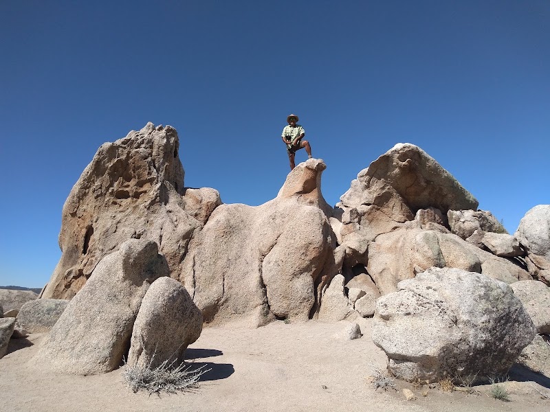
  • Unique Features:
    The hike to Eagle Rock spans approximately 6.5 miles roundtrip and traverses diverse terrain, including rolling meadows, shaded oak groves, and desert-like rocky landscapes. The highlight, of course, is the Eagle Rock formation, which seamlessly emerges from the boulders and resembles a natural sculpture of an eagle. The realism of the formation is astounding and makes for a fantastic photo opportunity.

  • Accessibility & Difficulty:
    This trail is moderate in difficulty, with a gradual incline that’s manageable for most hikers. It’s family-friendly, but proper hiking footwear is recommended due to uneven surfaces in some areas. Leashed dogs are also allowed on the trail, adding to its accessibility for pet owners.

Local Insights

  • This portion of the Pacific Crest Trail highlights the incredible diversity of Southern California ecosystems. Spring is particularly rewarding, as seasonal wildflowers blanket the meadows along the hike, enlivening the trail with vibrant colors. The area is also a frequent stop for through-hikers making their way along the entire PCT.

Visitor Tips

  • Best Time to Visit: Aim for early morning or late afternoon hikes during spring or fall to enjoy cooler temperatures and avoid peak sun exposure.
  • Essentials to Bring: Pack plenty of water, sunscreen, a hat, and a camera for capturing the views. Snacks are also recommended for refueling at Eagle Rock.
  • Driving Directions: From San Diego, take I-15 N to CA-76 E, then proceed to Highway 79 S. The drive typically takes about 1.5 hours.

Adventure Map

Reviews

Colleen Cooka year ago
This is a nice hike with minimal elevation gains. However, it is a fairly long hike (about 6.5 miles). Eagle Rock is pretty spectacular though! There are two different trails that you can follow. The one that starts out by the Warner Springs fire house is the easier one. I heard the other trail is approximately 10 miles round trip. I've done this hike in the summer which is nice during late afternoon. The hike is also nice in the late fall because there is a creek that runs next to the first half which offers the nice relaxing sound of flowing water.
Brendan Kielya year ago
Eagle Rock is an awesome large natural rock formation shaped like an Eagle or a hawk. It is located out in a vast open high elevation valley in Southern California. The hike on the trail from the parking area is also very nice and the views on a clear day are fantastic.
Bridget Afandi9 months ago
Easy walking, whether you're a fast walker or leisurely. Trail there and back was approximately 6.5 miles. It took us about 3.5 hrs including a 30 minute break at Eagle Rock. We went on a Thursday morning @8am and got back to the cars at 1130am. Weekends are busy with finding parking and many PCT hikers coming up from Campo or further up the trail towards Canada. Beautiful day with some cloud cover. Temperature was in the low 70s with a slight breeze. Trail starts in a grove of Oak trees and along a creek and opens out to a vast meadow as far as you can see with gently rolling hills.
David Myer3 months ago
A fairly easy winter hike along a section of the Pacific Crest Trail. Very hot & dry in the summer. Don't be fooled by the nearby Camino San Ignacio Rd, there is no access from there - no parking and a lot of barbed-wire fence. Take the trailhead either in Warner Springs (to the N) or on the S22 (to the S). No bikes. No bathrooms. No water.
Danielle M9 months ago
This is one of my favorite hikes near San Diego. It’s around 6 miles total, out and back. It’s a pretty flat and relatively easy hike that starts shady by a river and then ends in an open grassy area. The eagle is a really neat rock formation. Side note, I always have to stop for pie at Julian Pie Company in Santa Ysabel.

Related Posts

featured

Hiking Cedar Creek Falls Trail in San Diego

featured

Hiking Potato Chip Rock in San Diego

featured

Hiking Annie's Canyon Trail in San Diego

featured

Hiking to Three Sisters Falls in San Diego