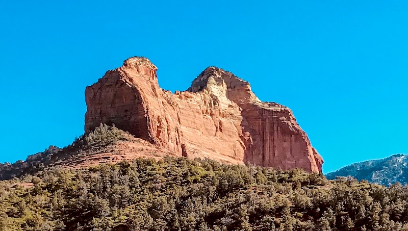
Hiking to Nancy's Rock Overlook in Sedona, AZ

Hiking to Nancy's Rock Overlook in Sedona, AZ
Introductory Overview
Nancy's Rock Overlook in Sedona, Arizona, offers a captivating hiking experience and some of the best panoramic views in the region. Positioned amid Sedona’s iconic red rock formations, this destination provides outdoor enthusiasts and nature lovers with a moderately challenging trail that rewards hikers with sweeping vistas of Oak Creek Canyon, Courthouse Butte, and Bell Rock. What makes Nancy's Rock unique is its relatively secluded location compared to Sedona’s busier trails, appealing to those seeking tranquility and stunning photography opportunities away from large crowds.
Adventure Guide to Hiking to Nancy's Rock Overlook
- Trail Access and Location: Start your hike from the Chapel of the Holy Cross Trailhead, located about 10 minutes from Sedona’s town center. The trail towards Nancy's Rock winds through juniper-studded pathways and offers occasional shade, with well-marked signposts to guide you. The hike is approximately 3 miles round-trip and takes around 2–3 hours depending on your pace.
- What Makes It Special: Nancy's Rock is celebrated for its unobstructed, elevated viewpoint, making it ideal for catching a sunrise or sunset. The overlook provides 360-degree views of Sedona's natural wonders, giving enthusiasts prime opportunities to observe the area's diverse desert vegetation, geological layers, and, on a clear day, even glimpses of the San Francisco Peaks.
- Key Features: The trail offers distinct landmarks, including a natural sandstone arch halfway through the trail, perfect for photos. The final ascent to Nancy's Rock requires some light scrambling, adding an adventurous element for hikers.
Local Insights
- Nancy’s Rock is not as widely publicized as trails like Devil’s Bridge, so it has a significant local following for those seeking solitude.
- The name derives from local lore, honoring a Sedona native who advocated for preserving the area’s natural beauty.
- The trail lies within Coconino National Forest, renowned for its geological diversity, so keep an eye out for wildlife like mule deer or Harris’s hawks.
Visitor Tips
- Best Time to Visit: Aim to start early in the morning or late afternoon to avoid midday heat. The trail is most vibrant during spring (wildflower bloom) and fall (cooler temperatures).
- What to Bring: Essentials include at least 2 liters of water, sturdy hiking shoes, sunscreen, and a camera for those incredible views.
- Getting There: From Sedona, take Hwy 179 south for 3 miles and turn left onto Chapel Road. Parking is limited, so arrive early to secure a spot.
Reviews
Alicia Hoskinsa year ago
Beautiful oasis on the creek. Easy to moderate hike down from the bridge.
David Golubev2 years ago
Beautiful hike. If you plan to cross the stream make sure your shoes can get wet.
Pavel Tracenco6 years ago
So many amazing places to see here
Brenda MacKaya year ago
Beautiful! Hiked down a fairly easy trail with a couple of small hairpin turns. Hiking up may be a bit of a challenge. Water is beautiful, cold, and clear. Once you get to the bottom of the trail, veer right and go around a large boulder to the continued trail. Highly recommend - bring a snack, towel/blanket and plenty of water.
Joe Colby7 years ago
Fantastic entry point into Sedona!


