Breathe in the whisper of Arizona's high desert as you step into Chiricahua National Monument, where towering rock formations beckon the intrepid at heart to discover their ancient secrets. This st...
National Monument12,0254+ Trails
1924NATIONAL MONUMENT
Designation
National Monument
Total Wilderness Area
12,025
Elevation / Terrain
Diverse Wilderness
Field Editorial Guide
About Chiricahua National Monument
Chiricahua National Monument is known for its stunning rock formations and scenic beauty, offering a unique glimpse into the geological wonders of southeastern Arizona.
Wilderness Landscape & Natural Heritage
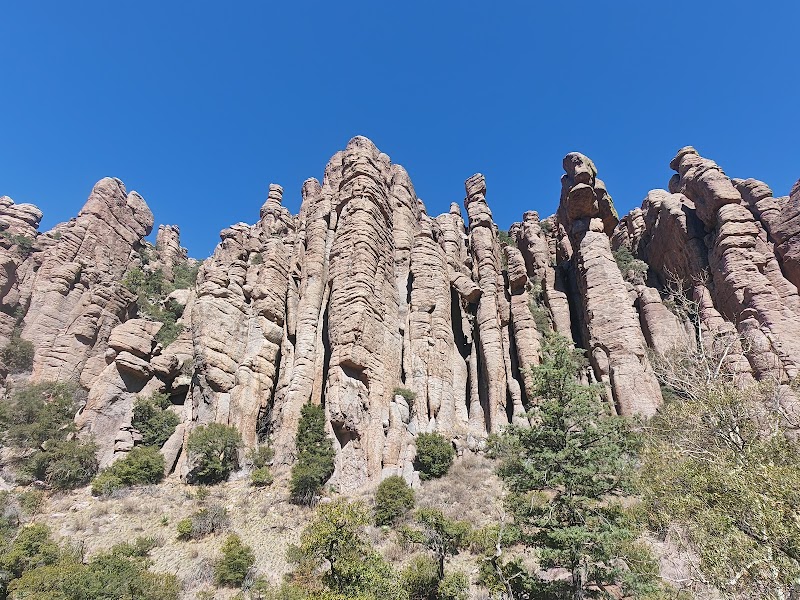
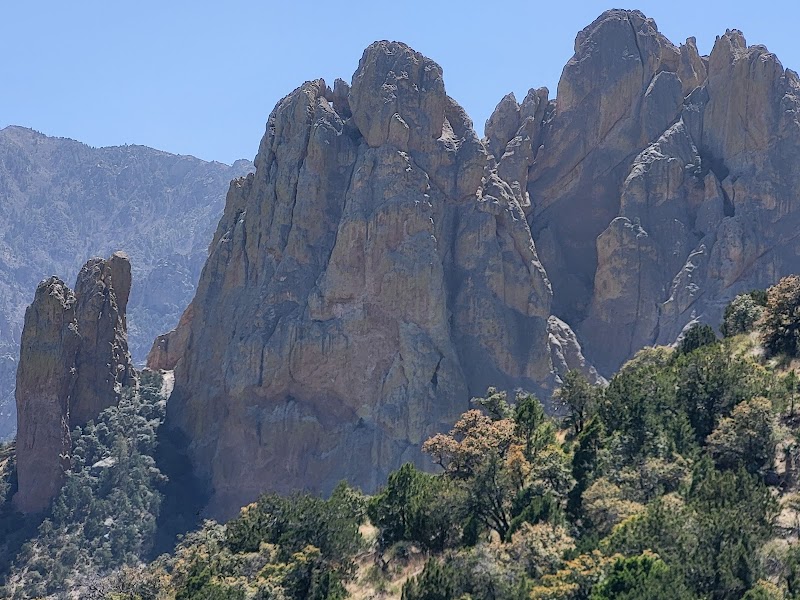
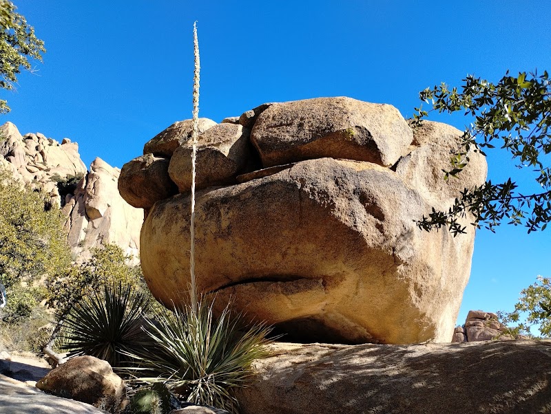
Chiricahua National Monument, located in Cochise County, Arizona, is renowned for its remarkable rock formations known as 'hoodoos,' which formed from volcanic ash erupted from the Turkey Creek Volcano nearly 27 million years ago. The landscape is a dynamic combination of towering rock spires, balanced boulders, and deep canyons, providing a fascinating backdrop for outdoor adventures and exploration. Established in 1924, the monument covers over 12,000 acres, preserving not only its geological marvels but also a rich biodiversity with a diverse range of habitats supporting both desert and mountain species. Visitors can engage in a variety of activities, from hiking through its 17 miles of trails to observing the various species of birds and wildlife that inhabit the area. Iconic sites such as the Echo Canyon Loop allow for intimate interaction with the landscape, making it a popular choice for photographers and nature enthusiasts alike. The monument attracts those intrigued by its natural beauty as well as its historical significance, including the Faraway Ranch Historic District which offers a glimpse into the lives of early settlers.
Field Guide · National Monument
Adventure Destinations
Notable Destinations Near Chiricahua National Monument
Scenic viewpoints, outdoor landmarks, and notable points of interest within 60 miles.
Key Wilderness Highlights
✦ Echo Canyon Loop✦ Cochise Head Overlook✦ Faraway Ranch Historic District✦ Massai Point
Wilderness Visuals & Gallery
Visual Guide to Chiricahua National Monument
Wilderness Recreation
Outdoor Adventures in Chiricahua National Monument
Explore curated guides for top outdoor sports, trail networks, and wilderness activities.
Activity Field GuideChiricahua National Monument
Hiking in Chiricahua National Monument
Journey to Chiricahua National Monument: An Adventurer's Guide to Hiking Skyward
Breathe in the whisper of Arizona's high desert as you step into Chiricahua National Monument, where towering rock formations beckon the intrepid at heart to discover their ancient secrets. This stunning landscape, sculpted by centuries of geological artistry, invites you to embark on a journey through time. Every step forward is a step deeper into a world shaped by volcanic activity and shaped further by wind, water, and the implacable march of time.
Your path begins at the Echo Canyon Trailhead, a portal into a realm where the earth shows its artistry in dramatic stone spires, pinnacles that pierce the azure sky. As you move forward, the trail weaves through rock formations that rise like ancient sentinels, their rough surfaces whispering tales of eras long gone. The initial descent through the canyon's cool shade reveals the playful interplay of light and shadow, the sun casting fleeting patterns on the stone walls.
This journey takes you through a spectrum of natural regions—each offering its unique challenge and reward. Chiricahua boasts 17 miles of interconnected trails, delivering both casual walks for the serene sightseer and more challenging routes for the seasoned wanderer. The trail distance varies, from quick loops that whet the appetite for exploration to longer hikes that demand stamina and plenty of water.
For those seeking the heart-thumping thrill of a more strenuous hike, the Big Loop is your calling. This 9.5-mile adventure twists through picturesque vistas and affords a view of the monument that is nothing short of breathtaking. The elevation gain of 1,400 feet becomes a rite of passage, a test of endurance against the majestic sweep of sloping paths and rocky crags.
With every ascent, the ecosystem subtly shifts. Experience the camaraderie of pine and juniper that line the trails, their evergreen presence a comforting constant amid the rugged adventure. Pause to admire the delicate beauty of desert flora, vibrant bursts of color in springtime that contrast with the stark austerity of the rock backdrop. Keep your senses attuned to the soft rustle of local wildlife; javelinas may graze nearby, fully aware yet peacefully indifferent to your journey.
Hydration and preparation are your allies here. The sun's rays, although a friendly companion lighting your path, can quickly become an adversary in this arid environment. Carry ample water and sunscreen to extend your stay beneath the endless clarity of the high desert sky. Sturdy hiking boots with good traction will serve you well on the rocky terrain, providing stability as you navigate this otherworldly landscape.
Every turn offers a new perspective—a moment of awe in the depth of the canyon or the expanse of the view from higher ground. At one with the earth's ancient guardians, you become a part of the landscape's vibrant story.
In this monument born of fire, shaped by the elements, and commemorated through your adventure, the spirit of exploration finds its echo. Each hike is not merely a physical endeavor, but a walk-through memory, a testament to the natural world's power to inspire and challenge. Embrace the call of the Chiricahua and let the spirit of adventure guide your steps.
Other Available Activity Guides in Chiricahua National Monument:
The Ranger Station
Visitor Logistics & Essential Planning
Everything you need to know about entrance passes, seasons, visitor centers, road transit, and wildlife safety in Chiricahua National Monument.
Passes & Fees
Entrance Requirements & Interagency Passes
Entrance to the monument is free; however, camping and certain activities may require permits or fees.
Wilderness Checklist
Carry paper topographic map & compass in remote zones.
Store all food and scented items in approved bear canisters.
Check wildfire / smoke advisories before backcountry departure.
Pack out everything you pack in (Leave No Trace).
Wilderness Stays
Camping & Overnight Stays in Chiricahua National Monument
Frontcountry developed campgrounds, backcountry wilderness permit guidelines, and starry-night camping advice.
Bonita Canyon Campground
Located within the monument, it offers 25 campsites suitable for tents and smaller RVs, providing a serene setting close to many trailheads.
Stay, dine, and gear up in these mountain towns and scenic basecamps surrounding the park.
⌖ 13.78 miles
Gateway Basecamp
Portal, Arizona
Portal, Arizona is a secluded destination for adventurers seeking hiking, birding, and stargazing opportunities. With access to the awe-inspiring Chiricahua Mountains, it’s a true gem for nature lovers.
San Simon, AZ, is your starting point for desert expeditions, rich history, and stunning landscapes. Explore trails, bird habitats, and historic sites in this tranquil retreat.
Steins, New Mexico is a fascinating off-the-grid ghost town in rugged desert terrain. Known for hiking, mountain biking, and solitude, it offers visitors a unique glimpse into New Mexico’s wild, historic landscapes.
Animas, NM, offers peaceful desert and mountain adventures with hiking, biking, fishing, and camping nearby. It’s an ideal base for exploring Gila National Forest's rugged landscapes away from crowds.
Willcox is your access point for Chiricahua's dramatic rock formations and epic skies. Enjoy prime bird watching, unique rock climbing challenges, and immersive hikes in this desert oasis.
Lordsburg is a desert gateway town ideal for hikers, bikers, and off-roaders seeking quiet Southwest wilderness and star-filled skies. Use it as a base to explore wide-open landscapes and nearby protected areas.
An hour-long evening ghost tour beginning at the Good Enough Mine that combines mine lore, a trolley tour through Tombstone’s haunted sites, and a spine-tingling graveyard finale—this guide explains what to expect and how to prepare.
A fully narrated, 45-minute walking tour that takes you 100 feet below the streets of Tombstone into an authentic 1880s silver mine—this guide explains what you’ll see and how to plan for the stairway descent and easy underground walking.
A 1.5-hour guided walk through Old Town Bisbee that maps the city’s Bisbee Noir era (1880–1915) and ends with introductions to the town’s present-day saloons—essential context for anyone who wants to read the town’s past in its streets and storefronts.
A five‑hour guided hike from old mining roads through pine‑oak and Douglas‑fir stands to the Black Bear Mine—this guide explains what you’ll see and what to bring.
A guided, 1.5-hour golf cart circuit of Old Town Bisbee that traces the town’s rise from a copper strike and mining camp to county seat and post‑mine community—this guide focuses on what you’ll see and why those sites matter.
An eight-hour motorized day trip from Bisbee into Agua Prieta that traces the town’s revolutionary past, industrial present and the contemporary realities of the border — all without a passport.
A guided 1.5-hour walking tour of Old Town Bisbee that traces the town’s copper boom, its notorious Brewery Gulch district, and the disasters and social changes that shaped the community.
A full-day, 10-hour outing that pairs a 3.4-mile Echo Canyon loop through towering volcanic pinnacles with a 4x4 traverse to Cave Creek Canyon and a visit to the little-known Chiricahua Desert Museum.
A full-day, backcountry 10-mile out-and-back hike from Tombstone to the Cochise Stronghold that pairs towering pink granite formations with Native American rock art and the historic Cochise peace site.
A five-hour motorized golf-cart tour that threads Bisbee’s mining legacy, vintage Lowell, the Shady Dell and Warren’s murals—this guide orients you to the stops, logistics and who this trip suits.
A 2.5-hour motorized outing from Bisbee to Whitewater Draw to witness the annual Sandhill Crane migration and a broad assemblage of wetland and raptor species.
A nine-hour guided walking and motorized tour from historic Bisbee that visits well-preserved brontosaur footprints, the Gammons Gulch film set, and a hands-on fossil collection at the Southern Arizona Museum of Science and Technology.