
Bura Irrigation Scheme Buffer Zones wilderness guide
Buffer Zone · Kenya

Bura Irrigation Scheme Buffer Zones

Bura Irrigation Scheme Buffer Zones are protected areas surrounding the Bura Irrigation Scheme in southeastern Kenya, designed to safeguard water resources, reduce soil erosion, and support sustainable agriculture alongside natural ecosystems.

Buffer ZoneApprox. 12,000 acres

Designation

Buffer Zone

Total Wilderness Area

Approx. 12,000 acres

Elevation / Terrain

Diverse Wilderness

Field Editorial Guide

About Bura Irrigation Scheme Buffer Zones

Bura Irrigation Scheme Buffer Zones are protected areas surrounding the Bura Irrigation Scheme in southeastern Kenya, designed to safeguard water resources, reduce soil erosion, and support sustainable agriculture alongside natural ecosystems.

Wilderness Landscape & Natural Heritage

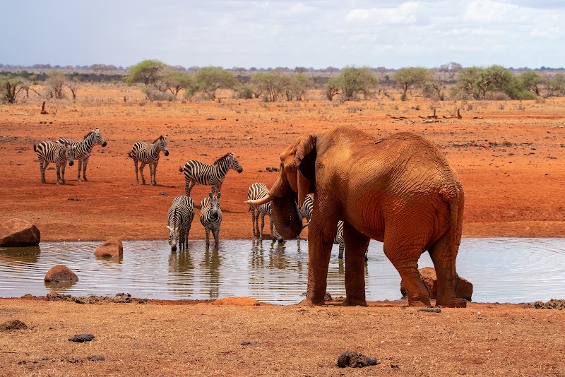
The Bura Irrigation Scheme Buffer Zones encompass land around the Bura irrigation infrastructure within Tana River and Garissa counties in southeastern Kenya. These buffer zones function as protective belts that minimize the negative impacts of agricultural runoff, soil erosion, and human activity on both the irrigation canals and surrounding ecosystems. Geographically, the zones cover areas transitioning from semi-arid savanna to agricultural fields, serving as a critical interface between intensive irrigation agriculture and the natural environment. The ecology includes drought-resistant shrublands, scattered acacia woodlands, and riparian habitats alongside the Tana River tributaries, supporting a variety of small wildlife species and birdlife adapted to dryland conditions. Established as part of broader efforts to improve water management and environmental sustainability in the region, the buffer zones help stabilize soils, filter pollutants, and provide habitat for native wildlife. While the primary function is environmental protection, visitors may observe rural landscapes and local farming activities, though recreation infrastructure is minimal. The buffer zones also play a role in preserving water quality for the approximately 34,000 hectares of irrigated land within the Bura Scheme, a landmark development project that began in the late 1970s to boost agricultural output for communities living in arid eastern Kenya. The area offers opportunities for eco-tourism and educational visits focused on sustainable water use, dryland farming techniques, and biodiversity conservation. Given its location, visitors can gain insight into challenges of irrigation management in semi-arid climates and the importance of land stewardship to enhance long-term productivity and environmental balance.
Field Guide · Buffer Zone
Adventure Destinations

Notable Destinations Near Bura Irrigation Scheme Buffer Zones

Scenic viewpoints, outdoor landmarks, and notable points of interest within 60 miles.

Key Wilderness Highlights

✦ Extensive network of irrigation canals feeding the Bura Scheme agricultural lands✦ Semi-arid flora adapted to buffer zone conditions, including native acacia species✦ Key role in reducing sedimentation and protecting water quality in irrigation infrastructure✦ Community-based management initiatives promoting sustainable land use practices
Wilderness Recreation

Outdoor Adventures in Bura Irrigation Scheme Buffer Zones

Explore curated guides for top outdoor sports, trail networks, and wilderness activities.

Park Recreation

Wildlife Viewing

Available in Bura Irrigation Scheme Buffer Zones
Park Recreation

Photography

Available in Bura Irrigation Scheme Buffer Zones
Park Recreation

Educational Tours

Available in Bura Irrigation Scheme Buffer Zones
Park Recreation

Bird Watching

Available in Bura Irrigation Scheme Buffer Zones
Park Recreation

Environmental Research

Available in Bura Irrigation Scheme Buffer Zones
The Ranger Station

Visitor Logistics & Essential Planning

Everything you need to know about entrance passes, seasons, visitor centers, road transit, and wildlife safety in Bura Irrigation Scheme Buffer Zones.

Passes & Fees

Entrance Requirements & Interagency Passes

Access generally requires coordination with local irrigation authorities; open access not guaranteed

Wilderness Checklist

Carry paper topographic map & compass in remote zones.
Store all food and scented items in approved bear canisters.
Check wildfire / smoke advisories before backcountry departure.
Pack out everything you pack in (Leave No Trace).
Adventure Basecamps

Gateway Towns Near Bura Irrigation Scheme Buffer Zones

Stay, dine, and gear up in these mountain towns and scenic basecamps surrounding the park.

Garsen, Kenya
⌖ 30.65 miles
Gateway Basecamp

Garsen, Kenya

Garsen is a quiet riverside town on the Tana River, perfect for travelers seeking off-the-beaten-path hiking, bird watching, and paddling. Explore the rich wetlands, local culture, and wildlife in this remote coastal Kenya spot.

June to October (Dry Season)
Explore Town
Witu, Kenya
⌖ 52.94 miles
Gateway Basecamp

Witu, Kenya

Witu is a peaceful town near Kenya’s coastal forests and mangroves, ideal for hiking, bird watching, and boat safaris. It offers rich wildlife and cultural experiences away from typical tourist routes.

June to October
Explore Town