Hike the Domingo Baca Trail to TWA Plane Crash Site in Sandia Mountains
Adventure Destination

Hike the Domingo Baca Trail to TWA Plane Crash Site in Sandia Mountains

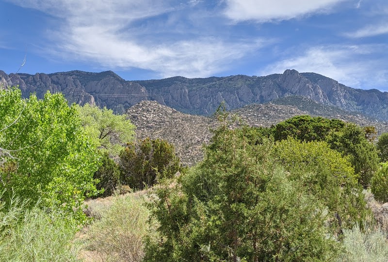
Explore the 7-mile round-trip Domingo Baca Trail in the Sandia Mountains, NM. This moderately strenuous hike takes you to the historic TWA Flight 260 crash site, offering stunning views and a mix of rocky terrain. Best in spring and fall for adventurous hikers.

Hiking7.8/10Moderate
Photo Gallery

Category

Hiking

Typical Duration

2-4 hours

Difficulty

Moderate

About This Adventure Destination

The Domingo Baca Trail leads to one of the most historic and challenging hikes in the Sandia Mountains—the site of the 1955 TWA Flight 260 crash. The trail offers stunning scenery, rugged terrain, and a somber yet fascinating glimpse into history. This journey is ideal for those with experience hiking in rocky and steep conditions who are looking for a rewarding and meaningful adventure.

Editorial Assessment

The Domingo Baca Trail to the TWA Plane Crash Site in the Sandia Mountains offers a unique blend of history and natural beauty, appealing to outdoor enthusiasts who enjoy hiking and exploring. The trail provides captivating views of the rugged mountain terrain, but its overall recognition as a global landmark falls short of the most iconic natural destinations.

Hike the Domingo Baca Trail to TWA Plane Crash Site in Sandia Mountains

Adventure Guide to Hike the Domingo Baca Trail to TWA Plane Crash Site in Sandia Mountains

1

#

  • Highlights:

2

Starting Point and Trail Details

  • Trailhead:

    Access the Domingo Baca Trail from the Ellena Gallegos Open Space, located at 7100 Tramway Blvd NE, Albuquerque, NM.

  • Distance & Difficulty:

    Approximately 7 miles round trip, rated moderate to strenuous due to steep elevation gains and rocky terrain.

  • Key Features:

    The trail takes you through canyons, past boulder fields, and ultimately to the crash site, located at 8,600 feet elevation.

3

What Makes This Hike Unique

  • Historical Significance:

    The crash of TWA Flight 260 occurred in February 1955, and hikers can still see remnants of the aircraft wreckage.

  • Diverse Terrain:

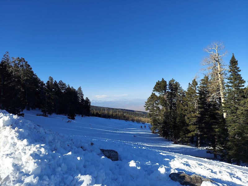
    The trail passes through shaded forests, rocky washes, and steep inclines, making for a dynamic hiking experience.

  • Wildlife and Scenery:

    Deer, black bears, and coyotes inhabit the area. Expect panoramic views of Albuquerque and the surrounding desert landscape.

4

Local Insights

  • Details:

    Remnants of the plane have been left undisturbed as a historical site. Out of respect, hikers are advised not to take or disturb any debris.

  • Details:

    The site has an eerie yet reflective atmosphere, often drawing outdoor enthusiasts and history buffs.

5

Visitor Tips

  • Best time to visit:

    Late spring and early fall offer the best weather conditions with less extreme heat.

  • What to bring:
  • Details:

    Hiking boots with strong ankle support.

  • Details:

    Plenty of water (at least 2 liters per person).

  • Details:

    Navigation tools (GPS or a detailed map).

  • Directions:

    From Albuquerque, take Tramway Blvd to Simms Park Road and reach the parking area in about 25 minutes.

Reviews

M
Magali Flores2 weeks ago

Great destination! Enjoyed the open trail and peaceful outdoor atmosphere.

V
Victor Xiaa month ago

It is still possible to summit Mt. Sandia from this trail and enjoy views of Albuquerque, despite the Forest Service work closures of Sandia Crest through 2027. Hikers should be aware that the trail becomes much harder to follow after the Domingo Baca trail ends and you enter the forested pass uphill to the peaks. There’s two colored wooden posts marked TWA illustrating the beginning of the crash site but very little marking otherwise because the trail is not maintained. The steep scramble begins 4 miles in and there are parts where you will have to boulder over. Once you reach the treeline you only have a half mile to go, but it’s very steep and eroded at that point so you will have to hold onto trees and roots. You’ll know you have made it when the TWA trail emerges onto a well maintained gravel summit loop. Backpackers should be warned that there are essentially no flat areas in the last 2 miles going up to the summit but past the massive boulder rock scramble there is a flat clearing behind you and to the left. Honestly if you’re backpacking I’d recommend taking La Luz or the tram down to sea level instead of an out and back because with a heavy load it would be a very sketchy hike back down TWA to the trailhead considering the erosion.

F
FrznFenix4209 months ago

Went up towards the Kiwanis area and took a great company photo for our new Mexico branch Christmas card. The trails were great and the weather was great that day! Still quite a few miles from civilization and redue of needed out there so pack accordingly. Take nothing from the wilderness, leave nothing in it.

R
Rob Maestas (GONZO)a year ago

Being an overweight man this trail was not easy. I was and am still a little sore but still a nice trail.

S
Soren Winter2 years ago

Great destination! Enjoyed the open trail and peaceful outdoor atmosphere.

Nearby Adventures

Bookable Experiences

No bookable tours found for this category near Albuquerque, New Mexico

Try switching to "All Adventures" to see available outdoor expeditions.