Rock Formations at Shark Fin Trailhead
Adventure Destination

Rock Formations at Shark Fin Trailhead

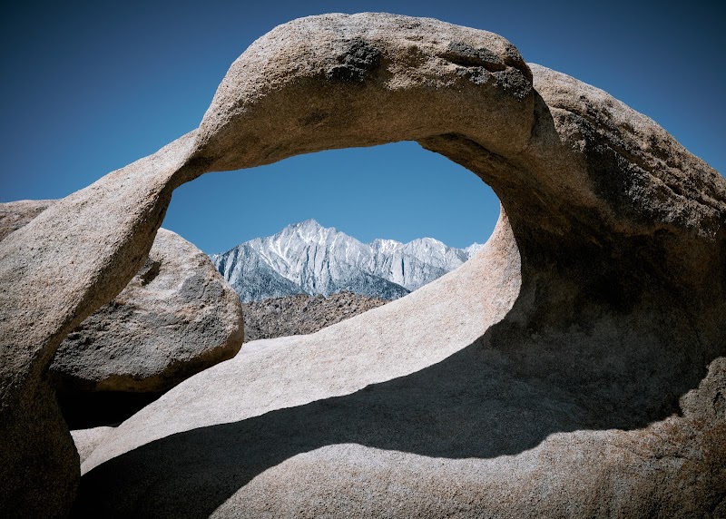
Explore the stunning rock formations at Shark Fin Trailhead, an ideal spot for hiking, climbing, and photography near Lone Pine, California. Enjoy breathtaking views and cinematic landscapes. Best visited in spring or fall.

Hiking8.7/10Moderate
Photo Gallery

Category

Hiking

Typical Duration

2-4 hours

Difficulty

Moderate

About This Adventure Destination

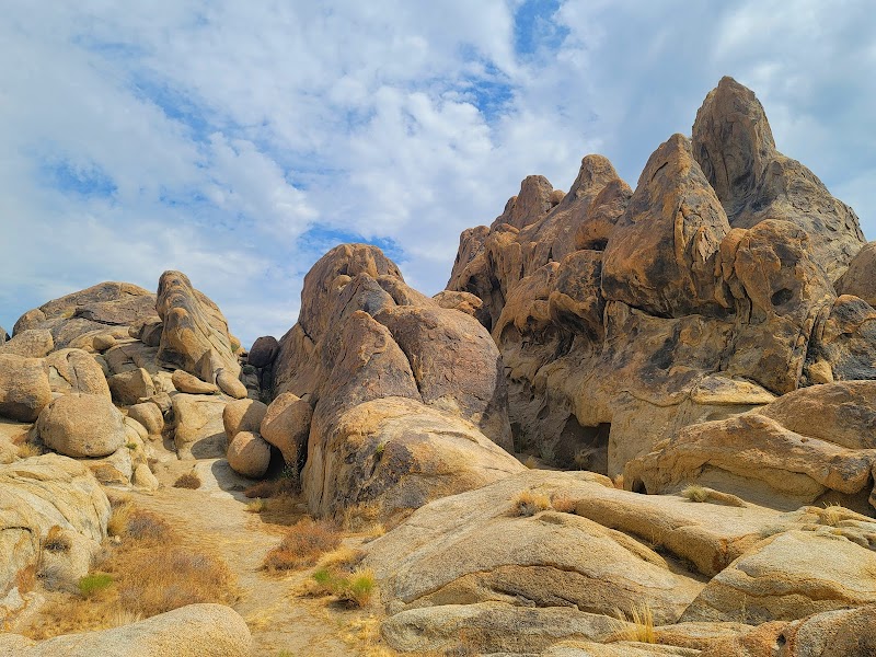
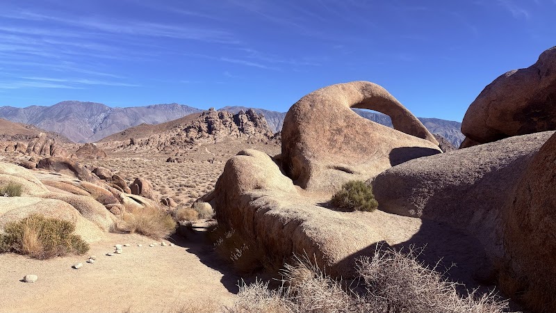
Shark Fin Trailhead, located just outside Lone Pine in California’s Eastern Sierra region, offers visitors an impressive introduction to the rugged beauty of the Alabama Hills. This area stands out for its dramatic rock formations, including the striking Shark Fin—a granite monolith shaped roughly like a dorsal fin jutting skyward. It’s a favorite spot for hikers, climbers, and photographers drawn to the unique shapes carved over millions of years by natural erosion.

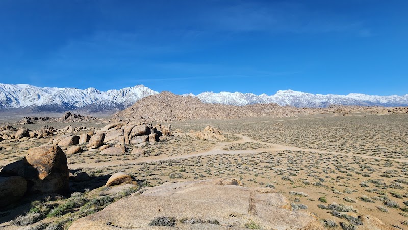
The trail to the Shark Fin is short and accessible, making it an inviting destination for those who want to witness remarkable geology without a strenuous hike. The rock formation itself rises sharply against the clear desert sky, with stunning views of the towering Lone Pine Peak and distant Mount Whitney, the tallest mountain in the contiguous United States. These backdrops create an unforgettable panorama that appeals to outdoor enthusiasts and storytellers alike.

Beyond its geological interest, the area carries rich cultural weight, having provided the setting for numerous classic Western films. Visitors enjoy the quiet desert air and the opportunity to see climbers testing their skills on the steep, challenging surfaces. Local wildflowers often brighten the surrounding landscape during spring, adding bursts of color to the rocky terrain.

Whether capturing mesmerizing photos or simply soaking up the expansive views, Shark Fin Trailhead offers a lively yet tranquil outdoor setting. Its combination of accessibility, visual drama, and outdoor adventure potential makes it a standout destination near Lone Pine.


Editorial Assessment

Shark Fin Trailhead is a spectacular location, boasting unique rock formations and stunning views. Its combination of hiking and climbing opportunities makes it a sought-after destination, though it's not as renowned globally as some of the most iconic natural landmarks.
Rock Formations at Shark Fin Trailhead

Adventure Guide to Rock Formations at Shark Fin Trailhead

1

Rock Climbing at Shark Fin

  • What Makes It Special:

    The jagged Shark Fin rock provides thrilling climbing routes suitable for experienced climbers looking for technical challenges in a stunning alpine desert setting.

  • Key Features:

    Multiple climbing routes, varied difficulty levels, and direct views of Mount Whitney offer a spectacular backdrop.

  • Visitor Tips:

    Best climbed in spring or fall when temperatures are moderate. Bring climbing gear, plenty of water, sunscreen, and a helmet.

2

Hiking the Easy Trail

  • What Makes It Special:

    The trail from the parking area to the Shark Fin formation is short and easy, perfect for hikers of all skill levels.

  • Key Features:

    Scenic views of the Alabama Hills’ unique granite formations with opportunities to spot blooming desert flowers in spring.

  • Visitor Tips:

    Morning visits help avoid midday heat. Wear sturdy shoes, bring water, and a camera to capture the views.

3

Camping Nearby in Alabama Hills

  • What Makes It Special:

    Numerous dispersed campsites in the Alabama Hills allow visitors to stay overnight among the rock formations.

  • Key Features:

    Campgrounds provide a front-row seat to stunning sunrises and sunsets with the Sierras as a backdrop.

  • Visitor Tips:

    Campsites are first-come, first-served. Pack out all trash and be prepared for large temperature swings between day and night.

4

Getting There

  • Details:

    From Lone Pine, drive west on Movie Road or Whitney Portal Road for about 10 minutes. The trailhead parking lot is clearly marked and easy to reach. Total drive time is roughly 10-15 minutes from town.

5

Best Time to Visit

  • Details:

    Spring and fall offer ideal weather conditions with milder temperatures and blooming desert flora in spring. Summer can be hot; winter may bring snow to higher elevations. By blending easy access with striking natural features and rich climbing opportunities, Shark Fin Trailhead draws visitors eager for memorable outdoor experiences in California’s dramatic Eastern Sierra.

Reviews

T
Todd Battey6 months ago

Spectacular views of the Shark’s Fin rock formation with the backdrop of Lone Pine Peak and Mount Whitney. It’s an amazing photo op for rock climbing and hiking.

G
Greg Davisa year ago

Great destination! Enjoyed the open trail and peaceful outdoor atmosphere.

E
Erin Rusawa year ago

Great destination! Enjoyed the open trail and peaceful outdoor atmosphere.

D
David Boyle2 months ago

Great destination! Enjoyed the open trail and peaceful outdoor atmosphere.

T
Tracya year ago

Great destination! Enjoyed the open trail and peaceful outdoor atmosphere.

Nearby Adventures

Bookable Experiences

All-Day Ride — Cottonwood Pack Station: A Full Day in the Saddle Around Lone Pine3.10 mi
Lone Pine, California

All-Day Ride — Cottonwood Pack Station: A Full Day in the Saddle Around Lone Pine

An all-day horseback outing that threads scenic trails and local history; this guide explains who can ride, what to expect, and essential safety rules.

3.10 miView Trips & Details →
RV Spot #5 — Eight fully serviced RV pads in Tuscumbia4.17 mi
Tuscumbia, Alabama

RV Spot #5 — Eight fully serviced RV pads in Tuscumbia

Eight RV pads with 50 amp power, water and a dump station, a two-night minimum and on-site service facilities make RV Spot #5 a compact, practical base in Tuscumbia.

4.17 miView Trips & Details →
Under the Cathedral Canopy: A Private Day Among Sequoias from Fresno26.0 mi
Fresno, California

Under the Cathedral Canopy: A Private Day Among Sequoias from Fresno

A private, 8.5-hour day trip from Fresno that guides beginner-to-moderate hikers from Clingan's Junction into Sequoia National Park to walk among giant sequoia groves, enjoy pastries and a mountain-top lunch, and visit the Giant Forest Museum.

26.0 miView Trips & Details →
Under One of California’s Darkest Skies: Stargazing from Wuksachi Lodge26.0 mi
Three Rivers, California

Under One of California’s Darkest Skies: Stargazing from Wuksachi Lodge

A one‑hour, guided naked‑eye astronomy program in Sequoia and Kings Canyon National Parks that pairs expert interpretation with some of the state’s most pristine night skies.

26.0 miView Trips & Details →
Walking Among Giants: A Private Day Hike Through Kings Canyon's Sequoia Groves31.4 mi
Fresno, California

Walking Among Giants: A Private Day Hike Through Kings Canyon's Sequoia Groves

A private, 8.5-hour day trip from Fresno that guides beginner and moderate hikers through Grant Grove’s giant sequoias, includes pastries and lunch, and offers optional stops like Cat Haven and a dinner add-on.

31.4 miView Trips & Details →
Full Moon on Moro Rock: When Sunset Aligns with a Rising Moon Above Three Rivers36.0 mi
Three Rivers, California

Full Moon on Moro Rock: When Sunset Aligns with a Rising Moon Above Three Rivers

An hourlong, naturalist‑led evening atop Moro Rock that times sunset with the full moon and pairs lunar stories and science with a short, steep ascent.

36.0 miView Trips & Details →