Hiking Eagle Rock in San Diego
Adventure Destination

Hiking Eagle Rock in San Diego

Hiking Eagle Rock9.6/10Moderate
Photo Gallery

Category

Hiking Eagle Rock

Typical Duration

2-4 hours

Difficulty

Moderate

About This Adventure Destination

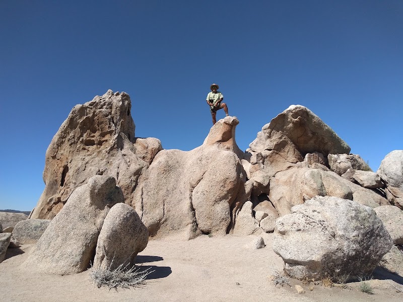
Hiking to Eagle Rock offers an unforgettable outdoor adventure in the San Diego region. This unique rock formation, located along the Pacific Crest Trail (PCT), is famed for its striking resemblance to a soaring eagle with outstretched wings, making it a must-see landmark for avid hikers and nature enthusiasts alike. The well-maintained trail provides a blend of scenic beauty, moderate challenge, and an iconic geological feature that’s truly one-of-a-kind in Southern California.
Hiking Eagle Rock in San Diego

Adventure Guide to Hiking Eagle Rock in San Diego

1

- Trailhead Location:

  • Overview:

    Begin your hike at the Warner Springs Community Resource Center, located about 65 miles northeast of downtown San Diego. The trailhead is well-marked off Highway 79, with easy parking availability nearby.

  • Details:

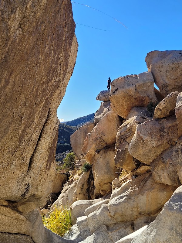
    Unique Features: The hike to Eagle Rock spans approximately 6.5 miles roundtrip and traverses diverse terrain, including rolling meadows, shaded oak groves, and desert-like rocky landscapes. The highlight, of course, is the Eagle Rock formation, which seamlessly emerges from the boulders and resembles a natural sculpture of an eagle. The realism of the formation is astounding and makes for a fantastic photo opportunity.

  • Details:

    Accessibility & Difficulty: This trail is moderate in difficulty, with a gradual incline that’s manageable for most hikers. It’s family-friendly, but proper hiking footwear is recommended due to uneven surfaces in some areas. Leashed dogs are also allowed on the trail, adding to its accessibility for pet owners.

2

Local Insights

  • Details:

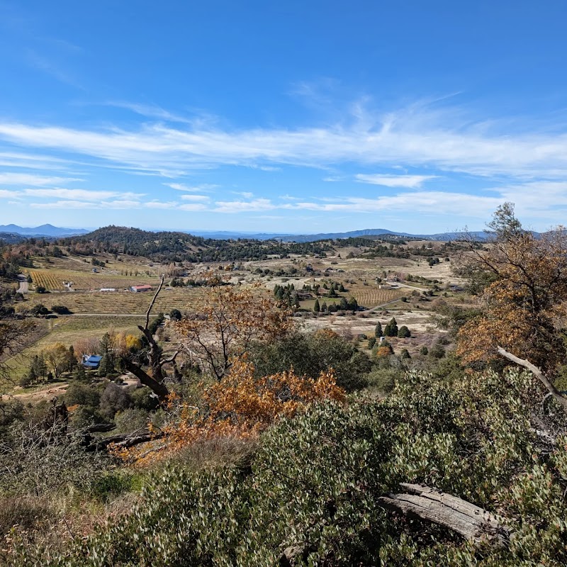
    This portion of the Pacific Crest Trail highlights the incredible diversity of Southern California ecosystems. Spring is particularly rewarding, as seasonal wildflowers blanket the meadows along the hike, enlivening the trail with vibrant colors. The area is also a frequent stop for through-hikers making their way along the entire PCT.

3

Visitor Tips

  • Details:

    Best Time to Visit: Aim for early morning or late afternoon hikes during spring or fall to enjoy cooler temperatures and avoid peak sun exposure.

  • Details:

    Essentials to Bring: Pack plenty of water, sunscreen, a hat, and a camera for capturing the views. Snacks are also recommended for refueling at Eagle Rock.

  • Details:

    Driving Directions: From San Diego, take I-15 N to CA-76 E, then proceed to Highway 79 S. The drive typically takes about 1.5 hours.

Reviews

W
William Byersin the last week

Great destination! Enjoyed the open trail and peaceful outdoor atmosphere.

J
Jason Issertell3 weeks ago

Great destination! Enjoyed the open trail and peaceful outdoor atmosphere.

K
Kevin NG3 weeks ago

Great destination! Enjoyed the open trail and peaceful outdoor atmosphere.

T
Taraa month ago

Great destination! Enjoyed the open trail and peaceful outdoor atmosphere.

E
Ericka Ortiz2 months ago

Great destination! Enjoyed the open trail and peaceful outdoor atmosphere.

Nearby Adventures

Bookable Experiences

Primitive Nights at Los Coyotes: Tent Camping on Warner Springs’ Quiet Ridge2.82 mi
Warner Springs, California

Primitive Nights at Los Coyotes: Tent Camping on Warner Springs’ Quiet Ridge

Tent camping at Los Coyotes Outdoor Recreation offers primitive campsites, trail access, and a chance to disconnect—this guide distills what to know before you pack.

2.82 miView Trips & Details →
Take the Controls: A Sailplane Introductory Flight Over Warner Springs3.20 mi
Warner Springs, California

Take the Controls: A Sailplane Introductory Flight Over Warner Springs

Sky Sailing’s Glider Ride in Warner Springs pairs short, priced introductory flights with ground instruction and the rare opportunity to fly the sailplane yourself.

3.20 miView Trips & Details →
Half-Hour Belly Rubs: Hands-On Time with Red Foxes in Santa Ysabel7.40 mi
Santa Ysabel, California

Half-Hour Belly Rubs: Hands-On Time with Red Foxes in Santa Ysabel

A concise, 30-minute, hands-on encounter at the Judith A Bassett Canid Education and Conservation Center that lets visitors aged 9 and up pet, feed, and observe friendly red foxes—this guide lays out what to expect.

7.40 miView Trips & Details →
Warner Springs Ascent: A Day Hike to San Diego County’s Tallest Peak10.4 mi
Warner Springs, California

Warner Springs Ascent: A Day Hike to San Diego County’s Tallest Peak

A focused day-use guide for the Warner Springs hike up to San Diego County’s highest point, covering the permit note, seasonal hours and the operator’s adult-only booking rule.

10.4 miView Trips & Details →
Picking Quiet: Berry Days at Fort Cross in Santa Ysabel12.1 mi
Santa Ysabel, California

Picking Quiet: Berry Days at Fort Cross in Santa Ysabel

A field guide to Fort Cross Old Timey Adventures’ General Admission & U‑Pick Berries — berry picking, a walk across pesticide‑free grounds, and a picnic framed by the nearby mountains.

12.1 miView Trips & Details →
Johnny Appleseed Returns: A Hands‑On Frontier Day in Santa Ysabel12.1 mi
Santa Ysabel, California

Johnny Appleseed Returns: A Hands‑On Frontier Day in Santa Ysabel

A family‑friendly, educational half‑day with hayride views, gardening lessons and an old‑time cider press—this guide explains what to expect and what to bring.

12.1 miView Trips & Details →