Majestic Waters: Upper Yosemite Falls
Adventure Destination

Majestic Waters: Upper Yosemite Falls

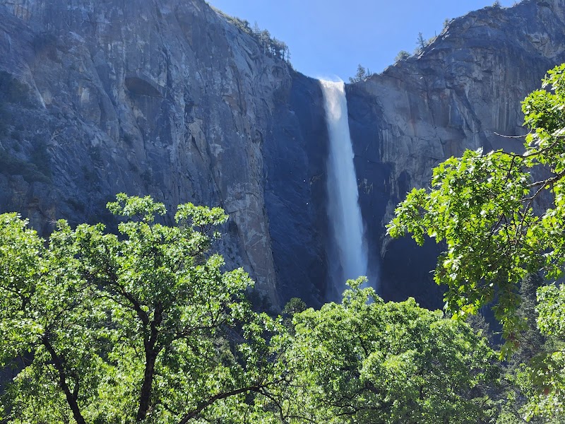
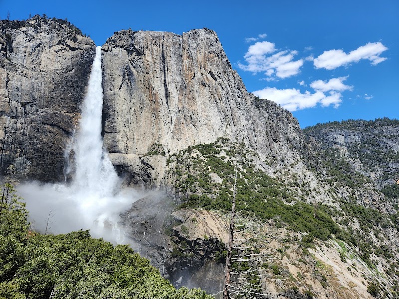
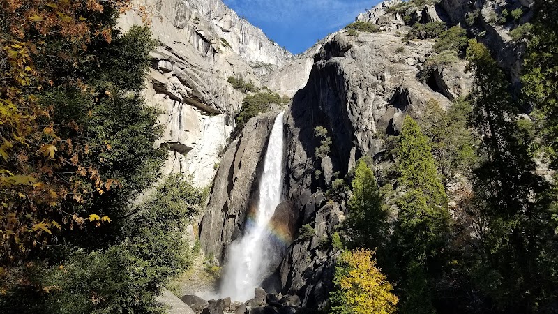
Upper Yosemite Falls in Yosemite National Park offers a challenging 7.2-mile round-trip hike with stunning views. It is popular for hiking, photography, and wildlife viewing, especially during spring. Experience the breathtaking waterfall cascading 1,430 feet.

Hiking9.2/10Hard
Photo Gallery

Category

Hiking

Typical Duration

2-4 hours

Difficulty

Hard

About This Adventure Destination

Upper Yosemite Falls, located in the stunning Yosemite National Park in California, is a marvel to behold. Cascading down from the mighty Sierra Nevada, this waterfall is one of the tallest in North America, dropping a dramatic 1,430 feet. Comprising three sections—the Upper Falls, the Middle Cascades, and the Lower Falls—it offers impressive views and a dynamic display of nature's power. Surrounded by granite cliffs and lush vegetation, the waterfall creates a majestic and awe-inspiring experience for visitors. The towering monoliths of El Capitan and Half Dome are visible from this locale, adding to the grandeur. Yosemite National Park has been a protected area since 1890, ensuring its natural beauty is preserved. Visitors flock here not only for its breathtaking scenery but also to engage in outdoor activities like hiking and photography. The park is a UNESCO World Heritage site, showcasing diverse ecosystems and unique geological formations. Witnessing the waterfall during the spring melt is especially popular, as the water roars down with incredible force. With its accessibility and sheer beauty, Upper Yosemite Falls is a must-visit for nature enthusiasts and adventure seekers alike.

Editorial Assessment

Upper Yosemite Falls is a highly sought-after destination due to its remarkable height and the breathtaking views it offers. The iconic status, rich flora and fauna, and the unforgettable hiking experience make it a standout location worthy of exploration.
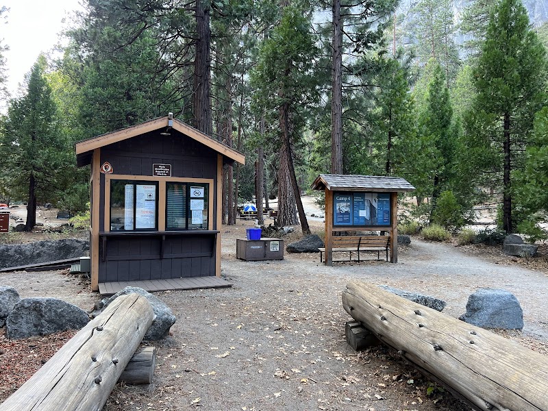
Majestic Waters: Upper Yosemite Falls

Adventure Guide to Majestic Waters: Upper Yosemite Falls

1

Experience Majestic Waters: Upper Yosemite Falls

  • Special Features: Upper Yosemite Falls in Yosemite National Park offers a challenging 7.2-mile round-trip hike with stunning views. It is popular for hiking, photography, and wildlife viewing, especially during spring. Experience the breathtaking waterfall cascading 1,430 feet.
  • Visitor Tips: Best time to visit is during Spring. Bring adequate water, appropriate outdoor gear, and camera.
  • Directions: Northside Dr, TUOLUMNE MEADOWS, CA 95389, USA
2

Exploring Near Yosemite Valley, California

  • Local Insights: Offers direct access to top trails, protected natural reserves, and picturesque viewpoints across Yosemite Valley, California.
  • Visitor Tips: Check local regulations, trail conditions, and weather before heading out.
3

Photography and Wildlife

  • Special Highlights: Watch for native wildlife including Black bears, Mule deer, Peregrine falcons.
  • Visitor Tips: Arrive in early morning or late afternoon for the softest lighting and quieter trails.

Reviews

R
Ryan B.4 weeks ago

Fantastic! Though I went in the end of July and literally the flow on Tuesday was completely gone by Saturday. Wow, glad I went on Tuesday. June is the sweet spot if you care about the strong snowmelt falls. By summer it’s typically all dried up. I think it was about 2100ft of elevation gain, and I’m not in any sort of good shape, so I was huffing and puffing the whole way up. I was also stupid and didn’t pack my sawyer squeeze, which I would have absolutely used at the top because there’s a pool of water that people go to and hang out at! I had the sawyer for the trip, just didn’t take it with me on this hike! It was the first one of the week, I’ll blame the pure excitement of it all and wanting to get out there in a hurry! Columbia Rock had a nice view and the views of the upper falls get better as you go up and get closer! The overlook at the top had a scary part just to get to it, would have been ironic to fall right there into the overlook area! The overlook is probably very different when the water is raging, but when it’s weak flow, it was mainly just a great view of the valley. I kept asking myself how the hell I got up that high pretty much all the way back down. Ran outta water at Columbia rock, but at least it was on the way back down. Was dehydrated, but that’s my own fault. I saw a smokin hot girl on the way down at Columbia Rock, she was goin up and I don’t even think she had ANY water. Wearing all black too, hot in all possible ways! Smokin hot, but maybe crazy to not have any water! There was a heat wave going on for goodness sake! Wear appropriate shoes with good grip for the way back down or you’ll be sorry, or dead if you slip and fall the wrong way! Have a great hike, this one is totally worth it! Bring water and you can generally count on there being a pool of water at the top IF the falls are still flowing. Trailhead is tricky to get to, head WEST if you are at the lower falls, otherwise cheat like I did and take the shuttle to stop #7. I walked all over the lower falls area and some of the valley loop trail before realizing I made a wrong turn and simply needed to head west on the valley loop trail to get to the upper Yosemite trailhead.

D
Damir Asanova month ago

Great destination! Enjoyed the open trail and peaceful outdoor atmosphere.

T
Tahir Syeda month ago

Great destination! Enjoyed the open trail and peaceful outdoor atmosphere.

N
Nurland T2 months ago

Long 7 miles dusty slippery hike. Good view

J
Javier Lopez2 months ago

Great destination! Enjoyed the open trail and peaceful outdoor atmosphere.

Nearby Adventures

Bookable Experiences

Half-Day Glide from Badger Pass: Cross‑Country Ski Rentals into Yosemite’s High Country46.5 mi
Yosemite Valley, California

Half-Day Glide from Badger Pass: Cross‑Country Ski Rentals into Yosemite’s High Country

A four‑hour, half‑day equipment rental from Badger Pass Ski Area gives access to Yosemite’s network of cross‑country trails — including a popular 21‑mile round trip to Glacier Point — making this guide useful for planning distance and logistics.

46.5 miView Trips & Details →
Flat‑water Parties Aboard a 25' Sun Tracker at Shaver Lake46.2 mi
Shaver Lake, California

Flat‑water Parties Aboard a 25' Sun Tracker at Shaver Lake

A 25' Sun Tracker pontoon from Shaver Lake Power Center — 12 passengers, 60 HP motor — this guide explains the boat, rules, and what to bring for a trouble‑free rental.

46.2 miView Trips & Details →
Rattling Along the Doorstep of Yosemite: A Guided Jeep Tour Through Stanislaus National Forest34.6 mi
Groveland, California

Rattling Along the Doorstep of Yosemite: A Guided Jeep Tour Through Stanislaus National Forest

A three‑hour guided off‑road excursion from Groveland that runs scenic trails through Stanislaus National Forest and the Tuolumne River Canyon, led by local guides from Miller’s Off Road Adventures.

34.6 miView Trips & Details →
A Halloween Evening on the Rails: Costumes, Campfire Stories and a Train through Fish Camp20.1 mi
Fish Camp, California

A Halloween Evening on the Rails: Costumes, Campfire Stories and a Train through Fish Camp

A 3.5-hour Halloween-themed event run by Yosemite Mountain Sugar Pine Railroad in Fish Camp featuring trick-or-treating, dinner, spooky storytelling and an optional Fright Class upgrade.

20.1 miView Trips & Details →
A Community Armory: Free Trail-Tool Loans for Groveland’s Volunteer Crews35.6 mi
Groveland, California

A Community Armory: Free Trail-Tool Loans for Groveland’s Volunteer Crews

Groveland Trail Heads, funded by a Sonora Area Foundation grant, provides free trail tools to local nonprofits and volunteer groups; this guide explains eligibility, contacts, pickup, and what gear is available.

35.6 miView Trips & Details →
A‑Frame Evenings at Mountain Cabin B, Mammoth Lakes28.1 mi
Mammoth Lakes, California

A‑Frame Evenings at Mountain Cabin B, Mammoth Lakes

A two‑story A‑frame at Red's Meadow Resort with a kitchenette, full bathroom, and outdoor fire pit—an intimate stay for groups up to seven.

28.1 miView Trips & Details →