Summiting Mount Hoffman via May Lake Trailhead
Adventure Destination

Summiting Mount Hoffman via May Lake Trailhead

Trek the 3.7-mile round-trip trail to summit Mount Hoffman near May Lake, CA. Offering moderate difficulty and stunning views of Yosemite's peaks, this hike is popular for adventurous wildlife watchers seeking solitude and breathtaking vistas.

Hiking7.8/10Moderate
Photo Gallery

Category

Hiking

Typical Duration

2-4 hours

Difficulty

Moderate

About This Adventure Destination

Summiting Mount Hoffman is one of the most rewarding day hikes in Yosemite National Park, offering breathtaking panoramic views and a moderate challenge for avid hikers. Located at the geographic center of the park, Mount Hoffman is accessible via the May Lake Trailhead, a spot renowned for its stunning alpine scenery. This hike is unique for its combination of awe-inspiring vistas and geological significance, as Mount Hoffman's summit provides sweeping 360-degree views of Yosemite’s iconic landmarks—including Half Dome, Clouds Rest, and Cathedral Range.

Editorial Assessment

Summiting Mount Hoffman via May Lake Trailhead offers stunning views and a rewarding hiking experience. It's a beautiful destination for outdoor adventures, though not as globally iconic as some top-tier natural landmarks.
Summiting Mount Hoffman via May Lake Trailhead

Adventure Guide to Summiting Mount Hoffman via May Lake Trailhead

1

- Trailhead Starting Point - May Lake Trailhead

  • Overview:

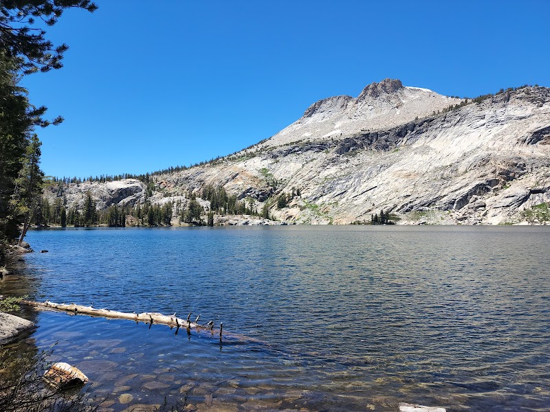
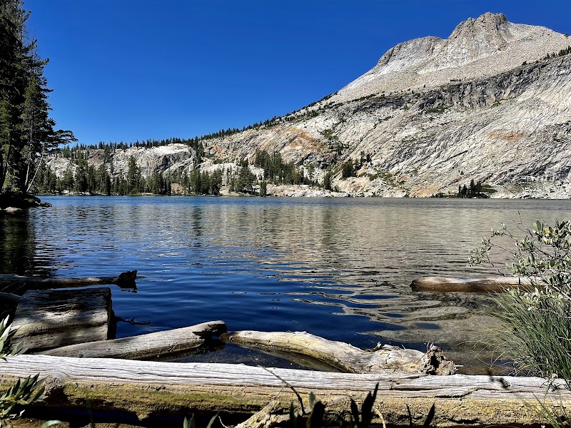
    The adventure begins at the May Lake Trailhead, located off Tioga Road (Highway 120). The initial hike to May Lake is a well-maintained, 1.2-mile trail with an elevation gain of approximately 500 feet. The crystal-clear alpine lake serves as a perfect rest spot before ascending the peak. Trail markers guide you toward the eastern ridge ascending Mount Hoffman.

  • Details:

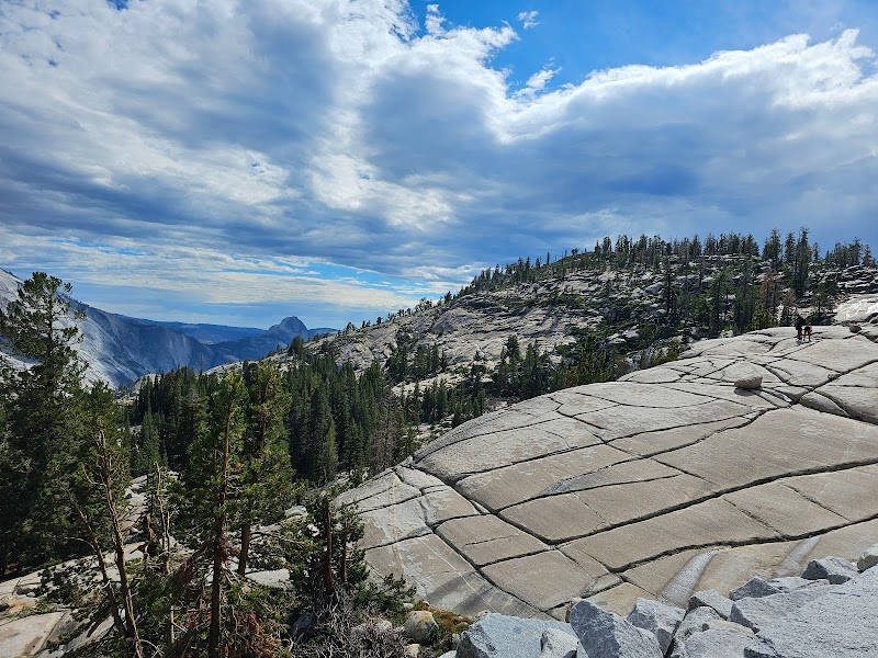
    Mid-Ascent Features - Granite Spires and Wildlife The ascent from May Lake to Mount Hoffman involves approximately 2.5 miles of rocky terrain and a challenging 1,500-foot elevation gain. You’ll cross fields of granite slabs and boulder-strewn slopes, which are home to marmots and pikas, offering glimpses of Yosemite’s unique wildlife. The unmaintained trail requires basic route-finding skills, making sturdy boots and trekking poles essential.

  • Details:

    The Summit Experience - Iconic Views and Tranquility At 10,850 feet, Mount Hoffman’s summit reveals unmatched views of Yosemite Valley, Tuolumne Meadows, and the distant Sierra Nevada peaks. Be prepared to celebrate your accomplishment in solitude, as this high-altitude vantage point is far less crowded than Yosemite’s more popular trails.

2

Local Insights

  • Overview:

    Mount Hoffman is considered the geographic heart of Yosemite National Park, making it a symbolic destination for many hikers. It is named after cartographer Charles F. Hoffman, a contributor to the iconic California Geological Survey of the late 19th century.

3

Visitor Tips

  • Details:

    Best Time to Visit: Late June to September, when Tioga Road is open and snow-free.

  • Details:

    What to Bring: Adequate water, sunscreen, layered clothing, and a trail map.

  • Details:

    Directions: From Yosemite Valley, drive about 1.5 hours along Tioga Road to the May Lake parking lot.

Reviews

T
Troy Windhorst2 months ago

This was one of my favorite Yosemite hikes. It’s off the beaten path, so it was not crowded at all (though there was an empty, but well-maintained campground up top, so I suspect there are times when there are quite a few people). The lake was beautiful with rocky outcrops creating both picturesque backdrops and, because they were easily accessible, a fun climbing playground. A trail encircles about two-thirds of the lake (I couldn’t see that there was a complete loop.). The journey up to and adjacent to the lake offers both shade and full sun. The journey up is quite steep in parts, but I thought it was in easy manageable short bursts. Overall, I thought this trail and lake was a hidden gem.

C
Curtis Lannoma month ago

This was a really nice hike up to May Lake. It's about 1.2 miles each way on an out and back trail. It is a moderate difficulty but not too bad. The views along the was are amazing and the lake itself is very beautiful. There was a decent amount of parking and the road was pretty good getting there, a bit rough and narrow in a couple of places but nothing bad. Highly recommend taking this hike and spending some time at the lake.

A
Alexandre Contreras3 months ago

I suggest you go a step further and hike all the way up to Mount Hoffmann. Amazing views! The hike is worth the efforts. Getting to Lake May is pretty chill (and the lake is stunning) but then it gets much harder, with rock scrambling at the end. Download the trail map and use the stone totems as guides.

V
Vi Lai Vuea year ago

Great destination! Enjoyed the open trail and peaceful outdoor atmosphere.

A
Axel Lundegren6 months ago

2800m above sea level. Great lake to swim in.

Nearby Adventures

Bookable Experiences

A Day in the Valley: Walking Yosemite’s Waterfalls, Monoliths, and River Rim2.57 mi
Groveland, California

A Day in the Valley: Walking Yosemite’s Waterfalls, Monoliths, and River Rim

A local-guided, easy-to-moderate walking tour through Yosemite Valley that visits waterfalls, iconic granite landmarks and historic places—this guide explains what to expect and how to prepare.

2.57 miView Trips & Details →
Above the Valley: A Four‑Day Push to Clouds Rest’s 9,930‑Foot Panorama2.71 mi
Yosemite National Park, California

Above the Valley: A Four‑Day Push to Clouds Rest’s 9,930‑Foot Panorama

A guided, four‑day backpacking tour that walks you into Yosemite Wilderness and up to the 9,930‑ft summit of Clouds Rest—this guide explains the route, key views and what to expect.

2.71 miView Trips & Details →
Above the Backbone: A One‑Hour Air Tour Over the Sierra Nevada and Yosemite2.75 mi
Groveland, California

Above the Backbone: A One‑Hour Air Tour Over the Sierra Nevada and Yosemite

A one-hour flight from Pine Mountain Lake Airport that delivers aerial views of Tuolumne Canyon, the Emigrant Wilderness and Yosemite’s El Capitan and Half Dome—essential for photographers and anyone short on time.

2.75 miView Trips & Details →
A razor‑thin ridge to Yosemite’s panorama: Clouds Rest in a day2.83 mi
Groveland, California

A razor‑thin ridge to Yosemite’s panorama: Clouds Rest in a day

A strenuous, 14.5‑mile round‑trip hike from Highway 120 to the Clouds Rest summit that delivers true 360‑degree views of Yosemite—this guide lays out what to expect, what to pack, and who should go.

2.83 miView Trips & Details →
Three Days on Yosemite’s Southern Rim: Glacier Point Sunrises, Taft Point Exposures, and Backcountry Nights3.37 mi
Groveland, California

Three Days on Yosemite’s Southern Rim: Glacier Point Sunrises, Taft Point Exposures, and Backcountry Nights

A 3‑day, 2‑night guided exploration from Groveland that combines secluded backcountry trails, iconic rim viewpoints, and camp cookouts beneath Sierra stars.

3.37 miView Trips & Details →
A Private Day in Yosemite: Tailored Trails, Waterfalls and a Gourmet Picnic3.42 mi
Belgrade, Montana

A Private Day in Yosemite: Tailored Trails, Waterfalls and a Gourmet Picnic

A full-day, private guided tour and hike through Yosemite’s valley that customizes walks and viewpoints to your group and includes a curated picnic and expert interpretation.

3.42 miView Trips & Details →