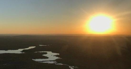
From the ground, the Poconos can feel intimate: a stand of hardwoods here, a glacial lake there, ski slopes cut into the forested spine of a ridge. From the air, those pieces snap together into a landscape that reads like a map come alive. An air tour over Albrightsville turns discreet local features into a coherent geography—crystalline lakes ringed by cottages, highways threading through wooded hollows, and the ragged blue line of ridgelines that mark watershed divides. The light in spring and fall is particularly kind; low-angle sun scours the small relief of the land and highlights shoreline patterns and rock exposures that are easy to miss at eye level.
These flights also offer a swift primer in the region’s natural and cultural history. From above you can make out the scars and seams left by past extractive industries, the geometric imprints of ski runs and reservoirs, and the patchwork of second-home developments that cluster around summer lakes. Pilots often point out landmarks—Hickory Run State Park’s boulder fields, the broad mirror of Lake Harmony, the ridgelines used by winter sports operators—and explain how local weather and topography interact. That context turns a short flight into a richer story: not just a view, but an orientation to landscape, season, and the ways people use these mountains.
Practically, an air tour is one of the most time-efficient ways to see the Poconos. A 20–45 minute flight compresses what could be a day of driving and hiking into a single golden-window experience. That makes air tours excellent complements to other activities: photographers can scout overlooks, kayakers can pinpoint backwater coves for quieter afternoons, and ski visitors can get a sense of the valley pattern before picking a run. For travelers who savor a clear visual reference to the land they’re crossing, the aerial perspective acts like a travel enhancer—informing decisions on hikes, paddle routes, and even where to chase sunset light on the drive back to base.
Short flights are ideal for first-timers and families; longer charters suit photographers or travelers who want to stitch multiple features—lakes, ridges, and river valleys—into a single mission.
Weather matters: visibility, wind over ridges, and low cloud decks are the typical constraints for operators in this region. Pilots will often reschedule for clearer windows when possible.
The harbor is the gateway, and the Pacific becomes the classroom.
Air tours pair well with ground activities—consider booking a morning flight for soft light and then an afternoon hike, paddle, or scenic drive to stay in the same light for photography.
Choose by purpose
Whale watching, snorkeling, sunset sailing, cultural canoeing, harbor sightseeing, or private chartering.
Start near the city
Waikiki and Honolulu Harbor are primary hubs, with some trips launching near Hanauma Bay.
Confirm the vessel
Gangways, shaded seating, and boarding requirements vary according to vessel size and operator.