Airplane Experiences in Fremont, California
Fremont Airplane Guide

Airplane Experiences in Fremont, California

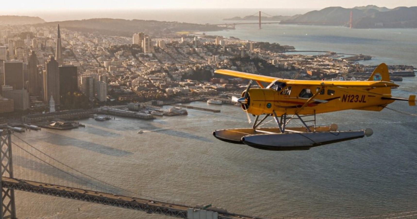
From low-and-slow scenic flights to discovery flights that introduce new pilots to the sky, airplane experiences near Fremont slice the Bay Area into a mosaic of salt marshes, ridge lines, and cityscapes. These small-aircraft outings are equal parts landscape viewing and technical appreciation—an aerial lens on the region’s industrial past, natural estuaries, and the ridge-and-bay geometry that shapes Silicon Valley.

San Francisco BaySouth Bay AirspaceMission PeakNiles Canyon

Live destination inventory

Top Airplane Trips in Fremont

18 trips · Book with confidence · Instant confirmation

The prototype intentionally does not invent replacement trip cards or add images that are not already part of the live source page.

The city from the water

Why Airplane Experiences Around Fremont Matter

There is a subtle geometry to flying in the Bay: a braided coastline of levees and marshes, a serrated skyline of hills, and the occasional human-made punctuation of runways and hangars. From a cockpit above Fremont these patterns become legible. The experience is not merely sightseeing; it’s a reorientation. Where street-level travel slices space into neighborhoods, an airplane stitches them back together into routes and corridors—Mission Peak’s western buttress, the long spine of the East Bay ridgeline, the tidal patches of the South Bay, and the broad mirror of the San Francisco channel all read differently when you move at 100–140 knots and two to four thousand feet. Fremont sits at a practical crossroads for these flights. It’s close enough to larger Bay-area airspace yet far enough from the largest commercial hubs to allow the small-plane rhythms that make flightseeing satisfying: low-altitude passes, tight visual approaches to interesting terrain, and the opportunity to orbit a landmark for photography. Many airplane experiences available from the region center on interpretive narration—pilots who double as local storytellers—pointing out geologic folds, old railroad cuts through Niles Canyon, salt pond mosaics, and the industrial lattice that powered Silicon Valley. For travelers, that commentary converts a simple view into a layered narrative of landscape and human history. On a practical level, airplane outings from Fremont are a study in contrasts: they demand familiarity with regional weather quirks—morning marine layers, afternoon thermal buildups, and wind shear near ridgelines—but reward patience with clear, dramatic visibility when conditions cooperate. For pilots and budding aviators, the area is also a training ground: short cross-country hops, touch-and-go practice at nearby airfields, and discovery flights that bridge the gap between curiosity and certification. For photographers, the golden hour over the Bay can reveal glassy water, glancing light on the bridges, and long shadows of hills. And for anyone who has the rare vantage to see the Bay’s tidal ecology from above, the perspective deepens a sense of place: the built environment and the wild edge of the estuary sit in plain relationship, revealing both vulnerability and the scale of conservation opportunities. This guide concentrates on the airplane-specific experience: the feel of the cabin, the rhythms of preflight briefings, the terrain that makes certain flight paths compelling, and the planning realities—airspace awareness, visibility windows, and appropriate expectations for cost and access. It intertwines practical advice with narrative description so you can imagine your flight and also know what to check off before you climb into the sky.

Flying near Fremont offers a compact sampler of Bay Area landscapes within short flight legs—ideal for 30–90 minute flights that maximize scenery over transit time.

Many airplane experiences double as introductions to flight training: discovery flights let novices take the controls under an instructor’s supervision.

The harbor is the gateway, and the Pacific becomes the classroom.

Visibility and light define the quality of a flight; scheduling around marine layer burn-off and afternoon wind increases the odds of memorable vistas.
Activity focus

Choose by purpose

Whale watching, snorkeling, sunset sailing, cultural canoeing, harbor sightseeing, or private chartering.

Departure hubs

Start near the city

Waikiki and Honolulu Harbor are primary hubs, with some trips launching near Hanauma Bay.

Accessibility

Confirm the vessel

Gangways, shaded seating, and boarding requirements vary according to vessel size and operator.

Seasonal planning

Best Time to Visit

Fremont is warm year-round, but wind, swell, migration, visibility, and demand change the best match between traveler and trip.

Fremont boat tour
Year-round destination

Seasonal highlights change the reason to go

Winter favors humpback encounters; warmer, calmer months favor snorkeling visibility and smoother water.

Humpback season

Late spring and early fall for stable visibility and moderate temperatures.

Prime whale watching, winter holidays, higher demand, and earlier sell-outs.

Snorkeling window

April–May–June–September–October

Typically gentler seas and clearer water for snorkeling trips.

Weather notes

Trade winds year-round

Spring and fall reliably offer the clearest visibility—mornings often begin in a marine layer that burns off into calm, clear skies. Summers can bring cool, low fog along the coast and variable afternoon winds; winter features more dynamic weather and occasional low ceilings that reduce flight windows.

Quieter opportunities

Late spring & summer weekdays

Winter flights can be dramatic—cloud layers and storm light offer moodier photography—but expect more frequent cancellations and shorter windows of VFR (visual flight rules) conditions.

Match the trip to your comfort

Choose Your Experience Level

Low effort

Beginner

Short, narrated scenic flights and discovery flights where an instructor or pilot handles all controls while you enjoy the view.

  • 30–60 minute bay scenic flight
  • Discovery flight with hands-on introduction under instructor supervision
  • Cityscape photo circuit at comfortable cruising altitudes
Active day trip

Intermediate

Longer cross-country scenic sorties, specialized photo flights, and introductory time-building for students working toward a pilot certificate.

  • Extended coastal or delta flights
  • Aerial photography-focused sorties during golden hour
  • Dual instructional flights for early pilot training
Longer or technical

Advanced

Aerobatic demonstration flights, advanced flight training (such as complex aircraft or instrument procedures), and private charters for customized routes.

  • Aerobatic or high-performance demonstration flights (operator-dependent)
  • Instrument training sorties in controlled airspace
  • Customized cross-country trips linking multiple Bay Area landmarks

Prepare for sun, spray, and swell

What to Bring

Essential

Core kit

  • Government ID (required for boarding at controlled facilities)
  • Layered outerwear—cockpit temperatures vary quickly
  • Sunglasses with UV protection
  • Camera with straps and a good lens for handheld shots
  • Charged phone and/or spare batteries for cameras
Recommended

Useful extras

  • Ear protection (light earplugs or headset if provided)
  • Small daypack for personal items and easy stowing
  • Light snacks and water for flights approaching an hour
  • A printed or offline copy of operator confirmation and emergency contact info
Optional

Trip-specific

  • Binoculars for long-distance viewing during higher-altitude segments
  • Compact notebook for jotting route notes or pilot commentary
  • A hat with a chin strap for preflight staging on windy ramp areas
Check NOTAMs and local airspace advisories; be mindful of potential delays from local airport operations.

Insider Tips & Local Knowledge

Reserve whale-watching and popular sunset cruises well ahead during December–April.
Choose morning snorkeling departures for calmer seas and better underwater visibility.
For motion sensitivity, choose a larger vessel, sit mid-ship, and take preventative medication before boarding.
Do not touch coral or wildlife, avoid standing on reefs, and use reef-safe sunscreen.
Community-based operators may add context about traditional navigation and stewardship.
Arrive early for parking and check-in because Waikiki departure areas can be busy.

Planning questions

Frequently Asked Questions

No pilot certification is required to be a passenger on a scenic or discovery flight. Operators will handle regulatory requirements; passengers should bring valid photo ID where applicable.
Airplane Experiences in Fremont, California
Ready for your airplane adventure?

Browse 18 verified trips in Fremont.

Compare current availability and book with instant confirmation.

Explore Fremont airplane