Kayak in McClellanville, South Carolina

Read the destination guide ↓
Popular Activities
More activities
0 adventures loaded
Kayak in McClellanville, South Carolina
McClellanville Kayak Guide

Kayak in McClellanville, South Carolina

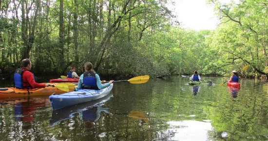
Tidal creeks, wide salt marshes, and lowcountry soundscapes make McClellanville a quietly exceptional place to paddle. This guide focuses on kayak experiences around the town — from calm estuary jaunts through spartina ribbons to longer crossings toward barrier islands and wildlife refuges. Expect birdlife, changing tides, and the tactile geography of South Carolina’s coastal plain.

Lowcountry Salt MarshesCape Romain National Wildlife RefugeBarrier Island Access
By Robert Eric CrewsFounder & Editor, The Adventure Collective

Kayak in McClellanville

Why Kayaking Around McClellanville Matters

There’s a quiet kind of geography on the South Carolina coast: low and horizontal, slowly shifting with the tides, defined by a patchwork of channels that thread through marsh and old rice fields. McClellanville sits on the threshold of that world — a small harbor town where wooden piers and working boats still measure the day. Kayaking here feels like a mode of translation. You move at paddling speed, which is slow enough to notice the faintly briny scent of oysters on the mud, fast enough to chase the way light slides across a flooded marsh grass channel. The experience rewards patience. Egrets and herons are routine companions. Dolphins may slip through the deeper cuts at high tide. The skyline reads as salt marsh and distant pines rather than dramatic peaks, and that flatness sharpens other textures: the pattern of mud crabs, the rustle of wind across spartina, the shuttered horizontals of reclaimed shrimp boats on the shore.

On a practical level, McClellanville’s paddling terrain is the kind of place that teaches you to think in tidal time. Routes that are smooth, shallow, and straightforward at high tide can compress into shallow creek beds or expose oyster bars as the water drops; a planned crossing toward outer islands or a wildlife refuge looks and paddles completely differently depending on whether the tide is pushing in or ebbing out. That variability is part of the appeal: every outing is a lesson in local rhythms and coastal navigation. Ecologically, these waterways are living infrastructure — nurseries for fish, staging areas for migratory birds, and buffers that dissipate storm energy. For a traveler, paddling the marsh is an intimate way to see these processes and to observe how human histories — commercial shrimping, small harbors, and land-use changes — have folded into them.

Culturally, McClellanville is a finger on the Lowcountry map: small-town rhythms, seafood economies, and a maritime heritage that still shapes the shoreline. Your day on the water can easily pair with a morning launching from a local ramp, an afternoon of birding with binoculars on a quiet sandbar, and an evening meal of regional seafood in town. For photographers and naturalists, the area’s soft light and repetitive patterns reward repetition — paddle the same channel at different tides and you’ll find entirely different compositions and wildlife behaviors. For less seasoned paddlers, the estuaries offer sheltered exploratory routes that build confidence; for more experienced sea kayakers, longer crossings and windier open-water segments toward barrier islands provide satisfying navigation challenges.

Finally, the ecological sensitivity of these places invites a particular ethic: come quietly, leave no trace, and time your trip to minimize disturbance to nesting birds and to avoid stranding yourself on exposed flats. With respect and a little planning, kayaking McClellanville becomes less about conquering a route than about entering a slow-motion ecosystem and learning to read its cues.

The coastal environment here is dynamic but approachable: sheltered marsh corridors for novices, and longer, exposed crossings for paddlers seeking a technical day. Tidal knowledge and wind awareness are the two non-negotiable planning tools.

Kayak trips are a natural complement to other Lowcountry experiences — birding along the refuge, chartered fishing trips from the harbor, beachcombing on nearby barrier islands, and learning about the region’s maritime history in small-town museums and seafood shacks.
Seasonal planning

Best Time to Visit

Seasonal conditions and travel timing in McClellanville.

McClellanville Kayak
Seasonal planning

McClellanville throughout the year

Spring and fall offer the most comfortable paddling temperatures and lower insect pressure. Summer brings heat, humidity, and frequent afternoon thunderstorms; plan early starts. Winter is mild compared with inland climates but can be windy and cooler on exposed crossings.

Peak season

Late spring and early fall are busiest for guided paddles and wildlife viewing (migrations and breeding activity).

Popular travel period with peak availability and booking demand.

Best months

March–April–May–September–October–November

Optimal seasonal conditions for outdoor trips.

Weather notes

Spring and fall offer the most comfortable paddling temperatures and lower insect pressure. Summer brings heat, humidity, and frequent afternoon thunderstorms; plan early starts. Winter is mild compared with inland climates but can be windy and cooler on exposed crossings.

Off-peak opportunities

Winter weekdays provide solitude and crisp light for photography; some guided operations reduce schedules but solitary paddlers can enjoy quieter channels while monitoring weather and tides.

Match the trip to your comfort

Choose Your Experience Level

Low effort

Beginner

Short, sheltered estuary loops and slow-moving creeks at high tide. These routes emphasize calm water, easy exits, and minimal exposure to wind.

  • Protected marsh corridor loop
  • Short wildlife-spotting paddle with a guide
  • Leisurely shoreline paddle with beach landings
Active trip

Intermediate

Longer day paddles that require tide planning and comfort with channel currents. May include crossings to small islands or travel in open creeks with some wind exposure.

  • Crossing to a nearby barrier island at favorable tide
  • Tidal channel navigation with moderate currents
  • Photography-focused sunrise or late-afternoon paddle
Technical or extended

Advanced

Extended crossings, multi-hour exposed legs, or trips scheduled around significant tidal runs and shifting weather. Requires solid navigation, self-rescue skills, and experience with coastal conditions.

  • Full-day sea kayak route to outer shores
  • Tidal-window shuttle paddles across longer sound crossings
  • Multi-leg eco-route combining paddling and shoreline hiking

Prepare for your excursion

What to Bring

Essential

Core kit

  • Wearable personal flotation device (PFD) — required in most situations
  • Tide and wind forecast printed or on-device (battery-backed)
  • Waterproof dry bag for phone, camera, and layers
  • Sun protection: hat, sunglasses with retainer, SPF
  • Footwear suitable for wet landings (sandals with straps or neoprene booties)
Recommended

Useful extras

  • Whistle and small VHF or charged phone in waterproof case
  • Bilge pump or sponge for sit-on-top kayaks
  • Light wind layer and a quick-dry insulating midlayer for cooler mornings
  • Insect repellent and long-sleeve sun shirt (mosquitoes common in summer marshes)
Optional

Trip-specific

  • Compact field guide or e-bird checklist for bird identification
  • Lightweight tripod or stabilization for shoreline photography
  • Tide table app with offline functionality
Tides, wind, and respect for wildlife are the three non-negotiables for safe, rewarding paddling.

Insider Tips & Local Knowledge

Start early on warm days to avoid afternoon storms and heavy insect activity. Always consult the tide chart and observe local boat traffic before committing to long crossings; when in doubt, wait for a more favorable tide or hire a local guide. Dock and landing etiquette matters — avoid trampling marsh grass, stay off nesting sites, and carry out all trash. If you’re photographing birds, give them space and avoid approaching shorelines with nesting activity. Finally, check in with local outfitters for real-time conditions: they can advise on current wind patterns, recent shoaling, and preferred launch points.

Planning questions

Frequently Asked Questions

Permit requirements vary by managed area. Some wildlife refuges and island landings have restrictions or require permits for overnight stays; check the land manager’s website before planning longer trips or camping.
Kayak in McClellanville, South Carolina
Ready for your kayak adventure?

Browse trips in McClellanville.

Compare current availability and book with instant confirmation.

Explore McClellanville kayak →
    Kayak Tour Adventures in McClellanville, South Carolina