Why a Skyward View of Mount Cobb Matters
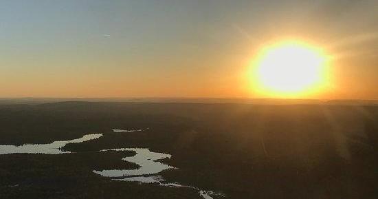
There are places where looking down alters what you think you know about a landscape. Mount Cobb is one of them. From the ridge-top roads and small-town lanes, the region reads as wooded hills, glinting water and the occasional cleared meadow. From the air, patterns emerge — long, narrow lakes and reservoirs threaded by inlets; old logging scars that have rebloomed into uneven forest; and the rhythmic contour of the Endless Mountains stepping east toward the Poconos. Air tours strip away context and replace it with scale and sequence: you see the shoreline of Lake Wallenpaupack unfurl, the checkerboard of second-growth forest and fields, and the way small valleys funnel weather and light.
Taking to the air here is less about adrenaline and more about perspective. Small-plane and helicopter flights provide low-altitude intimacy that highlights geological texture and seasonal color; hot-air balloon ascents deliver slow, painterly drift over harvest fields and tree-lined lakes. These flights are an invitation to read the land: to catch the ripple of late-summer storms moving across ridgelines, to watch shoreline cottages retreat into fall flame, or to spot nesting herons along quiet coves. For photographers and nature lovers, the air removes obstructions — no trees, no buildings — and replaces them with a panoramic continuity that’s hard to replicate on a trail or a lake.
There’s also a human history you can feel from above. Northeastern Pennsylvania bears the imprint of extractive industries and rural farming: tidelines of reclaimed land, long narrow clearings cut for utility corridors, and the small footprints of town centers. From the sky these marks tell a story of change and recovery; they reveal how the landscape has been managed, abandoned, and regrown. An air tour can therefore be both visually thrilling and quietly informative — a lesson in natural processes, seasonal cycles, and the ways communities sit within their terrain.
Finally, air tours pair exceptionally well with other outdoor activities here. A morning flight crowned by a lakeside breakfast, an afternoon hike on private or public trails, or an evening on the water after seeing the contours of the shoreline from above makes for a layered adventure. The air tour, frankly, reorients your whole trip: routes you thought might be unremarkable from the road become obvious natural attractions once you’ve seen their outline against the horizon.
Types of flights: Expect short scenic hops in 4–6-seat light-aircraft, occasional helicopter charters, and seasonal balloon lifts. Operators vary across the Poconos and from small regional airfields serving Mount Cobb.
Best uses: Aerial photography, fall foliage viewing, scouting routes for hikes and paddling, understanding watershed patterns, and quiet sightseeing that complements hiking, boating, and fishing.
Accessibility: Air tours are typically launched from nearby small airports or private strips; ground access is often easy from I-380 and local roads. Many providers will pick up from local lodging or public meeting points but confirm logistics when booking.