Why Schnecksville Is a Memorable Place for Air Tours
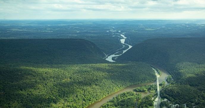
From the low hum of rotors to the hush that follows a single-engine climb, flying over Schnecksville reframes familiar landscapes into cinematic panels of color and line. The region is modest in elevation, but the contrasts are dramatic: narrow ridgelines like Blue Mountain throw long shadows across fertile valley floors; the Lehigh River snakes past industrial legacies and restored riparian corridors; patchwork farms meet suburban edges in a pattern that only becomes legible from the air. For travelers who normally seek vantage points on a ridge or ridgeline, an air tour supplies an immediately accessible, panoramic vantage—an aerial reconnaissance that dissolves roads and fences into tidy compositions and reveals how settlement, industry, and geology have shaped the valley.
Air tours around Schnecksville are as much about context as spectacle. You can use a 20- to 60-minute flight to fold together themes you might otherwise chase on different days: industrial history and adaptive reuse in Allentown and Bethlehem, the agricultural backbone of Lehigh and Northampton counties, and the recreational spine of the Appalachian foothills. Pilots often fly routes that highlight ridgelines, river meanders, and notable landforms, and that leaves room to layer the experience—seasonal color across fall foliage corridors, the soft geometry of spring fields, or the crystalline clarity of cold winter air for long sightlines. The Lehigh Valley’s relatively low elevation means calmer air in many seasons compared with high-mountain flights, and because the area is a short drive from regional population centers, it’s a convenient option for both day-trippers and weekend visitors seeking a distinct perspective.
Beyond the view itself, air tours plug into a broader palette of regional outdoor activities. A morning flight makes for a storytelling opener to a day of trail-running or ridge hiking on nearby public lands; a late-afternoon flight paired with a Lehigh River paddle launches the valley into sharp relief as you transition from air to water; photographers and naturalists use flights to spot potential sites for landscape shoots, birding, and conservation visits. Because these flights are often short, they’re accessible to a wide range of travelers—families, photographers, and seasoned adventurers—while still delivering an unforgettable sense of scale. Practical considerations—weather windows, light quality for photography, weight-and-space limits, and noise-sensitivity near preserves—shape the experience, but with a little planning, an air tour in Schnecksville becomes less a luxury and more an essential way to read a landscape most people only ever cross at ground level.
Air tours convert a day of local exploration into a layered narrative: see a feature from the air, then visit it on foot or by water to complete the story.
Because the terrain is moderate, flights are comfortable for many travelers; glassy winter air often provides the best visibility, while spring and fall offer the most visual variety.
The region's proximity to larger cities makes Schnecksville an accessible launch point for short, high-impact aerial experiences without a long travel commitment.