Into the Quiet: Chasing a Hidden Waterfall in the Ozark National Forest

Into the Quiet: Chasing a Hidden Waterfall in the Ozark National Forest

A quiet canyon, a short hike and a jaw-dropping cascade — discover Arkansas’s best-kept waterfall

Continue Reading

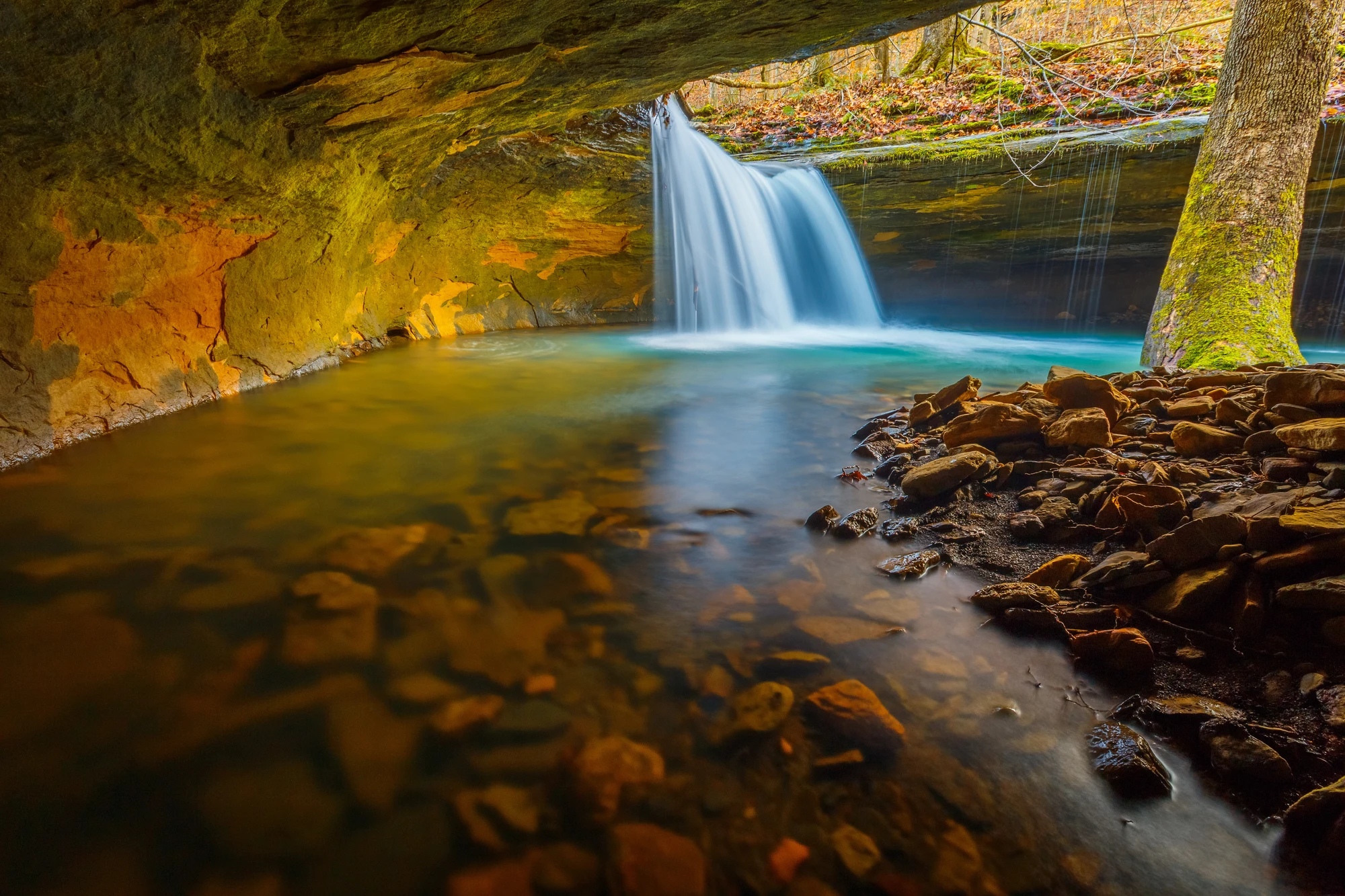
The trail begins as a conversation with the forest: a soft rustle of oak leaves, a low, persistent hum of water somewhere below. You pick your way over limestone slabs slicked by moss, the path narrowing until trees close in and sunlight becomes a texture rather than a source. Then the sound sharpens into a presence — an edge of white against green. By the time the canyon opens, the waterfall has already declared itself, water spilling over a jagged lip and feathering into a shallow pool that glows pale jade. It’s the kind of place that rearranges your breathing.

This hidden cascade in the Ozark National Forest is less a landmark than a habit — one of those local secrets held in common by anglers, weekend hikers and the occasional photographer who woke early enough to catch the light. Geologically, the Ozarks are an ancient plateau worn into cliffs, hollows and springs by millennia of rain and runoff. The waterfall sits where surface water meets fractured limestone and sandstone; over time the softer layers washed away and left the harder capstone to form the ledge you’re looking at now. In autumn, the cascade is framed by a riot of reds and golds; in spring, the ravine is a green throat echoing with frog calls.

Human history here is layered and quiet. Indigenous peoples traversed these ridgelines and river corridors for thousands of years before European settlers arrived, and later the region supported timber and small-scale homesteading. Today, the Ozark National Forest is managed for multiple use — recreation, habitat protection and sustainable timber harvest — and the waterfall is tucked within those uses, a small but beloved feature of a much larger ecosystem.

Practicalities: getting here is straightforward if you respect that ‘‘hidden’’ doesn’t mean ‘‘without rules.’’ Expect a moderately strenuous out-and-back hike of roughly 2–4 miles round-trip with 300–600 feet of cumulative elevation gain depending on the access route you choose. The terrain alternates between loose gravel, exposed tree roots and bedrock; there are a few short, steep sections and at least one stream crossing that can be ankle- to knee-deep in high water. Footwear with grippy soles and some ankle support is recommended. Navigation is simple with a GPS track or an up-to-date trail map, but wayfinding gets trickier after heavy rains when informal social trails appear — stick to the main tread and avoid scrambling down vegetated banks.

Timing matters more than you’d think. Late morning in summer brings heat and flies; golden hours — early morning or late afternoon — give gentler light for both photography and quiet. Spring brings swollen streams and more dramatic flows but also muddier trails and a higher chance of temporary closures after storms. Fall is arguably the sweet spot: cooler air, comfortable water temps, and the leaves putting on a show.

The waterfall invites multiple ways to enjoy it without turning it into a backyard swimming hole. Pack a small towel and be prepared to get wet if you want to stand beneath the curtain of water, but be mindful of slippery rock and undercut ledges. If you’re camping nearby, choose a legal campsite on durable ground and set up camp well away from the creek to protect riparian vegetation. Fishing in nearby streams is possible and popular — check the Arkansas Game & Fish Commission regulations for seasons and license requirements.

Leave No Trace isn’t theory here; it’s the baseline. The fragile moss mats and understory plants that make the ravine feel ancient are easily stomped into oblivion by off-trail traffic. Pack out everything, bury human waste properly if you’re away from facilities, and avoid moving large rocks that destabilize habitat.

For photographers, a neutral-density filter and a small travel tripod will let you make the water silky without blowing out highlights in the canopy. Bring polarizing sunglasses to cut glare and enliven leaves. If you prefer solitude, aim for weekdays or pre-dawn starts; the parking areas can fill quickly on good weather weekends.

This is the kind of place that rewards slow motion: sitting on a boulder and watching leaves sweep along the current, listening to the sudden hush as a rainband moves through, noticing a warbler strike and then vanish. Even if you only have a morning, the waterfall’s combination of geological presence, forest intimacy and plain Arkansas hospitality makes it a restorative detour — a pocket of wild that is still walkable from a town, but far enough away that the phone’s little blue circles mean nothing.

Practical trip checklist: good boots, a water filter or two liters of water per person, sun and tick protection, and a plan for leaving no trace. Respect the forest’s rhythm and you’ll find that the waterfall rewards a careful visit with something close to solitude — a few minutes of being wholly in place, where the present is measured only in the movement of water.

Duration2–4 hours
Plan your visit

Trail Wisdom

Pick early or late hours

Arrive at dawn or late afternoon to avoid crowds and to get the best light for photos.

Wear grippy footwear

Expect wet rock and loose gravel; hiking shoes with Vibram-like soles reduce slips.

Bring a small dry bag

Keep your camera and spare layers dry if you plan to sit near the spray or cross stream sections.

Stay on durable surfaces

Avoid creating new paths through moss and understory to protect sensitive riparian habitat.

Local Knowledge

Hidden Gems

  • Small upstream plunge pools that are perfect for a quiet rest
  • Rock overhangs and natural benches a few minutes from the main viewpoint that offer elevated perspectives

Wildlife

White-tailed deer, River otter

Conservation Note

The US Forest Service manages this landscape for multiple uses; practice Leave No Trace, camp on durable ground, and avoid disturbing riparian vegetation to protect water quality and habitat.

The Ozarks were historically used by Indigenous peoples and later supported logging and small-scale farming; the National Forest was established to conserve watersheds and manage timber resources sustainably.

Seasonal Guide

spring

Best for:Wildflowers and higher flows, Cooler air for longer hikes
Challenges:Muddy, slippery trails, Higher stream crossings after rain

Spring brings robust water flow and blooming understory, but expect muddy conditions and occasional hazardous crossings.

summer

Best for:Warm-weather swims, Longer daylight hours
Challenges:Heat and insects, Crowds on weekends

Summer is warm and lively; early starts help beat heat and bugs, and shade in the ravine offers respite.

fall

Best for:Peak foliage, Comfortable hiking temperatures
Challenges:Shorter daylight windows, Popular with leaf-watchers

Fall is ideal for color and comfortable conditions — plan for popular weekends and arrive early for solitude.

winter

Best for:Sparse crowds, Crisp, clear vistas
Challenges:Icy rock and cold water, Limited services in nearby towns

Winter offers quiet trails and stark beauty, but prepare for icy sections and dress in insulating layers.

Photographer's Notes

Shoot at golden hour for warm side-light on the fall canopy; use an ND filter and tripod for silky water at low ISO, and try a polarizer to reduce glare and boost color. Include foreground rocks or a leaf-covered log to add depth and scale.

What to Bring

Supportive hiking shoes or light boots

Essential

Grippy soles and ankle support help on wet bedrock and rooty tread.

Light rain shell

Essential

Protects against spray, sudden showers and wind in the canyon.

Water filter or purification tablets

Essential

Refills from streams after proper filtration keep packs light for longer outings.

○

Small travel tripod & ND filter

Stabilizes long exposures for smooth waterfall images in low light.

Common Questions

Do I need a permit to hike to the waterfall?

No special permit is required for day hiking in most parts of the Ozark National Forest, but check local trailhead signage and the US Forest Service website for any temporary closures or group limits.

Is swimming allowed at the pool below the falls?

Swimming is generally allowed where access is safe; use caution on slippery rock and avoid entering under the ledge where undercuts can create hazards.

Are dogs allowed on the trail?

Dogs are permitted on most forest trails but must be kept on leash per USFS rules in developed and parking areas; bring water and watch for ticks.

What's the best way to navigate to the trailhead?

Use a recent topo map or GPS track and target the nearest signed forest road; cell coverage is intermittent so download directions offline before you go.

When is the waterfall at its most dramatic?

After spring rains or following a steady run of showers, flows peak; otherwise late-winter and spring offer the most dramatic water volumes.

Is camping allowed nearby?

Dispersed camping is allowed in many sections of Ozark National Forest; choose durable surfaces, follow distance-from-water guidelines, and check for any seasonal restrictions.

What to Pack

Hiking boots for grip, water filter or 2L water for hydration, rain shell for canyon spray or sudden storms, headlamp if you’ll be returning near dusk

Did You Know

The Ozark National Forest encompasses roughly 1.2 million acres of public land in northwestern Arkansas, making it one of the largest contiguous forested areas in the region.

Quick Travel Tips

Arrive early to secure parking; download offline maps before leaving cell service; bring cash for rural businesses in nearby towns; check local weather for sudden storms

Local Flavor

Nearby towns like Russellville and Clarksville serve up Arkansas comfort food — think catfish, fried green tomatoes and slow-smoked barbecue — alongside small cafés and farm-to-table spots. Local music nights often feature bluegrass and old-time string bands that echo the region’s cultural roots.

Logistics Snapshot

Drive-in access via forest roads (some unpaved), free parking at trailhead, no kiosks or staffed rangers on-site most days, intermittent cell service, dispersed camping allowed with Leave No Trace practices.

Sustainability Note

Protect the fragile riparian zone by staying on trail, packing out all waste, using established campsites, and avoiding the removal of rocks or vegetation that stabilize the canyon.

Topics