Summit of Silence: Hiking Camel's Hump on the Long Trail

Summit of Silence: Hiking Camel's Hump on the Long Trail

A blunt, wind-sculpted summit with alpine views and old-growth stories—what to know before you climb

Continue Reading

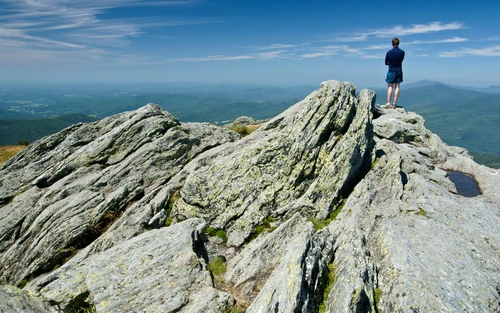
You break tree line as the last conifers thin to a wind-bent meadow and suddenly the world opens. Granite ribs lead your eyes to a rounded, solitary hump—Camel’s Hump—rising out of Vermont’s green like a blunt fist. Wind is the narrator here: it pushes, scours, and cleanses. It flattens the grasses, teases the clouds, and carries the smell of maple and mountain cool down the slope. Underfoot the trail rattles with the quick, urgent steps of hikers and the soft clack of microspikes when late-season ice tucks itself into root systems.

On a clear morning from the Burrows Trail—the most popular approach—the summit offers an uncompromising 360-degree classroom. To the west the Green Mountains roll toward Mount Mansfield and the ridge of the Long Trail; to the east the valleys cut by the Winooski and Mad Rivers pool fog in their bowl. The view is the reward, but the ascent is an education: a compressed lesson in Vermont’s geology, alpine ecology, and the human history threaded into these ridgelines.

Camel’s Hump (4,083 ft) is the state’s third-highest peak and one of the most recognizable silhouettes in New England. Its rounded profile is not an accident of erosion alone but of fire, ice, and hard rock—metamorphic schists and gneisses baked and folded over eons—exposed where glaciers scraped shallower vegetation away. That exposed ecosystem at the summit is a fragile alpine tundra, a remnant of a colder world, home to low-growing plants more commonly found in the Arctic. It’s why the summit is cordoned in places and why boots are asked to respect the lichens as if they were neighbors.

The human thread here runs long. Native peoples traversed these ridges for generations, and in the 19th and early 20th centuries farmers, timber harvesters and early conservationists shaped access and protection. The Long Trail, built by the Green Mountain Club and completed in the 1930s, stitches Camel’s Hump to a green corridor stretching the length of Vermont. Today, trails converge—Burrows, Monroe, and the Long Trail itself—making this a nexus for day-hikers who want steep, direct climbs and thru-hikers threading a much longer narrative.

Despite the classic New England summit experience—switchbacks that bite, rooty steps that test ankle stability, and exposed rock that will push you into hands-on scrambling—the hike is straightforward to plan. The Burrows Trail is roughly 4.8 miles round trip with about 2,100 feet of elevation gain; expect 3–5 hours depending on pace, weather, and how many photos you take. Terrain swings from root-choked, shaded forest to exposed rock and alpine meadow, so footwear with confident traction and a light wind shell will make the difference between a comfortable day and a cold slog.

Timing matters. Early starts win parking and quieter trails; late afternoon may offer the warm, golden edges of light across the valley but can also bring afternoon wind and sudden showers. In fall, the mountain becomes a viewing platform for Vermont’s famous foliage, but that same spectacle draws crowds—plan parking and shuttle options accordingly. Winter hikes demand a new layer of seriousness: snow, ice, and wind on the ridge make microspikes, traction, and route-finding skills non-negotiable.

There’s a conviviality to hiking Camel’s Hump. Trails meet and people swap trail tips at the ranger kiosk. Post-hike, Huntington and nearby Waterbury and Stowe have the kind of comforts hikers value: craft breweries, maple creemees, and inns that understand a laundered, tired hiker’s needs. The culture around these mountains balances reverence and practicality; conservation-minded locals remind visitors that the high alpine plants here take decades to recover from a single footstep.

Practical guidance: bring water—there is no reliable summit water—at least 2 liters per person in summer and more for long days; wear broken-in boots with ankle support; and carry layers—temperatures can drop rapidly once you crest. For navigation a map and compass or a charged phone with offline maps will do, but don’t rely solely on cell service. Practice Leave No Trace: pack out what you pack in, stay on durable surfaces in the alpine zone, and tie out your dog if you bring one (dogs are allowed on trails but may struggle on exposed sections).

Camping near Camel’s Hump is possible at designated sites in Camel’s Hump State Park, and backpackers can link sections of the Long Trail for a multi-day experience that stretches the sense of remoteness. Wildlife is part of the story—songbird migration funnels through these ridgelines, and on quieter mornings you might hear the distant clack of a grouse or spot white-tailed deer moving through the understory.

For the traveler: treat the hike as both a physical objective and a chance to slow down. Sit on a wind-scoured ledge and let the mountain tell you its age; watch the way clouds unroll over the valleys as if checking their bearings. There’s humility in these ridgelines—an honest difficulty to earn the summit and an honest joy once you have it. Plan well, tread lightly, and the Hump will give you one of Vermont’s clearest, most elemental summits.

Duration3–5 hours
Plan your visit

Trail Wisdom

Arrive early to beat the crowds

Parking at the Burrows trailhead fills quickly, especially on weekends and during fall foliage—aim for daybreak to secure a spot.

Respect the alpine zone

Stay on trails and rock; summit vegetation is fragile and can take decades to recover from foot traffic.

Bring traction in shoulder seasons

Microspikes or light crampons are essential in early spring or late fall when the trail on the ridge can ice over.

Carry sufficient water and sun protection

There’s no reliable water on the upper trail and the summit is exposed—pack at least 2 liters, sunscreen, and a wind shell.

Local Knowledge

Hidden Gems

  • Hike a short stretch of the Long Trail north or south from the summit for quieter viewpoints
  • Early-morning visits to Monroe Trailhead offer soft light and fewer hikers on the lower slopes

Wildlife

white-tailed deer, varied thrushes and warblers during migration

Conservation Note

The summit’s alpine tundra is extremely fragile; staying on designated paths and boots-clean practices help prevent erosion and protect rare plants.

The Long Trail, completed in the 1930s by the Green Mountain Club, links Camel’s Hump to a statewide corridor of protected ridges and was instrumental in early conservation efforts in Vermont.

Seasonal Guide

spring

Best for:wildflower transition, fewer crowds, cool temperatures
Challenges:muddy trails, variable snow patches, ice on shaded sections

Spring offers quiet trails and emerging flora, but expect mud and lingering snow—traction and gaiters are useful.

summer

Best for:long daylight, warm weather, wildlife viewing
Challenges:black flies and mosquitos, thicker crowds, hotter valley temps

Summer brings warm days and full views—early starts beat bugs and heat, and hydration is key.

fall

Best for:peak foliage, clear air, photography
Challenges:high visitor numbers, variable weather, shorter daylight

Fall rewards with spectacular colors and crisp air; plan for crowds and layer for rapid temperature shifts.

winter

Best for:snow-covered scenery, quiet solitude, snowshoeing and winter skills practice
Challenges:deep snow, ice on ridge, limited daylight and cold

Winter transforms the Hump into a rigorous alpine outing—microspikes, snowshoes, and winter navigation skills are required.

Photographer's Notes

Shoot early or late for warm sidelighting; include scale (hikers or cairns) to convey size, use a polarizer to deepen blue skies, and bracket exposures on bright summit days to retain cloud and foreground detail.

What to Bring

Sturdy hiking boots

Essential

Provide traction and ankle support on rooty and rocky sections.

Wind shell or lightweight insulated jacket

Essential

Summit exposure brings wind and rapid temperature drops—pack a warm, windproof layer.

Microspikes

Essential

Essential for late-fall, winter and spring ice on ridgelines and exposed rock.

2L water reservoir

Essential

There is no reliable summit water—carry sufficient hydration for the round trip.

Common Questions

How long is the hike to Camel’s Hump summit?

The Burrows Trail is about 4.8 miles round trip with roughly 2,100 feet of elevation gain; allow 3–5 hours depending on pace and conditions.

Is the trail dog-friendly?

Dogs are allowed on the trails but must be under control; be prepared to assist your dog on exposed or rocky sections and to carry out waste.

Do I need a permit or fee to hike Camel’s Hump?

There is no required permit to hike, but some parking areas may have a fee or limited spaces—check Camel’s Hump State Park information before visiting.

Can I camp overnight near Camel’s Hump?

Yes—designated campsites exist within Camel’s Hump State Park and backpackers can use sections of the Long Trail for multi-day trips; follow site regulations and camp only in designated areas.

When is the best time to see fall foliage from the summit?

Mid-to-late October typically provides peak color, though timing varies year to year with elevation and weather—plan a flexible window and expect larger crowds during peak color weeks.

Are there hazards I should know about?

Exposed ridge sections can be windy and icy; sudden weather changes occur frequently—carry layers, navigation tools, and traction for cold months.

What to Pack

Hiking boots (traction & ankle support), 2L water (no summit water), wind shell (exposed summit chills), microspikes (shoulder seasons/winter)

Did You Know

Camel’s Hump is Vermont’s third-highest peak at 4,083 feet and its summit supports an alpine tundra ecosystem—rare in the northeastern U.S.

Quick Travel Tips

Arrive before 8 a.m. for parking; check weather and avalanche/ice advisories in winter; pack out all trash and toilet paper; support local businesses in Huntington or Burlington after your hike.

Local Flavor

Post-hike, reward yourself with a Vermont creamery cone, local maple syrup souvenirs, and a pint at a Waterbury or Stowe brewery—trail culture here skews toward low-key, conservation-minded hospitality.

Logistics Snapshot

Trailhead: Burrows/Route 17; Distance/Elevation: ~4.8 mi RT, ~2,100 ft gain; Difficulty: challenging day-hike; Permits: none, parking may be limited; Dogs: allowed on trails—carry out waste.

Sustainability Note

Stick to durable surfaces in the alpine zone, clean boots before and after hiking to avoid invasive seeds, pack out waste, and favor established campsites to reduce impact.

Topics