Wilson Creek, North Carolina: Fall Color, Waterfall Hopping, and the Wild Heart of Pisgah

Wilson Creek, North Carolina: Fall Color, Waterfall Hopping, and the Wild Heart of Pisgah

A compact canyon of cascades and fall color — short hikes, long views, and creekside solitude in Pisgah National Forest.

Continue Reading

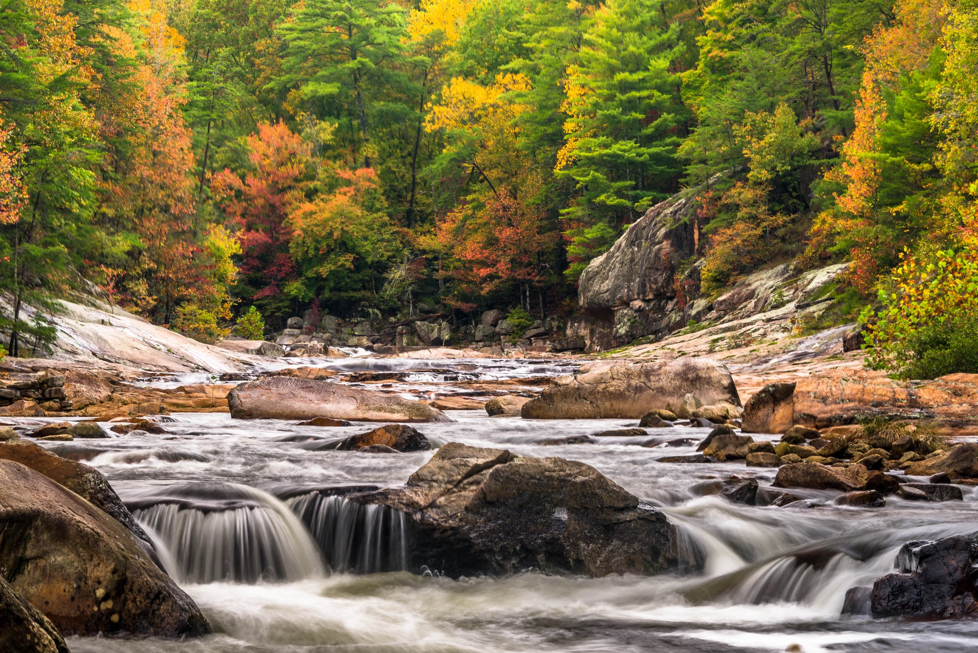
The first time you step into Wilson Creek the world compresses into the sound of water. It’s an immediate, physical thing—the creak of old oaks, the low rumble of the creek as it squeezes through a basalt boulder garden, and the bright slap of water on stone that seems to set the whole canyon vibrating. If you come in October the maples and sourwoods turn fluorescent, and the canyon feels like a cathedral built of mica-slate and sunlight. The air smells like pine resin and wet leaves; the river dares you forward.

Located in the western North Carolina highlands inside Pisgah National Forest, Wilson Creek cuts a narrow, waterfall-strewn gorge that draws photographers, hikers, and anyone who finds clarity in moving water. The landscape here is Appalachian at its rawest: folded, metamorphosed bedrock, steep ridgelines, and cascading tributaries that trace patterns laid down by ancient uplift and Pleistocene erosion. The creek’s bed is a mosaic of rounded boulders and plunge pools—ideal for short scrambles, fording in low water, and for finding a quiet spot to listen.

Human history here is layered. Cherokee peoples traveled these valleys long before Euro-American settlers arrived; traces of old logging roads and stonework from the 19th and early 20th centuries remain along some trails. Later, the Civilian Conservation Corps built many of the early roads and trail structures that gave access to these interior reaches. Today the canyon is protected under Pisgah’s larger mosaic of national forest lands, and the management emphasis is on low-impact recreation: hiking, photography, rock-hopping, and dispersed camping in designated areas.

Why go now? Wilson Creek is a succinct, satisfying wild slice of the Southern Appalachians that rewards both short visits and multi-day itineraries. Day-hikers can follow creekside tracks and short spur trails to several cascades and swimming holes—a concentrated dose of river canyon scenery without a long approach. For people who want pace, the backcountry spurs off into ridge loops and longer backpacking routes that thread higher hardwood ridges and deliver broad valley views.

Practical snapshot: day routes cluster around 2–6 miles with modest to moderate elevation change—expect short, steep pitches where trails leave the creek and climb to benches. Longer, multi-day outings in and around the Wilson Creek Wilderness can reach 15–20 miles with cumulative elevation gains of 2,000–4,000 feet depending on your chosen loop. Terrain is mixed: forested singletrack, loose talus near water, granite outcrops, and occasional muddy stretches after rain.

If you plan to swim, check water levels and never jump into unknown pools—the creek hides submerged boulders and undercut ledges. For photographers, the canyon’s short focal length is a boon: you can walk from sweep to sweep of color in a single afternoon. Arrive early or late for soft light and to avoid weekend crowds at the most popular pullouts.

A few local insights make the difference between a good visit and a great one. Time your hike around low water if you want to rock-hop; bring a pair of lightweight trekking shoes that can get wet. Learn the look of stable versus unstable talus—some boulders sit like bedrock, others shift when loaded. If you’re camping, reserve a site when required and follow all fire regulations—conditions can change rapidly in late summer and fall.

Getting there is straightforward if you’re based in the foothill towns—plan on a 45–90 minute drive from regional hubs like Asheville, Boone, or Lenoir depending on your trailhead. Cell reception is spotty; download maps or bring an offline GPS. Leave No Trace rules are not optional here: cairns and social trails are proliferating in fragile creekside zones, and the best practice is to stay on durable surfaces, pack out your waste, and use designated campsites.

For many visitors the draw is the creek itself: waterfall hopping, short scrambles across boulder gardens, late-season trout fishing in quieter reaches, and the visceral reward of a riverscape that feels older than your watch. Wilson Creek isn’t a manicured state park; it asks for observation and a slow gait. But in return it hands back a kind of wide, liquid silence that’s easy to carry home.

Whether you come for the color and the long exposure shots, the microadventures of creekside bouldering and scrambling, or the simple joy of a day spent under hardwood canopy punctuated by waterfalls, Wilson Creek delivers an Appalachian experience that’s both immediate and enduring. Bring good footwear, respect the water, and give yourself extra time—the canyon will insist you stop and listen.

Duration2–8 hours (day hikes); 1–3 days (backcountry loops)
Plan your visit

Trail Wisdom

Timing and light

Arrive at dawn or late afternoon for the best light on cascades and to avoid midday crowds at popular pullouts.

Footwear for creek crossings

Use grippy, quick-drying trail shoes or light approach shoes—rigid hiking boots can be cumbersome when rock-hopping.

Watch water levels

After storms the creek rises quickly; avoid crossing fast, high water and be cautious near undercut ledges.

Pack out and stay on trail

Stick to durable surfaces, avoid creating new trails, and carry out all trash to protect fragile creekside vegetation.

Local Knowledge

Hidden Gems

  • Upper boulder gardens above the main pullouts—less trafficked and great for quiet photos
  • Short ridge spur trails that provide overlook views of the canyon and valley below

Wildlife

Black bear (regional—observe from distance and secure food), White-tailed deer

Conservation Note

Trails and campsites are managed for low-impact recreation; visitors are asked to follow Leave No Trace principles to protect fragile creekside plants and water quality.

The area reflects both Cherokee travel corridors and later logging-era roads; portions of the current trail network follow older access routes improved by the Civilian Conservation Corps.

Seasonal Guide

spring

Best for:Waterfall volume, Wildflower blooms, Cool temps for long hikes
Challenges:High water after rains, Mud on low trails

Spring brings powerful flows and green-up; expect soggy trails and strong currents after rain.

summer

Best for:Swimming and cooling off, Long daylight hours, Evening photography
Challenges:Higher temps in lower elevations, Popular swimming holes get crowded

Warm weather makes creek plunges tempting—pick weekdays or early/late hours for solitude.

fall

Best for:Fall color, Crisp hiking conditions, Photography
Challenges:Shorter daylight, Higher visitation on peak color days

Peak leaf season is the most popular time—plan for limited parking and arrive early.

winter

Best for:Clear views from ridges, Quiet trails, Crisp, stark photography
Challenges:Icy sections on exposed rocks, Colder creek temps—no swimming

Cold, quiet months reward hikers with solitude; bring traction for icy rock and stream crossings.

Photographer's Notes

For waterfall long exposures bring a small tripod and neutral-density filter and aim for early or late light; capture the creek at knee-level to emphasize flow, and use a wide-angle lens to include surrounding hardwoods during peak color.

What to Bring

Lightweight waterproof trail shoes

Essential

Give traction on wet rock and drain quickly during creek scrambles.

Lightpack with 2–3L hydration

Essential

Water and snacks are crucial; creek water should be filtered before drinking.

Lightweight rain shell

Essential

Fast-changing mountain weather makes a breathable shell essential for comfort.

○

Microspikes or traction device

Useful for icy rock and frozen creek crossings in colder months.

Common Questions

Do I need a permit to hike or camp along Wilson Creek?

Day hiking requires no permit, but some backcountry campsites may require a dispersed camping permit—check Pisgah National Forest regulations before you go.

Are there safe swimming spots?

Yes—there are several calm plunge pools but always check depth and avoid jumping; currents can hide rocks and undercuts.

Is the area dog-friendly?

Dogs are welcome on most trails but must be kept under control; bring water and be mindful of steep terrain and creek hazards.

Can I fish in Wilson Creek?

You can fish in many stretches subject to North Carolina fishing regulations and licensing—look for trout in cooler headwater pools and confirm current rules before you go.

How crowded does it get in fall?

Peak leaf season draws crowds on weekends and holidays—arrive early, use less popular trailheads, or visit mid-week for quieter experiences.

Will my phone work out there?

Cell service is spotty inside the canyon and along many trail corridors—download maps and emergency contacts in advance, and carry a personal locator if heading into remote areas.

What to Pack

Light waterproof trail shoes, 2–3L water and filter, rain shell, compact first-aid kit — for wet rock, hydration, changing weather, and minor injuries.

Did You Know

Wilson Creek flows through Pisgah National Forest and features multiple named cascades and boulder fields popular with photographers during peak fall color.

Quick Travel Tips

1) Arrive early in peak season to secure parking; 2) Download offline maps and trail PDFs; 3) Check local water conditions after storms; 4) Pack a small trash bag—there are no trash services at many pullouts.

Local Flavor

Base your trip in nearby towns like Lenoir or Blowing Rock to sample Appalachian comfort food—smoky barbecue, biscuit-and-gravy breakfasts, and local craft beers—and stop at roadside farm stands for apples in the fall.

Logistics Snapshot

Nearest services in Lenoir or Marion; parking at designated trailheads; no cell in the canyon; day hikes suited to 2–6 miles; follow National Forest rules and check for seasonal closures.

Sustainability Note

Protect riparian vegetation by staying on durable surfaces, pack out all waste, avoid building rock cairns, and use existing fire rings where permitted to minimize impact on this sensitive creek canyon.

Topics