Scenic Wonders at Black Hole of Calcutta Falls Trailhead
Adventure Destination

Scenic Wonders at Black Hole of Calcutta Falls Trailhead

Explore the Black Hole of Calcutta Falls Trailhead near Auburn, CA. This picturesque site is a moderate trail that offers hiking along riverbanks with the beautiful Calcutta Falls. Excellent for nature lovers seeking scenic views and a touch of historical charm.

Hiking8.5/10Moderate
Photo Gallery

Category

Hiking

Typical Duration

2-4 hours

Difficulty

Moderate

About This Adventure Destination

Hiking to Black Hole of Calcutta Falls near Auburn, California

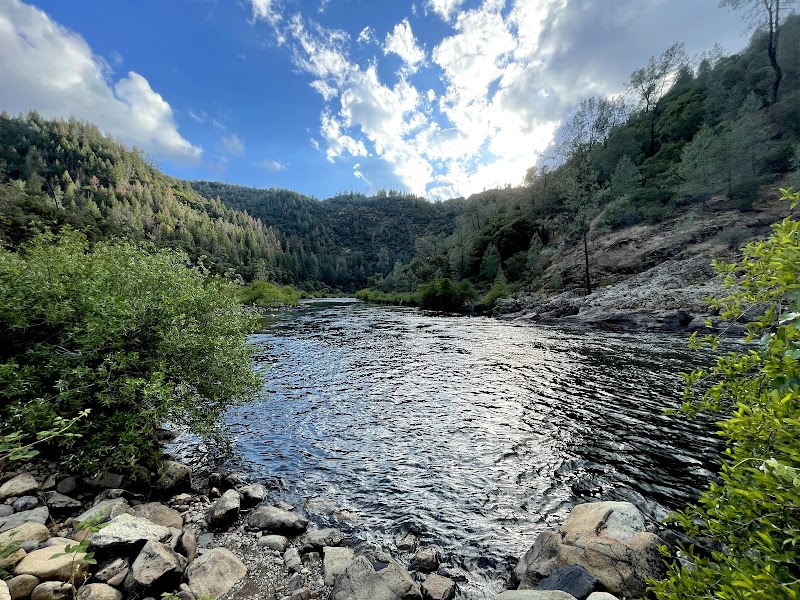
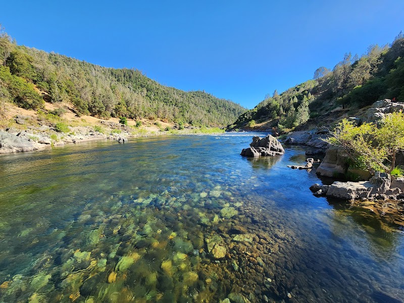
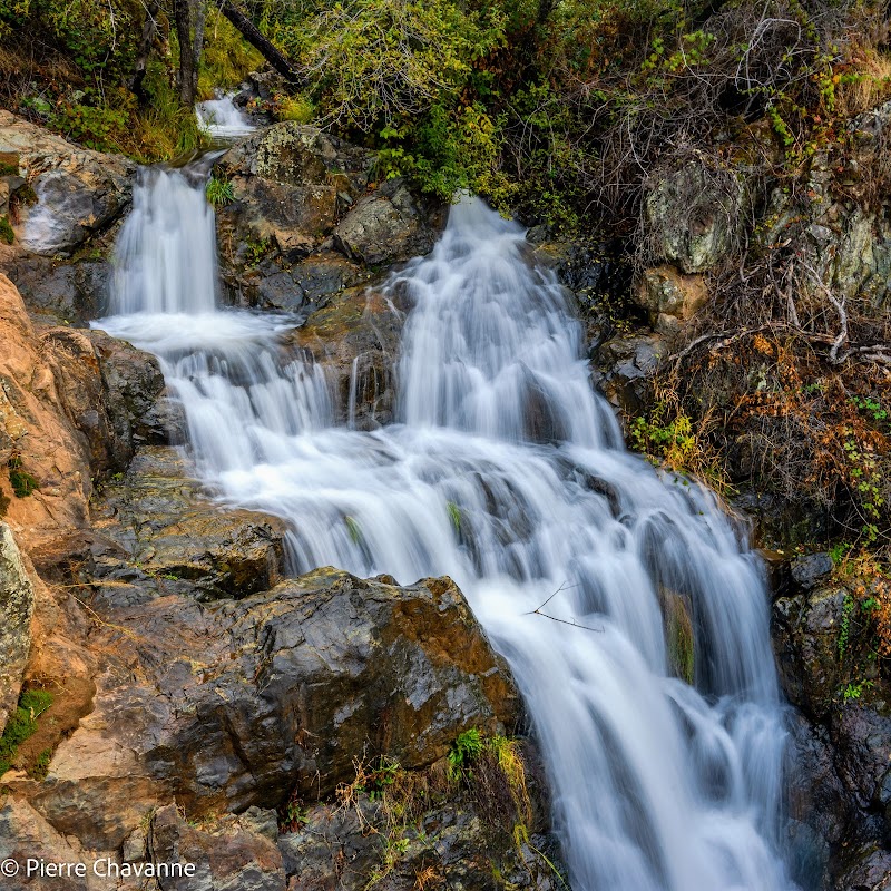
Located just outside Auburn in Northern California’s Sierra Nevada foothills, the Black Hole of Calcutta Falls Trailhead offers a refreshing and accessible outdoor retreat. This trailhead is your gateway to a mostly gentle hike running alongside the North Fork American River, leading to the beautiful Calcutta Falls. The falls are a standout attraction, showcasing clear cascading water over rugged rock faces framed by tall trees and native brush.

The trail travels through shaded woodlands filled with native plants like California buckeye and elderberry, with occasional sightings of local wildlife such as deer and songbirds. The river’s course and the rocky cliffs add geological interest, evolving from soft dirt paths to scattered rocky patches that require mindful footing. Along the route, hikers reach the historic steel bridge, a former railroad crossing now repurposed for pedestrians, adding a touch of regional history to the natural setting.

The name “Black Hole of Calcutta” refers to a deep pool at the base of the falls, a striking natural feature that has long attracted locals and visitors. This area has cultural roots tied to the Gold Rush era, and the surrounding forests have remained relatively untouched since then, preserving a peaceful atmosphere. The trail is family-friendly, with options to stop at calm river access points ideal for brief rest or a splash on warm days. With its combination of greenery, water, and history, this trailhead is one of Auburn’s special outdoor destinations.


Editorial Assessment

The Black Hole of Calcutta Falls Trailhead offers a serene blend of natural beauty, history, and adventure. Its iconic waterfall, scenic trails, and rich wildlife make it a must-visit for nature lovers, though it's not quite as globally renowned as some other natural landmarks.
Scenic Wonders at Black Hole of Calcutta Falls Trailhead

Adventure Guide to Scenic Wonders at Black Hole of Calcutta Falls Trailhead

1

1. Hiking to Calcutta Falls

  • What makes it special:

    The trail is approximately 1.5 miles each way, mostly level with some rocky areas near the falls. It offers scenic views of the North Fork American River, shaded forest, and a rewarding waterfall destination.

  • Key features:

    Historic pedestrian bridge, river side trails, shaded forest canopy.

  • Visitor tips:

    Start early, especially on weekends, to secure free parking. Wear sturdy shoes for rocky sections. Dogs are welcome but must be leashed and cleaned up after.

2

2. River Swimming and Wading

  • What makes it special:

    Several trail spurs lead down to quiet river spots for swimming or cooling off. The “black hole” itself is a deep pool popular in warmer months.

  • Key features:

    Clear river water, calm swimming holes, natural rock steps.

  • Visitor tips:

    Swim cautiously; river currents can be strong. Bring swimsuits, towels, and water shoes for comfort and safety.

3

3. Family-Friendly Nature Walks

  • What makes it special:

    Gentle terrain perfect for families with children or those seeking light exercise. Opportunities to observe local flora and fauna along shaded parts of the trail.

  • Key features:

    Easy access, restroom facilities at trailhead, peaceful environment.

  • Visitor tips:

    Bring water, snacks, and sunscreen. Weekend visits can be busy; weekdays are quieter. Portable bathroom facilities available only near the trailhead start.

4

Getting There & Practical Advice

  • Driving directions:

    From Auburn, take CA-193 east towards Foresthill. The trailhead is just off this route. Parking spots fill quickly on weekends; arrive early or use paid lots near the historic bridge for guaranteed spots. Estimated drive time from central Auburn is about 10 minutes.

  • Best times to visit:

    Spring through early fall for best weather and water flow. Early mornings help avoid crowds and secure parking.

  • Essentials to bring:

    Sturdy hiking shoes, water, dog waste bags if bringing pets, swimsuit for river stops, and a flashlight if returning after sunset. This trailhead offers a lovely blend of light hiking, natural beauty, and a touch of local history—perfect for a half-day outdoors near Auburn.

Reviews

T
tori howesin the last week

Beautiful adventure- I have twin toddlers that are three years old. They were able to make it to the falls and back without much intervention. Bring good shoes and water. We turned back at the falls but the trail does keep going. There’s lots of little trails that veer off the main trail that will lead you to the river. Very scenic and calm. We parked on the side of the road, but a little ways away there’s paid parking and bathrooms that you can utilize as well.

S
Steffya week ago

Great hike and don't park on the road. You'll get a ticket.

B
Bob Dobolina2 weeks ago

Only 1.5 miles to beautiful falls! Nice easy trail with some good shade. And right along the North Fork American River. Free parking.

A
Alfredo Gonzales2 weeks ago

Great destination! Enjoyed the open trail and peaceful outdoor atmosphere.

E
E WSin the last week

Great destination! Enjoyed the open trail and peaceful outdoor atmosphere.

Nearby Adventures

Bookable Experiences

Tunnel Chute and the 18‑mile Surge: A Full‑Day Run Through the Middle Fork American River2.31 mi
Auburn, California

Tunnel Chute and the 18‑mile Surge: A Full‑Day Run Through the Middle Fork American River

Auburn’s signature 6‑hour, 18‑mile Class III–IV run through a deep Tahoe National Forest canyon; this guide orients paddlers to the route, rapids and practical details.

2.31 miView Trips & Details →
Stand-Up Paddle Auburn: Inflatable and Hard‑Side SUPs for Beginner-Friendly Watertime3.09 mi
Auburn, California

Stand-Up Paddle Auburn: Inflatable and Hard‑Side SUPs for Beginner-Friendly Watertime

A concise field guide to NorCal Extreme Rentals’ SUP options in Auburn — what boards are offered, why it’s a solid beginner workout, and how to secure same‑day access.

3.09 miView Trips & Details →
Gorge Run — Lower Gorge Class III Through Granite Canyons (Lunch Included)8.59 mi
Lotus, California

Gorge Run — Lower Gorge Class III Through Granite Canyons (Lunch Included)

A 10.5-mile beginner–intermediate Class III run through a granite-walled gorge that includes a riverside lunch and a cold beverage at Folsom Lake.

8.59 miView Trips & Details →
Bigfoot Rafting’s Full-Day River Rentals — Self-Guided Rafts & Inflatable Kayaks from Junction City9.87 mi
Junction City, California

Bigfoot Rafting’s Full-Day River Rentals — Self-Guided Rafts & Inflatable Kayaks from Junction City

Daily rental packages include essential gear (PFDs and paddles) and give experienced rafters full-day access to Junction City’s river reaches; this guide explains what to expect and how to plan.

9.87 miView Trips & Details →
South Fork — The Gorge Express: A family-ready Class II–III run through Lotus’s Lower Gorge10.2 mi
Lotus, California

South Fork — The Gorge Express: A family-ready Class II–III run through Lotus’s Lower Gorge

Action Whitewater’s South Fork - The Gorge Express delivers a splashy, picture-ready descent of the Lower Gorge; this guide lays out the rapids, route, and practical essentials for running the trip.

10.2 miView Trips & Details →
Two Hours of Private Farm Backdrops in Loomis — Book the Land, Not the Evening Iris Show11.1 mi
Loomis, California

Two Hours of Private Farm Backdrops in Loomis — Book the Land, Not the Evening Iris Show

Reserve up to two hours of exclusive farm access in Loomis for professional photoshoots; this guide explains what’s included, limits on photographers, and how bloom season affects access.

11.1 miView Trips & Details →