Serenity by the South Fork
Adventure Destination

Serenity by the South Fork

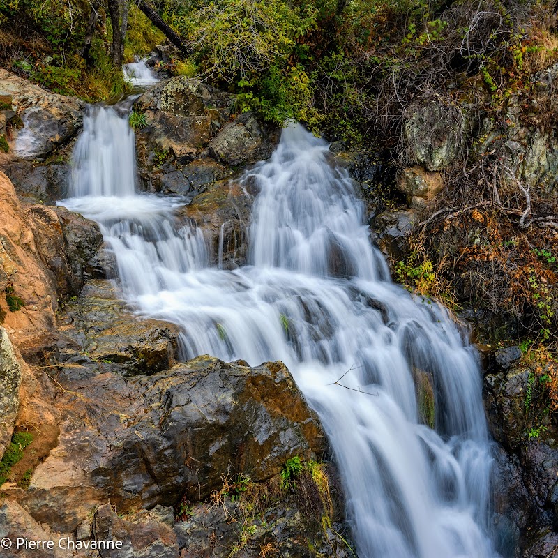
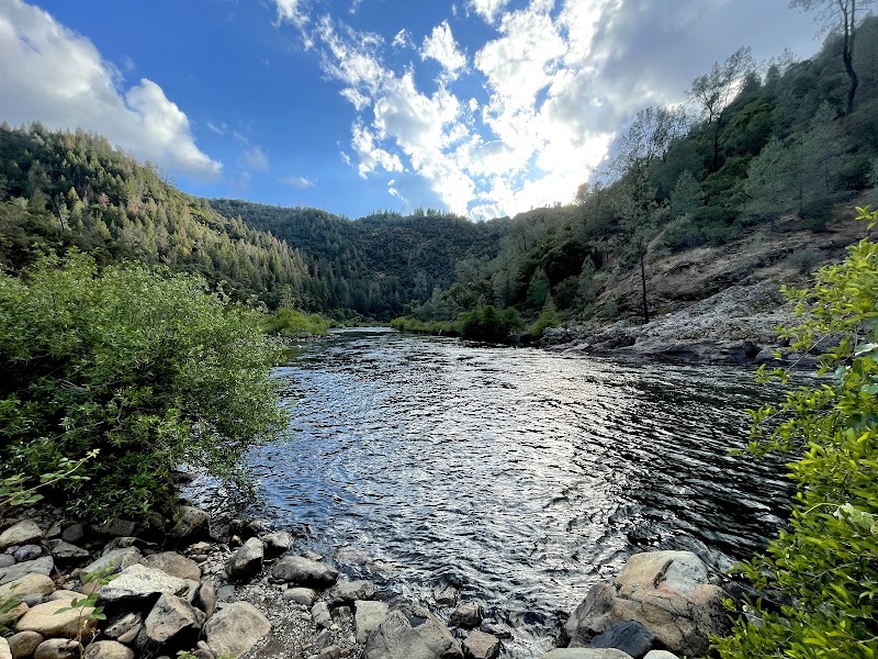
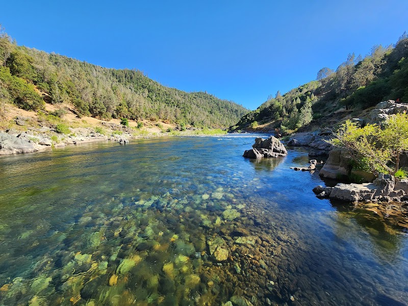
Explore the Red Shack Trailhead in Placerville, CA. This easy-to-moderate trail offers scenic views of the South Fork American River and is great for hiking, birdwatching, and family picnics. Immerse yourself in nature and history with trails connected to the Gold Rush era.

Hiking7.8/10Moderate
Photo Gallery

Category

Hiking

Typical Duration

2-4 hours

Difficulty

Moderate

About This Adventure Destination

Discover Red Shack Trailhead

Located in the scenic heart of Placerville, California, the Red Shack Trailhead is a gateway to the serene beauty of the Sierra Nevada foothills. This picturesque location offers a unique blend of lush forests and the calming waters of the South Fork American River. It's a standout destination for outdoor enthusiasts seeking a peaceful retreat within reach of the charming historic town of Placerville. The trailhead is known for its gently undulating paths and invigorating river views, which are especially captivating as sunlight dances on the water's surface.

Key Features: The area is adorned with towering pines and oaks, providing a natural canopy that accompanies visitors along the trails. One of the unique aspects of this destination is its accessibility to a variety of ecosystems, from woodland trails to riverside paths. This spot is also a part of the larger Eldorado National Forest, adding to its appeal with rich biodiversity and wildlife.

Interesting Fact: Red Shack Trailhead is deeply connected to the Gold Rush history of the region, with some trails echoing the routes taken by early pioneers in the search for gold. Today, it serves as a reminder of the natural riches and history of California.

Editorial Assessment

Red Shack Trailhead offers beautiful landscapes and rich history, making it a great regional destination but not globally iconic.
Serenity by the South Fork

Adventure Guide to Serenity by the South Fork

1

Experience Serenity by the South Fork

  • Special Features:

    Explore the Red Shack Trailhead in Placerville, CA. This easy-to-moderate trail offers scenic views of the South Fork American River and is great for hiking, birdwatching, and family picnics. Immerse yourself in nature and history with trails connected to the Gold Rush era.

  • Visitor Tips:

    Best time to visit is during Spring. Bring adequate water, appropriate outdoor gear, and camera.

  • Directions:

    Coloma Rd, Placerville, CA 95667, USA

2

Exploring Near Placerville, California

  • Local Insights:

    Offers direct access to top trails, protected natural reserves, and picturesque viewpoints across Placerville, California.

  • Visitor Tips:

    Check local regulations, trail conditions, and weather before heading out.

3

Photography and Wildlife

  • Special Highlights:

    Capture panoramic sunrise and sunset views across the surrounding mountain terrain.

  • Visitor Tips:

    Arrive in early morning or late afternoon for the softest lighting and quieter trails.

Reviews

B
Bryan Castaneda2 months ago

BE PREPARED!!! I did not research this trail enough! It is definitely on the intermediate to harder side of a hike. Straight down which means straight up haha. Beautiful walk. Will have to build up for this trail and try again!

B
BruhPaca9 months ago

Great destination! Enjoyed the open trail and peaceful outdoor atmosphere.

J
Jacke Adames10 months ago

Plenty of parking. Steep but well maintained trail. About a mile to the river. You have to pick your way over boulders and river rocks to get to the river itself. At least for us the water was deep and fast we did get to see several groups of rafters come through which was fun. The hike out is fairly demanding and on a hot afternoon would probably be brutal for casual hikers.

D
Douglas “Bigdog” Harmer11 months ago

Absolutely stunning. It's worth the drive.

J
Jonathan3 months ago

Finally hiked the Red Shack/Old Flume Trail and it absolutely took my breath away - both literally and figuratively! Be prepared for a steep climb back up that gets your heart pumping. The views are worth it. Once near the river, trails follow historic mining ditches, offering a fascinating glimpse into California's gold rush era. The sound of rushing water accompanies you throughout much the hike, and the vegetation is stunning - featuring lush ferns and native plants that create a vibrant green corridor along the path. I enjoyed poking around near remnants of old mining operations while hiking through this historical landscape. Fair warning: parking is limited, so arrive early. But once you're on the trail, the combination of natural beauty, local history, and invigorating terrain makes this trail a must-do for any hiking enthusiast. Just come with plenty of time & water - both for exploring and making the climb!

Nearby Adventures

Bookable Experiences

Chilli Bar: Ten Miles from Class III Surge to a Quiet Camp3.79 mi
Placerville, California

Chilli Bar: Ten Miles from Class III Surge to a Quiet Camp

A 10-mile whitewater run that launches into a first half of sustained Class III rapids before easing into a tranquil float to camp — this guide lays out what to expect and where to meet.

3.79 miView Trips & Details →
Run the Whole River: A 21‑Mile Whitewater Day Through Coloma Valley3.84 mi
Placerville, California

Run the Whole River: A 21‑Mile Whitewater Day Through Coloma Valley

An 8‑hour, 21‑mile rafting expedition run by Coloma Lotus Whitewater that pairs sustained whitewater with riverside scenery and a noon lunch—this guide explains what to expect and how to prepare.

3.84 miView Trips & Details →
Ten Miles of Class‑3 Fury, Then a Quiet Drift: Chilli Bar’s Whitewater Run3.90 mi
Placerville, California

Ten Miles of Class‑3 Fury, Then a Quiet Drift: Chilli Bar’s Whitewater Run

A concise guide to the Chilli Bar Whitewater Rafting Trip—10 miles that open with big class‑3 rapids and finish with a tranquil float to camp, plus the practical facts you need to plan the outing.

3.90 miView Trips & Details →
South Fork — The Gorge Express: A family-ready Class II–III run through Lotus’s Lower Gorge5.84 mi
Lotus, California

South Fork — The Gorge Express: A family-ready Class II–III run through Lotus’s Lower Gorge

Action Whitewater’s South Fork - The Gorge Express delivers a splashy, picture-ready descent of the Lower Gorge; this guide lays out the rapids, route, and practical essentials for running the trip.

5.84 miView Trips & Details →
Gorge Run — Lower Gorge Class III Through Granite Canyons (Lunch Included)8.07 mi
Lotus, California

Gorge Run — Lower Gorge Class III Through Granite Canyons (Lunch Included)

A 10.5-mile beginner–intermediate Class III run through a granite-walled gorge that includes a riverside lunch and a cold beverage at Folsom Lake.

8.07 miView Trips & Details →
Gorge Whitewater: 13 Miles from Calm Pools to Class 3 Rapids near Placerville8.10 mi
Placerville, California

Gorge Whitewater: 13 Miles from Calm Pools to Class 3 Rapids near Placerville

A one-day, 13‑mile river trip that begins with easy paddling and builds into sustained class‑3 whitewater — this guide lays out what to expect and how to plan for the full 6‑hour outing.

8.10 miView Trips & Details →