Rocky Adventures at No Name Trailhead
Adventure Destination

Rocky Adventures at No Name Trailhead

Explore No Name Trailhead in Glenwood Springs, Colorado. Offering diverse hiking and climbing opportunities amidst beautiful rock formations and forests. Best visited in spring and fall for serene adventures, with possible wildlife sightings such as deer and elk.

Hiking7.8/10Moderate
Photo Gallery

Category

Hiking

Typical Duration

2-4 hours

Difficulty

Moderate

About This Adventure Destination

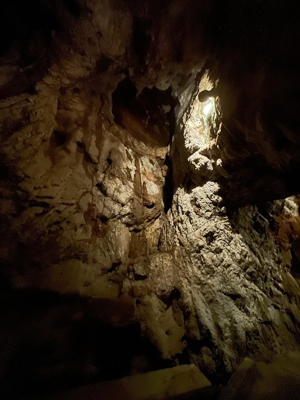
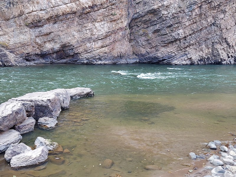
No Name Trailhead, located just outside Glenwood Springs, Colorado, presents an inviting entry into the rugged landscape of the Rocky Mountains. This trailhead is distinctive in the region due to its blend of striking canyon walls, flowing streams, and a peaceful forest setting that draws hikers looking for both challenge and calm. Unlike heavily trafficked tourist paths, No Name Trailhead offers a quieter, more immersive mountain experience with natural beauty at every turn.

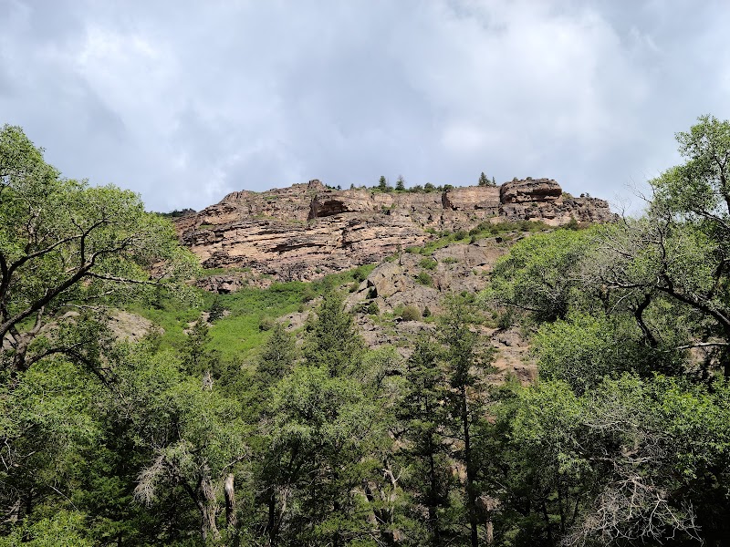
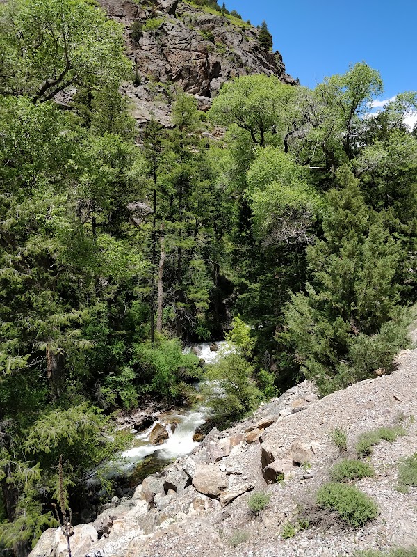
Key features include a series of steep, scenic ascents alongside a lively creek dotted with small waterfalls most prominent in early summer. The trail winds through dense pine and aspen forests, with forest floors often carpeted in pine needles and wildflowers during bloom. The towering canyon walls frame expansive views, creating a satisfying backdrop that changes with the seasons—from bright greens in spring and summer to golden aspens in fall. Wildlife enthusiasts may spot deer, elk, and a diverse array of bird species in this relatively undisturbed setting.

One standout feature of this location is its unique geological formations—the exposed rock faces provide limited but engaging opportunities for climbing and bouldering. The trail itself is moderate in difficulty, suitable for hikers comfortable with occasional steep sections and narrow paths. Along the way, a captivating bridge spans a quiet portion of the creek, making for a perfect rest or picnic spot halfway through the approximately three-mile trail that eventually connects to the Beaver Creek Trail.

This trailhead remains relatively low-key with only a handful of parking spots at the trail start and no entry fees, offering a genuine wilderness feel that appeals to day hikers, nature lovers, and outdoor adventurers alike.


Editorial Assessment

A great place for hiking and climbing with beautiful landscapes and geological features, though not as globally iconic.
Rocky Adventures at No Name Trailhead

Adventure Guide to Rocky Adventures at No Name Trailhead

1

1. Hiking The No Name Trail

  • What makes it special: This moderate, approximately 3-mile trail runs alongside a lively creek with small waterfalls in summer, framed by pine and aspen groves and striking canyon walls. The changing flora offers variety each season.
  • Key features: Streamside hiking with occasional steep climbs, scenic bridge for rest or picnics, connection to Beaver Creek Trail for longer routes.
  • Local insights: The trail passes near private property and a vital creek water source, so following posted signage and respecting boundaries is essential. Dogs are permitted on leash.
2

2. Streamside Picnicking and Wildlife Viewing

  • What makes it special: The creek alongside the trail offers soothing water sounds and natural spots perfect for breaks. Wildlife including deer and birds is frequently spotted here during quieter hours.
  • Key features: Scenic bridge and shaded spots near water create relaxing picnic areas. Ideal for peaceful breaks during your hike.
  • Local insights: Early morning or late afternoon offer the best chances to observe wildlife; bring binoculars and camera for birdwatching.
3

3. Rock Scrambling and Climbing Opportunities

  • What makes it special: The rugged rock faces near the trail provide limited climbing and scrambling challenges for intermediate enthusiasts, rewarding climbers with unique views of the canyon below.
  • Key features: Exposed geological formations perfect for bouldering and short climbs. Always assess rock quality and safety before attempting.
  • Local insights: Rock conditions can change with weather; exercise caution during wet or icy periods.
4

Visitor Tips

  • Best Times to Visit: Late spring through early fall; summer offers waterfalls, fall shows vibrant aspens, but be prepared for afternoon thunderstorms.
  • What to Bring: Sturdy hiking shoes, water, sun protection, snacks or picnic, dog supplies if pets accompany you.
  • Getting There: From Glenwood Springs, take Interstate 70 west to the No Name exit (~10 minutes). Parking at trailhead is limited (4 spots), so park at the nearby No Name rest area and walk a short distance to the trail. This trail provides a refreshing mountain experience, combining serene creekside walking with the visual drama of Colorado’s canyon landscape.

Reviews

J
John Gevedona week ago

We used this exit on I-70 East as a starting point for our bike ride on the Glenwood Canyon Bike Path. It's a fantastic rest stop with beautiful restrooms and lots of parking. Coast down a small path and connect to the Canyon Path. The Canyon Path actually starts a couple miles west of here in Glenwood Springs, but at No Name is where it starts to get beautiful. Another advantage to this exit is that there is access to I-70 West if you need if you need to drive that way after riding. Not all the exits along this corridor have that feature. We rode almost 10 miles east through the canyon and then returned. Gorgeous ride.

L
Lily Lauba month ago

We stopped here to eat our breakfast. We didn't have time to go hiking, but enjoyed the view and the picnic tables, restrooms and water fountains made this place a nice pit stop.

A
Ashley Kelleya month ago

Great destination! Enjoyed the open trail and peaceful outdoor atmosphere.

J
Jackson Echols3 months ago

Just visited in the spring of 2026. The creek is rushing and the wildflowers are blooming! Loved this trail

M
mitch warren4 months ago

Not an easy hike. Very fun, beautiful setting. Suggested hitting Glenwood Springs pool after to soak weary muscles for a nice day.

Nearby Adventures

Bookable Experiences

Hire a Private Guide in Cedaredge: Sharpen Your Snowmobile Skills and Ride the Snowy Backcountry51.5 mi
Cedaredge, Colorado

Hire a Private Guide in Cedaredge: Sharpen Your Snowmobile Skills and Ride the Snowy Backcountry

A full day of guided snowmobiling that pairs personalized instruction and safety briefings with trail time; book additional days and save $50 on each extra day.

51.5 miView Trips & Details →
Birdlike Lift: Tandem Paragliding Off Aspen Mountain36.5 mi
Aspen, Colorado

Birdlike Lift: Tandem Paragliding Off Aspen Mountain

A guided tandem paraglide from Aspen Mountain with USHPA-certified pilots — this guide explains what to expect, how the flight runs, and practical tips to reserve a spot.

36.5 miView Trips & Details →
Morning Throttle at Crested Butte: Three‑Hour Side‑x‑Side UTV Rental49.2 mi
Crested Butte, Colorado

Morning Throttle at Crested Butte: Three‑Hour Side‑x‑Side UTV Rental

A three‑hour morning rental in a choice of Polaris RZR or Can‑Am Maverick UTVs — helmets provided and a credit‑card security hold required.

49.2 miView Trips & Details →
A Quiet, Certain Ride: Private Shuttle from Snowmass Village to Regional Airports30.8 mi
Snowmass Village, Colorado

A Quiet, Certain Ride: Private Shuttle from Snowmass Village to Regional Airports

A concise guide to Aspen Peak Transportation’s private shuttle service from Aspen or Snowmass to regional airports — what to expect, what to pack, and who it’s best for.

30.8 miView Trips & Details →
Three Hours from Crested Butte to Aspen Highlands: The Overnight Hiker’s Shuttle50.3 mi
Crested Butte, Colorado

Three Hours from Crested Butte to Aspen Highlands: The Overnight Hiker’s Shuttle

A scheduled, approximately three-hour shuttle that picks up in Crested Butte area hotels and drops passengers at Aspen Highlands—perfect for hikers who spent the night in Crested Butte.

50.3 miView Trips & Details →
Tracing the Shadow Walk: A two‑hour stroll around the base of Shadow Mountain in Aspen36.3 mi
Aspen, Colorado

Tracing the Shadow Walk: A two‑hour stroll around the base of Shadow Mountain in Aspen

A concise, 2-hour, 2.5-mile guided walk that follows old railroad beds past historical landmarks into open meadows—essential reading for anyone planning the route.

36.3 miView Trips & Details →