Thingvellir National Park: Where Continents Converge
Adventure Destination

Thingvellir National Park: Where Continents Converge

Explore Thingvellir National Park, where the North American and Eurasian plates converge. Discover geological marvels, historical sites, and hike scenic trails. Snorkeling in Silfra offers clear visibility. Best visited in summer.

Hiking9.3/10Moderate
Photo Gallery

Category

Hiking

Typical Duration

2-4 hours

Difficulty

Moderate

About This Adventure Destination

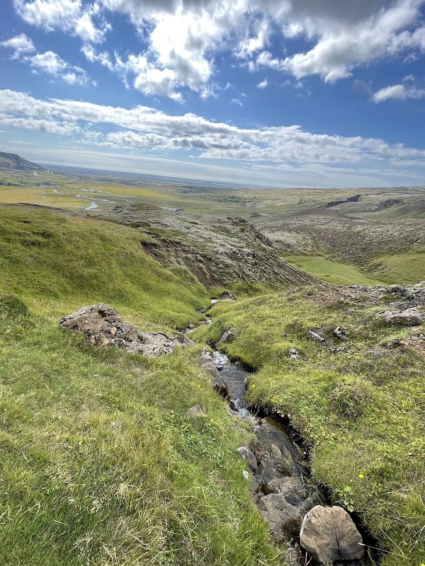
Thingvellir National Park, located near Selfoss in southern Iceland, offers an unparalleled glimpse into nature and history woven together in a dramatic landscape. This remarkable park sits at a rare geological crossroads where the North American and Eurasian tectonic plates meet, creating vast fissures, rocky cliffs, and deep canyons visible throughout the area. The unique geography allows visitors to walk literally between continents, a feature recognized worldwide.

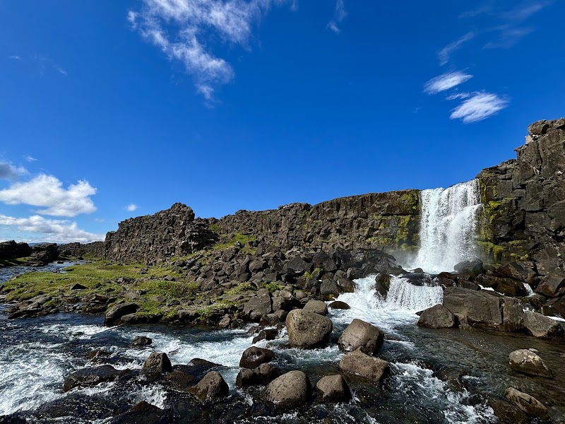
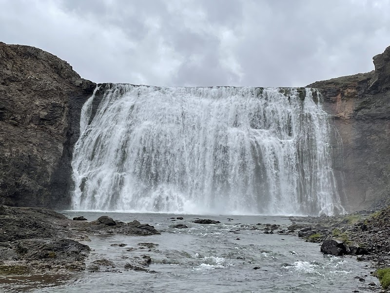
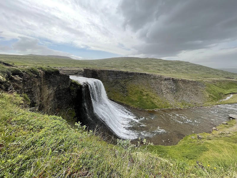
One of the park’s most captivating sights is the Oxararfoss waterfall, flowing over rugged black volcanic rock, adding dynamic movement to the striking terrain. Nearby, clear lakes mirror the imposing mountains and open skies, enhancing the scenic appeal. The surrounding flora, primarily hardy mosses and native wildflowers, adapts beautifully to volcanic soil and offers subtle seasonal colors.

Thingvellir's cultural significance is equally compelling. It was here, in 930 AD, that the Althing was founded—the world’s oldest parliament—which convened on the park’s plains for centuries. Walking these grounds connects visitors with over a thousand years of Icelandic governance and tradition, making the park both a natural and historical landmark.

Visitors praise the accessibility of trails, the clean facilities, and the park’s ability to feel both expansive and intimate. Whether appreciating geology, hiking quiet paths, or soaking in still waters, the site delivers a memorable experience. Its proximity to Reykjavik makes Thingvellir National Park a rewarding day trip for anyone interested in the forces shaping our planet and stories rooted deep in the earth.


Editorial Assessment

Thingvellir National Park scores 93 for its exceptional geological formations and historical significance. Its uniqueness lies in the visible tectonic plate boundaries, combined with rich cultural heritage, making it a must-visit for nature and history enthusiasts. Despite its prominence, it retains a pristine and authentic natural charm.
Thingvellir National Park: Where Continents Converge

Adventure Guide to Thingvellir National Park: Where Continents Converge

1

Hiking the Almannagja Gorge

  • What makes it special:

    Walk through one of the largest visible fissures as the tectonic plates diverge, offering dramatic cliffs and stunning views.

  • Key features:

    Well-marked trails, volcanic rock landscapes, panoramic vistas over the rift valley.

  • Local insight:

    The gorge is part of the Mid-Atlantic Ridge, the only place where this underwater mountain range rises above sea level in Iceland.

  • Visitor tips:

    Best from late spring to early autumn; wear sturdy shoes. About a 45-minute drive from Reykjavik along Route 36.

2

Snorkeling in Silfra Fissure

  • What makes it special:

    Swim or dive between two continents in pristine glacial water with visibility up to 100 meters—one of the clearest waters worldwide.

  • Key features:

    Cold, pure water filtered through volcanic rock; guided tours provide dry suits and equipment.

  • Local insight:

    The water temperature stays around 2–4°C year-round, creating a unique underwater environment.

  • Visitor tips:

    Book guided tours in advance; bring swimwear and a towel. Available year-round, located inside the park.

3

Visiting Oxararfoss Waterfall

  • What makes it special:

    A scenic waterfall cascading over black lava formations, easily accessible on foot near the visitor center.

  • Key features:

    Picturesque cascades with surrounding volcanic cliffs and peaceful hiking paths.

  • Local insight:

    The waterfall is fed by the park’s streams and offers excellent spots for photography and quiet reflection.

  • Visitor tips:

    Arrive early morning to avoid crowds; bring waterproof clothing and a picnic. Parking is available near the trailhead. ---

4

Practical Information

  • Best time to visit:

    Late May to September for hiking and warm weather; winter offers magical snow views but limited access.

  • What to bring:

    Layered clothing, hiking boots, camera, and for water activities, swimwear and dry suits are provided during tours.

  • Getting there:

    Thingvellir National Park is approximately a 45-minute drive northeast of Reykjavik via Route 36. Well-signposted with parking and visitor facilities on site. Thingvellir offers a blend of breathtaking scenery, geological wonder, and rich cultural heritage that makes every visit special.

Reviews

P
P Cin the last week

Great destination! Enjoyed the open trail and peaceful outdoor atmosphere.

R
Rich Dominiakin the last week

Come for the scenery, see the edge of a tectonic plate, and reflect on the 1,000 years of Icelandic history that occurred on this spot.

P
Paul Winterin the last week

Lovely place with tons of history.

L
Lucile Lecontein the last week

Nice park which is limited to 50km/h, it allows you to look at the landscapes including the tectonic plate fault (area with parking to visit).

C
cedric pilonin the last week

High place in Icelandic history. Beautiful family walk of around 6km with varied landscapes and accessible to all.

Nearby Adventures

Bookable Experiences

Three Hours, Reykjavík Light: A Private Photographic Walk from Harpa to Hallgrímskirkja27.2 mi
Reykjavík, Reykjavíkurborg

Three Hours, Reykjavík Light: A Private Photographic Walk from Harpa to Hallgrímskirkja

A 3-hour private photographic tour of Reykjavík led by Photoexploring, focused on iconic landmarks and intimate back streets and tailored to your needs.

27.2 miView Trips & Details →
Reykjavík Under Arctic Light: A Private Polar Night Photography Tour27.4 mi
Reykjavík, Reykjavíkurborg

Reykjavík Under Arctic Light: A Private Polar Night Photography Tour

A three-hour private photography outing around Reykjavík’s harbor and cityscapes that focuses on Arctic light, tailored instruction, and—between late August and early April—the chance to photograph the Aurora Borealis.

27.4 miView Trips & Details →
Chasing Arctic Light: Reykjavík to East Greenland’s Untouched Glaciers27.5 mi
Reykjavík, Reykjavíkurborg

Chasing Arctic Light: Reykjavík to East Greenland’s Untouched Glaciers

A 9‑day guided photography tour beginning in Reykjavík that takes adult photographers to East Greenland’s glaciers, fjords, ice caves and remote settlements.

27.5 miView Trips & Details →
Tórshavn on Tap: Celebrating BeerWalks’ 5th Birthday Through the Streets and Brews of the Faroes472.1 mi
Tórshavn, Streymoyar

Tórshavn on Tap: Celebrating BeerWalks’ 5th Birthday Through the Streets and Brews of the Faroes

A guided city walk in Tórshavn tasting seven beers from OY Brewing and Mikkeller—this guide explains the route, what to expect, and practical details for the 1 April 2026 celebration.

472.1 miView Trips & Details →
Brown Trout on the Machair: Fly‑Fishing South Uist’s Alkaline Lochs658.1 mi
Stornoway, Scotland

Brown Trout on the Machair: Fly‑Fishing South Uist’s Alkaline Lochs

A focused guide to guided fly fishing on South Uist’s shell‑sand machair lochs—what to expect, what to bring, and how the estate’s ghillies and hire kit make the fishing accessible.

658.1 miView Trips & Details →
4x4 Across South Uist: Machair Meadows, White Sands and Gaelic Storytelling665.8 mi
Isle of South Uist, Scotland

4x4 Across South Uist: Machair Meadows, White Sands and Gaelic Storytelling

Half- and full-day 4x4 tours around the Isle of South Uist that combine off-road landscapes, wildlife viewing, Gaelic culture and an optional Hebridean picnic.

665.8 miView Trips & Details →