Chiricahua National Monument
Adventure Destination

Chiricahua National Monument

Explore Chiricahua National Monument's unique rock formations on trails like the Heart of Rocks Loop. This moderately challenging hike offers opportunities for wildlife viewing and nature photography. Best visited in spring or fall, Chiricahua provides a peaceful retreat for hikers and photographers.

Hiking8.9/10Moderate
Photo Gallery

Category

Hiking

Typical Duration

2-4 hours

Difficulty

Moderate

About This Adventure Destination

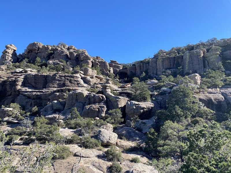
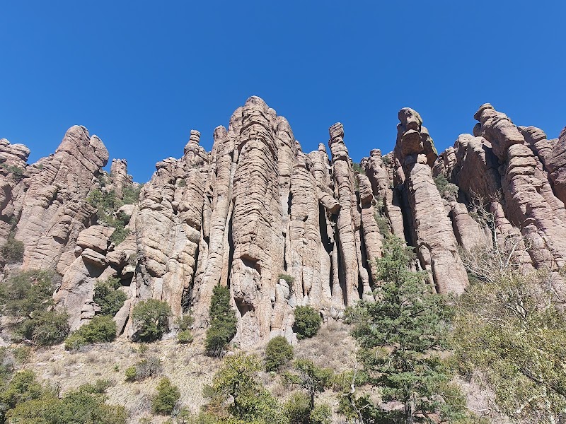
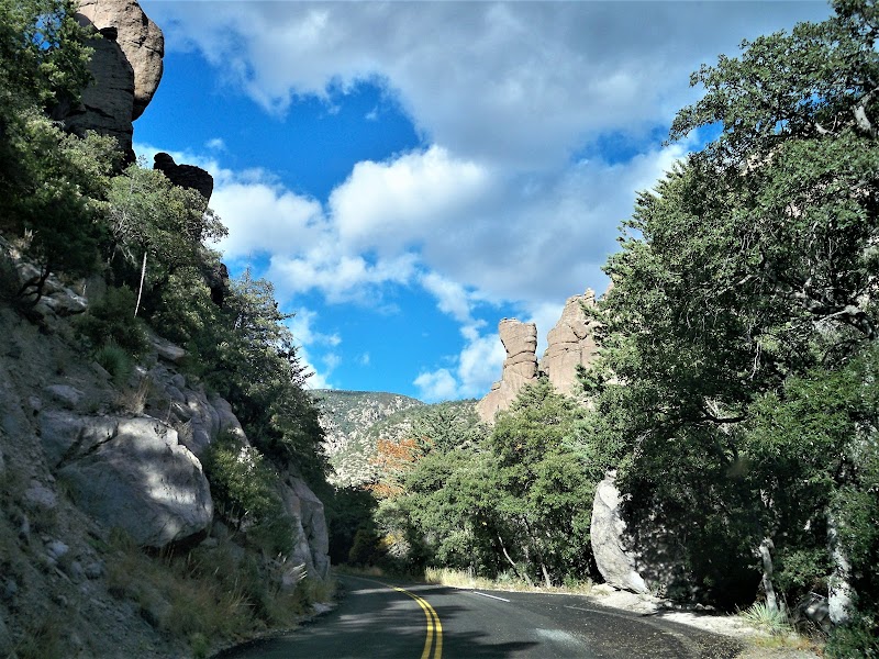
Chiricahua National Monument, located near Willcox in southeastern Arizona, is famous for its towering volcanic rock formations and rich natural diversity. Often called the "Wonderland of Rocks," this monument features dramatic rhyolite spires and hoodoos shaped by volcanic eruptions and erosion over 27 million years. The unique stone pillars create striking silhouettes against the clear Arizona sky, offering one of the most impressive geological landscapes in the region.

Visitors encounter a vibrant mix of ecosystems here, from pine and oak woodlands to grasslands and canyon bottoms. The elevation changes—from about 5,100 to over 7,300 feet—support a broad range of wildlife. White-tailed deer, black bears, and nearly 200 bird species, including the rare elegant trogon and Mexican spotted owl, inhabit this diverse environment. Birdwatchers often find exceptional opportunities to spot rare species against the backdrop of dramatic rock formations.

Historically, the monument preserves the land and heritage of the Chiricahua Apache people, honored through educational exhibits at the visitor center. Just beyond the natural wonders lies the Faraway Ranch Historic District, revealing the life of Swedish immigrants from the late 1800s. This blend of natural beauty and cultural history makes Chiricahua stand apart from other outdoor destinations in Arizona.

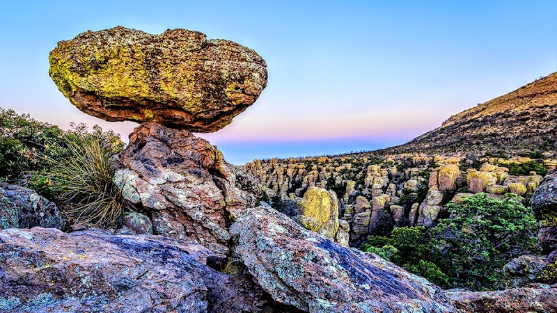
Hiking trails of varying difficulty wind through this 12,000-acre area, with routes like the Echo Canyon and Heart of Rocks loops showcasing the monument’s most iconic features. Whether gazing at balancing rocks along winding paths or catching sunset views from Massai Point, visitors will find unforgettable experiences that combine scenic grandeur and quiet wilderness in Chiricahua National Monument.

Editorial Assessment

**LaunchPad Value:** Chiricahua National Monument scores high for its remarkable geological formations and rich biodiversity. While not as globally recognized as some landmarks, its unique rock spires and historical significance offer a truly special experience for adventurers and nature lovers alike.#Chiricahua #Arizona #Hiking #RockFormations #NationalMonument #NaturePhotography
Chiricahua National Monument

Adventure Guide to Chiricahua National Monument

1

Experience Chiricahua National Monument

  • Special Features:

    Explore Chiricahua National Monument's unique rock formations on trails like the Heart of Rocks Loop. This moderately challenging hike offers opportunities for wildlife viewing and nature photography. Best visited in spring or fall, Chiricahua provides a peaceful retreat for hikers and photographers.

  • Visitor Tips:

    Best time to visit is during Spring and Fall. Bring adequate water, appropriate outdoor gear, and camera.

  • Directions:

    12856 East Rhyolite Creek Road, Willcox, AZ 85643, USA

2

Exploring Near Willcox, Arizona

  • Local Insights:

    Offers direct access to top trails, protected natural reserves, and picturesque viewpoints across Willcox, Arizona.

  • Visitor Tips:

    Check local regulations, trail conditions, and weather before heading out.

3

Photography and Wildlife

  • Special Highlights:

    Watch for native wildlife including Coatimundi, Deer, Various bird species.

  • Visitor Tips:

    Arrive in early morning or late afternoon for the softest lighting and quieter trails.

Reviews

A
Ameeruddin Javid Bashhain the last week

Chiricahua National Monument, located in southeastern Arizona, is an awe-inspiring destination that offers an unparalleled blend of natural beauty, geological wonders, and rich history. Covering an expansive area of 12,000 acres, this "Wonderland of Rocks" captivates visitors with its dramatic rock formations, diverse ecosystems, and fascinating cultural heritage. One of the most striking features of Chiricahua National Monument is its unique rock formations, known as hoodoos. These towering spires and balancing rocks were formed through a complex process of volcanic activity and erosion over millions of years. The rhyolite tuff, a type of volcanic rock, was deposited during a massive eruption approximately 27 million years ago. Over time, the forces of wind, water, and ice sculpted the rock into the stunning shapes that can be seen today. Hiking through the park, visitors are treated to a surreal landscape that seems almost otherworldly. The monument's diverse ecosystems support a wide variety of plant and animal life. The park's elevation ranges from 5,124 to 7,310 feet, resulting in a mix of habitats that include grasslands, oak woodlands, and pine forests. This diversity attracts an impressive array of wildlife, including white-tailed deer, black bears, and a variety of bird species. Birdwatchers will be particularly delighted by the opportunity to spot rare and migratory birds, such as the elegant trogon and the Mexican spotted owl. Chiricahua National Monument also boasts a rich cultural history that adds another layer of intrigue to its natural wonders. The area was originally inhabited by the Chiricahua Apache, a Native American tribe known for their fierce resistance to European settlers. The monument is named in their honor, and visitors can learn about their history and culture at the park's visitor center. Additionally, the park features the Faraway Ranch Historic District, which offers a glimpse into the lives of Swedish immigrants Neil and Emma Erickson, who established a successful cattle ranch in the late 19th century. The ranch buildings and exhibits provide a fascinating look at the challenges and triumphs of early settlers in this rugged landscape. For those seeking outdoor adventure, Chiricahua National Monument offers a wealth of recreational opportunities. The park features a network of well-maintained trails that cater to hikers of all skill levels. The Echo Canyon Loop, a popular moderate hike, takes visitors through narrow canyons and past striking rock formations, offering breathtaking views along the way. For a more challenging trek, the Heart of Rocks Loop provides a closer look at some of the park's most iconic hoodoos. In addition to hiking, the park also offers opportunities for camping, picnicking, and wildlife viewing. Chiricahua National Monument is a true hidden gem that offers a unique and unforgettable experience for nature lovers, history buffs, and outdoor enthusiasts alike. Its captivating landscape, rich biodiversity, and intriguing cultural heritage make it a destination that should not be missed. Whether you're marveling at the otherworldly rock formations, exploring the diverse ecosystems, or delving into the area's history, Chiricahua National Monument promises to leave a lasting impression on all who visit.

D
Dorothy Kowalskyin the last week

Gorgeous

N
Nataliia Kriukovain the last week

Magnificent. Park is free. There is a visitor Center, campground, a good road. There are almost no people on a trail in January. Massai Point overlook during sunset is amazing.

J
Jim Powellin the last week

Great trails with great views.

B
Brady Oliverin the last week

Beautiful park with great hiking.

Nearby Adventures

Bookable Experiences

Tombstone After Dark: Mine Shaft Murmurs and Trolley-Borne Ghost Stories47.3 mi
Tombstone, Arizona

Tombstone After Dark: Mine Shaft Murmurs and Trolley-Borne Ghost Stories

An hour-long evening ghost tour beginning at the Good Enough Mine that combines mine lore, a trolley tour through Tombstone’s haunted sites, and a spine-tingling graveyard finale—this guide explains what to expect and how to prepare.

47.3 miView Trips & Details →
Down the Shaft: A 45‑Minute Descent into Tombstone’s Good Enough Silver Mine47.4 mi
Tombstone, Arizona

Down the Shaft: A 45‑Minute Descent into Tombstone’s Good Enough Silver Mine

A fully narrated, 45-minute walking tour that takes you 100 feet below the streets of Tombstone into an authentic 1880s silver mine—this guide explains what you’ll see and how to plan for the stairway descent and easy underground walking.

47.4 miView Trips & Details →
A Stroll Through Sin and Salt: Tracing Bisbee’s Brewery Gulch from Bordellos to Barstools51.8 mi
Bisbee, Arizona

A Stroll Through Sin and Salt: Tracing Bisbee’s Brewery Gulch from Bordellos to Barstools

A 1.5-hour guided walk through Old Town Bisbee that maps the city’s Bisbee Noir era (1880–1915) and ends with introductions to the town’s present-day saloons—essential context for anyone who wants to read the town’s past in its streets and storefronts.

51.8 miView Trips & Details →
Lutz Canyon: A Miner’s Road Rising Above the San Pedro Valley51.8 mi
Bisbee, Arizona

Lutz Canyon: A Miner’s Road Rising Above the San Pedro Valley

A five‑hour guided hike from old mining roads through pine‑oak and Douglas‑fir stands to the Black Bear Mine—this guide explains what you’ll see and what to bring.

51.8 miView Trips & Details →
Luxury Golf Cart Tour: Riding Bisbee’s Copper-Era Streets51.8 mi
Bisbee, Arizona

Luxury Golf Cart Tour: Riding Bisbee’s Copper-Era Streets

A guided, 1.5-hour golf cart circuit of Old Town Bisbee that traces the town’s rise from a copper strike and mining camp to county seat and post‑mine community—this guide focuses on what you’ll see and why those sites matter.

51.8 miView Trips & Details →
Across the Line: A Motorized Day into Agua Prieta from Bisbee51.8 mi
Bisbee, Arizona

Across the Line: A Motorized Day into Agua Prieta from Bisbee

An eight-hour motorized day trip from Bisbee into Agua Prieta that traces the town’s revolutionary past, industrial present and the contemporary realities of the border — all without a passport.

51.8 miView Trips & Details →