Majestic Marvels: Bonita Canyon Scenic Drive
Adventure Destination

Majestic Marvels: Bonita Canyon Scenic Drive

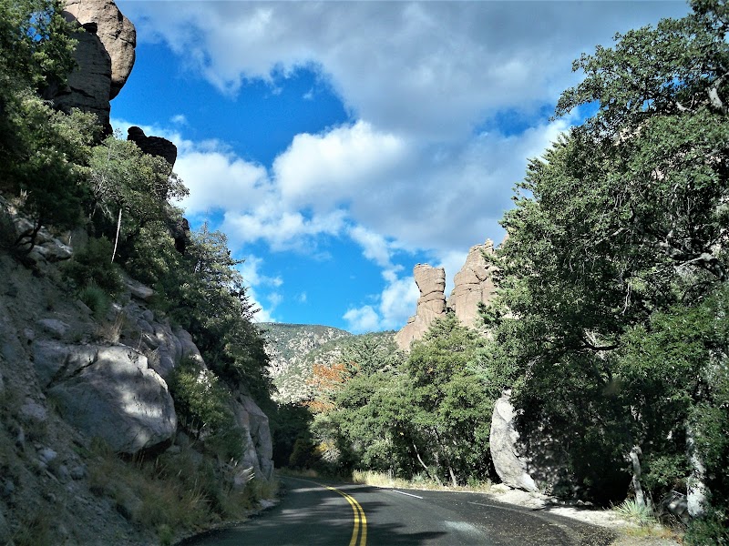
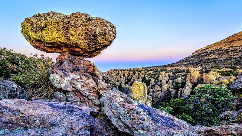
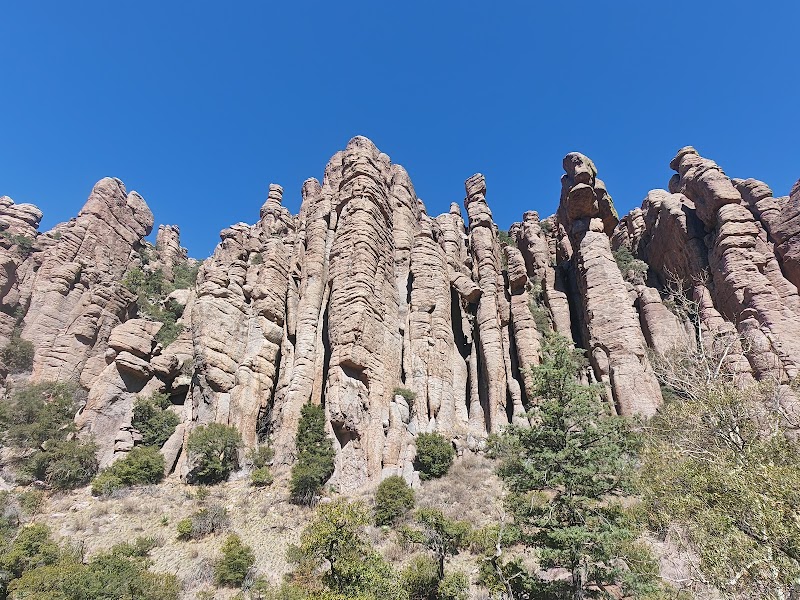
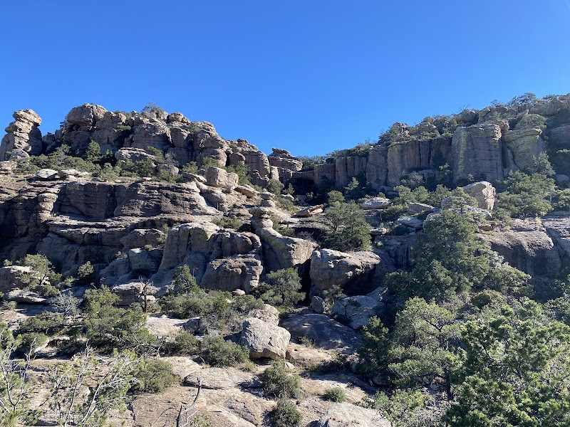
Explore the stunning Bonita Canyon Scenic Drive, located in Chiricahua National Monument, AZ. Enjoy hiking through unique rock formations and exceptional birding. It's an ideal spot for photographers seeking remarkable landscapes and wildlife.

Hiking8.3/10Moderate
Photo Gallery

Category

Hiking

Typical Duration

2-4 hours

Difficulty

Moderate

About This Adventure Destination

Bonita Canyon Scenic Drive, located in the charming Chiricahua National Monument in southeastern Arizona, offers travelers a stunning journey through a surreal landscape. Distinctive for its towering rock formations known as hoodoos, this destination provides an exceptional blend of natural beauty and geological wonder. The vibrant formations are crafted from volcanic tuff and depict fascinating shapes, often likened to statues and various creatures, making it a photographer's haven. The park was established in 1924 and named to honor the Chiricahua Apache tribe, adding a layer of cultural richness. With its high-desert ecosystem, visitors might catch glimpses of local wildlife like javelinas and coatimundis. Whether you're meandering along the drive or embarking on a hiking adventure, Bonita Canyon promises an unforgettable experience, characterized by panoramic vistas and the tranquil allure of the outdoors.

Editorial Assessment

Bonita Canyon Scenic Drive offers unique volcanic rock formations and exceptional hiking trails. It's a stunning natural area that's enjoyed for its geological and scenic diversity, but it's not quite at the pinnacle of global natural landmarks.
Majestic Marvels: Bonita Canyon Scenic Drive

Adventure Guide to Majestic Marvels: Bonita Canyon Scenic Drive

1

Experience Majestic Marvels: Bonita Canyon Scenic Drive

  • Special Features:

    Explore the stunning Bonita Canyon Scenic Drive, located in Chiricahua National Monument, AZ. Enjoy hiking through unique rock formations and exceptional birding. It's an ideal spot for photographers seeking remarkable landscapes and wildlife.

  • Visitor Tips:

    Best time to visit is during Spring and Fall. Bring adequate water, appropriate outdoor gear, and camera.

  • Directions:

    Fort Grant, AZ 85643, USA

2

Exploring Near Willcox, Arizona

  • Local Insights:

    Offers direct access to top trails, protected natural reserves, and picturesque viewpoints across Willcox, Arizona.

  • Visitor Tips:

    Check local regulations, trail conditions, and weather before heading out.

3

Photography and Wildlife

  • Special Highlights:

    Watch for native wildlife including Javelinas, Coatimundis.

  • Visitor Tips:

    Arrive in early morning or late afternoon for the softest lighting and quieter trails.

Reviews

L
Laura Vigila year ago

Great destination! Enjoyed the open trail and peaceful outdoor atmosphere.

W
Walter R8 months ago

A nice scenic drive from the Visitor Center up to the Massai point. We drove up in late afternoon to enjoy a breathtaking sunset.

C
Chris2 weeks ago

Beautiful easy drive up through the canyon. Ample pullouts to stop and admire the wonderful views.

E
Edward Bassa year ago

Amazing views of nature.

G
GRAMSa year ago

Paved road through park with about 4 pull outs on the left-hand side when driving into the park. Narrow passages with many blind curves and wildlife to watch out for.

Nearby Adventures

Bookable Experiences

Tombstone After Dark: Mine Shaft Murmurs and Trolley-Borne Ghost Stories46.3 mi
Tombstone, Arizona

Tombstone After Dark: Mine Shaft Murmurs and Trolley-Borne Ghost Stories

An hour-long evening ghost tour beginning at the Good Enough Mine that combines mine lore, a trolley tour through Tombstone’s haunted sites, and a spine-tingling graveyard finale—this guide explains what to expect and how to prepare.

46.3 miView Trips & Details →
Down the Shaft: A 45‑Minute Descent into Tombstone’s Good Enough Silver Mine46.4 mi
Tombstone, Arizona

Down the Shaft: A 45‑Minute Descent into Tombstone’s Good Enough Silver Mine

A fully narrated, 45-minute walking tour that takes you 100 feet below the streets of Tombstone into an authentic 1880s silver mine—this guide explains what you’ll see and how to plan for the stairway descent and easy underground walking.

46.4 miView Trips & Details →
A Stroll Through Sin and Salt: Tracing Bisbee’s Brewery Gulch from Bordellos to Barstools50.9 mi
Bisbee, Arizona

A Stroll Through Sin and Salt: Tracing Bisbee’s Brewery Gulch from Bordellos to Barstools

A 1.5-hour guided walk through Old Town Bisbee that maps the city’s Bisbee Noir era (1880–1915) and ends with introductions to the town’s present-day saloons—essential context for anyone who wants to read the town’s past in its streets and storefronts.

50.9 miView Trips & Details →
Lutz Canyon: A Miner’s Road Rising Above the San Pedro Valley50.9 mi
Bisbee, Arizona

Lutz Canyon: A Miner’s Road Rising Above the San Pedro Valley

A five‑hour guided hike from old mining roads through pine‑oak and Douglas‑fir stands to the Black Bear Mine—this guide explains what you’ll see and what to bring.

50.9 miView Trips & Details →
Luxury Golf Cart Tour: Riding Bisbee’s Copper-Era Streets50.9 mi
Bisbee, Arizona

Luxury Golf Cart Tour: Riding Bisbee’s Copper-Era Streets

A guided, 1.5-hour golf cart circuit of Old Town Bisbee that traces the town’s rise from a copper strike and mining camp to county seat and post‑mine community—this guide focuses on what you’ll see and why those sites matter.

50.9 miView Trips & Details →
Across the Line: A Motorized Day into Agua Prieta from Bisbee50.9 mi
Bisbee, Arizona

Across the Line: A Motorized Day into Agua Prieta from Bisbee

An eight-hour motorized day trip from Bisbee into Agua Prieta that traces the town’s revolutionary past, industrial present and the contemporary realities of the border — all without a passport.

50.9 miView Trips & Details →