Edge of the Earth: A Traveler’s Guide to Milford Sound

Edge of the Earth: A Traveler’s Guide to Milford Sound

Mitre Peak, constant rain, and whale-sized vistas—how to see Milford Sound well

Continue Reading

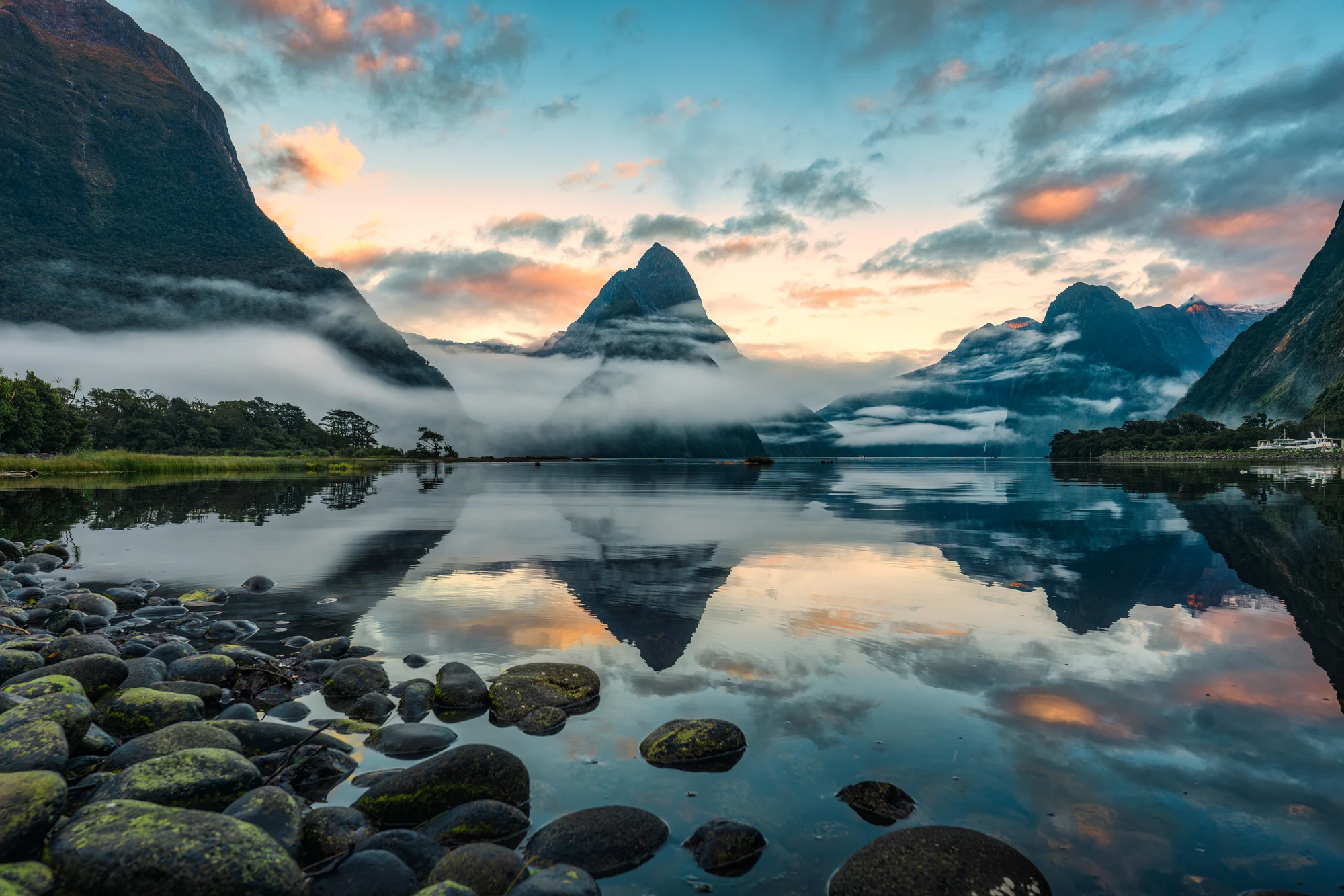
You arrive at Milford Sound like most visitors do—after a long, rutted drive that opens suddenly onto a black mirror of water, a line of mountains slicing the sky. Rain begins with an easy, pervasive hush; waterfalls bloom on bare rock faces as if someone has flicked a switch. Mitre Peak rises so sharply from the fiord it looks like a cathedral spire cleaved from granite. In that cool, wet silence the place feels both colossal and intimate: the mountains press in, the water holds you, and the sky decides the show.

Milford Sound (Piopiotahi in te reo Māori) is the sound that refuses to be tamed. Geologically, it’s a classic U-shaped glacial valley carved deep during repeated ice ages and drowned as sea levels rose. Those glacier-carved walls—steep, black, and covered in rain-fed waterfalls—make Milford feel like a slice of something primeval. The soft, constant percussion of rain here isn’t an inconvenience; it’s the reason the fiord is alive. The average annual rainfall measures in the thousands of millimeters, and that rain is why ephemeral curtains of water—temporary waterfalls—turn the cliffs into animated tapestries after storms.

This is also a place of layered human history. The Māori name Piopiotahi—‘single piopio’—references local legends and the now-extinct songbird whose story is tied to the fiord. Captain James Cook sighted and named it Milford Sound in 1770 after a port in Wales; he thought it was a river mouth. For generations, Fiordland has been a landscape of reverence and subsistence, and today it’s a protected heart of Te Wahipounamu UNESCO World Heritage area.

Why travelers keep coming: Milford is dramatic, accessible, and relentless in its ability to surprise. The classic way to experience it is on the water—a small-boat cruise will thread you up the fiord under cliffs that may throw off spouts of spray or reveal a waterfall you didn’t know was there. The small-boat cruises are intimate: fewer people, more viewpoints, and the chance to glide near seals resting on rock ledges and pods of bottlenose dolphins dancing the bow wake. Operators often craft routes to bring you close to Mitre Peak and the hidden coves, giving you both sweeping vistas and fine-grain details.

For another perspective, the air is unmatched. Helicopter flights depart Milford Sound airport and climb over the divide to alpine lakes, glaciers, and the Tutoko range. Many land briefly on snow or glacier rims—an instant of stillness on a white shelf above the fiord that reframes everything below. If you prefer to keep your feet on the ground, guided private tours from Queenstown or Te Anau offer curated stops—hidden viewpoints, short walks, and local storytelling that explain why Fiordland feels so different from elsewhere.

There’s adventure at every scale. You could kayak the inner reaches on a calm day, float under a spray of a waterfall, and feel the fiord’s immensity from water level. Or you could sign up for a multi-day experience combining Milford with other South Island icons—Mount Cook, Lake Pukaki, or the glowworm caves at Te Anau—if you’re after context as much as spectacle.

Practical edge: Milford is weather-driven. The road—the Milford Road (State Highway 94)—is one of the world’s great scenic drives but can be closed in bad weather. From Queenstown it’s roughly a 4-hour drive each way; from Te Anau it’s about 2 hours. Cruises typically run 1–2 hours for the standard scenic trip, while air experiences range from 30-minute scenic hops to 2-hour combined flights with glacier landings. Book ahead in high season (December–February) and always carry a waterproof shell and warm mid-layer—conditions change fast and often.

Wildlife is part of the draw but also a reminder of responsibility. Bottlenose dolphins and New Zealand fur seals are common; Fiordland crested penguins and blue penguins are seen but rarer. Respect viewing distances and listen to guides—operators follow Department of Conservation rules designed to minimize wildlife disturbance.

Tips that matter when planning: schedule boat cruises for early light to avoid afternoon winds; if you take a helicopter, aim for morning slots when cloud tends to be lower and visibility clearer; pick a small-boat operator if you want photographic flexibility and quieter cruising; and if rainy days are part of your trip, embrace them—the waterfalls, moss, and alpine streams are at their most cinematic after storms.

Milford Sound is not a checklist item; it is a place that asks for attention. Whether you come by road, boat, or air, you’ll find different scales of drama—close-up waterfalls and far-off peaks—that reward those who linger. Plan practically, pack for weather, and leave time to sit on the prow while the world recalibrates to the rhythm of rain and rock.

Duration2–6 hours (varies by activity)
Plan your visit

Trail Wisdom

Dress for rain and wind

Bring a waterproof shell and warm mid-layer; drizzle can become a downpour in minutes and the spray from waterfalls chills quickly.

Book small-boat cruises for better photos

Limited-passenger cruises allow closer views of seals and waterfalls and more flexible photo stops than large ferries.

Plan transport realistically

Allow 4+ hours from Queenstown and 2 hours from Te Anau; check road closures and fuel up in Te Anau before heading in.

Morning flights are steadier

Helicopter and scenic flights often have calmer conditions in the morning; book early slots for the clearest views.

Local Knowledge

Hidden Gems

  • Harrison Cove viewpoints (less visited, great for intimate waterfall views)
  • Lake Ada and the lower Milford Track entry—serene spots along the route

Wildlife

bottlenose dolphins, New Zealand fur seal

Conservation Note

Fiordland is a protected World Heritage area—visitors should stick to marked paths, avoid disturbing wildlife, and support DOC-accredited operators to minimize impact.

Named Milford Sound by Captain Cook in 1770, the Māori name Piopiotahi references a local legend about the piopio bird and gives cultural context to the landscape.

Seasonal Guide

spring

Best for:waterfall displays, early-season clarity
Challenges:variable weather, cooler temperatures

Spring brings swelling waterfalls from snowmelt and fewer crowds than summer; layers and waterproofs are key.

summer

Best for:long daylight for photography, all access to tours
Challenges:more visitors, occasional afternoon winds

Summer is the most popular season with warmer temperatures and reliable services—book cruises and flights well ahead.

fall

Best for:softer light, quieter trails
Challenges:shortening days, increasing rainfall

Autumn light is excellent for photography and the roads are less crowded, but expect changeable weather and early dusk.

winter

Best for:snow-capped peaks, dramatic storms
Challenges:road closures, short daylight hours

Winter offers stark alpine contrasts and glacier views from flights, but some services reduce schedules and road conditions can be challenging.

Photographer's Notes

Use a wide-angle lens to capture Mitre Peak and the fiord’s scale, and bring a polarizer to reduce reflections and deepen foliage. For waterfalls, use a slightly slower shutter (1/15–1/60s on a stabilized platform) to add flow; bracket exposures for high-contrast scenes. Morning light or post-storm skies often create the best color and drama. Note: drone use is restricted—check local rules and permits.

What to Bring

Waterproof shell jacket

Essential

Keeps you dry and windproof during unpredictable showers and boat spray.

Warm mid-layer (fleece or insulated jacket)

Essential

Temperatures feel colder near the water and wind-chill is common—insulation matters.

Sturdy waterproof hiking shoes

Essential

Good traction and waterproofing help on wet viewpoints and short walks.

○

Camera with wide-angle lens and polarizer

Wide-angle captures the scale; a polarizer helps manage reflections and deepen skies.

Common Questions

What is the best way to experience Milford Sound?

A small-boat cruise is the most common and intimate way to see waterfalls, seals, and Mitre Peak; combine with a scenic flight for a contrasting aerial view.

How long does the drive take from Queenstown?

Expect roughly 4 hours one way under normal conditions; allow extra time for photo stops and weather-related delays.

Are helicopter landings safe and worthwhile?

Yes—licensed operators follow strict safety and weather protocols; glacier or alpine landings offer unique perspectives but are weather dependent.

Can I kayak Milford Sound?

Yes—guided kayaking trips run in sheltered conditions; solo kayaking is not recommended due to rapidly changing weather and tide currents.

Will I see wildlife on a cruise?

Common sightings include bottlenose dolphins and New Zealand fur seals; penguins are occasional—wildlife sightings are never guaranteed.

Is Milford Sound accessible year-round?

Yes, but services and road access can be affected by weather—check the NZ Transport Agency and tour providers for current conditions.

What to Pack

Waterproof shell (rain is frequent), warm mid-layer (for wind-chill), waterproof hiking boots (wet terrain), camera with polarizer (to capture scale and reduce glare).

Did You Know

Milford Sound receives an average annual rainfall of roughly 6,400 mm (about 250 inches), which fuels the dramatic waterfalls that appear on its cliffs after storms.

Quick Travel Tips

Check Milford Road conditions before departure; book boat and flight experiences well in advance in summer; fuel and supplies in Te Anau—not at Milford; carry layered clothing and waterproof protection.

Local Flavor

Piopiotahi’s Māori heritage is reflected in place names and stories shared by local guides; regional seafood and hearty Southland fare in Te Anau and Queenstown complement an outdoor itinerary—think smoked salmon and freshly caught fish.

Logistics Snapshot

Nearest hubs: Te Anau (2 hours) or Queenstown (4 hours). Typical cruise: 1–2 hours. Helicopter flights: 30–120 minutes. Bookings: essential in summer. Road: State Highway 94—check for closures and single-lane bridges.

Sustainability Note

Choose DOC-accredited operators, avoid feeding or approaching wildlife, and stay on designated routes—Fiordland’s ecosystems are fragile and recovery from disturbance is slow.

Topics