
Iron Horse Regional Trail wilderness guide
Regional Trail · CA

Iron Horse Regional Trail

Iron Horse Regional Trail is a popular multi-use trail stretching over 30 miles across Contra Costa and Alameda counties, offering walking, biking, and equestrian access along a rail corridor through urban and natural landscapes.

Regional TrailApprox. 500 acres of corridor and adjacent open spaces4+ Trails

Designation

Regional Trail

Total Wilderness Area

Approx. 500 acres of corridor and adjacent open spaces

Elevation / Terrain

Diverse Wilderness

Field Editorial Guide

About Iron Horse Regional Trail

Iron Horse Regional Trail is a popular multi-use trail stretching over 30 miles across Contra Costa and Alameda counties, offering walking, biking, and equestrian access along a rail corridor through urban and natural landscapes.

Wilderness Landscape & Natural Heritage

The Iron Horse Regional Trail follows the former Southern Pacific Railroad right-of-way, running approximately 32 miles from the city of Concord in Contra Costa County through Livermore Valley and ending near Pleasanton in Alameda County, California. The trail traverses a variety of environments including urban centers, parks, wetlands, and open space preserves, providing a transportation corridor and recreational route for cyclists, hikers, joggers, and equestrians. The trail infrastructure mainly consists of paved and crushed gravel surfaces, making it accessible to people of all ages and abilities. Many sections run alongside creeks and small lakes, providing habitat for local wildlife such as herons, ducks, and other bird species. Along the route are numerous trailheads, parks, and points of interest, including Iron Horse Park in Concord, the Black Diamond Mines Regional Preserve near Antioch, and various community parks and open spaces. The trail acts as a vital green corridor linking neighborhoods, transit stations, schools, and shopping areas, encouraging active transportation and outdoor recreation in a heavily developed region. In addition to daily recreational use, the trail hosts community events like fun runs, charity rides, and guided nature walks. The well-maintained route also connects to other regional trails and park systems, offering extended outdoor experiences. Visitors appreciate the blend of suburban and natural landscapes, safe travel separated from motorized traffic, and amenities such as benches, restrooms, and water fountains at various points along the path.
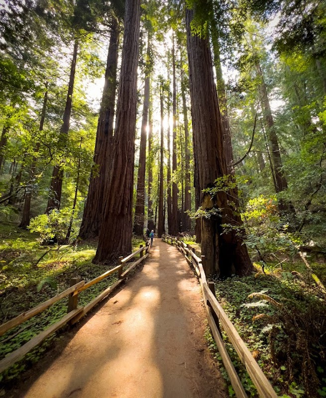
Field Guide · Regional Trail
Adventure Destinations

Notable Destinations Near Iron Horse Regional Trail

Scenic viewpoints, outdoor landmarks, and notable points of interest within 60 miles.

Key Wilderness Highlights

✦ Iron Horse Trail Downtown Concord Trailhead with interpretive exhibits✦ Wildlife viewing opportunities along the trail sections near Mulberry Creek and Shadow Cliffs✦ Connectivity to the Black Diamond Mines Regional Preserve✦ Equestrian facilities and designated horse trail sections in Diablo Foothills area
Wilderness Recreation

Outdoor Adventures in Iron Horse Regional Trail

Explore curated guides for top outdoor sports, trail networks, and wilderness activities.

Park Recreation

Hiking

Available in Iron Horse Regional Trail
Park Recreation

Mountain Biking

Available in Iron Horse Regional Trail
Park Recreation

Equestrian Riding

Available in Iron Horse Regional Trail
Park Recreation

Running

Available in Iron Horse Regional Trail
Park Recreation

Birdwatching

Available in Iron Horse Regional Trail
Park Recreation

Photography

Available in Iron Horse Regional Trail
Park Recreation

Commuting

Available in Iron Horse Regional Trail
Park Recreation

Dog Walking

Available in Iron Horse Regional Trail
Park Recreation

Skateboarding

Available in Iron Horse Regional Trail
Park Recreation

Inline Skating

Available in Iron Horse Regional Trail
The Ranger Station

Visitor Logistics & Essential Planning

Everything you need to know about entrance passes, seasons, visitor centers, road transit, and wildlife safety in Iron Horse Regional Trail.

Passes & Fees

Entrance Requirements & Interagency Passes

Free public access with no permits or fees required

Wilderness Checklist

Carry paper topographic map & compass in remote zones.
Store all food and scented items in approved bear canisters.
Check wildfire / smoke advisories before backcountry departure.
Pack out everything you pack in (Leave No Trace).
Adventure Basecamps

Gateway Towns Near Iron Horse Regional Trail

Stay, dine, and gear up in these mountain towns and scenic basecamps surrounding the park.

Danville, California
⌖ 3.37 miles
Gateway Basecamp

Danville, California

Danville offers peaceful open spaces, scenic hiking and biking trails, and family-friendly parks. Enjoy access to Mount Diablo, local preserves, and classic small-town charm for outdoor adventures year-round.

Spring through Fall
Explore Town
Alamo, California
⌖ 5.15 miles
Gateway Basecamp

Alamo, California

Alamo, California offers easy access to hiking, biking, and trail running in nearby Mount Diablo and East Bay regional parks. Ideal in spring and fall, it’s a calm suburban gateway to scenic outdoor adventures and panoramic summit views.

Spring and Fall
Explore Town
Walnut Creek, California
⌖ 7.89 miles
Gateway Basecamp

Walnut Creek, California

Walnut Creek offers a perfect mix of outdoor adventure and small-town comfort. From mountain biking local parks to hiking Mount Diablo’s summit trails, enjoy outdoor excursions year-round just minutes from town.

Spring through Fall
Explore Town
Dublin, California
⌖ 9.20 miles
Gateway Basecamp

Dublin, California

Dublin, California offers easy access to rolling hills, multi-use trails, and regional parks ideal for hiking, biking, and bird watching. Enjoy panoramic Bay Area views, welcoming picnic spots, and year-round outdoor fun near the heart of the East Bay.

Spring through Fall
Explore Town
Moraga, California
⌖ 10.16 miles
Gateway Basecamp

Moraga, California

Moraga is a quiet East Bay town with a friendly outdoor scene for hiking, mountain biking, and picnicking. Surrounded by Briones Regional Park, it offers peaceful trails and scenic views perfect for relaxed adventures year-round.

Spring through Fall
Explore Town
Pleasant Hill, California
⌖ 10.17 miles
Gateway Basecamp

Pleasant Hill, California

Pleasant Hill offers easy access to parks and trails ideal for hiking, biking, paddling, and bird watching. Located in Contra Costa County, it’s a convenient base for exploring scenic outdoor areas from spring through fall.

Spring through Fall
Explore Town
Expert-Led Wilderness Expeditions

Guided Experiences in Iron Horse Regional Trail

Explore scenic backcountry routes and epic wilderness adventures with certified local mountain guides, naturalists, and outfitters.