The Adventure Collective Journal · Regional guide

Utah Canyon Country & Colorado Rockies

Red-rock mornings, river days, and a mountain alternative: choose your base before you chase the horizon.

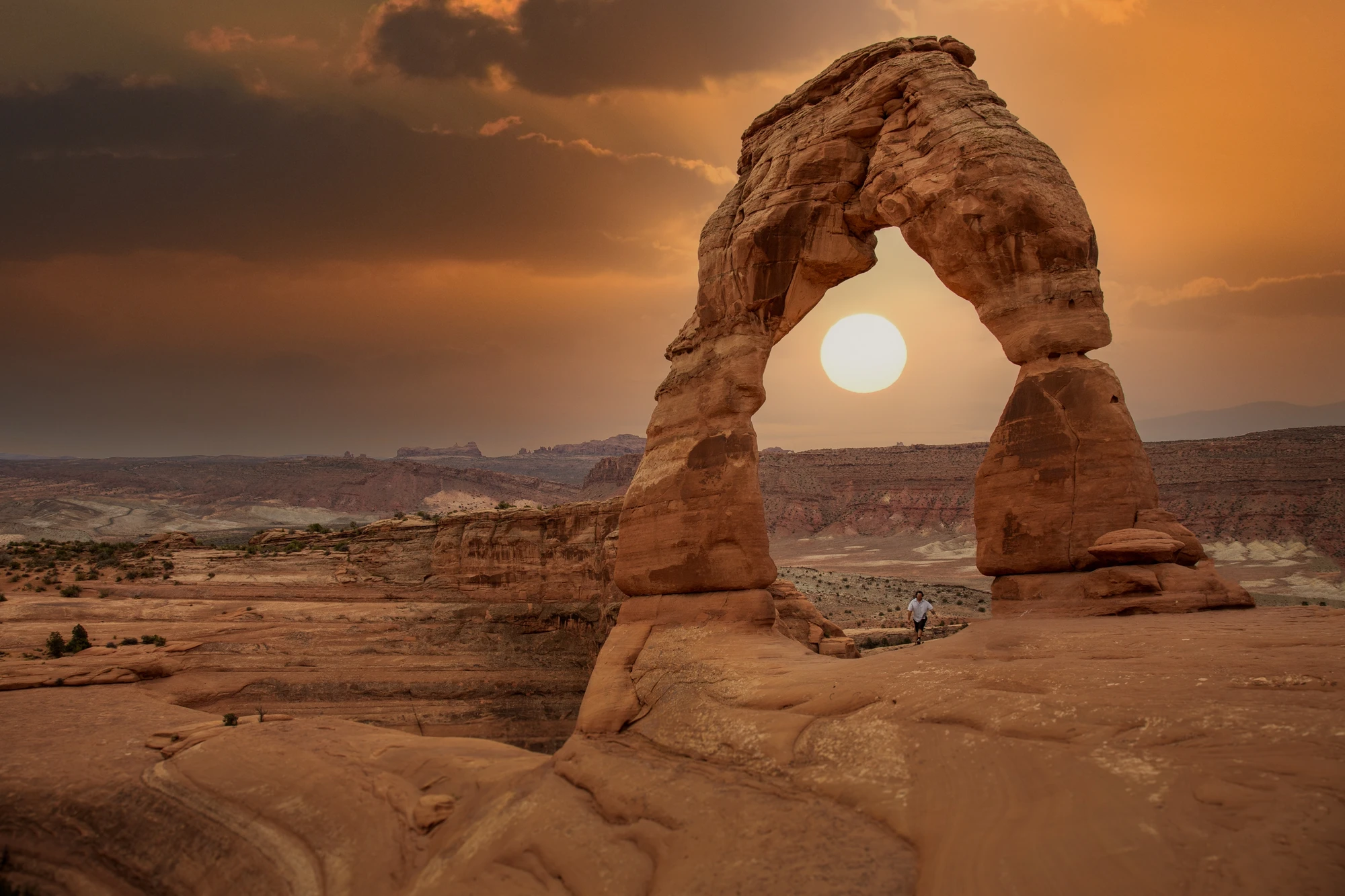
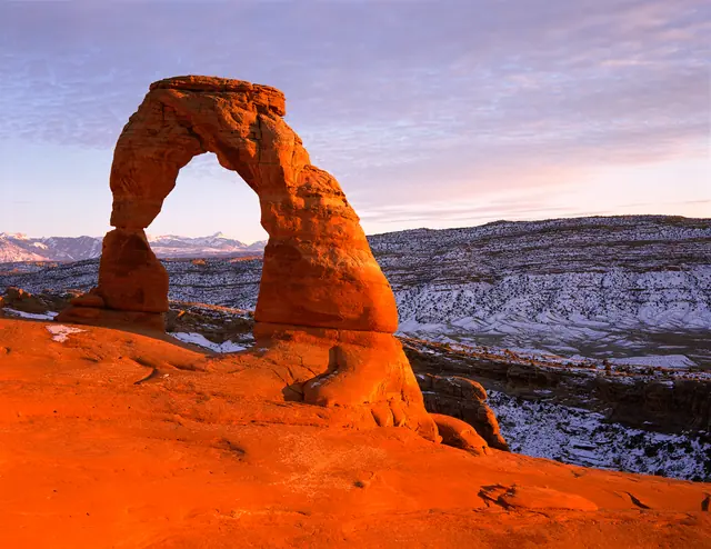
Delicate Arch in winter, Arches National Park near Moab, Utah.
Delicate Arch in winter, Arches National Park near Moab, Utah. · Photo: NPS Photo / Neal Herbert

A little less driving. A little more time outside.

The temptation is to draw one enormous loop. Put a finger on Moab, sweep across to Durango, drop down to Page, and congratulate yourself on a trip that contains arches, alpine country, and a slot canyon. On a screen, it looks efficient. On the ground, it spends your most useful hours moving between places that deserve very different kinds of attention.

This is a region for choosing a rhythm. Around Moab, the day works outward from sandstone: an early walk, a long view over the Colorado Plateau, perhaps an afternoon arranged around the river. Durango changes the ingredients to forest, an in-town river corridor, and the higher country of the San Juan Mountains. Page, Arizona, puts Horseshoe Bend and Navajo-guided Antelope Canyon visits within a different travel plan altogether.

The broad regional name connects those possibilities; it does not make them neighbors. For a first three-day visit, settle in Moab and let the landscape get bigger while your daily radius stays sensible. Come back for Durango when the mountains are the purpose, or build a separate Page stay around the canyon visit you actually want. The best souvenir here may be the list of things you deliberately left for another trip.

Choose where to linger

Choose a base, then settle in.

Moab is in southeastern Utah; Durango is in southwestern Colorado; Page is in northern Arizona. These are separate trip bases, not stops on the three-day itinerary below.

01

Moab

Moab: the red-rock starting point

Choose Moab for a first encounter with Arches, Island in the Sky, and the Colorado River corridor. It lets you alternate close-up sandstone walks with the immense, layered views of Canyonlands without moving accommodation each night. Give each park a clear job in the itinerary: Arches for individual formations; Island in the Sky for the larger canyon landscape. The Needles is another worthwhile Canyonlands choice, but it has its own approach road and deserves its own day. No roads connect the park’s districts internally. Moab works best when you stop treating every nearby name as an obligation.

02

Durango

Durango: a mountain trip with a gentle first day

Choose Durango when you want the San Juan Mountains to drive the trip. Start with the Animas River Trail to find your bearings, then consider a day walk from Junction Creek on the Colorado Trail. The opening stretch follows the creek before the route climbs; an out-and-back lets the group choose its turnaround instead of inheriting a summit deadline. Higher-elevation ambitions need separate checks for snow, road access, weather, and your response to altitude. Durango is an alternative base with its own possibilities, rather than an alpine excursion squeezed into a Moab weekend.

03

Page

Page: northern Arizona, with a reservation-led plan

Page belongs to northern Arizona, near the Utah border. Build a stay here around Horseshoe Bend and, if desired, an Antelope Canyon tour arranged with a Navajo Nation-authorized operator. Antelope Canyon is on Navajo land, and guided access is mandatory; it is not an independent hike to improvise after breakfast. Different canyon tours have different physical demands, including stairs or ladders on some routes. Ask the operator about the exact route before booking. Horseshoe Bend is a separate visit with an exposed desert approach, not an automatic cool-down after a slot canyon.

Ways into the landscape

Red rock. River days. A mountain alternative.

01

Meet the arches on foot

At Arches, the Windows area offers several formations in one compact area, making it a useful introduction before committing to a bigger hike. Delicate Arch is a different undertaking: the National Park Service lists a three-mile round trip with 480 feet of ascent. Its famous outline does not cancel the exposed approach or the need to judge heat and ice. Choose a principal walk for the day and enjoy it properly. A photograph is a poor reason to exhaust the group before lunch.

02

Read Canyonlands from above

Island in the Sky is the natural first Canyonlands district for this itinerary. Use the overlooks to understand how much country lies below the rim, then choose a trail rather than collecting every pullout. Mesa Arch is a short walk with uneven rock and steps, ending beside a cliff-edge formation. Grand View Point offers a longer rim walk. Neither length nor an “easy” label removes the need to watch footing. The reward is scale: roads and rock benches shrink until the landscape seems to have acquired another dimension.

03

Let the Colorado River set the pace

For a change from walking on hot rock, investigate a guided trip on the Moab Daily, also called the Fisher Towers section of the Colorado River. The BLM describes a river reach whose rapids change with season and water level. Ask the outfitter about present conditions, swimming expectations, minimum ages, and the exact stretch before deciding whether it suits your group. River trips are their own activity, with equipment and logistics, rather than a guaranteed easy option between hikes.

04

Trade a checklist for one bike ride

Dead Horse Point State Park has a mountain-bike trail network as well as canyon viewpoints. If riding is the point of your visit, make it the day’s main event and select a route with current park advice and an honest account of your experience. Hiking fitness and technical bike handling are different skills. A rented bike does not supply the latter. Keep time for breaks, navigation, and a turnaround; the scenery does not become better because the loop becomes longer.

05

Find a quieter scale in the forest

Junction Creek offers a useful counterpoint to canyon rims: a trail that begins beside water and lets you decide how far to continue. Use a current Forest Service map, confirm access, and turn back with enough energy for the return. Pair it with time along the Animas River in town instead of rushing straight to the highest trailhead. For a first mountain day, discovering how the group feels is a productive outcome.

06

See a slot canyon on its own terms

An Antelope Canyon visit begins with the Navajo Nation’s approved operator list. Book the canyon and access arrangement that suit your party, and follow the guide’s instructions rather than treating the visit as an unrestricted photo session. Leave flexibility for weather-related changes. Nearby Horseshoe Bend delivers a very different perspective, with the river far below an open overlook. Give both places attention, water, and time instead of assuming that two celebrated names make one effortless outing.

A suggested journey

Three days in Moab

Three full days, returning to the same Moab base each night. Durango and Page are separate trip options.

  1. Day 1

    Arches, with room to stop

    Make Arches the only major objective. Begin with the Windows area for an introduction to the shapes and spaces that define the park. If Delicate Arch is your priority, reverse that order and give the hike the cooler part of the day; do not stack both into a rigid morning schedule. Use viewpoints or shorter walks afterward according to energy, temperature, and parking. Return to Moab for a proper break. In cooler conditions, a later outing can work, but it should be a choice rather than an unpaid debt to the itinerary.

    Stay in Moab, Utah.
  2. Day 2

    Island in the Sky, at landscape scale

    Head to Canyonlands’ Island in the Sky district and stay with that district. Combine Grand View Point Overlook with a selected rim walk, or choose Mesa Arch if the uneven approach suits the group. For a lower-exertion day, build around viewpoints instead. Carry lunch and your water so the day is not organized around finding services. Dead Horse Point can be an optional final stop if conditions and energy make it sensible; skip it without regret if you have already had a full day. Return by the paved approach rather than treating a backcountry road as a shortcut.

    Stay in Moab, Utah.
  3. Day 3

    Choose the river or the bike

    Give the last day one main adventure: a guided Colorado River trip, or a planned mountain-bike outing at Dead Horse Point. Make that choice before the trip so you can ask the relevant operator or park the right questions. If weather or conditions cancel the activity, use the day to revisit a favorite paved-access viewpoint when safe, rather than improvising an unfamiliar canyon route. Leave time to pack, eat, and enjoy Moab without watching the clock. This is deliberately a three-day stay, not a launchpad for a late drive to another state.

    Stay in Moab, Utah.

Plan for the elevation

Plan for the season and the landscape.

Spring

Aim for desert walking, keep mountain plans flexible

Spring is a strong starting point for a Moab trip, though popular weather also attracts visitors. Layers matter: a comfortable afternoon does not tell you much about the next morning. Treat high-country plans near Durango separately; seasonal forest-road access and lingering snow can limit where a map says you can go. Choose the actual trail after checking conditions.

Summer

Build around heat and thunderstorms

Desert summer can make strenuous daytime walking a poor choice. Move effort into cooler hours, include a real indoor break, and be willing to drop a hike. Mountains offer a different forecast, not a weather exemption: thunder calls for shelter, and exposed ridges are no place to wait it out. Storm forecasts also matter for narrow canyons around Page, even when the sky overhead looks reassuring.

Fall

A useful desert window with shorter margins

Fall brings another popular walking season around Moab. Plan for cooler evenings and protect the daylight you need to get back. For Durango, treat a high-country outing as conditional on the latest forecast and road information. A date on the calendar cannot promise an open road or a snow-free trail.

Winter

Trade distance for conditions you can manage

Red rock does not mean winter-free travel. Snow or ice can make desert trails and roads difficult, and even a short viewpoint walk may need a different plan. Around Durango, seasonal closures change the mountain-access picture. Favor verified open routes, allow extra flexibility, and avoid transferring a summer itinerary unchanged into winter.

Make the trip work

Plan the details that matter.

Check the rule for your travel year

Checked October 16, 2026: Arches does not require advance timed-entry reservations for 2026. An entrance pass is still required, and the park’s announcement retains reservations for Devils Garden Campground and Fiery Furnace hikes. This is dated guidance, not a promise for future seasons. Check the current NPS requirements before traveling. Arriving without a timed ticket does not guarantee an empty entrance lane or a parking space.

Treat roads and districts as real constraints

Canyonlands’ districts have separate approaches. The paved route to Island in the Sky is not interchangeable with the park’s backcountry roads, where vehicle requirements, permits, and rapidly changing conditions matter. Check road status rather than accepting a navigation app’s shortcut. For Durango, check Forest Service seasonal road information and the forecast for your intended elevation, not only the town.

Plan access at the level of the actual route

NPS identifies Buck Canyon, Green River, and Grand View Point overlooks as wheelchair-accessible; that does not describe the full trails beyond them. At Arches, only the initial portion of the Windows trail is barrier-free, while Double Arch has slopes and sand near its end. Horseshoe Bend has a hardened accessible approach but little shade. Check current surface and facility information against your needs before choosing a route.

Let weather veto the plan

Carry water, food, sun protection, layers, and offline navigation, and leave your route with someone. Stay out of narrow canyons when storms or flash floods are forecast; rain does not have to be falling where you stand. Mountain thunder is a reason to reach safe shelter. On desert walks, stay on established routes and protect biological soil crust. The landscape can absorb your attention without absorbing the consequences of a shortcut.

Before you settle on a plan

A few useful questions.

Can I see Moab, Durango, and Page in this three-day trip?

Choose one base. The itinerary here uses three full days in Moab; Durango and Page are alternatives for another stay. Linking all three needs additional travel days and a plan built around those transfers.

Which Canyonlands district fits a first Moab visit?

Island in the Sky fits this route. The Needles is a separate day-trip choice, with a different approach road. Do not plan to drive between districts inside the park.

Can I enter Antelope Canyon on my own?

No. Navajo Nation Parks & Recreation requires guides for Antelope Canyon locations. Select an authorized operator and confirm the particular tour’s access requirements.

Before you go

Check the day’s conditions.

Check current park requirements, road and trail conditions, and the forecast before each outing. Reservations and seasonal schedules can change.

Keep the essentials simple.

  • Check official access information for your travel dates.
  • Choose routes for your group’s mobility, experience, and the day’s conditions.
  • Leave room to change plans when weather or access changes.
Sources & editorial scope

Research checked 2026-10-16. This is a sourced planning guide, not a live access report or firsthand account. The itinerary stays in Moab; Durango and Page are separate options.