Rainforest Roads: Private Wilderness Tour in Highlands, NC

Rainforest Roads: Private Wilderness Tour in Highlands, NC

A two-hour, all-ages backroad escape from Highlands—big views, river gorges, and easy walks without the heavy hiking.

Continue Reading

Mist lifts off the ridgelines as Highlands wakes, a small mountain town perched at 4,100 feet like a lookout post above the Nantahala Temperate Rainforest. The road noses past rhododendron and laurel so dense they seem to lean in, curious, as your guide swings the truck onto a forest service spur and the pavement yields to gravel. The mountains don’t shout here—they whisper. Water threads the slopes in a hundred voices: seeps, rills, creeks, and finally the Chattooga, rolling cold and insistent. It nudges the gorge walls and dares you to lean closer. This is a two-hour window into an ancient landscape, a private driving tour with easy, optional walks that makes the wild feel close, but not out of reach.

Locals call it the Ellicott Wilderness and Blue Valley circuit, a choose-your-own-adventure from Highlands that trades highway miles for backroads and overlooks. You start in town, then slip south toward the state line where Georgia and the Carolinas stitch themselves together. The guide points out slickrock shelves along the river, the pitted bowls at Iron Bridge where water has carved potholes into solid stone, and the blue haze that gives the valley its name, a cocktail of humidity and terpene-rich exhalations from the forest. This country is lush because the sky works overtime here; orographic lift wrings more than 80 inches of rain a year from passing systems, making this one of the wettest corners in the eastern United States.

The truck hums along and the forest plays tour director. Hemlocks stand like stern teachers, tulip poplars raise straight-backed columns, and rhododendron tunnels fold into cool shade even at noon. The road narrows and suddenly the horizon opens—shoulders dip, eyes widen. Blue Valley steps away in ridges, each paler than the last. Somewhere beyond those folds sits the tri-state boundary, marked by Ellicott Rock, a chiseled stone set in 1811 by surveyor Andrew Ellicott to settle a long-running dispute between North Carolina, South Carolina, and Georgia. History hides in plain sight here, etched into granite and guarded by the river.

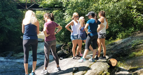
The Chattooga has a reputation, but it’s not a bully. Designated a National Wild and Scenic River in 1974, it keeps its corridors quiet—no bridges for long stretches, no houses peeking between trees. The current doesn’t nag; it nudges. On this tour, the river is a companion, the kind that reminds you to breathe when you step onto the Iron Bridge and watch sunlight fracture across riffles. Even those who aren’t hikers can feel the pull of trails like Slick Rock, short and soft underfoot, leading to boulder gardens and glimmering pools. You won’t rack up miles today. You’ll collect moments.

Highlands itself is a study in contrasts: white-tablecloth dining and trail mud under the same roof. When the summer crowds come for cool air, the mountains shrug off the heat. When fall paints the hillsides, overlooks like Blue Valley become theater seats for a show that starts slow and crescendos week by week. Winter strips the canopy, revealing long-distance views and sculptural branches; spring floods the understory with blooms. The tour leans into those seasons, pacing the route to the light—morning sun setting valleys aglow, late afternoon laying warm tones across granite and water.

This is an adventure with guardrails: private, guided, and comfortable, perfect for families, multi-generational groups, or anyone easing into the Southern Appalachians. It’s also a photographer’s gift. Your guide knows the pull-offs that frame layers of peaks and the angles where slickrock shines. Bring a polarizer to cut glare on the river and make greens pop. Bring patience, too—the forest likes to pose when the wind pauses and a warbler decides your lens looks friendly.

If you want a deeper primer, explore private wilderness tours in Highlands that focus on the region’s geology, botany, and conservation. Guides here speak the language of the land: the way granite domes shed water, why salamanders thrive (this region is a global hotspot), how a temperate rainforest ends up on an Appalachian ridge. They’ll translate the murmurs of the woods so you leave with more than pictures—you’ll leave with context.

Practically speaking, this two-hour tour is mostly driving with short, optional strolls to viewpoints and river edges. Wear sturdy shoes and long pants; rhodo thickets appreciate a respectful distance, and slickrock can be, well, slick. Pack a light rain jacket year-round—clouds build quickly when the ridges tug at sky. Bring water, a snack, and a curious eye. The roads are winding, but the pace is easy. The goal is not speed; it’s immersion.

The best time to go? Fall edges ahead for color and crisp air, but summer’s verdant canopy is a deep breath in plant form. Spring dazzles with wildflowers, and winter trades greenery for far-reaching views and quiet forest roads nearly to yourself. Early and late tours tend to catch the best light and the calmest pull-offs; midday works fine, but the forest prefers mornings and evenings.

You’ll finish back in Highlands, powerlines replaced by church steeples and clapboard storefronts. The truck door closes with a satisfying thunk and the rainforest hush dims to a murmur. The mountains don’t mind letting you go. They know you’ll be back. And when you are, consider another lap with a different focus—maybe a Highlands private scenic tour tuned to waterfalls or wild history. The forest will remember your footprints. It always does.

Duration2 hours
Plan your visit

Trail Wisdom

Dress for a rainforest

Orographic lift makes Highlands wet—pack a light rain jacket and quick-dry layers even when the forecast looks friendly.

Footing matters at overlooks

Wear grippy shoes for short walks to slickrock and viewpoints; roots and damp granite can be slick year-round.

Beat the curves

Backroads are winding; if you’re motion sensitive, sit up front and consider a non-drowsy remedy before departure.

Plan for photos

Bring a circular polarizer and a microfiber cloth—river glare and mist are common, but the right setup makes colors pop.

Local Knowledge

Hidden Gems

  • Blue Valley Overlook at golden hour for layered ridgelines
  • Potholes beneath Iron Bridge on the Chattooga for sculpted rock and silky flow

Wildlife

Pileated woodpecker, Black bear (usually shy and at a distance)

Conservation Note

The Chattooga River is federally protected as a Wild and Scenic River. Stay on established paths, pack out trash, and give wildlife space.

Ellicott Rock, chiseled in 1811, marks the boundary between the Carolinas and Georgia and resolved a long-standing colonial-era dispute.

Seasonal Guide

spring

Best for:Wildflowers, Waterfalls at peak flow
Challenges:Unpredictable showers, Muddy pull-offs

Expect cool mornings, blooming understory, and lively streams. Layers and waterproof footwear pay off.

summer

Best for:Cooler mountain temps, Lush canopy
Challenges:Afternoon thunderstorms, Increased visitation

Vibrant greens dominate; aim for morning or late-day tours to avoid storms and crowds.

fall

Best for:Foliage views, Crisp air and long vistas
Challenges:High demand for tours, Variable temps

Color ramps up late September through late October. Book ahead and pack layers for chilly overlooks.

winter

Best for:Leaf-off long views, Quiet roads
Challenges:Cold temps, Occasional black ice

Clear sightlines and solitude are the payoff. Dress warm and watch footing on frosty mornings.

Photographer's Notes

Aim for morning or late-day light to catch ridge layers in Blue Valley. Use a polarizer at the Chattooga to reveal riverbed textures and tame glare. Shoot slickrock details at 24–35mm, then switch to a short telephoto (70–100mm) to compress mountain layers at overlooks. A microfiber cloth is essential in mist; spot-meter off midtones to hold dynamic range.

What to Bring

Light Rain Jacket

Essential

Highlands’ rainforest climate makes a packable shell useful year-round.

Grippy Walking Shoes

Essential

Slickrock and damp trails near overlooks require traction for safe footing.

○

Circular Polarizer

Cuts glare on water and deepens greens for river and forest photography.

Insulated Water Bottle

Essential

Staying hydrated helps with winding mountain roads and short walks.

Common Questions

How much walking is involved?

This is mostly a driving tour with a few short, optional walks to overlooks and river spots; all are easy and can be skipped.

Is the tour suitable for kids and older adults?

Yes. It’s designed for all ages with frequent stops, flexible pacing, and comfortable vehicles.

Are dogs allowed?

Yes, customer dogs are welcome. You can also request the company’s friendly Aussie to join the adventure.

How many people can you accommodate?

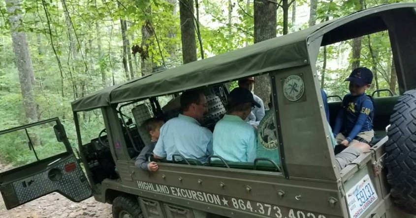
Pricing covers 1–4 guests with additional spots available. Max group size is 38; vehicles seat up to 20 each, and groups over 12 typically use two trucks.

What happens if it rains?

Tours run in light rain—the region is a temperate rainforest. Severe weather may delay or reschedule for safety.

Will we see the Chattooga River and Iron Bridge potholes?

Yes, the Ellicott Wilderness route typically includes the Chattooga River corridor and Iron Bridge potholes, conditions and time permitting.

What to Pack

Rain shell for sudden mountain showers; grippy closed-toe shoes for short walks to overlooks; insulated water bottle to stay hydrated on winding roads; compact binoculars for spotting birds and distant ridgelines.

Did You Know

Ellicott Rock, set in 1811 by surveyor Andrew Ellicott, marks the tri-state boundary between North Carolina, South Carolina, and Georgia and remains one of America’s few survey stones still in place in wilderness.

Quick Travel Tips

Book early for fall foliage weekends—they sell out fast; Mornings offer calmer roads and softer light for photography; Cell service drops near the Chattooga—download offline maps; Highlands’ elevation can be 10–15°F cooler than surrounding valleys—dress in layers.

Local Flavor

Post-tour, wander Main Street in Highlands. Grab a biscuit and coffee at a local bakery, then unwind with a craft beer at a cozy taproom. For dinner, book a table at one of the town’s chef-driven spots where Appalachian ingredients meet mountain hospitality. If you have daylight to spare, pop into the Highlands Biological Station to connect the dots between what you saw on the road and the science beneath it.

Logistics Snapshot

Closest airports: Asheville Regional (AVL) ~2 hours; Greenville-Spartanburg (GSP) ~2 hours. Meeting point: 499 Pine St, Highlands, NC. Driving time from downtown Highlands: 5 minutes to departure, 2-hour round-trip tour. Cell service: spotty to none in Blue Valley/Chattooga corridors. Permits: none required for guests on this private tour; guide handles access and routing.

Sustainability Note

These routes traverse sensitive river corridors and high-rainfall forests—stay on durable surfaces, keep noise low around wildlife, and pack out every crumb. The Chattooga’s Wild and Scenic designation relies on visitors who tread lightly.

Topics